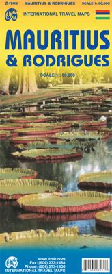
Wegenkaart - landkaart Mauritius & Rodrigues | ITMB

0
This is another brand new map title for ITMB. Although I’ve not yet been able to visit Mauritius, or its satellite island of Rodrigues, it’s in my planned trips for next year. The island, south and east of Cape Town, is a major sugar-producing country, with enormous tourist potential. Dozens of beach resorts already dot the coastline, including al...

Verkopers met dit product

Verkoper
Bezorging
Prijs
DeZwerver.nl logo
DeZwerver.nl
2,95
13,95

Anderen bekeken ook

Wegenkaart - landkaart Mauritius & Rodrigues | ITMB
This is another brand new map title for ITMB. Although I’ve not yet been able to visit Mauritius, or its satellite island of Rodrigues, it’s in my planned trips for next year. The island, south and east of Cape Town, is a major sugar-producing country, with enormous tourist potential. Dozens of beach resorts already dot the coastline, including all the ‘brand’ names, which bodes well for the future. Naturally, we’ve shown all the roads, villages, touristic sites, and attractions, and have respected the heritage of the island by inter-mingling French and English names, just as exists on the islands. This expands our country range to 150.
13,95
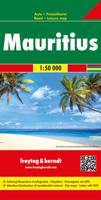
Wegenkaart - landkaart Mauritius - Rodrigues | Freytag & Berndt
Gedetailleerde, tweezijdige kaart met toeristische informatie, index en afstanden in kilometers. De berijdbare wegen zijn goed weergeven, zowel de hoofdwegen als provinciale en lokale wegen; wegnummers worden vermeld. Afstanden tussen plaatsen zijn in kilometers op de kaart ingetekend, daarnaast worden ook op belangrijke plekken benzinepompen gemarkeerd. In het kaartbeeld wordt door middel van schaduw het reliëf weergegeven en soms enkele punten in het landschap met de daadwerkelijke hoogte. Provinciegrenzen zijn goed terug te vinden, nationale parken en reservaten ook. Met allerhande symbolen worden toeristische bezienswaardigheden weergegeven als monumenten, historisch belangrijke plekken en uitzichtpunten. In bepaalde plaatsen zijn hotels en campings te vinden, luchthavens, treinverbindingen en havens vindt u er ook op!   Plan your itinerary and travel indepdendantly with this Freytag & Berndt double-sided road and leisure map of Mauritius and Rodrigues. The topography is depicted…
14,95
Wegenkaart - landkaart 740 Mauritius - Rodrigues | Michelin
Mooie, goed leesbare kaart van de eilanden Mauritius en Rodrigues, met een klein register, een kleine kaart van Port Louis en met de bekende Michelin aanduidingen als mooie wegen en bezienswaardigheden. The Michelin Mauritius Rodrigues Road and Tourist Map 740 includes an index of place names including tourist sites from the Michelin Green Guides and city map insets of Port, Louis, Mahébourg, and Port Mathurin. The scale is 1:80,000 (1 cm = 800 m, 1 inch = 1.26 miles) Mahébourg, Maurice, Pamplemousses, Port Louis, Port Mathurin, Rodrigues, Tamarin
12,95
Wegenkaart - landkaart Mauritius, Réunion & Rodrigues | Reise Know-How Verlag
Tweetalige kaart (Engels en Duits). Door ingetekende lengte- en breedtegraden is het gebruik van GPS mogelijk. Met hoogtelijnen en uitgebreid wegennetwerk: daarnaast worden ook de afstanden tussen belangrijke plaatsen duidelijk leesbaar weergegeven. Het kleurgebruik is zodanig dat je een goede indruk krijgt van hoogteverschillen en soorten landschap. Natuurlijk staan de toeristische bezienswaardigheden duidelijk vermeld.   Gedrukt op water- en scheurvast papier! Polyart is een synthetisch product vrij van giftige stoffen dus duurzaam. Het papier gaat echt lang mee.   Topography is indicated by altitude colouring with numerous spot heights and names of mountain ranges and passes. Salt lakes, swamps, seasonal rivers and glacier are also shown. Detailed presentation of the road network includes minor roads and tracks and railways are also shown.   Internal administrative units are presented with their boundaries and names. National parks and other protected areas are highlighted. A wide …
13,95
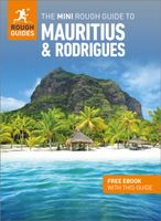
Mini Rough Guide Mauritius & Rodrigues | Rough Guides
This mini pocket Mauritius & Rodrigues travel guidebook is perfect for travellers seeking basic information about Mauritius & Rodrigues. It covers key places, main attractions and a short hotel and restaurant recommendations list. This book is printed on paper from responsible sources, verified to meet FSC's strict environmental and social standards.   This Mauritius & Rodrigues travel book covers: Port Louis, the north, the east, the south, the west, the plateau towns, Rodrigues. In this Mauritius & Rodrigues guidebook, you will find:- Curated recommendations of places - main attractions, child-friendly family activities, chilled-out breaks in popular tourist areas - Things not to miss in Mauritius & Rodrigues - L'Aventure du Sucre Museum, Belle Mare Beach, Kestrel Valley, Black River Gorges National Park, Le Gris Gris, Chamarel Falls, Francois Leguat Giant Tortoise & Cave Reserve, Ile Aux Cerfs, Sir Seewoosagur Ramgoolam Botanic Gardens, Eureka Mansion - Perfect Day - itinerary sugg…
12,50
Wegenkaart - landkaart Mauritius & Reunion | ITMB
Detailed map of the meeting and Mauritius published by ITM. On the front, map of Mauritius (1:90 000) with Rodrigues (on a scale 1: 140 000). Plans of the center of Port - Louis and Curepipe included. On the back, detailed map of the meeting at scale 1: 80,000. The islands are presented with altitude and listed points, as well as with the names of the different topographic characteristics (mountains ...). National parks and other protected areas are highlighted. Index of cities included.
12,95
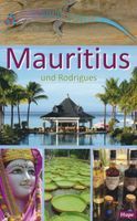
Reisgids Mauritius und Rodrigues | Hupe Verlag
Duitstalige reisgids over Mauritius en Rodrigues. Goede reisgids met heel veel infomatie voor zowel de georganiseerde als de zelfstandige reiziger. Mauritius und Rodrigues: Der kleine Inselstaat liegt nicht nur geographisch zwischen Afrika und Asien.Seine vulkanischen Berge, die üppige, tropische Vegetation und die multikulturelle, herzliche Bevölkerung geben Mauritius einen unverwechselbaren Reiz. Eine perfekte Hotellerie hat sich an den weißen Stränden und türkisfarbenen Lagunen der freundlichen Insel entwickelt, aber auch zahlreiche charmante Apartmentanlagen, romantische Villen und großzügige Ferienhäuser für aktive Selbstversorger.   Ein Reiseführer für neugierige Aktivreisende voller individueller Reisetipps, aktueller Preisangaben und vielseitigen Vorschlägen für eigene Unternehmungen.   Dieser Reiseführer beinhaltet auf 288 Seiten:Individuelle Reisetipps und aktuelle Preisangaben.Ehrliche Hotelbeschreibungen und Restaurantempfehlungen.Detaillierte Informationen für möglic…
20,50
Wegenkaart - landkaart Indonesië - Indonesia | ITMB
Een degelijke landkaart van Indonesië met aanduidingen van o.a. nationale parken, vliegvelden en grote wegen. Als overzichtskaart goed te gebruiken. De nadruk ligt echter vooral op de natuurkundige aspecten. Scheur- en watervast! Met een kleine kaart van Jakarta. The hundreds of islands making up the island nation of Indonesia make a double-sided map inevitable in order to show any significant amount of detail. Side 1 shows the western half, starting with Sumatra in the upper left and including Java and most of the island of Borneo (Kalimantan Province to the Indonesians). This side also includes a large inset map of central Jakarta (for better detail see our separate map of the city); ditto for Sumatra, Java, and Borneo. Bali, Lombok, and Sumbawa islands are in the lower right portion of the map, and most of Malaysia and all of Singapore are included, simply because they are there. The infamous volcanic island of Krakatoa is located just to the west of Java. The other side of the map…
13,95
Wegenkaart - landkaart Madagascar | ITMB
Een degelijke kaart met aanduidingen van o.a. nationale parken, vliegveld, benzinepomp, dirt-roads en kleine plattegrond van hoofdstad. Als overzichtskaart goed te gebruiken. Tweezijdig! IThe large island off the east coast of Africa is Madagascar. The actual name of the country is the Malagasy Republic, but the public is much more likely to know the country by its island name, so we call our map by the island’s name, rather than using the country name. Makes sense to us! Regardless, this is a major touristic destination. The double-sided map covers the island in great detail, with an inset map of the capital city, Antananarivo. As with other ITMB maps, this one includes a listing of ‘must see’ attractions, such as Tsingy National Park and the famous Lemur’s Park. The island also has a regular surface route to the Comoro Islands, which are also included on this map. Legend Includes: Railroads, Forest, Mational Park, International Airport, Domestic Airport, Fort, holtel, Cave, Museum, …
13,95
Wegenkaart - landkaart New Zealand North Island | ITMB
ITMB is very pleased to be expanding our coverage of New Zealand with the release of this fourth title (the others being the country map, the South Island, and Auckland). At this expanded scale, it takes both sides of the sheet to show off the attractions of the northern half of NZ, but the shape of the island provides ample space for a large inset of Auckland and more modest ones of the city region and of New Zealand’s public transport network on side one. Side two has an excellent inset map of Wellington and includes the northernmost portion of South Island, with the ferry connection linking the two islands. At this scale, the place names and road network are very readable, and there is lots of room to show attractions and touristic points of interest. The map also includes our Top Attractions list of must-sees, such as Napier Rotorua, and the Hobbitown Movie Set of Lord of the Rings fame.
13,95

Klanten-reviews van Wegenkaart - landkaart Mauritius & Rodrigues | ITMB

Er zijn nog geen beoordelingen voor dit productBen jij de eerste die een review plaatst?

Meer over Wegenkaart - landkaart Mauritius & Rodrigues | ITMB

Productomschrijving

This is another brand new map title for ITMB. Although I’ve not yet been able to visit Mauritius, or its satellite island of Rodrigues, it’s in my planned trips for next year. The island, south and east of Cape Town, is a major sugar-producing country, with enormous tourist potential. Dozens of beach resorts already dot the coastline, including all the ‘brand’ names, which bodes well for the future. Naturally, we’ve shown all the roads, villages, touristic sites, and attractions, and have respected the heritage of the island by inter-mingling French and English names, just as exists on the islands. This expands our country range to 150.

Productinformatie

    Verken gerelateerde categorieën

    Webshop.nl maakt gebruik van cookies. Ga je verder op onze website, ga dan akkoord met het plaatsen van cookies en de verwerking van deze data door ons en vermelde partners.