Wegenkaart - landkaart Mauritius & Reunion | ITMB

0
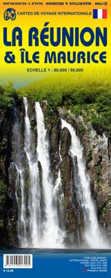
Detailed map of the meeting and Mauritius published by ITM. On the front, map of Mauritius (1:90 000) with Rodrigues (on a scale 1: 140 000). Plans of the center of Port - Louis and Curepipe included. On the back, detailed map of the meeting at scale 1: 80,000. The islands are presented with altitude and listed points, as well as with the names of...

Verkopers met dit product

Verkoper
Bezorging
Prijs
DeZwerver.nl logo
DeZwerver.nl
2,95
12,95

Anderen bekeken ook

Wegenkaart - landkaart Mauritius & Reunion | ITMB
Detailed map of the meeting and Mauritius published by ITM. On the front, map of Mauritius (1:90 000) with Rodrigues (on a scale 1: 140 000). Plans of the center of Port - Louis and Curepipe included. On the back, detailed map of the meeting at scale 1: 80,000. The islands are presented with altitude and listed points, as well as with the names of the different topographic characteristics (mountains ...). National parks and other protected areas are highlighted. Index of cities included.
12,95
Wegenkaart - landkaart Mauritius & Rodrigues | ITMB
This is another brand new map title for ITMB. Although I’ve not yet been able to visit Mauritius, or its satellite island of Rodrigues, it’s in my planned trips for next year. The island, south and east of Cape Town, is a major sugar-producing country, with enormous tourist potential. Dozens of beach resorts already dot the coastline, including all the ‘brand’ names, which bodes well for the future. Naturally, we’ve shown all the roads, villages, touristic sites, and attractions, and have respected the heritage of the island by inter-mingling French and English names, just as exists on the islands. This expands our country range to 150.
13,95
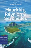
Reisgids Mauritius, Reunion & Seychelles | Lonely Planet
De perfecte reisgids voor Mauritius, Reunion en de Seychellen gericht op zowel de georganiseerde als de zelfstandige reiziger. Naast een algemene inleiding van het land / streek vol met praktische informatie over hoe je er het beste kunt reizen: slapen, eten, vervoer, excursies ... alles kun je er in vinden. Lonely Planet's Mauritius, Reunion and Seychelles is our most comprehensive guide that extensively covers all the country has to offer, with recommendations for both popular and lesser-known experiences. Hike through Cirque de Mafate, relax in waters off Denis Island, dive to the rock formations off Mauritius; all with your trusted travel companion. Inside Lonely Planet's Mauritius, Reunion and Seychelles Travel Guide: Lonely Planet's Top Picks - a visually inspiring collection of the destination's best experiences and where to have them Itineraries help you build the ultimate trip based on your personal needs and interestsLocal insights give you a richer, more rewarding travel …
23,95
Wegenkaart - landkaart 740 Mauritius - Rodrigues | Michelin
Mooie, goed leesbare kaart van de eilanden Mauritius en Rodrigues, met een klein register, een kleine kaart van Port Louis en met de bekende Michelin aanduidingen als mooie wegen en bezienswaardigheden. The Michelin Mauritius Rodrigues Road and Tourist Map 740 includes an index of place names including tourist sites from the Michelin Green Guides and city map insets of Port, Louis, Mahébourg, and Port Mathurin. The scale is 1:80,000 (1 cm = 800 m, 1 inch = 1.26 miles) Mahébourg, Maurice, Pamplemousses, Port Louis, Port Mathurin, Rodrigues, Tamarin
12,95
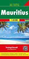
Wegenkaart - landkaart Mauritius - Rodrigues | Freytag & Berndt
Gedetailleerde, tweezijdige kaart met toeristische informatie, index en afstanden in kilometers. De berijdbare wegen zijn goed weergeven, zowel de hoofdwegen als provinciale en lokale wegen; wegnummers worden vermeld. Afstanden tussen plaatsen zijn in kilometers op de kaart ingetekend, daarnaast worden ook op belangrijke plekken benzinepompen gemarkeerd. In het kaartbeeld wordt door middel van schaduw het reliëf weergegeven en soms enkele punten in het landschap met de daadwerkelijke hoogte. Provinciegrenzen zijn goed terug te vinden, nationale parken en reservaten ook. Met allerhande symbolen worden toeristische bezienswaardigheden weergegeven als monumenten, historisch belangrijke plekken en uitzichtpunten. In bepaalde plaatsen zijn hotels en campings te vinden, luchthavens, treinverbindingen en havens vindt u er ook op!   Plan your itinerary and travel indepdendantly with this Freytag & Berndt double-sided road and leisure map of Mauritius and Rodrigues. The topography is depicted…
14,95
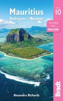
Reisgids Mauritius | Bradt Travel Guides
Zeer goede gids voor Mauritius en betrouwbaar alternatief voor de Lonely Planet. Zo mogelijk nog completer! Zelfde soort informatie als de Lonely Planet: vol met praktische feiten en achtergronden. This new, thoroughly updated tenth edition of Bradt's Mauritius, Rodrigues and Réunion remains the most comprehensive English-language guide available and is the only full-blown guide to focus solely on the Mascarene Islands, a place where the dodo once roamed and which today produces exquisite vanilla-flavoured tea. World-leading luxury resorts, excellent beaches, watersports and lively nightlife, weddings and medical tourism, the raw unspoiled beauty of Rodrigues and fascinating birdlife of the Ile aux Cocos nature reserve, world-class hiking through the mountainous interior of Reunion and an intriguing blend of European and African culture are all covered. Unlike other guides, Bradt's Mauritius includes detailed sections on natural history and conservation for each of the islands, as wel…
26,50
Wegenkaart - landkaart 85001 Mauritius - île Maurice | IGN - Institut Géographique National
Duidelijke wegenkaart van Mauritius met een gedetailleerde schaal van 1:85.000 waardoor veel detail zichtbaar is. Alle gehuchten en bewoningen staan vermeld, maar ook met symbolen aangegeven bezienswaardigheden en bijvoorbeeld mooie stranden en nationale parken.  With this range IGN produces all purpose maps for many overseas countries, many of which have been under French rule in the past. Maps in this range are printed at scales which vary according to coverage area. These are ideal for touring and are suitable as a reference for those driving hire-cars. The up-to-date mapping provides a wealth of coloured road and track information plus place names, railway line routes etc. Many map symbols are used to locate and quickly identify points of interest, and the multilingual legend has English, French, German and Italian translations.Laminated:This laminated weatherproof map is the last word in durability and will outlast many other apparently similar products. The map is covered in tou…
11,95
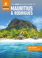
Mini Rough Guide Mauritius & Rodrigues | Rough Guides
This mini pocket Mauritius & Rodrigues travel guidebook is perfect for travellers seeking basic information about Mauritius & Rodrigues. It covers key places, main attractions and a short hotel and restaurant recommendations list. This book is printed on paper from responsible sources, verified to meet FSC's strict environmental and social standards.   This Mauritius & Rodrigues travel book covers: Port Louis, the north, the east, the south, the west, the plateau towns, Rodrigues. In this Mauritius & Rodrigues guidebook, you will find:- Curated recommendations of places - main attractions, child-friendly family activities, chilled-out breaks in popular tourist areas - Things not to miss in Mauritius & Rodrigues - L'Aventure du Sucre Museum, Belle Mare Beach, Kestrel Valley, Black River Gorges National Park, Le Gris Gris, Chamarel Falls, Francois Leguat Giant Tortoise & Cave Reserve, Ile Aux Cerfs, Sir Seewoosagur Ramgoolam Botanic Gardens, Eureka Mansion - Perfect Day - itinerary sugg…
12,50
Wegenkaart - landkaart Mauritius, Réunion & Rodrigues | Reise Know-How Verlag
Tweetalige kaart (Engels en Duits). Door ingetekende lengte- en breedtegraden is het gebruik van GPS mogelijk. Met hoogtelijnen en uitgebreid wegennetwerk: daarnaast worden ook de afstanden tussen belangrijke plaatsen duidelijk leesbaar weergegeven. Het kleurgebruik is zodanig dat je een goede indruk krijgt van hoogteverschillen en soorten landschap. Natuurlijk staan de toeristische bezienswaardigheden duidelijk vermeld.   Gedrukt op water- en scheurvast papier! Polyart is een synthetisch product vrij van giftige stoffen dus duurzaam. Het papier gaat echt lang mee.   Topography is indicated by altitude colouring with numerous spot heights and names of mountain ranges and passes. Salt lakes, swamps, seasonal rivers and glacier are also shown. Detailed presentation of the road network includes minor roads and tracks and railways are also shown.   Internal administrative units are presented with their boundaries and names. National parks and other protected areas are highlighted. A wide …
13,95
Wegenkaart - landkaart Mauritania & Mali | ITMB
Een degelijke kaart met aanduidingen van o.a. nationale parken, vliegveld, benzinepomp, dirt-roads en kleine plattegrond van hoofdstad. Als overzichtskaart goed te gebruiken. Mali 1:1.900.000 Mauretanië 1:2.200.000 In this edition, we have combined Mauritania with Mali. Although both are interesting countries, the two fit naturally together as a unit, albeit at slightly differing scales. Technically, this should be a 1st edition map, as it is the first time we have combined these two desert countries on to one sheet, but I ll let Robert at the Library of Congress worry about the niceties of bibliographic accuracy as soon as Trump allows him to do the work he loves for a salary. Mauritania was one of the most unusual countries I visited as a young traveller. Of course, I had an advantage, in that I was too young to know that what I was doing was supposed to be impossible. I entered from what was then the Spanish Sahara via a piste (a sandy track with multiple pathways, only some of whi…
13,95

Klanten-reviews van Wegenkaart - landkaart Mauritius & Reunion | ITMB

Er zijn nog geen beoordelingen voor dit productBen jij de eerste die een review plaatst?

Meer over Wegenkaart - landkaart Mauritius & Reunion | ITMB

Productomschrijving

Detailed map of the meeting and Mauritius published by ITM. On the front, map of Mauritius (1:90 000) with Rodrigues (on a scale 1: 140 000). Plans of the center of Port - Louis and Curepipe included. On the back, detailed map of the meeting at scale 1: 80,000. The islands are presented with altitude and listed points, as well as with the names of the different topographic characteristics (mountains ...). National parks and other protected areas are highlighted. Index of cities included.

Productinformatie

    Verken gerelateerde categorieën

    Webshop.nl maakt gebruik van cookies. Ga je verder op onze website, ga dan akkoord met het plaatsen van cookies en de verwerking van deze data door ons en vermelde partners.