webshop.nl
Categorieën
  Sluiten

Meer ITMB

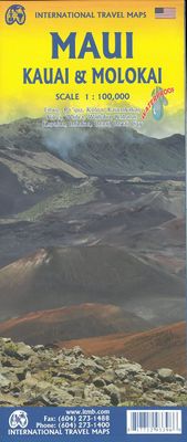
Wegenkaart - landkaart Maui, Kauai, & Molokai | ITMB

0
At long last, we have finally found time to complete our detailed mapping of the American state of Hawaii. The island of Maui may not be at well-known as Oahu, which is extremely popular with Japanese honeymooners, but it is as attractive touristically. Our coverage covers most of Side 1 and includes a detailed inset map of Wailuku, the principal u...

Webshops met dit product

Webshop
Bezorging
Prijs

Anderen bekeken ook

Wegenkaart - landkaart Maui, Kauai, & Molokai | ITMB
At long last, we have finally found time to complete our detailed mapping of the American state of Hawaii. The island of Maui may not be at well-known as Oahu, which is extremely popular with Japanese honeymooners, but it is as attractive touristically. Our coverage covers most of Side 1 and includes a detailed inset map of Wailuku, the principal urban area, as well as insets of Lahaina on the west coast and Wailea resort area. This side also includes a map of the island of Lanai, with its main urban area of Lanai City as an inset. Side 2 concentrates on the islands of Molokai, Kauai, and the lightly populated island of Ni’ihau, and includes detailed inset maps of Lihue, Kaunakakai, and Po’ipu, all of which are major resort destinations. The islands are loaded with beaches and places to stay, but also with attractions, which are shown on the map. This is a beautiful map, one of the best we have ever produced, and is a fitting companion to our maps of Big Island, and Oahu/Honolulu, as w…
13,95
Wegenkaart - landkaart Honolulu and Oahu | ITMB
Een degelijke kaart met aanduidingen van o.a. nationale parken, vliegveld, benzinepomp, dirt-roads en kleine plattegrond van hoofdstad. As overzichtskaart goed te gebruiken. Schaal: - Oahu 1:80.000 - Honolulu 1:18.000 Honolulu/Waikiki is a brand new map for ITMB, and our first new title for a part of the USA this year. Almost everyone flying to Hawaii goes to Honolulu, and the vast majority stay in hotels located close to Waikiki Beach. This is quite a comprehensive city plan map for the Honolulu urban area, stretching from east of Diamond Head to the international airport. It also includes a large inset of the Pearl Harbour area, with its many memorials to the ships sunk during the surprise Japanese attack on December 6, 1941. Ford Island is still a major US military base. Our Top Attractions list shows the highlights of touristic interest. The second side is a newly-updated version of our map of the island of Oahu. Although the focus of this map is on Honolulu, most visitors include …
13,95
Wegenkaart - landkaart Hawaiian Islands - Hawaii | Nelles Verlag
Overzichtskaart van alle eilanden. Folded road and tourist map for the Hawaiian Islands, U.S.A. at mostly 1:150 000 scale. The map covers the individual islands of Maui, Hawai i, Moloka i, Oahu, Kauai and Lanai. Places of interest, national parks, and beaches are all highlighted and shaded-relief colouring clearly depicts the topography.    The map includes insets showing Waikiki Beach in Honolulu at 1:14 000 and the Hawaii Volcanoes National Park at 1:125 000. The legend is in three languages, including English.   For over 20 years Nelles maps have been renowned throughout the world for their quality, faithfulness to detail and up-to-dateness.    So that streets, ferry links, railway lines, etc are always up to date, Nelles are continuously upgrading their maps - with the help of their international team of correspondents. Roads are provided with an exact kilometerage. Sights are highlighted extra clearly so that you don't miss any tourist attractions.   A good map must be hard-wearin…
11,95
Wegenkaart - landkaart Tasmania & Victoria | ITMB
Een degelijke wegenkaart van Tasmanie & Victoria, schaal 1:1.800.000, en Tasmanië, schaal 1:800.000 met aanduidingen van o.a. nationale parken, vliegveld, benzinepomp, dirt-roads. Als overzichtskaart goed te gebruiken. The island of Tasmania is Australia’s smallest state, but is packed with touristic delights. Hobart is the capital and a charming Victorian city in the south of the island. Much of the west coast is a large nature preserve with limited access and most development is close to the northern shore, centred on Devonport and its ferry connections with Melbourne, in Victoria State. Tasmania also administers several offshore islands, such as King, Flinders, and Bruny. We have included a Top Attractions listing for the reader to enjoy. The other side of the sheet is the Australian mainland state of Victoria, best known as the home of Melbourne and the beautiful coastal highway to Adelaide. A basic inset map of Melbourne is included, but the focus of the map is on the recreational…
13,95
Wegenkaart - landkaart Hawaiian Islands - Hawaiï | Borch
Mooie geplasticieerde kaart van Hawaiï. Deze kaart biedt een goed overzicht van deze eilanden met detailkaarten.   Our soft-laminated folded map of Hawaii shows: Hawaii (Big Island) 1:400 000, Kilauea Caldera 1:150 000, Hilo 1:70 000, Maui, Molokai / Lanai / Kahoolawe 1:200 000, Wailuku & Kahului 1:35 000, Hawaiian Islands 1:4 000 000, Niihau 1:400 000, Kauai / Oahu 1:200 000, Honolulu & Pearl Harbour 1:26 000, Honolulu Downtown 1:15 500, USA administrative & time zones. Borch Maps are easy to fold, durable and water-repellent with a wipeable surface. Borch Maps show hotels, museums, monuments, markets, public transport, top sights and points of interest, useful statistics, conversion charts for temperatures, weights and measurements, climate charts showing temperatures, sunshine hours, precipitation and humidity, overview maps, time zones, and much more...   Borne of fire and water barely 300 million years ago, the eight islands of the Hawaiian Archipelago together form the 50th US st…
11,50
Wegenkaart - landkaart New Zealand North Island | ITMB
ITMB is very pleased to be expanding our coverage of New Zealand with the release of this fourth title (the others being the country map, the South Island, and Auckland). At this expanded scale, it takes both sides of the sheet to show off the attractions of the northern half of NZ, but the shape of the island provides ample space for a large inset of Auckland and more modest ones of the city region and of New Zealand’s public transport network on side one. Side two has an excellent inset map of Wellington and includes the northernmost portion of South Island, with the ferry connection linking the two islands. At this scale, the place names and road network are very readable, and there is lots of room to show attractions and touristic points of interest. The map also includes our Top Attractions list of must-sees, such as Napier Rotorua, and the Hobbitown Movie Set of Lord of the Rings fame.
13,95

Klanten-reviews van Wegenkaart - landkaart Maui, Kauai, & Molokai | ITMB

Er zijn nog geen beoordelingen voor dit productBen jij de eerste die een review plaatst?

Meer over Wegenkaart - landkaart Maui, Kauai, & Molokai | ITMB

Productomschrijving

At long last, we have finally found time to complete our detailed mapping of the American state of Hawaii. The island of Maui may not be at well-known as Oahu, which is extremely popular with Japanese honeymooners, but it is as attractive touristically. Our coverage covers most of Side 1 and includes a detailed inset map of Wailuku, the principal urban area, as well as insets of Lahaina on the west coast and Wailea resort area. This side also includes a map of the island of Lanai, with its main urban area of Lanai City as an inset. Side 2 concentrates on the islands of Molokai, Kauai, and the lightly populated island of Ni’ihau, and includes detailed inset maps of Lihue, Kaunakakai, and Po’ipu, all of which are major resort destinations. The islands are loaded with beaches and places to stay, but also with attractions, which are shown on the map. This is a beautiful map, one of the best we have ever produced, and is a fitting companion to our maps of Big Island, and Oahu/Honolulu, as well as our state map. The Maui/Kauai map also has a double-sided cover, so can be displayed as two separate maps. Legend Includes: Roads by classification, Rivers and Lakes, National Park, Airports, Points of Interests, Highways, Main Roads, Zoos, Fishing, and much more...

Productspecificaties

Artikelnummer(s)
Brand
ITMB
Webshop.nl maakt gebruik van cookies. Ga je verder op onze website, ga dan akkoord met het plaatsen van cookies en de verwerking van deze data door ons en vermelde partners.