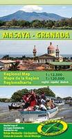
Wegenkaart - landkaart Masaya - Granada ( Zuidwest Nicaragua ) | Mapas Naturismo

0
South-Western Nicaragua map at 1:120,000 from Mapas NaTurismo, covering the area west of Lago Nicaragua between Managua and Rivas with, on the reverse, street plans of Masaya and Granada, plus enlargements for Volcán Mombacho, Isletas de Granada and Isla Zapatera. On one side is an indexed road map at 1:120,000 covering the area west of Lago Nicar...

Verkopers met dit product

Verkoper
Bezorging
Prijs
DeZwerver.nl logo
DeZwerver.nl
2,95
11,75

Anderen bekeken ook

Wegenkaart - landkaart Masaya - Granada ( Zuidwest Nicaragua ) | Mapas Naturismo
South-Western Nicaragua map at 1:120,000 from Mapas NaTurismo, covering the area west of Lago Nicaragua between Managua and Rivas with, on the reverse, street plans of Masaya and Granada, plus enlargements for Volcán Mombacho, Isletas de Granada and Isla Zapatera. On one side is an indexed road map at 1:120,000 covering the area west of Lago Nicaragua between Managua and Rivas. Isla de Ometepe is included as an inset. Relief shading and altitude colouring provides very clear presentation of the terrain. Road network includes local tracks and shows locations of fuel supplies. Symbols mark locations with tourist accommodation, beaches and surfing sites, protected area including turtle reserves, etc. The map has a UTM grid and its legend includes English. On the reverse are street plans of Masaya and Granada at 1:12,500, both highlighting tourist accommodation and various facilities and places of interest, plus enlargements for Volcán Mombacho and the surrounding area, Isletas de Granada…
11,75
Wegenkaart - landkaart Nicaragua | Mapas Naturismo
Uitstekende wegenkaart van Nicaragua. Zo niet de beste op de markt van de kleine uitgeverij Mapas Naturismo! Met gedetailleerde kaarten van: - Rio San Juan 1:200.000 - Island Ometepe 1:200.000 - Delta Río San Juan 1:10.000 - Big and Little Corn Island, elk 1:75.000 Met ook nog: - belangrijke historische plaatsen - alle nationale parken - afstanden in kilometers, benzine stations en touristische routes - de meest belangrijke volksfeesten De kaart heeft een GPS-Grid!
11,75
Wegenkaart - landkaart 3109 Adventure Map Nicaragua, Honduras , El Salvador | National Geographic
Wegenkaart van Nicaragua, Honduras, en El Salvador met vermelding van veel bezienswaardigheden, nationale parken en attrakties. Watervast en scheurvast. Juist door deze vermeldingen onderscheidt de kaart zich van andere wegenkaarten. National Geographic's Nicaragua, Honduras, El Salvador AdventureMap is designed to meet the unique needs of adventure travelers with its durability and accurate information. This folded map provides global travelers with the perfect combination of detail and perspective, highlighting hundreds of points of interest and the diverse and unique destinations within the country.   The map includes the locations of cities and towns with a user-friendly index, plus a clearly marked road network complete with distances and designations for major highways, main roads, and tracks and trails for those seeking to explore more remote regions.   Every AdventureMap is printed on durable synthetic paper, making them waterproof, tear-resistant and tough — capable of withst…
17,50
Vogelgids Birds of Nicaragua - a field guide | Zona Tropical
Birders in Central America have long known that Nicaragua is one of the best birding locations in the world, and with tourism to the country on the upswing, birders from the rest of the world are now coming to the same conclusion. The largest country in Central America, Nicaragua is home to 763 resident and passage birds, by latest count. Because of its unique topography--the country is relatively flat compared to its mountainous neighbors to the north and south--it forms a geographical barrier of sorts, which means that many birds that originate in North America reach their southernmost point in Nicaragua, while many birds from South America reach their northernmost point in the country. There are few places in the world where you can find both a Roadrunner and a Scarlet Macaw. Birds of Nicaragua features descriptions and illustrations of all 763 species currently identified in the country, along with information about 44 additional species that are likely to appear in the coming yea…
49,95
Reisgids Reishandboek Nicaragua | Uitgeverij Elmar
Nederlandstalige reisgids. Vooral veel praktische informatie en streekbeschrijvingen. Sober uitgevoerd, wel veel zeer veel details en achtergrondinformatie. Goede algemene reisgids.   Full colourgidsen boordevol informatie voor de moderne reiziger die zijn of haar weg snel wil kunnen vinden. Bondige en up-to-date informatie en voor de geïnteresseerde lezer veel achtergrondverhalen.Duidelijke kaarten en plattegronden en fraaie fotografie. Mooi vormgegeven boeken met een heldere indeling. Nicaragua heeft een grote variëteit aan landschappen. Behalve talrijke vulkanen heeft het bergen, meren en rivieren. De stranden zijn uitgestrekt en nog niet overspoeld door toeristen. De bos- en mangrovegebieden herbergen een uitbundige flora en fauna. Daarnaast kan de bezoeker genieten van de Spaanskoloniale erfenis. Steden zoals Granada en León huisvesten prachtige gebouwen uit deze vervlogen tijd. Voor de avontuurlijke reiziger zijn er volop onbetreden paden te gaan. Aan de onontdekte oostkust leve…
19,99

Klanten-reviews van Wegenkaart - landkaart Masaya - Granada ( Zuidwest Nicaragua ) | Mapas Naturismo

Er zijn nog geen beoordelingen voor dit productBen jij de eerste die een review plaatst?

Meer over Wegenkaart - landkaart Masaya - Granada ( Zuidwest Nicaragua ) | Mapas Naturismo

Productomschrijving

South-Western Nicaragua map at 1:120,000 from Mapas NaTurismo, covering the area west of Lago Nicaragua between Managua and Rivas with, on the reverse, street plans of Masaya and Granada, plus enlargements for Volcán Mombacho, Isletas de Granada and Isla Zapatera.
On one side is an indexed road map at 1:120,000 covering the area west of Lago Nicaragua between Managua and Rivas. Isla de Ometepe is included as an inset. Relief shading and altitude colouring provides very clear presentation of the terrain. Road network includes local tracks and shows locations of fuel supplies. Symbols mark locations with tourist accommodation, beaches and surfing sites, protected area including turtle reserves, etc. The map has a UTM grid and its legend includes English.

On the reverse are street plans of Masaya and Granada at 1:12,500, both highlighting tourist accommodation and various facilities and places of interest, plus enlargements for Volcán Mombacho and the surrounding area, Isletas de Granada and Isla Zapatera, all at 1:60,000.

Please note: the same map is also available with on the reverse an aerial photo of the environs of Masapete, plus a street plan of Masapete.

Productinformatie

    Verken gerelateerde categorieën

    Webshop.nl maakt gebruik van cookies. Ga je verder op onze website, ga dan akkoord met het plaatsen van cookies en de verwerking van deze data door ons en vermelde partners.