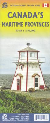
Wegenkaart - landkaart Maritieme Provincies Canada | ITMB

0

Verkopers met dit product

Verkoper
Bezorging
Prijs
DeZwerver.nl logo
DeZwerver.nl
2,95
13,95

Anderen bekeken ook

Wegenkaart - landkaart Canada | ITMB
Een degelijke kaart met aanduidingen van o.a. nationale parken, vliegveld, benzinepomp, dirt-roads en kleine plattegrond van hoofdstad. Well, it’s about time, eh?!? ITMB, after only thirty years on the go, finally gets around to publishing a map of Canada. When we first started mapping, there was a pressing need for good maps of Central and South America, then of Africa, then etc etc and we never found time to concentrate on our own country until fairly recently. This map was prepared by Natural Resources Canada and is, as a result, as accurate a map as one could hope to have. We are very proud of it, and very pleased to be able to use such top-rate cartography. The map covers all of the land mass of Canada, from its southernmost point to the top of Ellesmere Island and from the Atlantic coast to the Pacific. It’s an excellent map, but I’m going to give one proviso. Canada is the second-largest country on the face of the planet and there is no way that a single-sided sheet can portray…
13,95
Wegenkaart - landkaart Atlantic Canada | ITMB
The first edition was published in 2000 using artwork under licence. This edition uses original ITMB artwork. Side 1 covers Nova Scotia, New Brunswick, and Prince Edward Island as well as Quebec s Magdalen Islands at a scale of 1:800,000. This side also includes the Top 10 Attractions of the three provinces. The second side is devoted to the Canadian Province of Newfoundland and Labrador, with the much smaller island portion being a half-page inset at 1:150,000 scale and the larger mainland portion being at 1:1,700,000. The northernmost tip of Quebec/Labrador belongs to Nunavut. St. Pierre et Miquelon, a French overseas possession just south of Newfoundland Island, is also included, as well as the map s only urban inset, historic St. John s, one of North America s oldest cities. The map also includes a listing of 9 Top Attractions. ITMB also publishes maps of the individual provinces, but the advantage of this regional map is that it combines together four interesting parts of Canada …
13,95
Wegenkaart - landkaart Western Canada | ITMB
Een degelijke kaart met aanduidingen van o.a. nationale parken, vliegveld, benzinepomp, dirt-roads. Als overzichtskaart goed te gebruiken. This is actually our second attempt at mapping the western portion of Canada; the first covered everything from northwestern Ontario to the Pacific Ocean and, while it was an excellent map, the scale that such a huge area covered necessitated severe problems. In this version, all of British Columbia, Alberta, and the Yukon have been mapped from fresh digital data and presented at 1:1.4T scale. This would have been impossible when we prepared the first map. The Northwest Territories portion had to be compressed in two ways; first, the scale is 1:2M; second, only the portion with roads is shown. This is still an extremely large area. One has to consider the actual size of Canada when designing a map. Most countries in Europe would fit into this area, which only covers 20% of Canada. The Fort McMurray forest fire of a year ago covered an area larger t…
13,95
Wegenkaart - landkaart Gulf Islands & Nanaimo (Canada) | ITMB
This is completely new artwork and a new approach to ITMB’s mapping of the islands in the Gulf of Georgia, between the mainland and Vancouver Island. This double-sided map incorporates two NTS topographical maps into its artwork, with points of interest, hiking trails, boat launching spots, and B&Bs included. It also covers a wider area than previously, so we have decided to call this map a 1st Edition; printed on durable ITM plastic paper. Legend Includes: Roads by classification, Ferry terminal, camping sites, museums, canoeing, fishing, tourist information sites, hiking roads, lighthouse, picnic areas, parks, and point of interest.
13,95
Wegenkaart - landkaart British Columbia South (Canada) | ITMB
Deze wegenkaart van British Columbia bestrijkt het gebied tussen Vancouver en Calgary, en is de perfecte toeristische kaart voor het verkennen van de regio Rocky Mountain. Alle wegen en spoorlijnen tussen de twee steden worden getoond, evenals campings en parken.   This map covers the area between Vancouver and Calgary, and is the perfect tourist map for exploring the Rocky Mountain region. All roads and rail lines between the two cities are shown, as well as camp grounds, parks. Legend Includes: Points of interests, airports, RV and camping sites, wilderness camps, picnic areas, waterfalls, tourist information, museums, golf courses, gas stations, outdoor activities and other information. Folded paper, road and travel map in color. Scale 1:900,000. Distinguishes roads ranging from divided highways to other roads-4WD/dry weather. Legend includes railways, trails, ferry routes, glaciers, points of interest, international airports, domestic airports, museums, mountain peaks, camping/rec…
13,95
Wegenkaart - landkaart Canada East Coast | ITMB
Canada is a vast country in area; inconceivably enormous in European terms. It is best mapped as a series of regional maps and this is the first of two maps that we hope will portray the Atlantic coastline of all of North America. Side 1 concentrates on Newfoundland and Labrador, with a tiny bit of Nunuvut at the top end of the Ungava Peninsula. An inset map of St. John’s, capital of Nfld/Lab is included, as is the French Overseas Territory of St. Pierre et Miquelon. The new paved highway across Labrador is the highlight of this side of the map! The second side of the map focusses on Nova Scotia/Cape Breton and parts of Prince Edward Island and New Brunswick, with a detailed inset of central Halifax. The former French fortress of Louisbourg is a must-see for anyone visiting Cape Breton, as are the many Loyalist towns created along the coast of Nova Scotia to house refugees fleeing turmoil in the American colonies during the Revolutionary War. A separate map concentrating on the Atlant…
13,95
Wegenkaart - landkaart Cariboo Chilcotin (Canada - BC) | ITMB
ITMB is pleased to release the most recent recreational travel map for British Columbia, part of our goal of mapping this province comprehensively. The Cariboo district is immediately west of the Wells Gray region (released earlier this year), and the Chilkotin is west of the Cariboo. When combined with the yet-to be-released Tweedsmuir Park region (one week), we will have comprehensive mapping for central BC. This map covers the popular resort lakes of Bonaparte and Canim, follows the Fraser River north to Quesnel, and maps for the first time the wilderness western reaches of the province – Chilco Lake, the Itcha Range, and the Blackwater River. All known hiking trails, forestry campsites, parks, fishing areas, resorts, and canoeing areas are included on the map; printed double-sided on paper; Legend Includes: Roads by classification, Indian reserves, rivers, lakes, beaches, hot springs, gas stations, wildlife viewing, mines, glaciers, dams, falls, points of interests, camping and re…
13,95

Klanten-reviews van Wegenkaart - landkaart Maritieme Provincies Canada | ITMB

Er zijn nog geen beoordelingen voor dit productBen jij de eerste die een review plaatst?

Meer over Wegenkaart - landkaart Maritieme Provincies Canada | ITMB

Productinformatie

    Verken gerelateerde categorieën

    Webshop.nl maakt gebruik van cookies. Ga je verder op onze website, ga dan akkoord met het plaatsen van cookies en de verwerking van deze data door ons en vermelde partners.