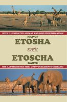
Wegenkaart - landkaart Map of Etosha | Honeyguide

0
Wegenkaart van Etosha NP in Namibie: met campings etc. A4 formaat. This reliable, very informative and cheap guide should be on board if Etosha Natonal Park is your destiny. It holds all information you need there: Telephon- and Fax numbers of the Central Reservation Offices and the Wildlife Ressort, the timetables for gates, shops and restaurants...

Verkopers met dit product

Verkoper
Bezorging
Prijs
DeZwerver.nl logo
DeZwerver.nl
niet bekend
17,50

Anderen bekeken ook

Natuurgids Mammals of Ethiopia, Eritrea, Djibouti and Somalia | Meru Publishing
This long awaited Field Guide to the Larger Mammals of the Horn of Africa depicts some of the world's rarest mammals. All of the larger mammals of Ethiopia, Eritrea, Djibouti and Somalia are described together with identification notes. In full colour, all of the endemic species, and distinctive sub-species, are covered by up to two pages of text with a distribution map and four images, showing the main characters of the mammal and its habitat. Almost all of the other species each occupy a full page with two images and a distribution map. Each species carries details of its distribution, IUCN status, typical localities, local or alternative name, size, description, habitat, similar species and behaviour. The descriptions of the specialties and endemic mammals, including many endangered and little known species, carry additional information including history, threats, status, future outlook and more behavioural details. Experts around the world, who are specialists in their field, have…
24,95
Wegenkaart - landkaart Planning Map Vietnam | Lonely Planet
From Lonely Planet, the world's leading travel guide publisher Durable and waterproof, with a handy slipcase and easy-fold format, Lonely Planet's Vietnam Planning Map helps you get around with ease. Get more from your map and your trip with images and information about top country attractions, itinerary suggestions, a transport guide, planning information, themed lists and practical travel tips. With this easy-to-use, full-colour map in your back pocket, you can truly get to the heart of Vietnam. Durable and waterproof Easy-fold format and convenient size Handy slipcase Full colour and easy to use Before-you-go info Beautiful imagery Tailored itineraries Can't-miss regional highlights Detailed town index Transport planner Themed lists Covers Hanoi, Halong Bay, Ha Giang Province, Sapa, Hoi An, Phong Nha-Ke Bang National Park, Hue, DMZ, Con Dao Islands, Mui Ne, Bai Xep, Ho Chi Minh City, Cu Chi, Cat Tien National Park, Dalat, Kon Tum, Phu Quoc Island, Can Tho, Sam Mount…
10,95
Wegenkaart - landkaart Kgalagadi - Tourist Map of Kgalagadi Transfrontier Park Botswana | Shell
Zeer bijzondere landkaart van het grensgebied van Botswana en Zuid Afrika. Uitermate handig zijn de GPS coordinaten van de meest belangrijke punten als campings of uitzichtpunten. De kaart is gebaseerd op een luchtfoto, waarbij alle details zijn ingetekend. The map: The map consists of a large map of the entire Park on the front of the map. On the back is enlargements of six maps - the South African side, Mabuasehube, Swart Pan area, Gemsbok Wilderness Trail, Mabuasehube Wilderness Trail and of the Kaa Kalahari Concession. Satellite images were used and the roads were tracked by GPS. There are 168 GPS coordinates on this map. Establishment of a Transfrontier Park: On the 7 th of April 1999 Botswana and South Africa signed a bilateral agreement in which they agreed to manage their adjacent national parks, Gemsbok National Park in Botswana and Kalahari Gemsbok National Park in South Africa, as a single ecological unit – the Kgalagadi Transfrontier Park. It is the first formally declared…
17,50
Wegenkaart - landkaart Planning Map Australia - Australië | Lonely Planet
Durable and waterproof, with a handy slipcase and an easy-fold format, Lonely Planet Australia Planning Map is your conveniently-sized passport to traveling with ease. Get more from your map and your trip with images and information about top country attractions, itinerary suggestions, a transport guide, planning information, themed lists and practical travel tips. With this easy-to-use, full colour navigation tool in your back pocket, you can truly get to the heart of Australia, so begin your journey now! Durable and waterproof Easy-fold format and convenient size Handy slipcase Full colour and easy-to-use Before-you-go info Beautiful imagery Tailored itineraries Can't-miss regional highlights Detailed town index Transport planner Themed lists Covers Sydney, Byron Bay, Blue Mountains, Canberra, Melbourne, Goldfields, Great Ocean Road, Murray River, Brisbane, Great Barrier Reef, Whitsundays, The Daintree, Darwin, Kakadu National Park, Uluru-Kata Tjuta National Park, Hob…
10,95
Wegenkaart - landkaart National Park Pocket Map Peak District | Collins
Handige kleine kaart van dit Nationaal Park. De kaart geeft een goed en helder overzicht van het gebied met alle plaatsen, doorgaande wandelpaden (alhoewel grof van schaal), bezienswaardigheden etc. Met een register en aanvullende tekst onder de kaart is het een mooi overzicht wat je waar kunt gaan doen. Handy little full colour map of Peak District National Park. Detailed mapping and visitor information to the National Park along with a selection of photographs. Map at a scale of 1:120 000 (1cm to 1.20km, 1.9 miles to 1 inch).This small map gives a great overview of the Peak District National Park, and is the perfect companion for exploring this beautiful area of England.• Clear, detailed mapping• Key park, tourist and travel information• Ideal for planning visits to the National Park• Index to help locate and plan your trip• Information on the Pennine Way, Stanage-North Lees, caving activities and other places of interest  
7,95
Wegenkaart - landkaart State Guide Map Oregon | National Geographic
Makkelijk leesbare kaart aan 2 zijden bedrukt. De ene kan met informatie en beperkte stadsplattegronden, de andere met de daadwerkelijke kaart. De kaart is geplastificeerd en dus watervast! The front side features an inset of Eugene. The back includes maps and information for Portland and Salem, information for Crater Lake National Park, points of interest, scenic drives, and National Park Service sites in Oregon. National Geographic Guide Maps combine the most reliable road maps available with detailed travel guide information. One side features a detailed state highway map, enhanced with terrain detail and major city insets. The flip side presents tourist, historic, and recreation information, along with color photos, maps, and illustrations. All this folds into a convenient, durable, laminated map perfect for either vacation or business travel.
12,95
Wegenkaart - landkaart National Park Pocket Map South Downs | Collins
Handige kleine kaart van dit Nationaal Park. De kaart geeft een goed en helder overzicht van het gebied met alle plaatsen, doorgaande wandelpaden (alhoewel grof van schaal), bezienswaardigheden etc. Met een register en aanvullende tekst onder de kaart is het een mooi overzicht wat je waar kunt gaan doen. Handy little full colour map of South Downs National Park.Detailed mapping and visitor information to the National Park along with a selection of photographs. Map at a scale of 1:125 000 (1cm to 1.25km, 2.0 miles to 1 inch).This small map gives a great overview of the South Downs National Park, and is the perfect companion for exploring this beautiful area of South East England.• Clear, detailed mapping• Key park, tourist and travel information• Ideal for planning visits to the National Park• Index to help locate and plan your trip· Information on the South Downs Way, Miles Without Stiles routes, the Seven Sisters and other places of interest
7,95
Wegenkaart - landkaart Planning Map USA | Lonely Planet
Durable and waterproof, with a handy slipcase and an easy-fold format, Lonely Planet USA Planning Map is your conveniently-sized passport to traveling with ease. Get more from your map and your trip with images and information about top country attractions, itinerary suggestions, a transport guide, planning information, themed lists and practical travel tips. With this easy-to-use, full colour navigation tool in your back pocket, you can truly get to the heart of the USA, so begin your journey now! Durable and waterproof Easy-fold format and convenient size Handy slipcase Full colour and easy-to-use Before-you-go info Beautiful imagery Tailored itineraries Can't-miss regional highlights Detailed town index Transport planner Themed lists Covers New York City, Washington, DC, Boston, New England, Walt Disney World, Miami, The Everglades, New Orleans, Nashville, Blue Ridge Parkway, Las Vegas, Grand Canyon National Park, Austin & San Antonio, Los Angeles, Pacific Coast Hig…
10,95
Wegenkaart - landkaart National Park Pocket Map Northumberland | Collins
Handige kleine kaart van dit Nationaal Park. De kaart geeft een goed en helder overzicht van het gebied met alle plaatsen, doorgaande wandelpaden (alhoewel grof van schaal), bezienswaardigheden etc. Met een register en aanvullende tekst onder de kaart is het een mooi overzicht wat je waar kunt gaan doen. Handy little full colour map and guide of Northumberland National Park. Detailed mapping and visitor information to the National Park along with a selection of photographs.   This small map with additional text and photographs gives a great overview of the Northumberland National Park, and is the perfect companion for exploring this beautiful area of Northern England.   Clear, detailed mapping Key park, tourist and travel information Ideal for planning visits to the National Park Index to help locate and plan your trip
7,95
Wegenkaart - landkaart National Park Pocket Map Pembrokeshire Coast | Collins
Duidelijke pocket wandelkaart met belangrijke toeristische informatie, bezienswaardigheden, campeerplekken e.d. Handy little full colour map and guide of Pembrokeshire Coast National Park. Detailed mapping and visitor information to the National Park along with a selection of photographs. Map at a scale of 1:133,000 (2.1 miles to 1 inch or 1.33 km to 1cm).   This small map with additional text and photographs gives a great overview of the Pembrokeshire Coast National Park, and is the perfect companion for exploring this beautiful area of West Wales.   Clear, detailed mapping Key park, tourist and travel information Ideal for planning visits to the National Park Index to help locate and plan your trip
7,95

Klanten-reviews van Wegenkaart - landkaart Map of Etosha | Honeyguide

Er zijn nog geen beoordelingen voor dit productBen jij de eerste die een review plaatst?

Meer over Wegenkaart - landkaart Map of Etosha | Honeyguide

Productomschrijving

Wegenkaart van Etosha NP in Namibie: met campings etc. A4 formaat.

This reliable, very informative and cheap guide should be on board if Etosha Natonal Park is your destiny. It holds all information you need there:

Telephon- and Fax numbers of the Central Reservation Offices and the Wildlife Ressort, the timetables for gates, shops and restaurants, the easy-to-read map to the tracks of the park(overall 4 pages), distances of legs, the name of waterholes and resort facilities.

Excellent colour illustrations of the 47 mammals and 211 birds species of Etosha, overall seven pages. Names in German and English.

- Colour map of the National Park (overall 4 pages)
- 7 pages colour illustrations of mammals and birds
- Detailed Information on the camps Namutoni, Halali and Okaukuejo
- Easy-to-read map with names of waterholes, outlooks and rest points

Verken gerelateerde categorieën

Webshop.nl maakt gebruik van cookies. Ga je verder op onze website, ga dan akkoord met het plaatsen van cookies en de verwerking van deze data door ons en vermelde partners.