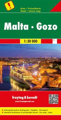
Wegenkaart - landkaart Malta Gozo | Freytag & Berndt

0
Goede wegenkaart van Malta, die gezien de schaal ook uitstekend als wandelkaart te gebruiken is. Road and tourist map of Malta and Gozo that uses shaded-relief and contour lines to depict elevation. Map shows major highways and roads, scenic routes, footpaths, ferry routes, ports, distances in kilometers, natural features, parks, and places of int...

Verkopers met dit product

Verkoper
Bezorging
Prijs
DeZwerver.nl logo
DeZwerver.nl
2,95
14,95

Anderen bekeken ook

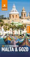
Reisgids Rough Guide Pocket Malta and Gozo | Rough Guides
Een kleinere versie in zakformaat van de grotere versies van de Rough Guides. Als altijd weer vol met goede informatie over cultuur en praktische zaken. Achterin een kaart van de stad. This compact, pocket-sized Malta & Gozo travel guidebook is ideal for travellers on shorter trips and those trying to make the most of Malta & Gozo. It's light, easily portable and comes equipped with a pull-out map.   This Malta & Gozo guidebook covers: Valletta, The Three Cities, Sliema and St Julian's, Mdina and Rabat, Central Malta, The north, The south, Gozo, Comino.   Inside this Malta & Gozo travel book you will find:   - Curated recommendations of places - main attractions, off-the-beaten-track adventures, child-friendly family activities, chilled-out breaks in popular tourist areas - Things not to miss in Malta & Gozo - Gozo's Citadel, Valletta, Hagar Qim And Mnajdra Temple Complex, Birgu, The Blue Lagoon, Mdina, Hal Saflieni Hypogeum, The Marsaxlokk Fish Market, Fort St Elmo & The National War…
14,95
Reisgids Malta & Gozo | Lonely Planet
De perfecte reisgids voor zowel de georganiseerde als de zelfstandige reiziger. Naast een algemene inleiding van het land / streek vol met praktische informatie over hoe je er het beste kunt reizen: slapen, eten, vervoer, excursies ... alles kun je er in vinden. Engelstalig. Lonely Planet Lonely Planet's local travel experts reveal all you need to know to plan the trip of a lifetime in this latest edition of our guide to Malta & Gozo.   Discover Malta & Gozo's most popular experiences and best kept secrets from feasting on fresh seafood in the ancient fishing village of Marsaxlokk, famed for its daily Waterfront Market; to taking a boat trip to Comino to swim in the Blue Lagoon; and seeing extraordinary prehistoric sculptures in the National Museum of Archaeology.   Build a trip to remember with Lonely Planet's Malta & Gozo travel guide:   Our classic guidebook format contains the most comprehensive level of information for planning multi-week trips All-new structure and desi…
24,95
Wandelgids Walking on Malta | Cicerone
Wandelgids met 33 dagtochten op Malta, Gozo en Comino. Goede omschrijvingen, veel praktische informatie. Redelijk kaartmateriaal. (goede wandelkaart Kompass / zie landkaarten) The Maltese Islands of Malta, Gozo and Comino bask in sunshine at the heart of the Mediterranean, between Europe and Africa. History has ensured that the islands have been colonised time and time again, leaving them with a colourful and complex history and heritage. The islands are a popular tourist destination. They offer plenty of historic walks, stunningly beautiful and dramatic architecture, and a good amount of excellent scenery, especially around the cliffs and coastlines. This guidebook describes 33 walks on Malta and its neighbouring islands of Gozo and Comino. Walks generally range from 3 to 17 km, and include Valetta, heritage trails, coastal walks and explorations inland, including the 30km 'Victoria Lines' route between Mgarr and Bahar ic-Caghaq. Malta offers year-round walking. This guidebook descri…
21,95
Wandelkaart Tour & Trail Malta & Gozo | Discovery Walking Guides
Goede scheur- en watervaste wandelkaart van Malta & Gozo. For the best adventures, use the best map. Water-proof, split-proof, tear-proof, adventure-proof. Malta and Gozo Tour & Trail Super-Durable Map is simply the toughest, most accurate, easy to read, easy to use map of the island you can buy at any price.   Super-Durable Maps come with a 2 year adventurous use `Wear and Tear' guarantee. A large 840mm by 694mm double sided map sheet has Malta at 1:32,000 scale on one side, with Gozo at 1:20,000 scale on the reverse. Our special concertina map fold makes our map easy to use and easy to refold to its 235mm by 120mm pocket size.   Our legendary 'Tour & Trail' level of detail ranges from major roads to secondary roads to minor roads to streets and narrow country roads, plus dirt roads and walking trails. Altitude background colouring is designed to clearly show the altitude range when travelling across the islands by car or on foot. 100 metre and 20 metre contours are clearly shown on …
15,95
Wegenkaart - landkaart 801 Malta | Michelin
Edition updated in 2025), Malta is an archipelago in the central Mediterranean between Sicily and the North African coast. It's a nation known for historic sites related to a succession of rulers including the Romans, Moors, Knights of Saint John, French and British. It has numerous fortresses, megalithic temples and the al Saflieni Hypogeum, a subterranean complex of halls and burial chambers dating to circa 4000 B.C. MICHELIN National Map Malta will give you an overall picture of your journey thanks to its clear and accurate mapping scale 1:50,000. Our map will help you easily plan your safe and enjoyable journey in Malta thanks to a comprehensive key, a complete name index as well a clever time & distance chart. Includes a City map of Valletta. Our National Map Series will help you easily plan your safe and enjoyable journey thanks to a comprehensive key, a complete name index as well a clever time & distance chart. Michelin's driving information will help you navigate safely in al…
11,95
Wegenkaart - landkaart Malta & Gozo | ITMB
Malta has a spectacular history, combined with a Mediterranean climate and its new status as a member of the EU and a user of the Euro, which makes it extremely attractive for European visitors. In this edition, we threw caution to the winds and converted the artwork into a much-expanded double-sided map at a far better scale than the previous edition. Both major islands are now shown in a much easier print size for easier usage, and insets of Valletta (the capital), Bugibba/Qawra (where most of the hotels are located), Marsaskala, Mdina, and Victoria now grace the map.
13,95
Wandelkaart - Wegenkaart - landkaart Liparische eilanden | Freytag & Berndt
Gedetailleerde wegenkaart en wandelkaart (géén wandelroutes ingetekend!) met uitgebreide legenda en plaatsnamenregister. Meer wegenkaart dan wandelkaart. Aeolian (Lipari) Islands at 1:20,000 from Freytag & Berndt on a double-sided map which presents on the reverse coverage of Italy south of Rome at 1:600,000 and shows ferry access to the islands from the mainland or Sicily.   On one side the islands are shown in a series of panels, with the three largest: Salina, Lipari and Vulcano together, and Alicudi, Filicudi, Panarea and Basiluzzo plus Stromboli as separate insets. Topography is shown by contours at 50m intervals enhanced by relief shading, with names of peaks, valleys, etc. All place names are in large, easy to read print.   Road network includes country tracks and a selection of hiking paths. Various places of interest and facilities are highlighted, including beaches, marinas, campsites, etc. Each individual inset has latitude and longitude lines at intervals of 1’.   Ferry po…
14,95
Wegenkaart - landkaart 3310 Adventure Map Sicily - Sicilië | National Geographic
Wegenkaart van Sicilië, Italië met vermelding van veel bezienswaardigheden, nationale parken en attrakties. Watervast en scheurvast. Juist door deze vermeldingen onderscheidt de kaart zich van andere wegenkaarten.   National Geographic's Sicily AdventureMap is designed to meet the unique needs of adventure travelers detailed, durable, and accurate. Sicily includes the locations of thousands of cities and towns with an index for easily locating them, plus a clearly marked road network complete with distances and designations for expressways, motorways, scenic routes, and more.    What sets National Geographic AdventureMaps apart from traditional road maps are the hundreds of points of interest that highlight the diverse and unique destinations within Sicily. National Parks, archeological sites, prehistoric monuments, museums, palaces, castles, churches, monasteries and more are noted making this map indispensable for travelers seeking to experience all the history, art, and culture …
17,50
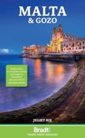
Reisgids Malta and Gozo | Bradt Travel Guides
Goede reisgids van Malta over steeds populairder wordende land. Vooral vol met allerhande praktische informatie die het reizen en verblijven makkelijker maken. Voorin aandacht voor cultuur en bevolking. Prima reisgids, engelstalig. This new, thoroughly updated fourth edition of Bradt's Malta - written by an expert who has been visiting for more than a decade - remains the most comprehensive guide available and has built a reputation for being the essential guide for getting beneath the surface of this island nation and discovering what lies beyond the beaches. Sun, sand and sea there may be, but Malta boasts so much more, and this new edition is packed with historical and archaeological insights, from the Stone Age to the Romans, the Knights Hospitaller to World War II. It also showcases the islands' wildlife and bird-watching opportunities, summer festas, and the less commercialised islands of Gozo and Comino.   Malta has been changing at the rate of knots, with Valletta's year as Eu…
20,95
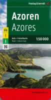
Wegenkaart - landkaart Azoren - Azores | Freytag & Berndt
Uitstekende wegenkaart van de Azoren. Met index, toeristische informatie, Autoveerboten en jachthavens. Elk eiland op een aparte inzet. Gedetailleerde landkaart, ook te gebruiken als wandelkaart of fietskaart van de Azoren (Acores, Portugal) schaal 1:50.000 met uitgebreide legenda en plaatsnamenregister. This large double-sided road map of the Azores, at 1:50,000 from Freytag & Berndt, shows the islands both individually and as a group and comes with an attached index and concise leisure guide booklet.    This map shows main and minor roads, motorways and toll roads, sections under construction or closed to traffic. Conveniently highlighted are scenic routes, gradients on steep roads, driving distances in kilometres, petrol and service stations etc. Railway lines are marked and international and local airports are indicated as well as ferry connections to the other islands.    Relief shading, spot heights and colouring and/or graphics provide a good presentation of the islands topogra…
14,95

Klanten-reviews van Wegenkaart - landkaart Malta Gozo | Freytag & Berndt

Er zijn nog geen beoordelingen voor dit productBen jij de eerste die een review plaatst?

Meer over Wegenkaart - landkaart Malta Gozo | Freytag & Berndt

Productomschrijving

Goede wegenkaart van Malta, die gezien de schaal ook uitstekend als wandelkaart te gebruiken is.

Road and tourist map of Malta and Gozo that uses shaded-relief and contour lines to depict elevation. Map shows major highways and roads, scenic routes, footpaths, ferry routes, ports, distances in kilometers, natural features, parks, and places of interest. Insets of Valletta & Sliema and regional map that shows the islands in relationship to Sicily. Legend in German, English, French, and Italian.

Productinformatie

    Verken gerelateerde categorieën

    Webshop.nl maakt gebruik van cookies. Ga je verder op onze website, ga dan akkoord met het plaatsen van cookies en de verwerking van deze data door ons en vermelde partners.