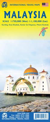
Wegenkaart - landkaart Maleisië | ITMB

0

Verkopers met dit product

Verkoper
Bezorging
Prijs
DeZwerver.nl logo
DeZwerver.nl
2,95
13,95

Anderen bekeken ook

Wegenkaart - landkaart Maleisië - Malaysia | Reise Know-How Verlag
Tweetalige kaart (Engels en Duits). Door ingetekende lengte- en breedtegraden is het gebruik van GPS mogelijk. Met hoogtelijnen en uitgebreid wegennetwerk: daarnaast worden ook de afstanden tussen belangrijke plaatsen duidelijk leesbaar weergegeven. Het kleurgebruik is zodanig dat je een goede indruk krijgt van hoogteverschillen en soorten landschap. Natuurlijk staan de toeristische bezienswaardigheden duidelijk vermeld.   West Maleisië (vasteland) op schaal 1:800.000 Sabah en Sarawak op schaal 1:1.000.000   Gedrukt op water- en scheurvast papier! Polyart is een synthetisch product vrij van giftige stoffen dus duurzaam. Het papier gaat echt lang mee.   Topography is indicated by altitude colouring with numerous spot heights and names of mountain ranges and passes. Salt lakes, swamps, seasonal rivers and glacier are also shown. Detailed presentation of the road network includes minor roads and tracks and railways are also shown.   Internal administrative units are presented with their …
11,50
Wegenkaart - landkaart 3021 Adventure Map Malaysia Maleisië | National Geographic
Wegenkaart van Maleisië met vermelding van veel bezienswaardigheden, nationale parken en attrakties. Watervast en scheurvast. National Geographic's Malaysia Adventure Map is designed to meet the unique needs of adventure travelers with its durability and accurate information. Each folded map provides global travelers with the perfect combination of detail and perspective, highlighting the area’s terrain and best locations for adventure activities like snorkeling, surfing, fishing, and more. Adventure Maps include hundreds of points of interest that highlight diverse and unique destinations within the country.   The map includes the locations of thousands of cities and towns with a user-friendly index, plus a clearly marked road network complete with distances and designations for major highways, main roads, and tracks and trails for those seeking to explore more remote regions.   Key Features: Waterproof and tear-resistant Detailed interpretive information and local travel tips Det…
17,50
Wegenkaart - landkaart Bahamas | ITMB
Een degelijke kaart met aanduidingen van o.a. nationale parken, vliegveld, benzinepomp, dirt-roads en kleine plattegrond van hoofdstad. As overzichtskaart goed te gebruiken. The Bahamas is one of the most touristic Caribbean island countries, with huge resort complexes in Nassau and in Freeport. We visited Grand Bahama Island earlier this month and can attest to the friendliness of the people and the attractiveness of the island. This map shows all of the many islands that comprise The Bahamas. There isn’t a lot of contouring, as the country’s highest point is only 36 feet above sea level. An inset map expanding the island of New Providence, and separate inset maps of Nassau and of Freeport, are included. The map is double-sided, east half-west half, printed on waterproof paper for durability.
13,95
Wegenkaart - landkaart India | ITMB
Een degelijke kaart met aanduidingen van o.a. nationale parken, vliegveld, benzinepomp, dirt-roads en kleine plattegrond van Delhi. Kleine overzichtskaarten van de regio's rondom Mumbai en Kolkata. Als overzichtskaart goed te gebruiken. Gedrukt op watervast papier wat de levensduur van deze kaart ten goede komt! In spite of the current turmoil, India is not just an important Asian country, it is a dynamic powerhouse of the continent, vying with China for dominance in the emerging world order. It is also an ancient society, home of Buddhism, Hinduism, and the Sikh faith. It is also a very complicated country to map and we have spent a lot of time and effort into adding new roads and extra towns. India evokes for me the days of the Rajasthan, the pink city of Jaipur, the deserted city of Fathepur Sikri, the Red Fort at Delhi, and the Residency at Lucknow. India is huge, it is beautiful, and it is – well, India. It is unique. Legend Includes: Main roads, Tourism information, historic pla…
13,95
Wegenkaart - landkaart Madagascar | ITMB
Een degelijke kaart met aanduidingen van o.a. nationale parken, vliegveld, benzinepomp, dirt-roads en kleine plattegrond van hoofdstad. Als overzichtskaart goed te gebruiken. Tweezijdig! IThe large island off the east coast of Africa is Madagascar. The actual name of the country is the Malagasy Republic, but the public is much more likely to know the country by its island name, so we call our map by the island’s name, rather than using the country name. Makes sense to us! Regardless, this is a major touristic destination. The double-sided map covers the island in great detail, with an inset map of the capital city, Antananarivo. As with other ITMB maps, this one includes a listing of ‘must see’ attractions, such as Tsingy National Park and the famous Lemur’s Park. The island also has a regular surface route to the Comoro Islands, which are also included on this map. Legend Includes: Railroads, Forest, Mational Park, International Airport, Domestic Airport, Fort, holtel, Cave, Museum, …
13,95
Wegenkaart - landkaart Gibraltar | ITMB
We are always pleased to announce the release of a new title. The Straits of Gibraltar, as this map should be named is historically significant as the crossing point between Europe and North Africa and, more recently, as the guardian of the Mediterranean. It is now moving into a new era – tourism. The city/colony of Gibraltar itself is well worth a visit, and a detailed map is provided. The Spanish city/colony on the North African coast is equally interesting and is also shown, as is Tangier and a good stretch of the Moroccan north coast. This map is printed single-sided, on paper.
13,95
Wegenkaart - landkaart Ecuador | ITMB
Duidelijke wegenkaart van Ecuador, aan 2 zijden bedrukt. Met stadsplattegronden van Quito, Guayaquil. Aanduidingen van benzinestations, Nationale parken en bezienswaardigheden. Very detailed, double sided travel map of Ecuador shows road network and physical features. Distances between communities are shown, as well as gas stations outside of major towns. National parks and points of interest are also shown. Includes an inset map of Quito and Environs of Guayaquil as well as a comprehensive place name index. Printed on waterproof synthetic paper suitable for tropical conditions.
13,95

Klanten-reviews van Wegenkaart - landkaart Maleisië | ITMB

Er zijn nog geen beoordelingen voor dit productBen jij de eerste die een review plaatst?

Meer over Wegenkaart - landkaart Maleisië | ITMB

Productinformatie

    Verken gerelateerde categorieën

    Webshop.nl maakt gebruik van cookies. Ga je verder op onze website, ga dan akkoord met het plaatsen van cookies en de verwerking van deze data door ons en vermelde partners.