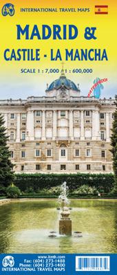
Wegenkaart - landkaart Madrid & Castile/La Mancha | ITMB

0
ITMB is pleased to introduce this new map, using our own artwork, for Madrid, covering essentially all the area within the circular ring road motorway. All the streets are named and included in a place names index. Parks, touristic attractions, hotels, shopping areas, churches, mosques, restaurants, pubs, transit lines – it’s all there. Coverage i...

Verkopers met dit product

Verkoper
Bezorging
Prijs
DeZwerver.nl logo
DeZwerver.nl
2,95
14,95

Anderen bekeken ook

Wegenkaart - landkaart Madrid & Castile/La Mancha | ITMB
ITMB is pleased to introduce this new map, using our own artwork, for Madrid, covering essentially all the area within the circular ring road motorway. All the streets are named and included in a place names index. Parks, touristic attractions, hotels, shopping areas, churches, mosques, restaurants, pubs, transit lines – it’s all there. Coverage is from the railway station in the south to the university in the north and from the Parque del Oeste in the west to the bull fighting ring in the east. The reverse side is a detailed regional map for the Castilla La Mancha province to the south of Madrid, with Toledo, Albacete, Murcia, and Cordoba. All roads and parks are shown, as well as major touristic attractions.  
14,95
Wegenkaart - landkaart 576 Extremadura - Castilla La Mancha - Madrid - Toledo - Mérida | Michelin
Zoals je van Michelin mag verwachten zijn het onmisbare overzichtskaarten van een uitstekende kwaliteit: een duidelijk en goed leesbaar kaartbeeld.  Vrijwel alle berijdbare wegen staan er op ingetekend, in kleur verschillend voor grote en kleine wegen. Andere weginformatie omvat bijvoorbeeld kilometer-afstanden, tolwegen, helling-aanduiding, winterafsluitingen, tankstations maar ook de bekende groene routes: de mooiste wegen om te rijden.   Daarnaast geeft de kaart toeristische informatie met symbolen weer: bezienswaardigheden als kastelen, kloosters, musea, maar ook campings (niet allemaal overigens). De kaart is voorzien van een 4-talige legenda.   Toch hebben de makers door een beperkt gebruik van symbolen geen drukke kaart gemaakt. De kracht zit hem dan ook in de combinatie van meer dan voldoende informatie en goede leesbaarheid.  Part of the orange regional series from Michelin, this Extremadura, Castilla La Mancha, Madrid map shows this part of Spain in excellent detail. Primary…
11,95
Wegenkaart - landkaart Litouwen & Letland | ITMB
ITMB is very pleased to release its first-ever map of the Baltic country of Lithuania, which occupies Side 1 of this double-sided map. It is bordered by Latvia on its north, the Russian enclave of Kalingrad on its southeast, and Poland and Belarus on its south and east. It is now on the front lines of tension between Russia and its neighbours, as are all the Baltic states. It is also a valued member of both NATO and the EU, and as such is easy to access from either Poland or Latvia. Lithuania fronts on to the Baltic Sea with a major port at Klaipeda (formerly Memel), with its capital being Vilnius. Historically, the country has suffered German and Russian invasions during the 20th century, the last of which resulted in the country losing its independence completely by being absorbed into the Russian Empire in the latter stages of WW2. It regained its independence in 1991, with the collapse of the USSR and shortly thereafter applied to join both the European Union and NATO. Touristical…
14,95
Wegenkaart - landkaart Grand Canyon and Arizona | ITMB
Aan de ene zijde degelijke wegenkaart van Arizona, schaal 1:1.000.000, met aanduidingen van o.a. nationale parken, vliegveld, benzinepomp, dirt-roads. Als overzichtskaart goed te gebruiken. Op de andere kant een gedetailleerde kaart van de Grand Canyon, schaal 1:90.000. This is a double-sided map, with a very good map of the State of Arizona on one side and an excellent exploratory map of the Grand Canyon on the other. The map can be marketed equally well as a State map or as a recreational/touristic map. Needless to say, the deep canyons carved by the Colorado River over millennia have created one of the great natural wonders of the world. This is a ‘must-see-before-I-die’ travel experience, visited by millions of people each year. Our map shows access areas, viewpoints, trails leading down to the valley floor, and the man-made attractions common to a major touristic site. The other side covers all of Arizona, with bits of Nevada, Utah, California, and Mexico and shows wilderness cam…
13,95
Wegenkaart - landkaart Ierland | ITMB
As technology improves, we are able to produce more detailed maps than was previously possible. Such is the case with Ireland, a part of the world consisting of two countries divided by religion and history. Preparing a map of Ireland as a double-sided map means cutting the island into two geographic portions. Side 1 covers the northern half. This includes the portion known as Northern Ireland, or Ulster, and a fair portion of the Republic of Ireland, or Eire; essentially everything north of Dublin and west to Counties Mayo and Galway. Side 2 covers the southern half of the island from just north of Dublin to the outer tips of County Kerry. It also includes a nice inset map of central Dublin. Naturally, all motorways and roads are included, as are touristic attractions, camping/caravan sites, ferry terminals, and Top Attractions. This is a very detailed travel map of the island, printed on waterproof paper for durability. We had great fun driving around Ireland researching this map. I…
14,95
Wegenkaart - landkaart Queensland | ITMB
Een degelijke wegenkaart van Queensland met aanduidingen van o.a. nationale parken, vliegveld, benzinepomp, dirt-roads en kleine plattegrond van hoofdstad. Als overzichtskaart goed te gebruiken. We complete our series of regional maps covering Australia with this map of Queensland, which nicely fills a double-sided sheet with only small portions of adjoining states showing. The map also includes a large inset map of central Brisbane. At this scale, the road/rail network of this part of Australia becomes very clear. The first side concentrates on the northern portion of the state, and the other side, the more densely-developed southern half. The map includes a listing of the state’s top attractions, and notes al major touristic attractions. Although gas/petrol stations are commonly found, we have included some gas symbols in remoter parts of Queensland to encourage drivers to venture into roads less travelled. All states and territories of Australia are now available from ITMB as separ…
13,95
Wegenkaart - landkaart Spain Mediterranean Coast | ITMB
Een degelijke overzichtskaart van het oosten en zuiden van Spanje. Spain is one of the most popular travel destinations in Europe. The country is extremely diverse, reflecting its history. The coastal areas of the Mediterranean were probably first settled by Phoenicians, then Greeks, then Romans, and then Arabs before being brought into a united Spain at the time Columbus was seeking a sponsor to fund his proposed journey to discover new lands to the west. This map focuses on the coast from the French border south through Catalunya all the way to the Straits of Gibraltar and Cadiz. The offshore islands of Mallorca, Ibiza, and Menorca are included, as is the North African Spanish enclave of Ceuta and the British enclave of Gibraltar. All road and rail lines are shown, including the new Cadiz to Madrid fast train. By the nature of mapping, a considerable amount of the interior is on the map as well, so this map is much more than just a coastal journey through Valencia and Murcia to reac…
13,95
Wegenkaart - landkaart England & Wales - Engeland | ITMB
Een degelijke kaart met aanduidingen van o.a. nationale parken, vliegveld, benzinepompen. ITMB publishes a map of Great Britain, but each portion of GB needs its own map to show roads and attractions in more detail. This is a brilliant map of both England and Wales, showing the entire 'country' in a double-sided format. The place names index is formidable, but England in particular is a series of little villages, so it has been very difficult to decide what to include and what to leave out. This map is showing motorways, divided carriageways, all A & B highways, railway lines, airports, historic sites and touristic attractions, parks and gardens, and just about everything that we could fit on to the page to provide users with a detailed, usable map. We have been able to fit all of southern England/Wales as far north as Chester/Lincoln on side A and with a little overlap, from those cities north to the well over the Scottish border, up to Perth/Dundee filling side B. The Isle of Man an…
13,95
Wegenkaart - landkaart Southern Alberta & Southern British Columbia | ITMB
ITMB, being based in Vancouver, BC, understandably has a local/regional market for our map line. We have a map of Western Canada, as well as an atlas, a very nice map of BC itself, a map of the south half of BC, and a map of part of BC combined with Washington State. What we did not have, until now, was a map covering the most touristically-visited part of all of Canada – namely, the southern halves of both British Columbia and its neighbour, Alberta, with a small amount of Washington State, Idaho, and Montana (to assist those heading north and needing to know about border crossings). Therefore, ITMB is pleased to announce the release of Southern BC and Alberta. Side One covers BC from the US border (with a carry-on to Seattle) north to Prince George and east to the Alberta border, with a carry-on to Calgary. All of Vancouver Island, the Okanagan Valley, and the Rock Mountain National Parks of Banff and Jasper, are included. The map is rich with wilderness campsite (almost 1,000 are s…
13,95
Wegenkaart - landkaart New Zealand North Island | ITMB
ITMB is very pleased to be expanding our coverage of New Zealand with the release of this fourth title (the others being the country map, the South Island, and Auckland). At this expanded scale, it takes both sides of the sheet to show off the attractions of the northern half of NZ, but the shape of the island provides ample space for a large inset of Auckland and more modest ones of the city region and of New Zealand’s public transport network on side one. Side two has an excellent inset map of Wellington and includes the northernmost portion of South Island, with the ferry connection linking the two islands. At this scale, the place names and road network are very readable, and there is lots of room to show attractions and touristic points of interest. The map also includes our Top Attractions list of must-sees, such as Napier Rotorua, and the Hobbitown Movie Set of Lord of the Rings fame.
13,95

Klanten-reviews van Wegenkaart - landkaart Madrid & Castile/La Mancha | ITMB

Er zijn nog geen beoordelingen voor dit productBen jij de eerste die een review plaatst?

Meer over Wegenkaart - landkaart Madrid & Castile/La Mancha | ITMB

Productomschrijving

ITMB is pleased to introduce this new map, using our own artwork, for Madrid, covering essentially all the area within the circular ring road motorway. All the streets are named and included in a place names index. Parks, touristic attractions, hotels, shopping areas, churches, mosques, restaurants, pubs, transit lines – it’s all there. Coverage is from the railway station in the south to the university in the north and from the Parque del Oeste in the west to the bull fighting ring in the east. The reverse side is a detailed regional map for the Castilla La Mancha province to the south of Madrid, with Toledo, Albacete, Murcia, and Cordoba. All roads and parks are shown, as well as major touristic attractions.  

Productinformatie

    Verken gerelateerde categorieën

    Webshop.nl maakt gebruik van cookies. Ga je verder op onze website, ga dan akkoord met het plaatsen van cookies en de verwerking van deze data door ons en vermelde partners.