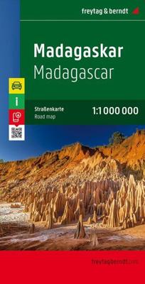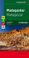
Wegenkaart - landkaart Madagascar - Madagaskar | Freytag & Berndt

0
Uitstekende, dubbelzijdige kaart van Madagascar. Met index, Nationale parken en afstanden in kilometers. Met Mauritius en Réunion er ook nog op. Explore Madagascar with this Freytag & Berndt double-sided road map. The best way to plan your trip, prepare your itinerary, and to travel independently in this country. As with all Freytag & Berndt maps ...

Verkopers met dit product

Verkoper
Bezorging
Prijs
DeZwerver.nl logo
DeZwerver.nl
2,95
14,95

Anderen bekeken ook

Wegenkaart - landkaart Madagascar - Madagaskar | Freytag & Berndt
Uitstekende, dubbelzijdige kaart van Madagascar. Met index, Nationale parken en afstanden in kilometers. Met Mauritius en Réunion er ook nog op. Explore Madagascar with this Freytag & Berndt double-sided road map. The best way to plan your trip, prepare your itinerary, and to travel independently in this country. As with all Freytag & Berndt maps the cartography is clear and detailed with the topography shown by relief shading with plenty of spot heights.   The map also includes an inset showing the Comoros Islands and Mayotte at the same scale as the main map.   Tourist information and places of interest are clearly marked by a range of icons, including:    railways, local airports and ferry routes campsites beaches diving and windsurfing sites UNESCO sites spas, wells and caves   Distances between points are shown as well as indications of steep gradients, all distances are in kilometres. The legend is in several languages inlcuding English.    
14,95
Reisgids Madagascar - Madagaskar | Bradt Travel Guides
Zeer goede gids voor Madagaskar en betrouwbaar alternatief voor de Lonely Planet. Zo mogelijk nog completer! Zelfde soort informatie als de Lonely Planet: vol met praktische feiten en achtegronden. Engels. Bradt Guide A new, thoroughly updated 13th edition of Bradt's Madagascar, the leading and most comprehensive guide to this unique island nation, written by Hilary Bradt, who first visited in 1976 and has returned roughly 35 times, and Daniel Austin, who has visited 12 times and continues to travel there annually. Bradt's Madagascar is by far the most thorough guide to the country in English and is written and updated by established experts whose unparalleled knowledge of Madagascar combines with contributions from over 50 experts in a book which has been the most authoritative guide to the country for three decades. It covers national parks and protected areas and includes itineraries to suit all interests and budgets, plus details of around 1,000 hotels and restaurants. Madagascar …
24,95
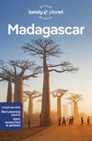
Reisgids Madagascar - Madagaskar | Lonely Planet
De perfecte reisgids voor zowel de georganiseerde als de zelfstandige reiziger. Naast een algemene inleiding van het land / streek vol met praktische informatie over hoe je er het beste kunt reizen: slapen, eten, vervoer, excursies ... alles kun je er in vinden. Engelstalig. Lonely Planet Lonely Planet's Madagascar is our most comprehensive guide that extensively covers all the country has to offer, with recommendations for both popular and lesser-known experiences. Spot chameleons and lemurs in national parks, haggle like a local in Antananarivo, and snorkel incredible coral reefs; get close to gorillas in Volcanoes National Park, Rwanda; all with your trusted travel companion.   Inside Lonely Planet's Madagascar Travel Guide:     Lonely Planet's Top Picks - a visually inspiring collection of the destination's best experiences and where to have them   Itineraries help you build the ultimate trip based on your personal needs and interests Local insights give you a richer, mo…
23,95
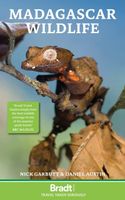
Natuurgids Madagascar Wildlife - Madagaskar | Bradt Travel Guides
Een gids met zowel een beschrijving van de mooiste gebieden en biotopen als een (beperkte) fotografische veldgids met aandacht voor de meest voorkomende soorten. Prachtig uitgevoerd. Puur alleen aandacht voor natuur. Engelstalig. This new, fifth edition of Bradt's Madagascar Wildlife, first published over 25 years ago, celebrates the unique fauna of this remarkable Indian Ocean island. Written by naturalist tour-leaders and Madagascar experts, and aimed at visitors and natural-history enthusiasts alike, this guide has been thoroughly updated to reflect both the latest discoveries – on an island where new species for science are continuously discovered – and the latest developments at the country's top wildlife-tourism locations.     Wildlife is the key draw for English-speaking visitors to Madagascar. Enjoying nature couldn't be more different to continental Africa. Rather than going out on safari to see the Big Five from the safety of a jeep, in Madagascar you approach wildlife on ra…
26,95
Wegenkaart - landkaart Madagascar | ITMB
Een degelijke kaart met aanduidingen van o.a. nationale parken, vliegveld, benzinepomp, dirt-roads en kleine plattegrond van hoofdstad. Als overzichtskaart goed te gebruiken. Tweezijdig! IThe large island off the east coast of Africa is Madagascar. The actual name of the country is the Malagasy Republic, but the public is much more likely to know the country by its island name, so we call our map by the island’s name, rather than using the country name. Makes sense to us! Regardless, this is a major touristic destination. The double-sided map covers the island in great detail, with an inset map of the capital city, Antananarivo. As with other ITMB maps, this one includes a listing of ‘must see’ attractions, such as Tsingy National Park and the famous Lemur’s Park. The island also has a regular surface route to the Comoro Islands, which are also included on this map. Legend Includes: Railroads, Forest, Mational Park, International Airport, Domestic Airport, Fort, holtel, Cave, Museum, …
13,95
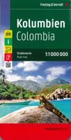
Wegenkaart - landkaart Colombia | Freytag & Berndt
Gedetailleerde, tweezijdige landkaart van Colombia, prima geschikt voor planning en rondtrekken over alle eilanden. De berijdbare wegen zijn goed weergeven, zowel de hoofdwegen als provinciale en lokale wegen; wegnummers worden vermeld. Afstanden tussen plaatsen zijn in kilometers op de kaart ingetekend, daarnaast worden ook op belangrijke plekken benzinepompen gemarkeerd. Explore Columbia with this Freytag & Berndt double-sided road map. The best way to plan your trip, prepare your itinerary, and to travel independently in this country. As with all Freytag & Berndt maps the cartography is clear and detailed with the topography shown by relief shading with plenty of spot heights.   Freytag & Berndt maps make good use of an icon system. Icons show tourist information such as:   Surfing areas and Diving Sites Monuments and Places of Interest Camping Sites and Hiking Trails Lake, Rivers and Canals   Distances between points are shown as well as indications of steep gradients, all distanc…
14,95
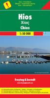
Wandelkaart - Wegenkaart - landkaart Chios - Hios | Freytag & Berndt
Freytag & Berndt kaarten op schaal 1:50.000 (of kleiner) zijn zeer overzichtelijk, wandelpaden werden erop ingekleurd, ze bevatten voldoende details om een wandeltocht in te schatten en worden meestal geleverd met een wandelgids waarin beknopte gegevens van wandelingen naar almen en hutten terug te vinden is alsook heel wat nuttige toeristische informatie en een tabel met GPS-punten. gedetailleerde landkaart met toeristische informatie, ook te gebuiken als fietskaart - met uitgebreide legenda en plaatsnamenregister.  Explore Chios with this Freytag & Berndt road map. The best way to plan your trip, prepare your itinerary, and to travel independently in this country.    As with all Freytag & Berndt maps the cartography is clear and detailed with the topography shown by relief shading with plenty of spot heights.   The map includes a detailed index and legend, along with tourist information and National Park information.   Distances between points are shown as well as indications of ste…
14,95
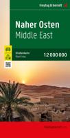
Wegenkaart - landkaart Naher-Osten, Midden Oosten | Freytag & Berndt
Overzichtskaart van het Midden Oosten. Met register en duidelijk kaartbeeld. xplore Middle East with this Freytag & Berndt map. The best way to plan your trip, prepare your itinerary, and to travel independently in this country. As with all Freytag & Berndt maps the cartography is clear and detailed with the topography shown by relief shading with plenty of spot heights.   This map includes a booklet at the front containing a detailed index and insets of major capitol cities in the area, including Cairo, Tehran, and more.   Freytag & Berndt maps make good use of an icon system. Icons show tourist information such as:   Forest Lakes, rivers and canals Places of interest Castles, ruins and other archaeological sites   Distances between points are shown as well as indications of steep gradients, all distances are in kilometres. The legend is in several languages including English.
14,95
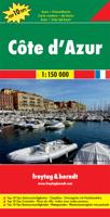
Wegenkaart - landkaart Côte d'Azur- Franse Riviera | Freytag & Berndt
Deze bijzonder gedetailleerde Freytag & Berndt Wegenkaart van de Cote d'Azur is aan één kant geprint en heeft een schaal van 1:150.000. Op deze kaart staan o.a. fietsroutes, lange afstandswandelpaden, toeristische wegen en bezienwaardigheden aangegeven. In de omslag van de kaart is een apart boekje geniet met een korte beschrijving van de TOP 10 van bezienswaardigheden, een uitgebreide index en plattegrondjes van enkele toeristische plaatsen. Explore the French Riviera with this Freytag & Berndt road map. The best way to plan your trip, prepare your itinerary, and to travel independently in this country. As with all Freytag & Berndt maps the cartography is clear and detailed with the topography shown by relief shading with plenty of spot heights.   This map includes detailed land information of the French Riviera area, and also insets of major towns including Nice, Toulon, Cannes, Monte Carlo and more. Also included is a booklet of top tips of what to do and see when visiting there.  …
14,95
Wegenkaart - landkaart Hongarije | Freytag & Berndt
Goede wegenkaart van het hele land. Met register en enkele stadsplattegronden. De berijdbare wegen zijn goed weergeven, zowel de hoofdwegen als provinciale en lokale wegen; wegnummers worden vermeld. Afstanden tussen plaatsen zijn in kilometers op de kaart ingetekend, daarnaast worden ook op belangrijke plekken benzinepompen gemarkeerd. In het kaartbeeld wordt door middel van schaduw het reliëf weergegeven en soms enkele punten in het landschap met de daadwerkelijke hoogte. Provinciegrenzen zijn goed terug te vinden, nationale parken en reservaten ook. Met allerhande symbolen worden toeristische bezienswaardigheden weergegeven als monumenten, historisch belangrijke plekken en uitzichtpunten. In bepaalde plaatsen zijn hotels en campings te vinden, luchthavens, treinverbindingen en havens vindt u er ook op! Explore Hungary with this Freytag & Berndt road map. The best way to plan your trip, prepare your itinerary, and to travel independently in this country. As with all Freytag & Berndt…
14,95

Klanten-reviews van Wegenkaart - landkaart Madagascar - Madagaskar | Freytag & Berndt

Er zijn nog geen beoordelingen voor dit productBen jij de eerste die een review plaatst?

Meer over Wegenkaart - landkaart Madagascar - Madagaskar | Freytag & Berndt

Productomschrijving

Uitstekende, dubbelzijdige kaart van Madagascar. Met index, Nationale parken en afstanden in kilometers. Met Mauritius en Réunion er ook nog op.

Explore Madagascar with this Freytag & Berndt double-sided road map. The best way to plan your trip, prepare your itinerary, and to travel independently in this country. As with all Freytag & Berndt maps the cartography is clear and detailed with the topography shown by relief shading with plenty of spot heights.   The map also includes an inset showing the Comoros Islands and Mayotte at the same scale as the main map.   Tourist information and places of interest are clearly marked by a range of icons, including:    railways, local airports and ferry routes campsites beaches diving and windsurfing sites UNESCO sites spas, wells and caves   Distances between points are shown as well as indications of steep gradients, all distances are in kilometres. The legend is in several languages inlcuding English.


Productinformatie

    Verken gerelateerde categorieën

    Webshop.nl maakt gebruik van cookies. Ga je verder op onze website, ga dan akkoord met het plaatsen van cookies en de verwerking van deze data door ons en vermelde partners.