webshop.nl
Categorieën
  Sluiten

Meer ITMB
Meer ITMB in Literatuur boeken

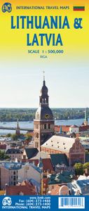
Wegenkaart - landkaart Litouwen & Letland | ITMB

ITMB is very pleased to release its first-ever map of the Baltic country of Lithuania, which occupies Side 1 of this double-sided map. It is bordered by Latvia on its north, the Russian enclave of Kalingrad on its southeast, and Poland and Belarus on its south and east. It is now on the front lines of tension between Russia and its neighbours, as a...
14,95

Webshops met dit product

Webshop
Bezorging
Prijs

Anderen bekeken ook

Wegenkaart - landkaart Litouwen & Letland | ITMB
ITMB is very pleased to release its first-ever map of the Baltic country of Lithuania, which occupies Side 1 of this double-sided map. It is bordered by Latvia on its north, the Russian enclave of Kalingrad on its southeast, and Poland and Belarus on its south and east. It is now on the front lines of tension between Russia and its neighbours, as are all the Baltic states. It is also a valued member of both NATO and the EU, and as such is easy to access from either Poland or Latvia. Lithuania fronts on to the Baltic Sea with a major port at Klaipeda (formerly Memel), with its capital being Vilnius. Historically, the country has suffered German and Russian invasions during the 20th century, the last of which resulted in the country losing its independence completely by being absorbed into the Russian Empire in the latter stages of WW2. It regained its independence in 1991, with the collapse of the USSR and shortly thereafter applied to join both the European Union and NATO. Touristicall…
14,95
Stadsplattegrond Letland - Latvia & Riga | ITMB
Een degelijke kaart met aanduidingen van o.a. nationale parken, vliegveld, benzinepomp, dirt-roads en plattegrond van hoofdstad. Als overzichtskaart goed te gebruiken. This is a brand new mapping area for ITMB. We have had a map of Riga for years, but not the country of Latvia, which now graces one side of the sheet while Riga occupies the other. The country is larger than one might think, touristically friendly, historically significant, and strategically important. Wedged between Estonia on the north and Lithuania on the south, Latvia tends to be a fast north-south route through the Baltic States, but its strength lies in being an east-west country with a very long coastline. Riga itself is a very interesting city, and our map shows it to perfection. This map would be very useful for anyone going to the Baltic Sea countries and firs very well with our companion map of Estonia/Talinn
13,95
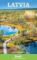
Reisgids Latvia - Letland | Bradt Travel Guides
Voor vele landen net zo goed, zo niet beter dan de Planet. Beduidend soberder uitgevoerd, maar ook met veel informatie voor backpackers en met veel kaartmateriaal. Een aanrader! Engels. This thoroughly updated edition, rewritten by the current British Ambassador to Latvia, remains the only English-language guidebook with comprehensive coverage of the country. Latvia is best known internationally through its capital city Riga, whose centre is a UNESCO World Heritage site combining a medieval core providing testimony of its importance as a port of the Hanseatic League and an outer centre containing the most extensive assemblage of Art Nouveau buildings in Europe.   Beyond the capital, Latvia is much larger than Denmark or Switzerland, yet with a population of under two million is one of the most verdant countries in Europe. It is a low-lying landscape of forests, lakes and marshes, offering wonderful hiking, cycling and canoeing, with an increasing range of rural tourism options. During …
27,50
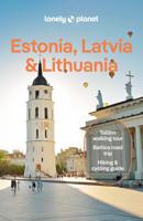
Reisgids Estonia (Estland), Latvia (Letland) & Lithuania (Litouwen) |
De perfecte reisgids voor zowel de georganiseerde als de zelfstandige reiziger. Naast een algemene inleiding van het land / streek vol met praktische informatie over hoe je er het beste kunt reizen: slapen, eten, vervoer, excursies ... alles kun je er in vinden. Engelstalig. Lonely Planet. A land of crumbling castles, soaring dunes, enchanting forests and shimmering lakes – a trip to the Baltics proves that fairy tales do come true. Lonely Planet is your passport to Estonia, Latvia & Lithuania, with amazing travel experiences and the best planning advice.   Imagine medieval life in Tallinn’s fairy-tale old town, recharge your batteries at Curonian Spit, or feast on art nouveau architecture in Rīga; all with your trusted travel companion. Get to the heart of Estonia, Latvia & Lithuania and begin your journey now!   Inside Lonely Planet’s Estonia, Latvia & Lithuania Travel Guide:   Full-colour maps and images throughout Highlights and itineraries help you tailor your trip to your…
22,95
Wegenkaart - landkaart Wales & southwest England | ITMB
Een degelijke kaart met aanduidingen van o.a. nationale parken, vliegveld, benzinepompen. Finally, we have been able to create our own map of the lovely country of Wales. I use the word ‘country’ in its truest sense, as Wales was invaded and taken over by the English centuries ago. Regardless, the Welsh language and Welsh culture continue to flourish, although English is commonly spoken. We have visited Wales on several occasions and find that the attractions are so numerous that we could never see them all. There are too many castles to count, but some of the best preserved in the British Isles are in Wales, notable Caernarfon, but nearby Harlech is a World Heritage Site. St, David’s must be one of the smallest and loveliest cathedrals in the world, and Tintern Abbey ruins among the most poignant anywhere. We took Johnny to Abergavenny for lunch in March, not that it made any difference; he just pined for a McDonalds. This map is double-sided, with Wales on one side and the West Count…
13,95
Wegenkaart - landkaart Northern British Columbia | ITMB
British Columbia is big! Gargantuan huge, in fact, although it is lightly populated. ITMB published a map of the more densely populated southern half of the province a number of years ago, and we have been asked to give the same emphasis to the northern half ever since. Here it is! Side 1 is of the western portion, including the Alaskan Panhandle, with the route followed by cruise ships heading north and clearly delineates the border between Canada and the USA that nearly erupted into warfare (54 40 or fight). It also shows the Stewart Highway heading north towards the Yukon, with its branch leading to Hyder, Alaska, the only place in the USA that uses Canadian money and does all its banking in Canada. The second side covers the eastern half of BC’s north, with the Alaska Highway starting in Dawson Creek and extending north to Fort Nelson before veering west into the eastern edge of the Rocky Mountains to the Yukon border. This is true wilderness country. It is virtually unpopulated ou…
14,95

Klanten-reviews van Wegenkaart - landkaart Litouwen & Letland | ITMB

Er zijn nog geen beoordelingen voor dit productBen jij de eerste die een review plaatst?

Meer over Wegenkaart - landkaart Litouwen & Letland | ITMB

Productomschrijving

ITMB is very pleased to release its first-ever map of the Baltic country of Lithuania, which occupies Side 1 of this double-sided map. It is bordered by Latvia on its north, the Russian enclave of Kalingrad on its southeast, and Poland and Belarus on its south and east. It is now on the front lines of tension between Russia and its neighbours, as are all the Baltic states. It is also a valued member of both NATO and the EU, and as such is easy to access from either Poland or Latvia. Lithuania fronts on to the Baltic Sea with a major port at Klaipeda (formerly Memel), with its capital being Vilnius. Historically, the country has suffered German and Russian invasions during the 20th century, the last of which resulted in the country losing its independence completely by being absorbed into the Russian Empire in the latter stages of WW2. It regained its independence in 1991, with the collapse of the USSR and shortly thereafter applied to join both the European Union and NATO. Touristically, the main attractions are shown in our Top Attractions listing. Culturally, it is closely associated with Scandinavia, especially Finland, and maintains cordial relations with Latvia and Poland. The current war in Ukraine has created difficulties entering either Russia or Belarus. Side 2 of the map is an updated map of Latvia, with a detailed inset of its capital Riga. This Baltic country is bounded by Lithuania to the south, Estonia to the north, and Russia to the east. As all the Baltic states are members of the EU, access by air, ferry, and land are easy. Historic Riga is the main attraction of Latvia, but the region around Cesis has several significant sites of touristic interest, and the cathedral at Rezekne, in the east, is well-worth a visit.

Productspecificaties

Artikelnummer(s)
Brand
ITMB

Verken gerelateerde categorieën

Webshop.nl maakt gebruik van cookies. Ga je verder op onze website, ga dan akkoord met het plaatsen van cookies en de verwerking van deze data door ons en vermelde partners.