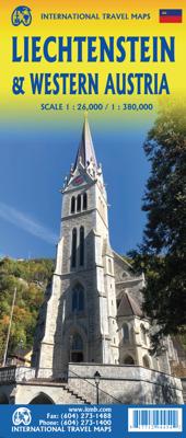
Wegenkaart - landkaart Liechtenstein & Oostenrijk West | ITMB

0
Europe is dotted with mini-states that exist solely for historic reasons but are fiercely independent. Liechtenstein, surrounded by Switzerland on its west and south and Austria on its other borders, is such a state. It is larger and more diverse than many imagine and is quite a popular ski resort region. Side 1 is a detailed map of the principali...

Verkopers met dit product

Verkoper
Bezorging
Prijs
DeZwerver.nl logo
DeZwerver.nl
2,95
14,95

Anderen bekeken ook

Wegenkaart - landkaart Liechtenstein & Oostenrijk West | ITMB
Europe is dotted with mini-states that exist solely for historic reasons but are fiercely independent. Liechtenstein, surrounded by Switzerland on its west and south and Austria on its other borders, is such a state. It is larger and more diverse than many imagine and is quite a popular ski resort region. Side 1 is a detailed map of the principality, framed on the west by the Rhine River and a bit of Switzerland and on the east by Austria. Most development occurs in the Rhine Valley in a north-south direction, dominated by the capital city of Vaduz. There are five access points from Switzerland across the Rhine, one from the south, and two from Austria in the north. The ski haven of Malbun is prominently shown, and the scale of the map is detailed enough to name every major street. This also enabled us the opportunity to include schools, shopping areas, post offices, and churches, as well as a wide range of eating establishments. Walking/hiking trails have also been included. This is …
14,95
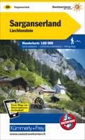
Wandelkaart 30 Sarganserland - Liechtenstein | Kümmerly & Frey
Zeer duidelijke wandelkaart van een deel van Zwitserland. Deze kaart - gemaakt op scheur en watervast papier - is bedoeld voor de gewone en gemiddelde bergwandelaar. Ook voor huttentochten is deze zeker geschikt. Slechts voor de gevorderde wandelaar die glesjers gaat overschrijden zijn de 25.000 topografische kaarten aan te raden. Op deze 1:60.000 kaarten staan de wandelroutes in 3 soorten weergegeven: Wanderweg, Bergweg en Alpine route. De routes staan goed ingetekend en werken prima naast de vele markingen in het veld. Hoogteverschillen, overnachtingsmogelijkheden, bus routes en gps-informatie ontbreken allemaal niet op deze landkaarten.   The maps have contours at 50m or 25m intervals according to the terrain, enhanced by graphic relief and shading. An overprint distinguishes between sign-posted hiking paths, mountain path where proper walking shoes are necessary, and alpine paths requiring special equipment.   Mountain huts are marked, plus various types of accommodation: campsite…
22,50
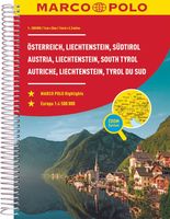
Wegenatlas Oostenrijk, Liechtenstein, Zuid Tirol (Italie) | Marco Polo
Mooie wegenatlas van Maro Polo van Oostenrijk, Liechtenstein en het deelgebied Zuid Tirol in Italie. Veel detail met wegenummers, onderschedi in verschillende wegen, afstanden tussen dorpen en steden. Ook bezienswaardigheden en andere toeristische aspecten staan met symbolen ingetekend. Achterin nog een behoorlijk aantal stadsplattegronden en een uitgebreid register.  Spiraalbinding, A4 formaat.  Durch moderne Kartografie zeichnet sich der MARCO POLO Reiseatlas aus und bietet im Detailmaßstab die perfekte Orientierung. Im Maßstab 1:200 000 sind selbst kleine Orte und kleine Straßen schnell zu finden. Das klare und ausgewogene Kartenbild bietet viele Informationen zu Sehenswürdigkeiten, Natur- und Nationalparks und sonstigen touristischen Highlights. Ein MARCO POLO Reiseatlas ist der ideale Begleiter auf Ihren Fahrten, wo auch immer es mit ihm hingehen soll. Die praktische Spiralbindung unterstützt das perfekte Handling. Der Kartenteil: Hauptkarte im Maßstab 1:200 000 mit mehrsprachige…
17,50
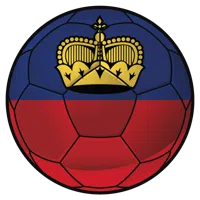
Voetbal Liechtenstein - Muurcirkel sticker
Met de muurcirkel stickers van een voetbal met de vlag van Liechtenstein tover je iedere muur om tot een echte eyecatcher.Alle muurcirkel stickers worden in onze studio gemaakt en met onze zeer geavanceerde snijcomputer uit de beste kwaliteit zelfklevende folie gesneden. ✓  Plakinstructie wordt meegeleverd. ✓  In verschillende formaten verkrijgbaar. ✓  Eenvoudig aan te brengen op vlakke ondergronden. ✓  Makkelijk verwijderen zonder lijmresten. ✓  100% eigen productie. ✓  Levertijd binnen 2 tot 5 werkdagen. * Let op: De ondergrond moet glad en vet- en stofvrij zijn. Muurverf waar siliconen in verwerkt is en behang met een beschermlaag, zijn niet geschikt.Als je twijfelt kan je altijd even contact opnemen via info@muurteksten.nl. We helpen je graag!
9,50
Wegenkaart - landkaart Mont Blanc & Alpen | ITMB
As far as mountains go, Mont Blanc in France and Italy, forming the border between the two countries, with Switzerland nearby, is the best known and most attractive mountain in the Alps. The peak itself is far too challenging for most climbers to attempt, but the region is dotted with ski lifts, hiking trails in the lower regions, and fascinating scenic villages. Mont Blanc tops out at 4,807.81 metres and is protected by Monte Bianco National Park in Italy. There is a long tunnel underneath the mountain joining France (near Chamonix) and Italy (near Courmayeur) and a beautiful highway along its western side (the D1506) and in Italy along its south side (SS26). There is also a Grande Route long-distance hiking trail that surrounds the mountain. We show it in its entirety, including numerous overnight stopping areas, either in towns or in mountain refuges. Naturally, skiing is a huge draw, and we include several ski lifts, all rail lines in the region, including the fabulous cog line fr…
14,95
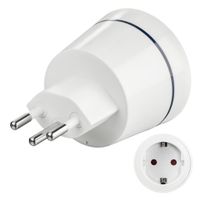
Hama Reisadapter Type I 3-polig Voor Zwitserland En Liechtenstein
Maakt aansluiting van elektrische apparaten mogelijk in landen met Zwitsers stopcontactsysteemCompacte reisstekker voor reizigers uit EuropaWitte design-behuizing met blauwe led-weergaveStekker (10A/250V) te gebruiken in Liechtenstein en ZwitserlandVoor aansluiting van 2- en 3-polige elektrische apparaten met geaarde, contour- of Euro-stekkerVoor gebruik met geaarde en niet-geaarde apparaten zoals camera's, scheerapparaten en smartphone-opladers, ook geschikt voor krachtige apparaten zoals laptops en reisföhnsGeschikt voor ingangsspanningen van 100V - 250VVoor gebruik met stopcontacten van type JVoor apparaten met stekkertype C en FConsumentenadvies:Een conversie (omzetting) van de elektrische spanning of een verandering van de netfrequentie vindt niet plaats. Controleer de compatibiliteit van uw apparaat voordat u het op het stopcontact aansluit. Het product is alleen bedoeld voor tijdelijk gebruik en is niet ontworpen om met andere adapters te werkenWeet u niet zeker of de adapter ge…
14,95
Wegenkaart - landkaart Cuba West | ITMB
Een degelijke wegenkaart met aanduidingen van o.a. nationale parken, vliegveld. Als overzichtskaart goed te gebruiken. his is a brand new title for ITMB and reflects the growing interest in travel to Cuba resulting from improved relations with the USA. Licenses to fly into the country from a dozen cities have already been approved; 60 more are awaiting approval. All are for flights into Havana and Varadero airports – in other words, the western half of the country. ITMB already has an exceptionally good map of the entire country. We also have a separate map of Havana. This map expands the scale and opens the information for the western half of the island nation as a double-sided map, with the portion west of Havana (La Habana) to Pinar del Rio province in the far west and south to the Isla de la Juventud (better known, but mis-named, as the Bay of Pigs Invasion Site). This side also has an excellent map of the Varadero beach resort area as an inset, and a map of greater Havana. The ot…
13,95
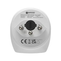
Hama Reisadapter Type J 3-Polig voor Zwitserland en Liechtenstein Wit
Hama reisadapter type J 3-poligMaakt aansluiting van elektrische apparaten mogelijk in landen met Zwitsers stopcontactsysteemCompacte reisstekker voor reizigers uit EuropaWitte design-behuizingStekker (10A/250V) te gebruiken in Liechtenstein en ZwitserlandVoor aansluiting van 2- en 3-polige elektrische apparaten met geaarde, contour- of Euro-stekkerVoor gebruik met geaarde en niet-geaarde apparaten zoals camera's, scheerapparaten en smartphone-opladers, ook geschikt voor krachtige apparaten zoals laptops en reisföhnsGeschikt voor ingangsspanningen van 100V - 250VVoor gebruik met stopcontacten van type JVoor apparaten met stekkertype C en FTechnische detailsNaleving van duurzaamheid: JaDuurzaamheidscertificaten: CE, UKCAKenmerkenType stekkeraansluiting: Type JType stopcontactaansluiting: Typ C (Eurostekker) + Type FConnector 1 vormfactor: RechtConnector 2 vormfactor: RechtAC-ingangsspanning: 100 - 250 VHuidige waardering: 10 AKleur van het product: WitMaximaal vermogen: 2500 WAantal pol…
16,95
Wegenkaart - landkaart Italy North & Central | ITMB
Italy is a very densely populated country, requiring sectional maps to portray its complex road/rail network in sufficient detail to make sense. This is a brand new title for ITMB, covering the central portion of the peninsula from Naples north to Florence on side one, and includes a large inset map of Sardinia. Side two covers the vast expanse of the north of the country, from the high alpine valleys of D’Aosta and Trentino to the plains of northern Italy and the coastal provinces of the Mediterranean and Adriatic coastlines. The immediate border areas of France and Switzerland are included, but the extensive plate name index covers most of those countries. Motorways (in blue) tend to be toll highways. Multi-lane highways (in magenta) and principal highways (in green) tend to be non-toll. The red lines are ordinary two-lane roadways, and tend to go through villages every kilometer or so and to follow mountainous contours. We spent a week in January, 2020, in the Rome to Naples to Mon…
13,95
Wegenkaart - landkaart West Turkije - Turkey west | ITMB
Turkey is a big country. Most visitors concentrate on Istanbul and the Izmir Coast, which is a shame as there are so many other interesting parts of the country to visit. This map covers the western third of the country as a double-sided map, covering from the Greek/Bulgarian border south to the Mediterranean and east to Eregli and Antalya in the east. Naturally, at a better scale, roads and road conditions can be shown to better advantage, and the ferry routes from Istanbul make more sense. The topography is now showing as contouring more easily, and we have been able to add the next layer of villages. The scale is still not appropriate for showing minor roads and tracks, but we have included as many as we feel we can. The map is printed on durable plastic paper, so will stand up to the rigours of travel quite well. A basin inset map of Istanbul has been included as well.   Legend Includes: Road by classification, Motorways, Multilane Hwy, Main Roads, Rail Ways, Ferry Routes, Nationa…
13,95

Klanten-reviews van Wegenkaart - landkaart Liechtenstein & Oostenrijk West | ITMB

Er zijn nog geen beoordelingen voor dit productBen jij de eerste die een review plaatst?

Meer over Wegenkaart - landkaart Liechtenstein & Oostenrijk West | ITMB

Productomschrijving

Europe is dotted with mini-states that exist solely for historic reasons but are fiercely independent. Liechtenstein, surrounded by Switzerland on its west and south and Austria on its other borders, is such a state. It is larger and more diverse than many imagine and is quite a popular ski resort region. Side 1 is a detailed map of the principality, framed on the west by the Rhine River and a bit of Switzerland and on the east by Austria. Most development occurs in the Rhine Valley in a north-south direction, dominated by the capital city of Vaduz. There are five access points from Switzerland across the Rhine, one from the south, and two from Austria in the north. The ski haven of Malbun is prominently shown, and the scale of the map is detailed enough to name every major street. This also enabled us the opportunity to include schools, shopping areas, post offices, and churches, as well as a wide range of eating establishments. Walking/hiking trails have also been included. This is the only map of Liechtenstein ever produced by a cartographic firm, and joins Andorra, Luxembourg, and Monaco as a valued part of ITMB’s coverage of Europe. Side 2 concentrates on eastern Austria and southern Germany from Lake Boden (Bodensee) to Linz and from the Italian border north to Passau, in Germany. It is both a road/rail map and a physical relief map of this portion of the Alps. It includes its own Top Attractions list. Border crossings are shown merely as a formality, except for Switzerland. This would be an excellent map to use to explore the mountains south of Innsbruck or to discover small villages in the Tirol.  

Productinformatie

    Verken gerelateerde categorieën

    Webshop.nl maakt gebruik van cookies. Ga je verder op onze website, ga dan akkoord met het plaatsen van cookies en de verwerking van deze data door ons en vermelde partners.