webshop.nl
Categorieën
  Sluiten

Meer ITMB

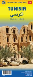
Wegenkaart - landkaart Libya - Tunisia / Libië - Tunesië | ITMB

The recent 'jasmine revolution' brings real-life reality very close to our consciousness. It is fitting that a new map of Tunisia is coming out just at this momentous time of the country's long history, as the country has long been seen as a small but stable fortress in the sea of shifting sand known as North Africa. Having visited the country, the...
13,95

Webshops met dit product

Webshop
Bezorging
Prijs

Anderen bekeken ook

Wegenkaart - landkaart Libya - Tunisia / Libië - Tunesië | ITMB
The recent 'jasmine revolution' brings real-life reality very close to our consciousness. It is fitting that a new map of Tunisia is coming out just at this momentous time of the country's long history, as the country has long been seen as a small but stable fortress in the sea of shifting sand known as North Africa. Having visited the country, the publishers wish its inhabitants well as they undertake the next leg of their political development, and hope that the 'revolution' won't be hijacked by extremist elements. This map benefits from the research the publishers were able to carry out during their recent visit to Tunisia. They were able to confirm a lot of road information, and improve the information on this map. The map also now includes several text blocks called capsule comments, describing in words certain brief facts about points of interest in the country.  The north coast of Africa is also the southern edge of Roman Africa, and the best-preserved ruins are in Libya, which …
13,95
Wegenkaart - landkaart Angola | ITMB
Goede overzichtskaart van Angola met een helder kleurgebruik. Angola is a fascinating mixture of ethnicity and wealth. It is still climbing out of the morass of post-colonial rule, but is now as safe as any country for travellers. Its infrastructure, particularly its roads, are of uneven quality, and we hope that this map will stimulate visitors to write us of their experiences with travelling through this vast country. We have tried to include as much detail as possible, and as accurately as possible, given the uncertain nature of much of the base material. The map includes a decent inset of Luanda , the capital, and all areas designated as parkland. This is the latest ITM map related to Africa and completes our coverage of Central and Southern Africa. East Africa and North East Africa have also been completed, and we are now working on Equatorial Africa. This map is double-sided (north half/south half). Legend Includes: Roads by classification, ferry route, ruins, camping sites, acco…
13,95
Wegenkaart - landkaart Canada | ITMB
Een degelijke kaart met aanduidingen van o.a. nationale parken, vliegveld, benzinepomp, dirt-roads en kleine plattegrond van hoofdstad. Well, it’s about time, eh?!? ITMB, after only thirty years on the go, finally gets around to publishing a map of Canada. When we first started mapping, there was a pressing need for good maps of Central and South America, then of Africa, then etc etc and we never found time to concentrate on our own country until fairly recently. This map was prepared by Natural Resources Canada and is, as a result, as accurate a map as one could hope to have. We are very proud of it, and very pleased to be able to use such top-rate cartography. The map covers all of the land mass of Canada, from its southernmost point to the top of Ellesmere Island and from the Atlantic coast to the Pacific. It’s an excellent map, but I’m going to give one proviso. Canada is the second-largest country on the face of the planet and there is no way that a single-sided sheet can portray …
13,95
Wegenkaart - landkaart Botswana - Zimbabwe | ITMB
Een degelijke kaart met aanduidingen van o.a. nationale parken, vliegveld, benzinepomp, dirt-roads en kleine plattegrond van hoofdstad. Als overzichtskaart goed te gebruiken. 7th Edition 1:1,600,000/11:1,000,000 on waterproof stone paper Both Botswana and its neighbour, Zimbabwe, form a common entity and a British heritage in Central Southern Africa, but there the resemblance ends. The Bechuana formed an alliance of sorts with the Pritish to protect them from the Boers in the then-nearby Transvaal. Upon a peaceful transition to independence as Botswana, it has evolved into a democratic and peaceful country. Zimbabwe, formerly Rhodeisa, is a failed state, although potentially, Zimbabwe could dominate tourism if governmental affairs were orderly. This map focuses on Botswana simply because that country is a beacon of orderly pleasantness in the continent; well run, routistacally well developed, with good infrastructure, and close to the game preserves of both South Africa and Zimbabwe. T…
13,95
Wegenkaart - landkaart Egypt & Cairo | ITMB
Following the so-called Arab spring of a few years ago, northern Africa experienced much turbulence. Egypt experienced the overthrow of the government, the installation of a radical religious-oriented replacement, and the installation of military governance. Tourism plummeted. Most map publishers discontinued their maps of the country. Five years later, Egypt has stabilized and tourism is growing. We feel that the time is right to re-introduce our ITMB map of Egypt. This version focuses on the portions of the country that have been re-opened for tourism, which means from the Mediterranean coastline south to the Aswan Dam. The portion further south remains closed for the moment, as is the border crossing with Sudan. We have also been forced to leave off the Great Sand Sea and the Western Desert portions for the same reason of unrest, as the border areas with Libya remain very unstable. However, we have provided a large inset map of Egypt, covering everything, in the area of desert. We h…
13,95
Wegenkaart - landkaart Namibië | Infomap
Another InfoMap classic – now in its 13th edition and highly recommended!   Famous for its Namib desert, the oldest desert in the world, which straddle the western shore along the Atlantic, Namibia is country of intense beauty and seemingly unlimited space. It is a photographer’s paradise. Watch the afternoon shadows add drama to the dunes at Sossusvlei, walk through the ghost town of Kolmanskop, hike the Fish River Canyon, see the lunar landscape and Quiver trees near Keetmanshoop, experience a world transformed when the Etosha pan fills with water, or look out for the endangered cheetah of which Namibia has the highest population left in Africa.   The country is a hugely popular tourist destination that offers endless possibilities to travellers throughout all budgets and travel requirements. Tourism is one of the country’s main economic activities, with around one million tourists visiting Namibia each year. Given that the country’s population currently sits somewhere around 2 milli…
15,95
Wegenkaart - landkaart Western Africa - Afrika westen | ITMB
Een degelijke kaart met aanduidingen van o.a. nationale parken, vliegveld, benzinepomp, dirt-roads en kleine plattegrond van hoofdstad. Als overzichtskaart goed te gebruiken.   This map, at 1:3,400,000 scale is ideal for travellers crossing Africa from Europe to central and southern parts of Africa by land. It covers from the southern tip of Spain through Morocco and western Algeria on one side to Mauritania and the Bight of Benin states of West Africa, as far east as western Nigeria. As a regional map, the detail provided is unsurpassed by any other map of this part of the world. It is the most detailed map to date of the West African states of Guinea, Guinea-Bissau, Liberia, and Sierra Leone. As is always the case with Africa, road information is presented in practical terms of road quality, not road designation. This is a practical map for travellers, so information has been provided with the greatest degree of accuracy possible, given that reliable information can be extremely diff…
13,95

Klanten-reviews van Wegenkaart - landkaart Libya - Tunisia / Libië - Tunesië | ITMB

Er zijn nog geen beoordelingen voor dit productBen jij de eerste die een review plaatst?

Meer over Wegenkaart - landkaart Libya - Tunisia / Libië - Tunesië | ITMB

Productomschrijving

The recent 'jasmine revolution' brings real-life reality very close to our consciousness. It is fitting that a new map of Tunisia is coming out just at this momentous time of the country's long history, as the country has long been seen as a small but stable fortress in the sea of shifting sand known as North Africa. Having visited the country, the publishers wish its inhabitants well as they undertake the next leg of their political development, and hope that the 'revolution' won't be hijacked by extremist elements. This map benefits from the research the publishers were able to carry out during their recent visit to Tunisia. They were able to confirm a lot of road information, and improve the information on this map. The map also now includes several text blocks called capsule comments, describing in words certain brief facts about points of interest in the country.  The north coast of Africa is also the southern edge of Roman Africa, and the best-preserved ruins are in Libya, which was also the site of the famous Battle of Tobruk in WWII. This travel map shows roads into the desert as well as the coastal region. Printed double-sided on paper.    Legend Includes: Roads ranging from motorways to local roads and desert tracks. Legend includes railroads, ferry routes, airports and airfields, gas stations, hospitals, border crossings, wells, oasis, lodging, rest/guest houses, hostels, campsites/huts, parks/reserves, beaches, points of interest, archaeological sites, ruins, forts, museums, churches, mosques.

Productspecificaties

Artikelnummer(s)
Brand
ITMB
Webshop.nl maakt gebruik van cookies. Ga je verder op onze website, ga dan akkoord met het plaatsen van cookies en de verwerking van deze data door ons en vermelde partners.