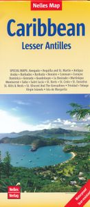
Wegenkaart - landkaart Lesser Antilles - Caraibisch gebied - Antillen
Goede wegenkaart van van een groot aantal eilanden. Aan beide kanten bedrukt. Met veel toeristische aanduidingen als nationale parken en culturele bezienswaardigheden. Prima leesbare kaart en zeker als overzichtskaart goed te gebruiken. Folded road and tourist map of the Lesser Antilles Caribbean island chain at 1:2 500 000 scale. Places of interest, national parks, and beaches are all highlighted and shaded-relief colouring clearly depicts the topography. The map includes insets showing Trinidad and Tobago at 1:500 000, the Virgin Islands at 1:250 000, Anegada at 1:250 000, St. Croix at 1:300 000, Anguilla and St. Martin at 1:300 000, St. Kitts and Nevis at 1:300 000, St. Barts at 1:300 000, Saba at 1:300 000, St. Eustatius at 1:300 000, Montserrat at 1:300 000, Aruba at 1:150 000, Curacao at 1:300 000, Bonaire at 1:300 000, Barbados at 1:300 000, The Grenadines at 1:300 000, Grenada at 1:300 000, St. Vincent and The Grenadines at 1:300 000, Canouan at 1:300 000, Barbuda at 1:300…
11,95


