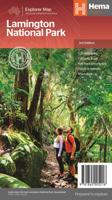
Wegenkaart - landkaart Lamington National Park | Hema Maps

0
Detailkaart van een deel van Australië. Zeer goed leesbaar, met naast de topografische details veel symbolen waarmee allerhande toeristische zaken worden aangeduid als campsites, nationale parken, attracties, wandelmogelijkheden etc. This map covers the whole area of the park and all the graded walking tracks that start from Binna Burra and O'Reil...

Verkopers met dit product

Verkoper
Bezorging
Prijs
DeZwerver.nl logo
DeZwerver.nl
2,95
17,50

Anderen bekeken ook

Wegenkaart - landkaart Lamington National Park | Hema Maps
Detailkaart van een deel van Australië. Zeer goed leesbaar, met naast de topografische details veel symbolen waarmee allerhande toeristische zaken worden aangeduid als campsites, nationale parken, attracties, wandelmogelijkheden etc. This map covers the whole area of the park and all the graded walking tracks that start from Binna Burra and O'Reilly's. It has been drawn at a good walking scale of 1:35 000 and shows all points of interest in the park. The walking tracks are shown in different colours on the map and have been broken up into short walks, half day walks and full day walks. A detailed description of each of the walks is shown on the back of the map. Detailed contoured map of the park in southern Queensland on the NSW border. Overprint highlights several hiking routes, from 0.5km to 24km long. Symbols show various facilities in the park, including accommodation, camping areas, viewpoints, places of interest, etc. Enlargements show two areas with main facilities and accommod…
17,50
Wegenkaart - landkaart Tasmanië - Tasmania | Hema Maps
Op deze kaart staat Tasmanië in zijn geheel op 1 deel van de kaart. Goede, overzichtelijke, leesbare kaart van het hele eiland. Nationale Parken zijn er goed op te vinden en de afstanden worden weergegeven. Op de achterkant nog deelkaartjes van enkele steden en NP s. The fourth edition of Hema’s Tasmania State Map features Hema’s distinctive and informative maps fully, all of which have been field checked by Hema’s Map Patrol to ensure the best possible accuracy with the latest mapping data.    A fully indexed state map of Tasmania (TAS) at a scale of 1:500,000. Marked on the mapping are national parks, fuel locations as well as camping and rest areas.    The reverse side consists of:   a summary of the key things to see and do broken up into the North West, Launceston, Tamar and the North a table listing of National Parks and Reserves with key features and facilities (such as Camping and Caravan sites, BBQ, toilets and showers) Visitor centre listing Map of the area around Zeehan…
17,50
Wegenkaart - landkaart 04 Mpumalanga, Kruger National Park & Panorama Route | MapStudio
Toeristische wegenkaart met veel aanduidingen van interessante punten. Heldere kaart, goed leesbaar. speciaal stukje Africa: Mpumalanga, Kruger National Park and Panorama Route Road Map covers the entire Kruger National Park, includes a detailed exploring map of Mpumalanga and the Panorama Route, plans of camps in the Kruger National Park and is up-to-date with all research compiled and updated in Africa   Detailed streetmaps and site maps with text and photography of Pilgrims Rest, Mashishing (Lydenburg), Dullstroom, Sudwala Caves, eMakhazeni (Belfast), eNtokozweni (Machadodorp), White River, Sabie, eMgwenya (Waterval Boven), Hazyview, Mbombela (Nelspruit) and Barberton   Easy-to-use map symbols showing hotel, lodges, rest camps, campsites, concession areas, bush camps, private rest camps and lodges, caravan facilities, caves, lookout points, waterholes, hides and much more. Information on hiking, trekking, walking and fly-fishing areas. Along with an alphabetised index, enlarged map…
16,95
Wandelkaart - Fietskaart - Wegenkaart - landkaart Biebrza National Park | Cartomedia
Wandelkaart  Biebrza National Park 1:100.000 en 1:50.000 met praktische informatie en wandelideeën.   Hiking, cycling, and horse riding paths are highlighted, as well as special educational trails. Along the Biebrza and its tributaries the map shows kayaking routes and marks stretches where fishing is prohibited. Symbols indicate various types of accommodations, including campsites, B&Bs and youth hostels, restaurants and bars, bike and kayak/canoe rentals, nature observation towers, sport and recreational facilities, etc. The map has no geographical coordinates. Map legend includes English. Insets at 1:50,000 show the two main marches in greater detail, plus the areas around the villages of Goniadz and Wizna. Also included is an inset showing the physical geography of the region around the national park. On the reverse, extensive text, in Polish, describes numerous hiking, cycling and water trails, places of interest, etc, including a suggested itinerary for a 7-day visit to the area…
9,95
Wandelkaart - Wegenkaart - landkaart 902 Jasper South National Park | National Geographic
Goede kaart van een deel van Jasper National Park. Geschikt voor overzicht maar ook voor de langere trails: campsites, rivieren, paden, alles kun je er op terug vinden.   National Geographic's Trails Illustrated map of Jasper South is a two-sided, waterproof map designed to meet the needs of outdoor enthusiasts with unmatched durability and detail. This map was created in conjunction with local land management agencies and is loaded with valuable recreation information.   The front side of the Jasper South map details the east side of the national park, from Whitehorse Wildland Provincial Park to the north, to White Goat Wilderness Area to the south. The reverse side of the map details the west side of the park, extending from Cummins Lakes Provincial Park to the south, to Victoria Cross Ranges to the North. Insets show survival tips, safe travel in Bear Country, and all the recreation the park has to offer with backpacking, camping, biking, hiking and horseback riding.   Trails …
17,50
Wegenkaart - landkaart Brisbane to Cairns | Hema Maps
Detailkaart van een deel van Australië. Zeer goed leesbaar, met naast de topografische details veel symbolen waarmee allerhande toeristische zaken worden aangeduid als campsites, nationale parken, attracties, wandelmogelijkheden etc. An easy-to-follow map that shows both the coastal and inland routes from Brisbane to Cairns. Roadside rest areas, intermediate distances, and a quick-find distance chart are also shown. The map shows all the popular tourist destinations along the Queensland coast. Routes between Brisbane with Cairns in a series of touring maps connecting Australia’s main centres of population along some of the most spectacular routes such as the Great Ocean Road or the Savannah Way. The maps highlight 24-hour fuel supplies, roadside rest areas, camping facilities, places of interest, etc., and include distance charts and, in some titles, city maps. Road network indicates unsurfaced roads and tracks. The maps also show railway lines. There is no topographical information b…
17,50
Wandelkaart - Wegenkaart - landkaart 903 Jasper North National Park | National Geographic
Goede kaart van een deel van Jasper National Park. Geschikt voor overzicht maar ook voor de langere trails: campsites, rivieren, paden, alles kun je er op terug vinden. National Geographic's Trails Illustrated map of Jasper North is a two-sided, waterproof map designed to meet the needs of outdoor enthusiasts with unmatched durability and detail. This map was created in conjunction with local land management agencies and is loaded with valuable recreation information.   The front side of Jasper North map details the east side of the national park, from Rock Lake Solomon Creek Wildland Park to the north, to Whistler's Summit to the south. The reverse side of the map details the west side of the park, extending from Mt. Terry Fox Provincial Park to the south, to Willmore Wilderness Park to the North. Insets show survival tips, safe travel in Bear Country, and what to do while visiting.   Trails Illustrated maps are expertly researched and frequently updated. The maps are printed in the …
17,50
Wegenkaart - landkaart Iconic Map Fraser Island - Australië | Hema Maps
Detailkaart van een deel van Australië. Zeer goed leesbaar, met naast de topografische details veel symbolen waarmee allerhande toeristische zaken worden aangeduid als campsites, nationale parken, attracties, wandelmogelijkheden etc. This map is the only complete map of Fraser Island that gives full topographic contours. In addition, all the tracks on the island have been graded accurately and located using Hema's GPS mapping system. The reverse side includes large colour photos, comprehensive text on the history, environment and attractions, and a telephone directory for accommodation, permits, tours and more. Detailed map of the island with contours at 20m intervals plus colouring and graphics to indicate various types of terrain and protected areas, including national and marine parks. Four scenic drives are highlighted and given brief descriptions. The map also shows vehicle entry restrictions, tracks, and footpaths, including the Fraser Island Great Walk. A wide range of symbols …
17,50
Wegenkaart - landkaart Pilbara and the Coral Coast | Hema Maps
Detailkaart van een deel van Australië. Zeer goed leesbaar, met naast de topografische details veel symbolen waarmee allerhande toeristische zaken worden aangeduid als campsites, nationale parken, attracties, wandelmogelijkheden etc. One of the last great frontiers in Australia, the Pilbara is real 4WD country. This map has been field-checked using Hema's GPS mapping system and includes tracks and roads that have never before appeared on maps. The information side of the map presents all the points of interest, the history, and all the important information a person needs to know in order to safely traverse this remote countryside. Detailed, indexed road map with cartography similar to Hema’s excellent coverage of Australia’s interior in the “Great Desert Tracks” series: road information distinguishes between tracks plotted by the publishers themselves with GPS and those complied from the country’s topographic survey data. Topography is shown by relief shading, with colours and graphi…
17,50
Wegenkaart - landkaart - Fietskaart Clare (Ierland) | Xploreit Maps
Mooie geplastificeerde en scheurvaste kaart van de County Clare met index. This Xploreit map is an essential companion for your next trip to County Clare. Whatever your location in the county, a quick scan of the map will reveal all the local attractions including the best drives, cycle routes and walks in the area.  It is fully revised and now includes the Clare section of the long-distance Euro Velo Atlantic Cycle Route. From Loop Head, with its famous lighthouse, you can follow West Clare’s wild and rugged coast as it rises to the spectacular Cliffs of Moher and meets The Burren, the unique limestone pavement of the northern uplands. East Clare has numerous walking and sightseeing opportunities also, with Lough Derg and Slieve Bernagh as highlights. Convenient and informative, this touring map will help you discover ancient megalithic tombs, imposing castles, sparkling lakes, golden beaches and the many charming towns and villages dotted around ‘The Banner County’. Topography is sh…
23,50

Klanten-reviews van Wegenkaart - landkaart Lamington National Park | Hema Maps

Er zijn nog geen beoordelingen voor dit productBen jij de eerste die een review plaatst?

Meer over Wegenkaart - landkaart Lamington National Park | Hema Maps

Productomschrijving

Detailkaart van een deel van Australië. Zeer goed leesbaar, met naast de topografische details veel symbolen waarmee allerhande toeristische zaken worden aangeduid als campsites, nationale parken, attracties, wandelmogelijkheden etc.

This map covers the whole area of the park and all the graded walking tracks that start from Binna Burra and O'Reilly's. It has been drawn at a good walking scale of 1:35 000 and shows all points of interest in the park. The walking tracks are shown in different colours on the map and have been broken up into short walks, half day walks and full day walks. A detailed description of each of the walks is shown on the back of the map.

Detailed contoured map of the park in southern Queensland on the NSW border. Overprint highlights several hiking routes, from 0.5km to 24km long. Symbols show various facilities in the park, including accommodation, camping areas, viewpoints, places of interest, etc. Enlargements show two areas with main facilities and accommodation: Green Mountains/O’Reilly’s and Binna Burra. The map has a UTM grid and margin ticks at 1’ intervals. Also included is a general map showing access to the park from Brisbane and the Gold Coast and notes on the 28 recommended walks.


Productinformatie

    Verken gerelateerde categorieën

    Webshop.nl maakt gebruik van cookies. Ga je verder op onze website, ga dan akkoord met het plaatsen van cookies en de verwerking van deze data door ons en vermelde partners.