Wegenkaart - landkaart Lagos del Sur - Araucania - Puerto Montt - Bariloche | Zagier & Urruty

0
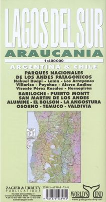
Overzichtskaart van dit met name door Zuidamerikanen zelf veel bezocht gebied. The most popular Parks of northern Patagonia: Nahuel Huapi, Lanin, Los Arrayanes, Villarrica, Puyehue, Alerce Andino, Vicente Perez Rosales, Hornopiren. Relief, roads, trails, distances, camping, fishing, etc. Roads to Bariloche, Puerto Montt, San Mart�n de los Andes,...

Verkopers met dit product

Webshop
Bezorging
Prijs
DeZwerver.nl logo
DeZwerver.nl
niet bekend
17,95

Anderen bekeken ook

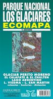
Wegenkaart - landkaart Parque Nacional los Glaciares | Zagier & Urruty
LOS GLACIARES NATIONAL PARK ECOMAP The most incredible Park of Patagonia, including Perito Moreno Glacier and Mount Fitz Roy. Satellite relief, roads, navigation, camping, inns and estancias, etc. El Parque mas espectacular de la Patagonia, donde sobresalen el Glaciar Perito Moreno y el Monte Fitz Roy. Rutas, navegaciones, estancias turisticas, paradores, camping, etc. Spanish / English edition. Southern Patagonia’s main National Park, Los Glaciares, with the world's only advancing glacier. The map uses satellite imagery, enhanced with colours and hill-shading to give a vivid representation of the relief. Many local peaks, glaciers and other geographical features are marked and named. Road network includes unpaved roads and dirt tracks, with locations of petrol stations and intermediate driving distances. Ferry connections on the region’s numerous lakes are also indicated. Symbols highlight accommodation and restaurant facilites. Latitude and longitude lines are drawn at 15' intervals…
17,95
Wegenkaart - landkaart Santa Cruz - Tierra del Fuego - Sur de Chile (Zuid Chili - Vuurland) | Zagier & Urruty
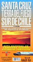
Mooie overzichtskaart / wegenkaart voor het zuiden van Chili en Vuurland. Inclusief een overzicht van de voor fietsers aantrekkelijke Carretera Austral, de eindeloze weg die Vuurland met het echte Chili verbindt. The southern tip of America from Coihaique and Copahue to Cape Horn. Estancias, National Road 40 and Carretera Austral. Patagonian Channels. National Parks and inns. Service charts and distances.
17,95
Wegenkaart - landkaart - Wandelkaart trekkingmap Tierra del Fuego & Isla Navarino | Zagier & Urruty
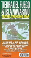
Kaart gebaseerd op satellietfoto's met ingetekende hoogtelijnen, campsites, routes en hutten. Bedenk dat het allemaal wel heel globaal is, het is niet de meest ideale schaal om op te lopen. The Argentine and Chilean sectors of Tierra del Fuego. Satellital relief, winter resorts, secondary roads, tracks, distances. Special maps of Staten Land, Navarino Island and beagle Channel. The most updated available. Isla Navarino 1:200.000 rest 1:500.000
17,95
Wegenkaart - landkaart Mexico Border States Northeast Coahuila, Nuevo Leon, Tamaulipas | ITMB
Een degelijke kaart met aanduidingen van o.a. nationale parken, vliegvelden en grote wegen. Als overzichtskaart goed te gebruiken. Tweezijdig. The Rio Grande dips south after curving around Big Bend, to flow into the Gulf of Mexico just east of Brownsville, Texas, and its sister city of Matamores, in Tamaulipas State of Mexico. This map covers Coahuila, Nuevo Leon, and Tamaulipas states, with a bit of Zacatecas thrown in for flavour. (This description will mean absolutely nothing to Europeans). The other side of the map contains detailed city maps of Monterrey (Mexico’s second largest city), Saltillo, and Victoria. Just think of this as being Mexico south of Texas, from Matamores west to Torreon and from Del Rio/Acuna all the way south to historic San Luis Potosi. This map will appeal to the American market primarily, but is a very detailed map of a part of Mexico that has largely been ignored until now. Legend Includes: International and provincial borders, roads by classification, r…
13,95
Nieuw
Wegenkaart - landkaart 3323 Adventure Map Slovakia - Slowakije | National Geographic
Wegenkaart van Slowakije met vermelding van veel bezienswaardigheden, nationale parken en attrakties. Watervast en scheurvast. Juist door deze vermeldingen onderscheidt de kaart zich van andere wegenkaarten. National Geographic's Slovakia Adventure Map is designed to meet the unique needs of adventure travelers with its durability and accurate information. Each folded map provides global travelers with the perfect combination of detail and perspective, highlighting the area’s terrain and best locations for adventure activities like snorkeling, surfing, fishing, and more. Adventure Maps include hundreds of points of interest that highlight diverse and unique destinations within the country.   The map includes the locations of thousands of cities and towns with a user-friendly index, plus a clearly marked road network complete with distances and designations for major highways, main roads, and tracks and trails for those seeking to explore more remote regions.   Key Features: Waterproo…
17,50
Nieuw
Wegenkaart - landkaart 3021 Adventure Map Malaysia Maleisië | National Geographic
Wegenkaart van Maleisië met vermelding van veel bezienswaardigheden, nationale parken en attrakties. Watervast en scheurvast. National Geographic's Malaysia Adventure Map is designed to meet the unique needs of adventure travelers with its durability and accurate information. Each folded map provides global travelers with the perfect combination of detail and perspective, highlighting the area’s terrain and best locations for adventure activities like snorkeling, surfing, fishing, and more. Adventure Maps include hundreds of points of interest that highlight diverse and unique destinations within the country.   The map includes the locations of thousands of cities and towns with a user-friendly index, plus a clearly marked road network complete with distances and designations for major highways, main roads, and tracks and trails for those seeking to explore more remote regions.   Key Features: Waterproof and tear-resistant Detailed interpretive information and local travel tips Det…
17,50

Klanten-reviews van Wegenkaart - landkaart Lagos del Sur - Araucania - Puerto Montt - Bariloche | Zagier & Urruty

Er zijn nog geen beoordelingen voor dit productBen jij de eerste die een review plaatst?

Meer over Wegenkaart - landkaart Lagos del Sur - Araucania - Puerto Montt - Bariloche | Zagier & Urruty

Productomschrijving

Overzichtskaart van dit met name door Zuidamerikanen zelf veel bezocht gebied.

The most popular Parks of northern Patagonia: Nahuel Huapi, Lanin, Los Arrayanes, Villarrica, Puyehue, Alerce Andino, Vicente Perez Rosales, Hornopiren. Relief, roads, trails, distances, camping, fishing, etc. Roads to Bariloche, Puerto Montt, San Mart�n de los Andes, Alumine, El Bolson, La Angostura, Osorno, Temuco, Valdivia.

afmeting 70 x 95 cm

Verken gerelateerde categorieën

Webshop.nl maakt gebruik van cookies. Ga je verder op onze website, ga dan akkoord met het plaatsen van cookies en de verwerking van deze data door ons en vermelde partners.