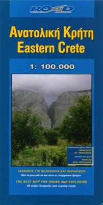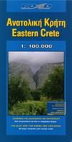
Wegenkaart - landkaart 8 Kreta - Oostelijk deel | Road Editions

0
On a scale of 1:100,000, which is the most detailed scale available for a map of Crete, you will find the most detailed road network ever to have appeared on a map of Crete, a precise geophysical background (in cooperation with the Hellenic Military Geographic Service), all the island's hydrography and the greatest wealth of information of interes...

Verkopers met dit product

Verkoper
Bezorging
Prijs
DeZwerver.nl logo
DeZwerver.nl
2,95
10,95

Anderen bekeken ook

Wegenkaart - landkaart 8 Kreta - Oostelijk deel | Road Editions
On a scale of 1:100,000, which is the most detailed scale available for a map of Crete, you will find the most detailed road network ever to have appeared on a map of Crete, a precise geophysical background (in cooperation with the Hellenic Military Geographic Service), all the island's hydrography and the greatest wealth of information of interest to the traveller: All the archaeological sites, monasteries, country chapels and castles. Nature lovers and hikers will be overjoyed by the mapping of E4 trail and all its side trails, the mountain refuges, the mountain peaks, the canyons and the gorges.
10,95
Wegenkaart - landkaart - Fietskaart 7 Crete - Kreta | Terrain maps
Gedetailleerde wegenkaart en wandelkaart met alle kleine wegen, wandelpaden, hoogtelijnen en toeristische informatie aangegeven. Alle tekst is tweetalig in Engels en Grieks en de waterproof kaart is geschikt voor gebruik met GPS.   The ideal map for planning your trip, as well as the journey itself – if you belong to the 99% of the island’s visitors, who have no intention whatsoever to take the narrowest dirt path leading to the remotest beach of the island! This map is very practical, at a scale of 1:200.000 which allows for a detailed presentation of the road network and sights without the exhaustive detail only the travelers – explorers are interested in.    We made this map based on our archival series of 1:100.00 Crete maps. We omitted all secondary dirt roads and loads of other unnecessary little roads, magnified the symbols and width of the roads for better visibility, and made colors more vibrant. All this makes for the best general map of Crete on the market!    Naturally, we…
13,50
Wandelkaart - Fietskaart - Wegenkaart - landkaart 450 Eastern Crete - Kreta Oost | Terrain maps
Gedetailleerde wegenkaart en wandelkaart met alle kleine wegen, wandelpaden, hoogtelijnen en toeristische informatie aangegeven. Alle tekst is tweetalig in Engels en Grieks en de waterproof kaart is geschikt voor gebruik met GPS. Terrain’s map of Eastern Crete provides travelers with everything they need:  Scale of 100.000, which attributes all the information with clarity and in detail.  Map data processed within a GIS environment, resulting in great accuracy.  Double coordinate system, WGS 84 and ΕΓΣΑ 87, completely compatible with GPS.  It is printed on Polyart material, making it totally waterproof and rip-proof. You can fold it and unfold it a hundred times, fold it in irregular ways, dunk it in the sea or leave it out in the rain. This map is indestructible!  Clear symbols, easily readable fonts, rich colors and excellent arrangement of every element make the map extremely friendly to the user.  Unique wealth of information. Every village, every road (including their dista…
12,50
Wandelkaart - Fietskaart - Wegenkaart - landkaart 448 Western Crete - Kreta West | Terrain maps
Gedetailleerde wegenkaart en wandelkaart met alle kleine wegen, wandelpaden, hoogtelijnen en toeristische informatie aangegeven. Alle tekst is tweetalig in Engels en Grieks en de waterproof kaart is geschikt voor gebruik met GPS. Terrain’s map of Western Crete provides travelers with everything they need:    Scale of 100.000, which attributes all the information with clarity and in detail.  Map data processed within a GIS environment, resulting in great accuracy.  Double coordinate system, WGS 84 and ΕΓΣΑ 87, completely compatible with GPS.  It is printed on Polyart material, making it totally waterproof and rip-proof. You can fold it and unfold it a hundred times, fold it in irregular ways, dunk it in the sea or leave it out in the rain. This map is indestructible!  Clear symbols, easily readable fonts, rich colors and excellent arrangement of every element make the map extremely friendly to the user.  Unique wealth of information. Every village, every road (including their dis…
12,50
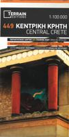
Wandelkaart - Fietskaart - Wegenkaart - landkaart 449 Central Crete - Kreta centraal | Terrain maps
Gedetailleerde wegenkaart en wandelkaart met alle kleine wegen, wandelpaden, hoogtelijnen en toeristische informatie aangegeven. Alle tekst is tweetalig in Engels en Grieks en de waterproof kaart is geschikt voor gebruik met GPS. Terrain’s map of Central Crete provides travelers with everything they need:  Scale of 100.000, which attributes all the information with clarity and in detail.  Map data processed within a GIS environment, resulting in great accuracy.  Double coordinate system, WGS 84 and ΕΓΣΑ 87, completely compatible with GPS.  It is printed on Polyart material, making it totally waterproof and rip-proof. You can fold it and unfold it a hundred times, fold it in irregular ways, dunk it in the sea or leave it out in the rain. This map is indestructible!  Clear symbols, easily readable fonts, rich colors and excellent arrangement of every element make the map extremely friendly to the user.  Unique wealth of information. Every village, every road (including their dista…
12,50
Wegenkaart - landkaart Kreta - Crete | Borch
Mooie geplasticieerde kaart van Kreta. Deze kaart biedt een goed overzicht van dit eiland met detailkaarten.   Our soft-laminated folded map of Crete shows: Crete (West) 1:200 000, Crete (East) 1:200 000, Iraklio 1:7 000, Agios Nikolaos 1:6 000, Chania 1:10 000, Ierapetra 1:10 000, Rethimno 1:9 000, Samaria Gorge 1:90 000, Sitia 1:7 000 and Gavdos 1:200 000. Borch maps are easy to fold, durable and water-repellent with a wipeable surface. Borch Maps show hotels, museums, monuments, markets, top sights and points of interest, useful statistics, conversion charts for temperatures, weights and measurements, climate charts showing temperatures, sunshine hours, precipitation and humidity, overview maps, time zones, and much more...   Crete is more than just another Greek island, it is the fifth largest island in the Mediterranean Sea and the cradle of ancient Mediterranean civilization. By 2000 B.C. the Minoans had set up a base here for their international trade with the East, North Afric…
11,50
Fietskaart - Wegenkaart - landkaart 1 Touring Map Thracië - Thrace en oostelijk (grieks) Macedonië - Griekenland | Terrain maps
Landkaart van een deel van Griekenland met zeer veel plaatsen, kleine wegen, hoogtelijnen en toeristische informatie in symbolen aangegeven, met plaatsnamenregister - schaal 1:200.000. De kaart wordt veel gebruikt door fietsers vanwege de mate van detail, is watervast en GPS-geschikt.   Detailed and updated map of Thrace including eastern Macedonia, as well as the islands of Samothrace and Thasos. It uses G.I.S. (Geographical Information Systems) technology and the WGS84 reference system, supplemented by a ΕΓΣΑ87 grid.    Like all of TERRAIN’s large maps, the map of Epirus is printed on Polyart, which is extremely durable against folding and unfolding, does not rip, and is 100% waterproof.    Based on field research completed in 2013, this map features all the newest national motorways, their interchanges, toll stations and Motorway Service Stations, as well as Egnatia motorway, its interchanges and vertical axes, and the border crossings.    Also depicted are the region’s tour…
13,50
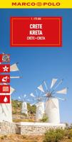
Wegenkaart - landkaart Kreta | Marco Polo
Goede wegenkaart voorzien van alle noodzakelijke aanduidingen. Daarnaast bijvoorbeeld ook campings, mooie wegen e.d. Crete on a double-sided, indexed map in MairDumont's Marco Polo series, with four street plans, plus special features to make route planning and navigating easier: a fold-out flap in the jacket shows the whole island highlighting popular locations, with the grid reference system in the margins making it easier to find various places on the main map.  Road network shows main and secondary roads with driving distances and highlights scenic routes. Smaller country roads or tracks, presented in white on a background with relief shading, are perhaps less clear to see than on maps with altitude colouring. In addition to the shading, topography is presented by numerous peaks and names of mountain ranges. E4 long-distance hiking route is marked, both the section across the central mountains and the variant along the south coast. Picturesque towns, places of interest and landsca…
14,95
Wegenkaart - landkaart 3317 Adventure Map Crete - Kreta | National Geographic
Wegenkaart van Kreta met vermelding van veel bezienswaardigheden, nationale parken en attrakties. Watervast en scheurvast. Juist door deze vermeldingen onderscheidt de kaart zich van andere wegenkaarten.   National Geographic's Crete Adventure Map is designed to meet the unique needs of adventure travelers with its durability and accurate information. This folded map provides global travelers with the perfect combination of detail and perspective, highlighting hundreds of points of interest and the diverse and unique destinations within the country.   The front side of the Crete map details the eastern region of the island with the Sea of Crete to the north. The reverse side of the map shows the western region of the island with the Aegean Sea to the north and the Mediterranean Sea to the south. The map includes the locations of cities and towns with a user-friendly index, plus a clearly marked road network complete with distances and designations for major highways, main roads, and t…
17,50

Klanten-reviews van Wegenkaart - landkaart 8 Kreta - Oostelijk deel | Road Editions

Er zijn nog geen beoordelingen voor dit productBen jij de eerste die een review plaatst?

Meer over Wegenkaart - landkaart 8 Kreta - Oostelijk deel | Road Editions

Productomschrijving

On a scale of 1:100,000, which is the most detailed scale available for a map of Crete, you will find the most detailed road network ever to have appeared on a map of Crete, a precise geophysical background (in cooperation with the Hellenic Military Geographic Service), all the island's hydrography and the greatest wealth of information of interest to the traveller: All the archaeological sites, monasteries, country chapels and castles. Nature lovers and hikers will be overjoyed by the mapping of E4 trail and all its side trails, the mountain refuges, the mountain peaks, the canyons and the gorges.

Productinformatie

    Verken gerelateerde categorieën

    Webshop.nl maakt gebruik van cookies. Ga je verder op onze website, ga dan akkoord met het plaatsen van cookies en de verwerking van deze data door ons en vermelde partners.