webshop.nl
Categorieën
  Sluiten

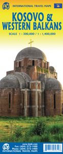
Wegenkaart - landkaart Kosovo & Westelijke Balkan | ITMB

Kosovo is the country that shouldn’t exist, but does. When Yugoslavia fells to pieces after Tito died, Kosovo was lumped in with Serbia but was very unhappy with being a part of an Eastern Orthodox regime. It broke away, resulting in genocidal fighting until the Americans stepped in and stopped the fighting. The region was then placed under a Europ...
13,95

Webshops met dit product

Webshop
Bezorging
Prijs

Anderen bekeken ook

Wegenkaart - landkaart 3327 Adventure Map Western Balkans - Westelijke Balkan | National Geographic
Wegenkaart van de Westelijke Balkan met vermelding van veel bezienswaardigheden en attrakties. Watervast en scheurvast. Juist door deze vermeldingen onderscheidt de kaart zich van andere wegenkaarten. Landen: Slovenië, Kroatië, Bosnië Herzegovina, Montenegro, Albanië, Servië,  Kosovo, and Macedonië.   The Western Balkans region, an adventure playground and rising star of Europe, is loaded with Old World traditions, slow food culture, ancient towns, and rarely visited villages. The area stretches from the Adriatic Sea in the west, up and over mountain ranges, raging rivers, tectonic lakes, steep gorges, and thousands of miles of paths, trails, and routes. Discover eight countries—all with their special brand of Balkan magic: Slovenia, Croatia, Bosnia and Herzegovina, Montenegro, Albania, Serbia, Kosovo, and Macedonia.   National Geographic's Western Balkans Adventure Map will meet the needs of travelers with its detailed and accurate information. The map includes the locations of UNESCO…
17,50
Wegenkaart - landkaart Bosnië en Montenegro | ITMB
For some reason, Bosnia Herzegovina has never attracted the attention of firms publishing maps. Understandably, since the breakup of Yugoslavia, the entire region has been somewhat unattractive for visitors. Also, Bosnia by itself is difficult to map, due to its shape. However, we have visited the country several times and find it to be interesting, friendly, and attractive. We were particularly impressed by Montenegro. Since it broke away from Serbia, this country has moved forward quickly. It uses the Euro as a currency, has lovely Mediterranean Sea resorts along its coast, and is a progressive country tying its future to the rest of Europe as a future EU member. The roads in both countries are good, and the damage done by civil in-fighting largely a thing of the past. Both countries are well-worth a visit. The map also includes Kosovo. Ethnically, it is probably more tied to Albania than to Bosnia, but geographically, Bosnia is closer and Kosovo is shown in good detail on this doubl…
13,95
Wegenkaart - landkaart Balkans Rail and Road | ITMB
The region of Europe known as the Balkans is normally restricted to the area that used to be Yugoslavia, but it is geographically much larger and needs to be seen in its expanded format that includes Hungary, Romania, Moldova, and Greece, with that portion of Turkey that has had so much influence on the region over many centuries. Side 1 is dominated by the great land mass of historic strategic importance that has been fought over for centuries. Nowadays, conflict is still threatening, with Kosovo and Serbia always at each other's throats and Romania warily watching Russia's aggression next door in both Ukraine and Moldova. Attitudes are shifting towards closer integration with the EU in the region, with Albania, Northern Macedonia, Kosovo, and Montenegro clamouring for admission and NATO being looked at to provide security against further Russian aggression. As a result, the region retains huge geopolitical significance, but it also offers touristic opportunities that are difficult to…
13,95
Wegenkaart - landkaart Balkan - Zuidoost Europa | Freytag & Berndt
A nicely detailed travelers map of Southeast Europe from Prague east to Odessa and south to Italy, Greece and western Turkey, including the Danube, Romania, Bulgaria and the Black Sea from Odessa to Istanbul. At a scale of 1:2,000,000.  Explore the Balkans and South-East Europe with this Freytag & Berndt road map - the best way to prepare your trip, to plan your itinerary, and to travel independently.    This map covers the following countries: Greece, Albania, FYROM, Bulgaria, Kosovo, Serbia, Montenegro, Bosnia Herzegocina, Croatia, Slovenia, Hungary, Romania, Moldova, the Czech & Slovak Republics, Western Turkey, Western Ukraine, Austria, and Southern Italy.   The map includes a localities index and more detailed city maps of Athens, Belgrade, Bratislava, Bucarest, Budapest, Chisinau, Istanbul, Kiev, Ljubljana, Podgorica, Prague, Pristina, Sarajevo, Skopje, Sofija, Tirana, Vienna, and Zagreb.
14,95
Wandelgids Trekking the Peaks of the Balkans Trail | Cicerone
Uitstekende wandelgids van dit geweldige gebied. Goed beschreven met veel praktische informatie om de route te kunnen lopen, inclusief redelijke kaarten. This guide describes the Peaks of the Balkans Trail, a 192km circular route through the spectacularly wild and rugged borderlands of Montenegro, Albania and Kosovo in Europe, with around a third of the trek lying in each country. Developed to promote sustainable local tourism and transcend political borders, it winds its way through the spectacular scenery of the Prokletije mountains, taking in high passes and remote valleys. Since its launch, the trail's popularity has continued to rise: however, despite increasing visitor numbers, the area - off-limits to foreigners until comparatively recently - remains underdeveloped and unspoilt. The route can be hiked in around two weeks: it is presented in 10 daily stages and the guide also includes suggestions for excursions to bag neighbouring peaks and visit local sites of interest. While a …
24,95
Wegenkaart - landkaart Albania - Albanië | ITMB
Een degelijke kaart met aanduidingen van o.a. nationale parken, vliegveld, benzinepomp, dirt-roads en kleine plattegrond van hoofdstad. Als overzichtskaart goed te gebruiken. Albania is the latest addition to ITMB's European map series. Lan and I visited the country last October to ground-truth our artwork before publishing and were pleasantly surprised to find good quality roads, friendly people, attractive scenery, and a quiet 'get-ahead' attitude. Although still underdeveloped, tourism in Albania is amongst the fastest growing in Europe. With its Greek, Roman and Ottoman architecture and its natural beauty, including Mediterranean beaches and the Albanian Alps, this is not at all surprising. The country had a reputation during the Cold War of being rather secretive and unfriendly, but it is the only formerly-communist-run country to have its totalitarian government hold a referendum on future governing systems (in 1992) and respected the will of the people as expressed and arranged …
13,95
Wandelgids Via Dinarica | Bradt Travel Guides
Bijzondere wandelgids : het beschrijft de wandelroute in Bosnie Herzegovina van de Via Dinarica, the White trail. Veel praktische informatie, redelijk kaartmateriaal en een goede beschrijving van de route.  This is the first detailed guide to the Bosnian part of the new Via Dinarica hiking trail that carves its way through the Dinaric Alps, one of Europe's least explored mountain ranges and last true wilderness frontiers, connecting the seven nations of Slovenia, Croatia, Bosnia and Herzegovina, Montenegro, Serbia, Kosovo, and Albania. In total, this trail system will span over 1,350km, 333km of which is in Bosnia Herzegovina. The Via Dinarica consists of three routes - White, Green and Blue - and this guide focuses primarily on the White Trail through Bosnia and Herzegovina, following the natural flow of the highest peaks of the Dinaric Alps. Detailed descriptions of each of the 12 stages of the White Trail through Bosnia and Herzegovina are included, along with maps, altitude charts …
20,95
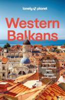
Reisgids Western Balkans | Lonely Planet
De perfecte reisgids voor zowel de georganiseerde als de zelfstandige reiziger. Naast een algemene inleiding van het land / streek vol met praktische informatie over hoe je er het beste kunt reizen: slapen, eten, vervoer, excursies ... alles kun je er in vinden.   Lonely Planet's Western Balkans is your passport to the most relevant, up-to-date advice on what to see and skip, and what hidden discoveries await you. Catch the cable car up Mt Srd for breathtaking views of Dubrovnik, Croatia; watch the beautiful people over the rim of a coffee cup in Budva's cobbled Old Town lanes in Montenegro; and trek around the stunning landscapes of Kosovo's Rugova Mountains. All with your trusted travel companion. Get to the heart of the Western Balkans and begin your journey now!   Coverage includes: Albania, Bosnia & Hercegovina, Croatia, Kosovo, Montenegro, North Macedonia, Serbia, Slovenia and more   Inside Lonely Planet's Western Balkans:   Full-colour maps and images throughout Highlightsand it…
25,95
Wegenkaart - landkaart Turkmenistan - Afghanistan | ITMB
These two countries, bordering on Iran and Uzbekistan, are in a very volatile part of the world. They constitute the heart of Central Asia; a bit difficult to reach, but definitely suitable for adventure travel. Turkmenistan occupies one side of the sheet, and Afghanistan is on the other side at a better scale. Turkmenistan stretches from the Caspian Sea to a major river (the Amuder) that forms its eastern boundary with Uzbekistan and its border with Afghanistan. An inset map of the capital just north of the Iranian border, Ashgabat, is included. On the other side, Afghanistan is a lovely country and is slowly coming out of an extremely bad situation. It is still quite an unsafe country, and fighting could flare up again in the spring. Regardless, it is a strategically important country and one that ITMB has taken quite a bit of effort to make into a significant map. This is a very interesting map, of an of-the-beaten-track part of the world. It reflects the best information we have, b…
13,95
Wegenkaart - landkaart Spitsbergen Svalbard | ITMB
North of Norway exists one of the northernmost communities in the world, an archipelago of islands called Svalbard in Norwegian, and better known as Spitsbergen in English. Until now, it has only been available in map format from the Norwegian Arctic Institute, and then only with difficulty. Side one shows the various islands as an entity. There is only one town of any size in the islands, called Longyearbyen, although there is a more northerly town called Pyramiden and an isolated community on the west coast called Alesund. This is true high Arctic adventure travel; one does not come here unprepared! Most of the islands are uninhabited and largely ice-covered. Edge Island, for example, is a large nature reserve, and Prins Karl Forland is a national park. We have translated land area names into English and placed the Norwegian names in brackets, but have tried leaving the Norwegian names in place wherever possible to assist with local usage. This is one of those ‘off the beaten path’ t…
13,95

Klanten-reviews van Wegenkaart - landkaart Kosovo & Westelijke Balkan | ITMB

Er zijn nog geen beoordelingen voor dit productBen jij de eerste die een review plaatst?

Meer over Wegenkaart - landkaart Kosovo & Westelijke Balkan | ITMB

Productomschrijving

Kosovo is the country that shouldn’t exist, but does. When Yugoslavia fells to pieces after Tito died, Kosovo was lumped in with Serbia but was very unhappy with being a part of an Eastern Orthodox regime. It broke away, resulting in genocidal fighting until the Americans stepped in and stopped the fighting. The region was then placed under a European Union control in the faint hope that it would merge with Albania, or Montenegro, but it didn’t. Relations with Serbia are still quite strained, but Kosovo is still surviving as a mountainous Balkan state. Fought over for centuries by Turks and Serbs, Kosovo is emerging as a small but touristic European country. This is definitely an off-the-beaten-path travel destination! The second side of the sheet provides an excellent regional coverage for the Western Balkans, essentially Slovenia, Croatia, Montenegro, Serbia, and reasonably large tracks of land for Hungary, Albania, and North Macedonia, showing the growing number of wilderness parks being created.
Webshop.nl maakt gebruik van cookies. Ga je verder op onze website, ga dan akkoord met het plaatsen van cookies en de verwerking van deze data door ons en vermelde partners.