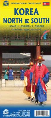
Wegenkaart - landkaart Korea, North & South | ITMB

0
Een degelijke kaart met aanduidingen van o.a. nationale parken, vliegveld, benzinepomp en dirt-roads. Als overzichtskaart goed te gebruiken. Met Noord Korea, schaal 1:830.000, aan een kant en op de andere zijde Zuid Korea, schaal 1:550.000. This is a brand new title for ITMB, combining North and South Korea into one double-sided map focusing on th...

Verkopers met dit product

Verkoper
Bezorging
Prijs
DeZwerver.nl logo
DeZwerver.nl
2,95
13,95

Anderen bekeken ook

Wegenkaart - landkaart Liechtenstein & Oostenrijk West | ITMB
Europe is dotted with mini-states that exist solely for historic reasons but are fiercely independent. Liechtenstein, surrounded by Switzerland on its west and south and Austria on its other borders, is such a state. It is larger and more diverse than many imagine and is quite a popular ski resort region. Side 1 is a detailed map of the principality, framed on the west by the Rhine River and a bit of Switzerland and on the east by Austria. Most development occurs in the Rhine Valley in a north-south direction, dominated by the capital city of Vaduz. There are five access points from Switzerland across the Rhine, one from the south, and two from Austria in the north. The ski haven of Malbun is prominently shown, and the scale of the map is detailed enough to name every major street. This also enabled us the opportunity to include schools, shopping areas, post offices, and churches, as well as a wide range of eating establishments. Walking/hiking trails have also been included. This is …
14,95
Spoorwegenkaart - Wegenkaart - landkaart Scotland Far North & Islands Railway & Road | ITMB
Great Britain, by its shape, is difficult to map. The population is dense, the road network intense, and the coastline convoluted. A map of the British Isles shows only the major features. Sectional maps of just England, or Just Wales, make little sense, due to the geographic shape of the island kingdom. Scotland also needs more than one map to show its treasures in sufficient detail. ITMB previously issued Scotland Central and South, and now extends its coverage at 1:300,000 to the sparsely-populated highlands and the isolated Western, Orkney, and Shetland island archipelagos that are usually shrunk to insignificance on most maps, as insets. This double-sided map covers the area from Loch Lochy south of Invergarry to John O’Groats in the north, and from the Western islands of Uist and Lewis to the Moray Firth and Craigellachie in the east. The second side has to duplicate part of the first side in order to extend the artwork further eastward to include Aberdeen and northward to inclu…
13,95
Wegenkaart - landkaart Botswana - Zimbabwe | ITMB
Een degelijke kaart met aanduidingen van o.a. nationale parken, vliegveld, benzinepomp, dirt-roads en kleine plattegrond van hoofdstad. Als overzichtskaart goed te gebruiken. 7th Edition 1:1,600,000/11:1,000,000 on waterproof stone paper Both Botswana and its neighbour, Zimbabwe, form a common entity and a British heritage in Central Southern Africa, but there the resemblance ends. The Bechuana formed an alliance of sorts with the Pritish to protect them from the Boers in the then-nearby Transvaal. Upon a peaceful transition to independence as Botswana, it has evolved into a democratic and peaceful country. Zimbabwe, formerly Rhodeisa, is a failed state, although potentially, Zimbabwe could dominate tourism if governmental affairs were orderly. This map focuses on Botswana simply because that country is a beacon of orderly pleasantness in the continent; well run, routistacally well developed, with good infrastructure, and close to the game preserves of both South Africa and Zimbabwe. …
13,95
Wegenkaart - landkaart South Pacific Cruising & Samoa | ITMB
Een overzichtskaart van de zuidelijke Stille Oceaan met de cruise routes tussen de verschillende eilanden aangegeven. Op de achterzijde een overzichtskaart van Samoa This is a new venture for ITMB. Cruising is a rapidly-growing segment of the travel industry, experiencing double-digit growth rates annually. Obviously, this is a thriving market. In conjunction with several cruise ship lines, we have prepared a map of the South Pacific Ocean, which extends southwards from Hawai'i to the southern tip of New Zealand and eastwards from central Australia/Papua New Guinea to the Pitcairn Islands. Thus, it does not include the popular South East Asia and China coast routes. We think this has to change at a time when 25,000,000 people are travelling by cruise ships. At the same time, we must keep coverage area relevant for those end users of the artwork. Even at 1:12M, most of the area covered is water, with island countries such as Fiji, Tonga, Kiribati, Tahiti, and the Cook Islands being vis…
13,95
Wegenkaart - landkaart Litouwen & Letland | ITMB
ITMB is very pleased to release its first-ever map of the Baltic country of Lithuania, which occupies Side 1 of this double-sided map. It is bordered by Latvia on its north, the Russian enclave of Kalingrad on its southeast, and Poland and Belarus on its south and east. It is now on the front lines of tension between Russia and its neighbours, as are all the Baltic states. It is also a valued member of both NATO and the EU, and as such is easy to access from either Poland or Latvia. Lithuania fronts on to the Baltic Sea with a major port at Klaipeda (formerly Memel), with its capital being Vilnius. Historically, the country has suffered German and Russian invasions during the 20th century, the last of which resulted in the country losing its independence completely by being absorbed into the Russian Empire in the latter stages of WW2. It regained its independence in 1991, with the collapse of the USSR and shortly thereafter applied to join both the European Union and NATO. Touristical…
14,95
Wegenkaart - landkaart Northern British Columbia | ITMB
British Columbia is big! Gargantuan huge, in fact, although it is lightly populated. ITMB published a map of the more densely populated southern half of the province a number of years ago, and we have been asked to give the same emphasis to the northern half ever since. Here it is! Side 1 is of the western portion, including the Alaskan Panhandle, with the route followed by cruise ships heading north and clearly delineates the border between Canada and the USA that nearly erupted into warfare (54 40 or fight). It also shows the Stewart Highway heading north towards the Yukon, with its branch leading to Hyder, Alaska, the only place in the USA that uses Canadian money and does all its banking in Canada. The second side covers the eastern half of BC’s north, with the Alaska Highway starting in Dawson Creek and extending north to Fort Nelson before veering west into the eastern edge of the Rocky Mountains to the Yukon border. This is true wilderness country. It is virtually unpopulated o…
14,95
Reisgids North Korea - Noord Korea | Bradt Travel Guides
Er bestaat geen Lonely Planet van North Korea. Daarom vermelden wij de enige goede gids van North Korea, die van Bradt Guides. Net zo goed, zo niet beter dan de Planet. Beduidend soberder uitgevoerd, maar ook met veel informatie voor backpackers en met veel kaartmateriaal. Een aanrader! This new edition of Bradt's North Korea has been completely written from scratch and remains the only standalone guide to what is often regarded as the world's most secretive state, a place never far from media scrutiny but about which very little is actually known in the wider world. Detailed is everything you need to know for a successful visit, from the practicalities of how to get there and who to go with to cultural sensitivities and etiquette, safety, money and travelling around. Amongst the places covered are the supra-centrally planned showcase capital of Pyongyang; Panmunjom, where North meets South face-to-face inside the 4km-wide DMZ - the dividing line between two nations and one people; Ku…
26,50
Wegenkaart - landkaart Southern Alberta & Southern British Columbia | ITMB
ITMB, being based in Vancouver, BC, understandably has a local/regional market for our map line. We have a map of Western Canada, as well as an atlas, a very nice map of BC itself, a map of the south half of BC, and a map of part of BC combined with Washington State. What we did not have, until now, was a map covering the most touristically-visited part of all of Canada – namely, the southern halves of both British Columbia and its neighbour, Alberta, with a small amount of Washington State, Idaho, and Montana (to assist those heading north and needing to know about border crossings). Therefore, ITMB is pleased to announce the release of Southern BC and Alberta. Side One covers BC from the US border (with a carry-on to Seattle) north to Prince George and east to the Alberta border, with a carry-on to Calgary. All of Vancouver Island, the Okanagan Valley, and the Rock Mountain National Parks of Banff and Jasper, are included. The map is rich with wilderness campsite (almost 1,000 are s…
13,95
Wegenkaart - landkaart Guam - West Pacific Cruising | ITMB
Een degelijke kaart met aanduidingen van o.a. nationale parken, vliegveld, benzinepomp, dirt-roads. Als overzichtskaart goed te gebruiken. Certainly, this is the only map of Guam by any major cartographic publishing house. Here are some details: Guam is a north-south island considerably north of New Guinea, and forms part of the American-held group of islands known as the Northern Marianas. Its capital is Hagatna, and the main town is called Tamuning. The island has a well-developed international airport in the middle portion of the island, with a large US military airbase in the northeast corner. The vast majority of the island is touristic, and well worth a visit. The island was "discovered" by Ferdinand Magellan in 1521, and Hagatna is the oldest "European" city in the Pacific, dating from 1686. The town of Inarajan retains a decidedly Spanish appearance to this day. Other attractions include Tumon Beach and its many resorts, the Piti Underwater Observatory, and the famous Cocos Is…
13,95
Wegenkaart - landkaart Kamchatka Peninsula & Russia Far east | ITMB
Een degelijke kaart met aanduidingen van o.a. nationale parken, vliegveld, benzinepomp, dirt-roads en kleine plattegrond van hoofdstad. Als overzichtskaart goed te gebruiken. Schaal: Kamchatka 1 : 1,700.000 & Eastern Siberia 1 : 3.600.000 This is the most recently released title in our Russia series. In this revised edition, we have expanded the area of coverage to include the portion of Russia known as the Far East Republic and the eastern portions of Siberia (in January, we released Siberia itself). Lets start with the Kamchatka peninsula itself. This is a very interesting adventure travel destination, famous for its geothermal geysers and its isolation from the rest of Russia. There is only one city of any size, Petropavlovsk Kamchatsky (which I genuinely hope is colloquially known as PK), the capital and location of the peninsula only significant airport. We have included an inset map of the city. We also include a map of the famous Valley of Geysers (south of Klyuchi). Interestin…
13,95

Klanten-reviews van Wegenkaart - landkaart Korea, North & South | ITMB

Er zijn nog geen beoordelingen voor dit productBen jij de eerste die een review plaatst?

Meer over Wegenkaart - landkaart Korea, North & South | ITMB

Productomschrijving

Een degelijke kaart met aanduidingen van o.a. nationale parken, vliegveld, benzinepomp en dirt-roads. Als overzichtskaart goed te gebruiken.

Met Noord Korea, schaal 1:830.000, aan een kant en op de andere zijde Zuid Korea, schaal 1:550.000.

This is a brand new title for ITMB, combining North and South Korea into one double-sided map focusing on the entire Korean Peninsula rather than its political components. The peninsula is undergoing a lot of change at the moment, and no one knows the ultimate outcome. North Korea seems interested in opening itself somewhat to South Koreans, and even if steps to date seem like baby ones, tensions between north and south seem cordial at the moment. For the time being, this map replaces our separate map of North Korea, as changing conditions makes it too risky for us to re-do our North Korea title until its future path is clearer. However, although this map also shows South Korea in good detail, we will continue marketing our Seoul and South Korea map as well as this one. It is still quite difficult to enter North Korea, but we have included an inset map of central Pyongyang and another of its metro system just in case one makes it to the city. South Korea has emerged as one of the most economically developed countries in Asia and is well worth visiting.   Legend Includes: Expressway, Main Road, Secondary Road, Railway with Station, Sea Route, Point of Interest, Temple, Museum, Hot Spring, Hotel, Monument, Fort, World Heritage, International Airport, Domestic Airport, Border Crossing, Beach, Lighthouse, Waterfall, Spa, Theater, University, Harbour, Ferry, Golf Course, etc.

Productinformatie

    Verken gerelateerde categorieën

    Webshop.nl maakt gebruik van cookies. Ga je verder op onze website, ga dan akkoord met het plaatsen van cookies en de verwerking van deze data door ons en vermelde partners.