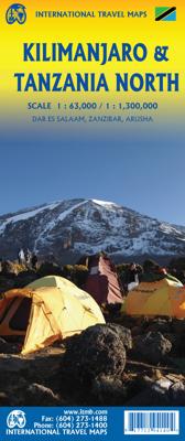
Wegenkaart - landkaart Kilimanjaro & Tanzania North | ITMB

0

Verkopers met dit product

Verkoper
Bezorging
Prijs
DeZwerver.nl logo
DeZwerver.nl
2,95
14,50

Anderen bekeken ook

Reisgids Handbook Kilimanjaro & Northern Tanzania | Footprint
Kleine versie van de grotere Handbooks serie van Footprint, daardoor een stuk handzamer voor wie zich beperkt to dit bepaalde gebied. Nog altijd vol met goede tips, veel praktische informatie en handige kaartjes. From the snow-capped beauty of Mount Kilimanjaro, Africa's highest mountain, to the vast plains of the Serengeti, the north of Tanzania offers enormous diversity. Whether you're spotting the Big Five on safari, trekking spectacular peaks or exploring the incredible Ngorongoro Crater, Footprint's Kilimanjaro & Northern Tanzania Handbook covers all the top attractions in this fascinating region, plus tips for escaping the crowds and getting off the beaten track. Practicalities section with essential advice on getting there and around. Highlights map & inspirational color section, so you know what not to miss. Comprehensive listings including where to eat, sleep and relax - whatever your budget. Detailed street maps for Dar es Salaam, Arusha and other key locations & national pa…
15,50
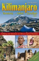
Reisgids Klimgids Kilimanjaro, Tanzania, Safari, Zanzibar | Tom Kunkler
Uitgebreide wandelgids, klimgids en reisgids in één.   Updated in 2015, this book offers a complete and comprehensive guide for climbing Mount Kilimanjaro in Tanzania. Well-known in Germany for many years and now, finally available in English! The author, Tom Kunkler, documents detailed and exciting information of his successful climbs up Mount Kilimanjaro via all six routes, as well as Mount Meru and Ol Doinyo Lengai. Included are important insider tips from A to Z, from altitude training to Zanzibar.    Political and cultural history, information about Tanzania s world famous national parks, and the spice island of Zanzibar are presented to the reader in detail and with remarkable color photos. Tom Kunkler's familiarity with the legendary Maasai provides additional fascinating insights into Tanzania.  364 pages 295 photos 35 maps and city maps 6 elevation profiles All current routes Tips from A-Z Health and medicine Climate, flora and fauna People and the country and more
23,95
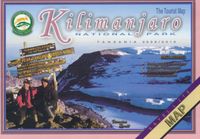
Wegenkaart - landkaart Tourist Map of Kilimanjaro National Park | Veronica Roodt
Veronika Roodts Kilimanjaro-Karte, die Tourist Map of Kilimanjaro National Park, ist wie alle anderen Karten aus ihrer Ostafrika-Kartenserie, auf Satellitenaufnahmen aufgebaut und mit einem kräftigen, gut lesbaren Kartendesign versehen. Hier finden sich Höhenlinien, Kartengitter mit Gradangaben, die die Ablesung eigener GPS-Daten ermöglicht.   Die Karte hat ihren Schwerpunkt natürlich auf dem Bergsteigen und alles für die Besteigung des Map of Kilimanjaro wichtige ist auf der Legende indiziert, zum Beispiel die Schutzhütten und das Wegesystem. Mit der Karte wird reichlich geschriebene Information geliefert. Dies betrifft natur-, landeskundliche und historische Fragen und Themen der Kilimanjaro-Besteigung wie Vorbereitung, Verpflegung, Fitness, Gesundheit und Vorsichtsmaßnahmen.   Zur Sache geht es bei der Vorstellung der acht ausgewiesenen Besteigungsrouten für den Kilimanjaro: hier erfahren Sie die wesentlichen Unterschiede und Besonderheiten hinsichtlich der Aufstiegsdauer und des A…
10,-
Wegenkaart - landkaart Tanzania | ITMB
Uitstekende wegenkaart van Tanzania met zowel de toeristische informatie als Nationale Parken en bezienswaardigheden, maar ook de topografische details als plaatsen en wegen, spoorlijnen en rivieren, hoogten, lengte- en breedtegraden. An easy-to-use road and geographical map of Tanzania to plan your trip, to prepare your itinerary, and to travel independently in this African country. This double-sided map contains a place name index, inset maps of Dar es Salaam, Arusha and Stone Town. The legend is in English. Touristic information: places of interest, vistas, ruins and archaeological sites, museums, Unesco World Heritage sites, hotel/motel, campsites, ferry lines, ports, airports, national parks, petrol stations, hospitals and médical facilities, border crossing.
14,95
Wandelgids Kilimanjaro trekking | Cicerone
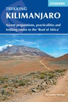
Goede trekking - wandelgids van de Kilimanjaro. Beklimmingen kunnen van alle kanten in vele vormen en vrijwel alle routes staan goed beschreven  in deze gids. Veel praktische informatie en een duidelijke routebeschrijving, duidelijke enigszins schetsmatige kaarten en een uitgebreide inleiding over wat je wel en niet moet meenemen, regelen en voorbereiden. At 5895m, Kilimanjaro is Africa's highest point and the highest freestanding mountain in the world, yet it is possible to reach its summit, Uhuru Peak, without any technical climbing ability. However, that is not to say that it is an easy undertaking: each year, many people fail in their attempt, often due to poor preparation or insufficient acclimatisation. Those who do make it to 'the Roof of Africa' are richly rewarded, enjoying outstanding views, the unique experience of being 'on top of the world' and, of course, a tremendous sense of achievement.   Guidebook describing all the trekking routes on Kilimanjaro (5895m), one of the …
23,95
Wandelgids Kilimanjaro & East Africa | Cordee
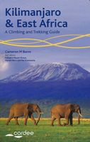
For trekkers or climbers hoping to reach the top of Kilimanjaro or challenge themselves on the remote spires of Mount Kenya, or explore East Africa's lesser-visited areas such as Mount Meru and Rwenzoris of Uganda, this new and completely revised guide is ideal.    The guide includes more than 50 routes, including summit walk-ups and serious technical climbs, there are details of useful websites for the trekker/climber visiting the area and dozens of do's and don'ts to help you stay safe. Also covered are tips on transportation, places to stay and how to obtain permits and visas.    The author, Cameron Burns, has been writing guidebooks for many years and has travelled extensively all over the world; he is a regular contributor to the outdoor press writing articles on a range of topics - he also has a regular monthly column in Climber magazine
18,50

Klanten-reviews van Wegenkaart - landkaart Kilimanjaro & Tanzania North | ITMB

Er zijn nog geen beoordelingen voor dit productBen jij de eerste die een review plaatst?

Meer over Wegenkaart - landkaart Kilimanjaro & Tanzania North | ITMB

Productinformatie

    Verken gerelateerde categorieën

    Webshop.nl maakt gebruik van cookies. Ga je verder op onze website, ga dan akkoord met het plaatsen van cookies en de verwerking van deze data door ons en vermelde partners.