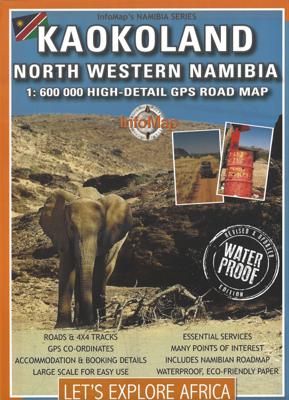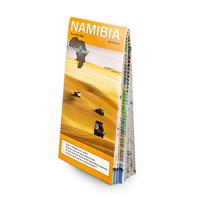
Wegenkaart - landkaart Kaokoland and northern Damaraland - Namibië | Infomap

0
Goede betrouwbare kaart van het noordwesten van Namibië: Damaraland en Kaokoland. Met GPS coordinaten. Engels Colour folding Map, 52x73 cm, scale 1:620.000. The first scale road map of this area to be produced with GPS co-ordinates. 100 GPS Co-ordinates of major intersections, refuelling points and accommodation information. Map range 11°45’ to 15...

Verkopers met dit product

Verkoper
Bezorging
Prijs
DeZwerver.nl logo
DeZwerver.nl
2,95
15,95

Anderen bekeken ook

Wegenkaart - landkaart Namibia - Namibië | Tracks4Africa
Uitstekende dubbelzijdige wegenkaart van Namibië, gemaakt door gerenommeerde kaartenmaker Track4Africa in Afrika. Met afstanden en reistijden tussen steden en op alle wegen vermeld. GPS via hun website te downloaden. De kaart wordt door vrijwel elke reisorganisatie geadviseerd als je met een eigen auto in Namibië rond gaat rijden. The Tracks4Africa Namibia paper map is designed to be used in conjunction with the T4A GPS Map of Namibia. It is the largest available Namibia map at 1:1,000,000 scale, offering you the perfect trip planning tool for your next Namibian holiday.  This T4A paper map series are probably the first comprehensive country maps in the world, offering travel time information for the entire road network, be it on tar, gravel or sand!    Key features:    Large 1:1,000,000 scale  Travel times and distances included on the map  What you see on the paper map is exactly what you get on T4A GPS Maps  Comprehensive set of roads and tracks in nature reserves  Detailed in…
27,50
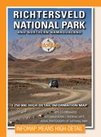
Wegenkaart - landkaart Richtersveld National Park and Northern Namaqualand | Infomap
Wegenkaart met toeristische informatie en geschikt voor gebruik met GPS   The original InfoMap! Now in its 8th edition this map remains as popular as ever. For those who don’t know, the Richtersveld National Park is a 160 000 hectare national park found on the banks of the Orange River in South Africa’s Northern Cape. It is the only mountain desert park in Southern Africa and is one of the few national parks in which you are not confined to your car. Dry, arid with a feeling of isolation, life in the park is influenced by the mist created by the cold Atlantic Ocean. Known to the local Nama people as ‘malmokkie’ it brings moisture to an otherwise parched land. Despite its lack of rainfall the area is rich in flora containing many species, like the Halfmens, which exist nowhere else on earth.   The area has long been a favorite for botanists, photographers, lovers of remote places and 4×4 enthusiasts who flock to this corner of South Africa for its unique character, isolation and fee…
15,95
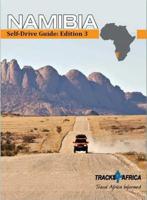
Accommodatiegids Namibia Self-Drive Guide | Tracks4Africa
So, what is so special about the Tracks4Africa guide books? These are not guides written by armchair travellers or the personal experience of one person, but the combined experiences of a whole community of travellers. The T4A community travel far and wide – not by luxury bus or safari vehicle but on their own wheels. Sometimes they travel in groups and sometimes as lone rangers, but they always travel by motorbike, sedan or 4WD, therefore this guide is specifically aimed at self-drive travellers.   If you are a self-drive tourist, there are five things that you need to know when you are on the road: 1. Where to sleep. 2. Where to get fuel. 3. What to see and do. 4. Where to buy supplies. 5. Where to go in case of an emergency.   If you have the Tracks4Africa Self-Drive Guide as your travel companion, the answers to all these and many more questions will be at hand. If you are well prepared and well informed, you can really enjoy the unspoilt beauty of Africa! The Tracks4Afr…
52,50
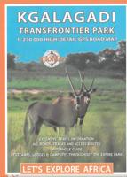
Wegenkaart - landkaart Kgalagadi Transfrontier Park | Infomap
Kgalagadi Transfrontier Park in Zuid Afrika, wegenkaart 1:500.000. Met toeristische informatie en geschikt voor gebruik met GPS   The reverse side of the map shows the main tourist areas in the large scale of 1: 270 000.   The traveller can make use of the well established and well maintained infrastructure and roads on the South African side of the Park including rest camps that offer all luxuries or rough it on the Botswana side with deep sandy tracks and unfenced camping spots. Apart from the park itself our map covers also the immediate surrounding of the park with emphasis on the area north of the park in Western Botswana between Hukuntsi and Ukhwi known as the Western Woodlands, a remote and wild paradise for the 4x4 enthusiast.Easy to read in a vehicle   Practical, user-friendly scale Accommodation listed with booking details Waterholes Distances between points through the park Viewpoints and picnic sites GPS co-ordinates Botswana section with camps listed Gate times Border pos…
15,95
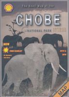
Wegenkaart - landkaart Chobe | Shell
Zeer bijzondere goede landkaart van Chobe National Park in Botswana. Uitermate handig zijn de GPS coordinaten van de meest belangrijke punten als campings of uitzichtpunten. De kaart is gebaseerd op een luchtfoto, waarbij alle details zijn ingetekend. The map: The Chobe map consists of a complete map of Chobe on the front of the map and there are 5 individual maps of the major tourist areas on the back of the map. These are Chobe river front east, Chobe river front west, Nogatsaa, Savute and a small orientation map. The map was compiled by using satellite images, giving one a birds eye-view of the area. The roads were tracked by means of a GPS and then super-imposed on the photographs. Detailed GPS co-ordinates are supplied for game-drive areas. The Chobe map contains 126 GPS co-ordinates. The four main tourist areas: The Chobe National Park consists of a variety of vegetation types and geological features, offering extreme contrasts and a wide range of wildlife experiences within the…
17,50
Wegenkaart - landkaart Namibia - Namibië | ITMB
Een degelijke kaart met aanduidingen van o.a. nationale parken, vliegveld, benzinepomp, dirt-roads en kleine plattegrond van hoofdstad. Als overzichtskaart goed te gebruiken. The former German colony and mandated territory of South-west Africa has emerged as a major touristic destination. Following our recent research trip to the country, we have made numerous changes to the map – upgrading roads that have been paved, changing our Caprivi Strip information, and re-doing our inset map of Windhoek. Printed on paper, single-sided; Folded road and travel map. Scale 1:1,600,000. Distinguishes roads ranging from highways to tracks (seasonal). Legend includes points of interest, internet cafes, restricted access roads, railroads, international/domestic airports, aerodromes, lodging, rest houses, guest farms, campsites, ruins historic/archaeological), museums, vistas, hot springs, caves, forts, shipwrecks, gas stations, medical facilities, missions, national parks/reserves, salt pans, restric…
13,95
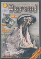
Wegenkaart - landkaart Moremi - Tourist Map of Moremi Game Reserve Botswana | Shell
Zeer bijzondere landkaart van Moreni Game Reserve in Botswana. Uitermate handig zijn de GPS coördinaten van de meest belangrijke punten als campings of uitzichtspunten. De kaart is gebaseerd op een luchtfoto, waarbij alle details zijn ingetekend. The map: The Moremi map is based on satellite photos. The front of the map consists of a map of the entire Reserve and on the back are six separate maps of Khwai river-front east, Khwai river-front west, an orientation map of Moremi, Xakanaxa area and the Moanachira river, Xakanaxa game-drive area and Bodumatau area. The roads were tracked by GPS and there are 162 GPS co-ordinates on the map. General: As part of the Okavango Delta, Moremi consists of permanent swamp, seasonally swamped areas and dry land. It is one of the prime tourist destinations in Botswana and offers water activities, top game-viewing, some of the best bird-life in Africa and incredible scenery. Not to be missed! Locality and size: The Moremi Game Reserve is nestled withi…
17,50
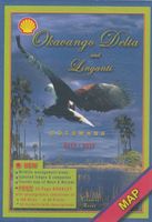
Wegenkaart - landkaart Okavango Delta - Tourist Map of the Okavango Delta and Linyanti Botswana - Veronica Roodt | Shell
Zeer bijzondere landkaart van de Okavango Delta en Linyanti. Uitermate handig zijn de GPS coördinaten van de meest belangrijke punten als campings of uitzichtpunten. De kaart is gebaseerd op een luchtfoto, waarbij alle details zijn ingetekend. The map: The map of the Okavango and Linyanti was compiled by using LANDSAT satellite images. The main reason for a tourist map of the area is to indicate the localities of the lodges as well as the wildlife management areas in which they occur. Tourists to the Okavango often visit more than one lodge and this will give them a good idea of where they have been. On the back of the map are enlargements of the different tourist areas, which shows more detail of the landscape. There are no GPS co-ordinates on the Okavango map as all the Wildlife areas consist of private concessions, which are not open to the general public. The roads in the private concessions have also not been indicated as this may mislead the self-driving public, making them thin…
17,50
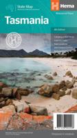
Wegenkaart - landkaart Tasmanië - Tasmania | Hema Maps
Op deze kaart staat Tasmanië in zijn geheel op 1 deel van de kaart. Goede, overzichtelijke, leesbare kaart van het hele eiland. Nationale Parken zijn er goed op te vinden en de afstanden worden weergegeven. Op de achterkant nog deelkaartjes van enkele steden en NP s. The fourth edition of Hema’s Tasmania State Map features Hema’s distinctive and informative maps fully, all of which have been field checked by Hema’s Map Patrol to ensure the best possible accuracy with the latest mapping data.    A fully indexed state map of Tasmania (TAS) at a scale of 1:500,000. Marked on the mapping are national parks, fuel locations as well as camping and rest areas.    The reverse side consists of:   a summary of the key things to see and do broken up into the North West, Launceston, Tamar and the North a table listing of National Parks and Reserves with key features and facilities (such as Camping and Caravan sites, BBQ, toilets and showers) Visitor centre listing Map of the area around Zeehan…
17,50
Wegenkaart - landkaart Brazilië | ITMB
Een degelijke kaart met aanduidingen van o.a. nationale parken, vliegveld, benzinepomp, dirt-roads en kleine plattegrond van hoofdstad. Als overzichtskaart goed te gebruiken. Brazil, or more properly, Brasil, is a difficult country to map as a country, in that most of the developed areas are in the relatively small extreme south of the country. The vast region of the Amazon Basin is lightly populated and is not easy to access. Our solution has been to portray the south portion on one side at a detailed scale, to enable such locations as Rio and Sao Paulo a better scale to help travellers, while mapping the north at a respectable but more limited scale on the That said, one still needs both sides of the map, as Brasilia, the capital, falls on the north side other side of the sheet. I should also note that roads north of Brasilia tend to be less well-paved than those in the south. The  shape of the country also presents mapping difficulties, in that little room is available for inset ma…
13,95

Klanten-reviews van Wegenkaart - landkaart Kaokoland and northern Damaraland - Namibië | Infomap

Er zijn nog geen beoordelingen voor dit productBen jij de eerste die een review plaatst?

Meer over Wegenkaart - landkaart Kaokoland and northern Damaraland - Namibië | Infomap

Productomschrijving

Goede betrouwbare kaart van het noordwesten van Namibië: Damaraland en Kaokoland. Met GPS coordinaten. Engels

Colour folding Map, 52x73 cm, scale 1:620.000. The first scale road map of this area to be produced with GPS co-ordinates. 100 GPS Co-ordinates of major intersections, refuelling points and accommodation information.

Map range 11°45’ to 15°00’ East and 17° to 20°00’ South.

Detailed road map Kaokoland / Kaokoveld (Namibia) includes GPS co-ordinates of major intersections, refuelling points and accomodation information.

  This map covers North-Western Namibia on the one side and BUSHMANLAND and CAPRIVI in North-Eastern Namibia on the reverse side. This map is very much recommended for travelers to these regions as an addition to our bigger scaled Namibia map. Here you get a nice amplified look at the regions with loads of GPS coordinates, accommodation and petrol points. Furthermore we included extensive route and travel ideas and general information on Kaokoland. Sold in a plastic pouch.   This picture of the map shows Kaokoland in North West Namibia at a scale of 1:620 000. The reverse side of the map features Bushmanland and Caprivi in North-Eastern Namibia at a scale of 1: 470 000.

Productinformatie

    Verken gerelateerde categorieën

    Webshop.nl maakt gebruik van cookies. Ga je verder op onze website, ga dan akkoord met het plaatsen van cookies en de verwerking van deze data door ons en vermelde partners.