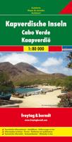
Wegenkaart - landkaart Kaapverdische Eilanden - Cabo Verde | Freytag & Berndt

0
Uitstekende kaart van alle Kaapverdische eilanden met sommigen op een zodanige schaal dat er ook mee gewandeld kan worden. Cape Verde Islands on a large double-sided map from Freytag & Berndt, with the larger islands shown both individually and in groups with the surrounding islands, all presented at a convenient scales and with tourist informatio...

Verkopers met dit product

Verkoper
Bezorging
Prijs
DeZwerver.nl logo
DeZwerver.nl
2,95
14,95

Anderen bekeken ook

Reisgids Cabo Verde Kapverdische Inseln - Kaapverdische Eilanden | Reise Know-How Verlag
Uitstekende - meest uitgebreide - reisgids van de Kaapverdische Eilanden. Hoge kwaliteit, veel kaartjes en praktische informatie. Duits, 612 (!) bladzijden. Cabo Verde ist nicht nur reich an faszinierenden Landschaften, Bergen und Schluchten, Wüsten und grünen Tälern, weiten Stränden und kleinen Buchten, sondern besitzt auch einen großen kulturellen Reichtum. Ein Reichtum, der aus den Begegnungen rund um den Atlantischen Ozean entstanden ist und eine neue kreolische Kultur hervorgebracht hat: so stark wie das Meer und so vielfältig wie die Landschaften. Jede der kapverdischen Inseln für sich ist ein authentisches und unverwechselbares Reiseziel.   Das steckt in unserem Reiseführer Cabo Verde / Kapverdische Inseln:   - Übersichtsseiten mit Beschreibungen aller Inseln: Sal: Sonne, Sand und Salz, Boa Vista: Sahara im Atlantik, Maio: Einsamkeit und viel Ruhe, Santiago: Hauptinsel des Archipels, Fogo: die Vulkaninsel, Brava: die kleineste Insel, São Vicente: Insel der Kontraste, Santo…
28,95
Reisgids Pocket Cabo Verde | Lonely Planet
Lonely Planet's Pocket Cabo Verde is your guide to the city's best experiences and local life - neighbourhood by neighbourhood. Explore the spectacular island of Santo Antão, climb Pico do Fogo or lay on a beach on Boa Vista; all with your trusted travel companion. Uncover the best of Cabo Verde and make the most of your trip! Inside Lonely Planet's Pocket Cabo Verde: Full-colour maps and travel photography throughout Highlights and itineraries help you tailor a trip to your personal needs and interests Insider tips to save time and money and get around like a local, avoiding crowds and trouble spots Essential info at your fingertips - hours of operation, phone numbers, websites, transit tips, prices Honest reviews for all budgets - eating, sightseeing, going out, shopping, hidden gems that most guidebooks miss User-friendly layout with helpful icons, and organised by neighbourhood to help you pick the best spots to spend your time Covers Santo Antão, São Vicente, Santa Luzia, São Nic…
14,95
Wandelkaart - Wegenkaart - landkaart Liparische eilanden | Freytag & Berndt
Gedetailleerde wegenkaart en wandelkaart (géén wandelroutes ingetekend!) met uitgebreide legenda en plaatsnamenregister. Meer wegenkaart dan wandelkaart. Aeolian (Lipari) Islands at 1:20,000 from Freytag & Berndt on a double-sided map which presents on the reverse coverage of Italy south of Rome at 1:600,000 and shows ferry access to the islands from the mainland or Sicily.   On one side the islands are shown in a series of panels, with the three largest: Salina, Lipari and Vulcano together, and Alicudi, Filicudi, Panarea and Basiluzzo plus Stromboli as separate insets. Topography is shown by contours at 50m intervals enhanced by relief shading, with names of peaks, valleys, etc. All place names are in large, easy to read print.   Road network includes country tracks and a selection of hiking paths. Various places of interest and facilities are highlighted, including beaches, marinas, campsites, etc. Each individual inset has latitude and longitude lines at intervals of 1’.   Ferry po…
14,95
Reisgids Cape Verde Islands - Kaapverdische Eilanden | Bradt Travel Guides
Als er geen Lonely Planet is, is dit het alternatief ... En vaak nog beter ook. De beste gids over de Kaapverdische eilanden met alle mogelijke informatie, zowel praktisch (eten, slapen, reizen) als achtergronden over cultuur, landschap en bevolking. The new, thoroughly updated eighth edition of Bradt’s Cape Verde (Cabo Verde) remains the most detailed and extensive English-language guidebook available to this alluring Atlantic archipelago, described by some as ‘Africa light’. Stable and peaceful, quietly isolated by its mid-Atlantic location, malaria-free, and with year-round sun, Cabo Verde’s appeal to independent travellers is a natural one – with its unique island geography making it somewhat of an adventure to navigate beyond the more conventional single-island visit of the increasing numbers of package tourists.   The archipelago is diverse, particularly in terms of its tourist infrastructure. Sal and Boavista, the oldest of these volcanic islands, boast white-sand beaches that …
27,95
Reisgids Reise-Taschenbuch Kapverdische Inseln | Cabo Verde | Dumont
Fraai ogende gids, handzaam formaat en toch uitgebreid over de Kaapverdische Eilanden. Deze serie reisgidsen zijn algemene reisgidsen en bevatten een brede selectie aan bezienswaardigheden, excursies, achtergronden, praktische tips en een uitneembare kaart. Über das Buch Reif für die Insel? Aber für welche? Jede der Kapverden-Inseln ist ein eigener Kosmos in der Einsamkeit des Atlantiks. Überall gibt es Orte mit marode-kolonialem Charme, aus der Zeit gefallene Dörfer, bunte Märkte und herzliche Einheimische, die nicht nur bei ihrer Ouril-Passion zu Meistern der Muße werden. Jede Insel versprüht ein ganz eigenes Ambiente, das die Autoren Susanne Lipps und Oliver Breda auf zahlreichen Touren und Lieblingsorten einfangen. Mal sattgrün, mal karg und fast immer steil ragt das Wanderparadies Santo Antão empor, wo ein Original zur Vesper bittet und eine Wanderführerin die Schönheit der Landschaft besingt. Höchsten Genuss verspricht auch das gebirgige São Nicolau, wo der archipelweit größte…
21,95
Wegenkaart - landkaart Azoren - Azores | Freytag & Berndt
Uitstekende wegenkaart van de Azoren. Met index, toeristische informatie, Autoveerboten en jachthavens. Elk eiland op een aparte inzet. Gedetailleerde landkaart, ook te gebruiken als wandelkaart of fietskaart van de Azoren (Acores, Portugal) schaal 1:50.000 met uitgebreide legenda en plaatsnamenregister. This large double-sided road map of the Azores, at 1:50,000 from Freytag & Berndt, shows the islands both individually and as a group and comes with an attached index and concise leisure guide booklet.    This map shows main and minor roads, motorways and toll roads, sections under construction or closed to traffic. Conveniently highlighted are scenic routes, gradients on steep roads, driving distances in kilometres, petrol and service stations etc. Railway lines are marked and international and local airports are indicated as well as ferry connections to the other islands.    Relief shading, spot heights and colouring and/or graphics provide a good presentation of the islands topogra…
14,95
Wegenkaart - landkaart Dalmatische Kust | Freytag & Berndt
Uitstekende tweezijdige wegenkaart van een  groot deel van de Dalmatische kust van Kroatie. Zeer gedetailleerde kaart met topografische details, maar ook campings. Ideaal om deze eilanden per boot of auto / fiets te ontdekken. Alle bezienswaardigheden staan zeer goed aangegeven. Met register en enkele stadsplattegronden. Dalmatian Coast "Top 10 Tips" Map at 1:150,000 from Freytag & Berndt with a booklet containing an index, brief descriptions of region’s 10 most popular destinations, plus street plans of Dubrovnik’s Old Town and central Pula, Rijeka, Split, Sibenik and Zadar.   The map is double-sided and presents the region in three sections, as indicated on our area coverage image (NB. Istrian Peninsula is included). Topography is shown by relief shading with spot heights, with plenty of names of mountain and hill chains, etc. National parks and other protected areas are clearly marked.    Road network includes small local roads and selected cart tracks, and indicates motorway servi…
14,95
Reisgids Cape Verde - Kaapverdische Eilanden | Marco Polo
Handige en overzichtelijke, kleine reisgids voor een eerste kennismaking met de vakantiebestemming. Globale uitklapkaart achterin, makkelijk binnenzakformaat. Let Marco Polo Cape Verde guide you around this beautiful country. Explore Cape Verde with this handy, pocket-sized, authoritative guide, packed with Insider Tips. Discover boutique hotels, authentic restaurants, the islands' trendiest places, and get tips on shopping and what to do on a limited budget. There are plenty of ideas for travel with kids, and a summary of all the festivals and events that take place. Cape Verde is all about colour: the turquoise ocean, lush tropical valleys, beaches of black and white sand, the bright yellow of the bananas, the orange-coloured papayas, green heads of cabbage and red peppers. Colourful fishing boats lie on the white sandy beaches, the deep blue ocean glitters as far as the eye can see, a gentle breeze cools off the scorching sun. Let Marco Polo Cape Verde guide show you all this wond…
13,95
Wegenkaart - landkaart Madagascar - Madagaskar | Freytag & Berndt
Uitstekende, dubbelzijdige kaart van Madagascar. Met index, Nationale parken en afstanden in kilometers. Met Mauritius en Réunion er ook nog op. Explore Madagascar with this Freytag & Berndt double-sided road map. The best way to plan your trip, prepare your itinerary, and to travel independently in this country. As with all Freytag & Berndt maps the cartography is clear and detailed with the topography shown by relief shading with plenty of spot heights.   The map also includes an inset showing the Comoros Islands and Mayotte at the same scale as the main map.   Tourist information and places of interest are clearly marked by a range of icons, including:    railways, local airports and ferry routes campsites beaches diving and windsurfing sites UNESCO sites spas, wells and caves   Distances between points are shown as well as indications of steep gradients, all distances are in kilometres. The legend is in several languages inlcuding English.    
14,95
Wegenkaart - landkaart Trinidad & Tobago | Freytag & Berndt
Goede gedetailleerde wegenkaart van Trinidad & Tobago. Met natuurparken, Bezienswaardigheden. De afstand worden aangegeven in kilometers. Very clear map of the two islands with road information and place names easy to read. The map has the same geographic content as that published by Rough Guides, but with different colouring and the presentation of the topography - here with vivid relief shading rather than with contours and altitude tinting, and without the bathymetric tinting over the surrounding sea. Altitudes for a few peaks are marked, and swamps and reefs are also shown.   The clear road detail includes minor roads and tracks, with intermediate driving distances marked on main routes and selected petrol stations. Internal administrative boundaries and names are clearly marked, and reserves and protected areas are shown. Symbols show airports, harbours and many other tourism features and landmarks e.g. golf courses, zoos, botanical gardens, waterfalls, beaches and watersport sit…
14,95

Klanten-reviews van Wegenkaart - landkaart Kaapverdische Eilanden - Cabo Verde | Freytag & Berndt

Er zijn nog geen beoordelingen voor dit productBen jij de eerste die een review plaatst?

Meer over Wegenkaart - landkaart Kaapverdische Eilanden - Cabo Verde | Freytag & Berndt

Productomschrijving

Uitstekende kaart van alle Kaapverdische eilanden met sommigen op een zodanige schaal dat er ook mee gewandeld kan worden.

Cape Verde Islands on a large double-sided map from Freytag & Berndt, with the larger islands shown both individually and in groups with the surrounding islands, all presented at a convenient scales and with tourist information.

Relief shading and spot heights indicate the topography, with roads clearly marked and icons highlighting main ports, ferries, archaeological sights and other places of interest. A general map of the whole Cape Verde archipelago shows frequency of ferry connections between various islands. Latitude and longitude lines are shown on all island maps. Multilingual map legend includes English.

Larger islands at 1:80,000
Fogo; Santiago; Santo Antão; Sao Nicolau; São Vicente; Brava (at 1;30,000).

Maps of groups at 1:150,000:
Boavista and Sal; Santo Antão, Sao Vicente, Santa Luzia, Ilheu Braco, Ilheu Razo, and São Nicolau; Santiago and Maio; Fogo and Brava.


Productinformatie

    Verken gerelateerde categorieën

    Webshop.nl maakt gebruik van cookies. Ga je verder op onze website, ga dan akkoord met het plaatsen van cookies en de verwerking van deze data door ons en vermelde partners.