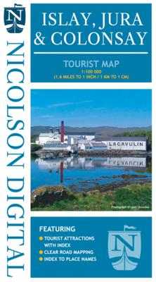
Wegenkaart - landkaart Islay, Jura & Colonsay Tourist Map | Nicolson

0
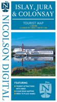
Nicolson Digital Tourist Maps are ideal for planning your visit to some of the most beautiful areas of Scotland.  Tourist attractions and places are clearly marked. Topography is shown through layer tints with major peaks highlighted.  Detailed street maps included for main towns within the area shown.  A must for every visitor!Featuring:Except...

Verkopers met dit product

Verkoper
Bezorging
Prijs
DeZwerver.nl logo
DeZwerver.nl
2,95
12,95

Anderen bekeken ook

Wegenkaart - landkaart Orkney Pocket Tourist Map | Nicolson
This Nicolson Digital Pocket Tourist Map is the latest addition to our range & ideal for your visit to Orkney. Tourist attractions & places are clearly marked. Detailed street maps included for main towns within the area shown.   Topography is shown by layer tints & peak heights. Quality information for a budget-friendly price! Glorious colour photographs & tourist informationIndex to place names & major tourist attractionsIndexed street plans of Kirkwall & StromnessExceptionally clear road mapping
7,95
Wegenkaart - landkaart Scotland Tourist Map | Nicolson
The Nicolson Digital Scotland Tourist Map is a must-have for planning your trip to Scotland. Clearly shows main tourist attractions, places, national & fore st parks, the increasingly popular long distance driving routes and locations for wild swimming, kayaking & paddleboarding. National cycle routes and long distance footpaths are also included.    Featuring: Clear road mapping with mileagesIndex to place names and main tourist attractionsLong distance driving routes footpaths & national cycle routesNational & forest parksLocations for wild swimming, kayaking & paddleboarding  
9,95
Wegenkaart - landkaart North Coast Journey | Nicolson
Nicolson Digital Tourist Maps are ideal for planning your visit on a circular tour round the Northern Scotland tourist route. A great map to use along with Bridget Benson’s North Coast Journey.   Our sectional map showing the popular tourist route round the North of Scotland.   Starting at Inverness, heading west through Applecross then North to Gairloch, Ullapool to Lochinver then on to Durness. Along the Northern Coastline to John O'Groats and back down the east coast to finish in Inverness   Back of the map has the index to places & attractions for each section   Featuring: Exceptionally clear road mapping Popular tourist and historical sites Alternative routes for large vehicles Electric Vehicle Charging points & Petrol Stations 1/150000 Tourist Mapping   Card cover   Cover size approx 135 mm wide x 240mm tall   Sheet size (unfolded) 1000 mm wide x 690mm tall    
12,95
Wandelgids Islay, Jura and Colonsay | Pocket Mountains
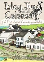
Handige compacte wandelgids met 40 dagwandelingen. Deze gids bevat kleine kaartjes en leuke uitgebreide informatie over wat er langs de route te zien is. Goede wandelkaarten zijn echter wel aan te raden voor deze tochten: de Ordnance Survey explorer maps of Landranger maps zijn zeer geschikt. Islay, Jura and Colonsay make up the most southerly Hebridean island group and are famed for their outstanding wildlife, glorious sandy beaches, fascinating historical treasures, rugged hills and dramatic coastlines, and – on Jura, but especially on Islay – legendary distilleries which produce distinctively peaty whisky.   This book aims to help you get the most from your visit to these islands. Most of the 40 walks are a half day or shorter, with many suitable for families, but there are also a few more challenging hillwalks for those who can’t resist the allure of reaching an island summit.
10,95
Wegenkaart - landkaart Visitors map Scotland - Schotland | A-Z Map Company
xplore the whole of Scotland from Dumfries and Galloway in the South to the Orkney Islands in the North. With detailed road mapping and illustrated town plans of major cities, this feature rich, helpful tourist guide is ideal for touring around Scotland. Published at a clear 8.7 miles to 1 inch scale (5.51 cm to 1 km), this handy map is a detailed and informative exploration of what Scotland has to offer.   Highlights include: 8 inset street maps to major cities and popular destinations, including: Edinburgh, Glasgow, Stirling, and Cairngorms National Park, with detailed descriptions and places of interestLocations of visitor centres and tourist information sitesUseful key to map symbols making it a clear and easy readMore than 700 places of interest The perfect map for exploring Scotland whether you are a tourist or a local.
11,50
Wandelgids Islay, Jura & Colonsay | Hallewell Publications
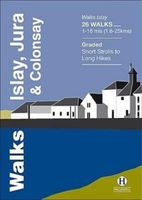
Walks Islay, Jura & Colonsay features walks on the three inner Hebridean islands. Each island has it's own distinct character and the 26 walks featured give a good feel for this. The walks range in length from 1 mile to 16 miles (1.6-25km). Routes include 6 walks on each Colonsay and Jura and 14 on the larger island of Islay. Part of a popular series of A6 pocket walking guides which describe routes which are suitable for walkers of all abilities and to suit all tastes. Route descriptions are accompanied by 2-colour sketch maps. The guides are illustrated with line illustrations, and will provide walkers with a good introduction to what each area covered has to offer.  
5,95
Wegenkaart - landkaart Visitors map Devon | A-Z Map Company
Explore the whole county of Devon extending from Taunton to Plymouth. With detailed road mapping and illustrated town plans of major cities, this feature-rich, helpful tourist guide is ideal for visitors to Devon. Published at a clear 3.33 miles to 1 inch scale (2.11 cm to 1 km), this handy map is a detailed and informative exploration of all Devon has to offer.   Highlights include:* 8 inset street maps to major cities and popular destinations, including: Exeter, Paignton, Dartmouth and Torquay, with detailed descriptions and places of interest* Locations of visitor centres and tourist information sites* Useful key to map symbols making it a clear and easy read The perfect map for exploring Devon whether you are a tourist or a local.  
11,50
Wegenkaart - landkaart Visitors map Yorkshire | A-Z Map Company
Explore the whole region of Yorkshire extending from Sheffield to Darlington. With detailed road mapping and illustrated town plans of major cities, this feature rich, helpful tourist guide is ideal for touring around Yorkshire. Published at a clear 3 miles to 1 inch scale (1.9 cm to 1 km), this handy map is a detailed and informative exploration of what Yorkshire has to offer.   Highlights include: 4 inset street maps to major cities and popular destinations, including: Bradford, Middlesborough and York, with detailed descriptions and places of interestLocations of visitor centres and tourist information sitesUseful key to map symbols making it a clear and easy read The perfect map for exploring Yorkshire whether you are a tourist or a local.
11,50
Nieuw
Wegenkaart - landkaart South Africa: Swartberg & Klein-Karoo | Slingsby Maps
All roads from National Highways to minor gravel roads are shown; the many classifications that indi- cate the quality of each road help you plan your route No less than 28 mountain passes are shown — all are public roads! Distances are clearly shown; comprehensive 4 x 4 information GPS coordinates in DD MM SS format are provided for every road-junction All tourism facilities and accommodation establishments are shown in the out-of-town areas; there are insets of the major towns The map links to our maps of the Baviaanskloof, the Garden Route, Overberg and the Tankwa-Karoo Additional info:   Swartberg and Klein-Karoo region on a contoured and GPS compatible, double-sided, waterproof and   tear-resistant map at 1:160,000 from Slingsby Maps, with excellent topographic detail and plenty of tourist information, including street plans of ten main towns.   The map provides a very detailed picture of this mountainous terrain, with altitude colouring, shading, con- tours at 20m intervals and …
29,95
Nieuw
Wandelgids Walking on Jura, Islay and Colonsay | Cicerone
Uitstekende wandelgids van deze weldadige eilanden. goed beschreven met veel praktische informatie om de route te kunnen lopen, inclusief redelijke kaarten. This guidebook presents a selection of 23 walking routes on the wild and beautiful southern islands of Scotland's Inner Hebrides, with nine walks on Jura, one on neighbouring Scarba, seven on Islay and five on Colonsay, plus a spectacular 5-day trek along Jura's dramatic west coast. The wildest of the southern Hebrides, the walking on Jura is frequently rugged, with many routes crossing remote and often pathless terrain that calls for fitness, self-reliance and navigational competence. The routes on the other islands are somewhat easier, but should still not be underestimated.   In addition to clear route description illustrated with 1:50,000 OS mapping, the guide offers practical advice on the various options for getting to the islands, accommodation and amenities. There are suggestions for linking walks and notes on the islands'…
20,95

Klanten-reviews van Wegenkaart - landkaart Islay, Jura & Colonsay Tourist Map | Nicolson

Er zijn nog geen beoordelingen voor dit productBen jij de eerste die een review plaatst?

Meer over Wegenkaart - landkaart Islay, Jura & Colonsay Tourist Map | Nicolson

Productomschrijving

Nicolson Digital Tourist Maps are ideal for planning your visit to some of the most beautiful areas of Scotland.  Tourist attractions and places are clearly marked. Topography is shown through layer tints with major peaks highlighted.  Detailed street maps included for main towns within the area shown.  A must for every visitor!Featuring:Exceptionally clear road mappingIndex to place names & major tourist attractionsIndexed street plans of Lerwick & ScallowayLayer tints and peak heights. The ideal map for any tourist visiting Islay & Jura

Productinformatie

    Verken gerelateerde categorieën

    Webshop.nl maakt gebruik van cookies. Ga je verder op onze website, ga dan akkoord met het plaatsen van cookies en de verwerking van deze data door ons en vermelde partners.