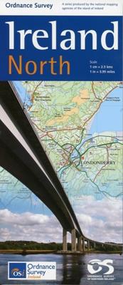
Wegenkaart - landkaart Ireland North ( Ierland ) | Ordnance Survey Ireland

0
Hele duidelijke kaarten van een groot gebied: Ierland is in vieren gedeeld. Met alle noodzakelijke informatie, bijna topografisch van aard. Campings en bezienswaardigheden zijn er o.a. op terug te vinden! Veel wegen staan ingetekend, spoorlijnen, vliegvelden maar ook nationale parken zijn er goed op ingetekend. Whether you are on a motoring tour o...

Verkopers met dit product

Verkoper
Bezorging
Prijs
DeZwerver.nl logo
DeZwerver.nl
2,95
19,50

Anderen bekeken ook

Wegenkaart - landkaart Ireland West ( Ierland ) | Ordnance Survey Ireland
Hele duidelijke kaarten van een groot gebied: Ierland is in vieren gedeeld. Met alle noodzakelijke informatie, bijna topografisch van aard. Campings en bezienswaardigheden zijn er o.a. op terug te vinden! Veel wegen staan ingetekend, spoorlijnen, vliegvelden maar ook nationale parken zijn er goed op ingetekend.   Whether you are on a motoring tour or exploring cross-country, these maps show you how to get there. They contain a clear presentation of the road network. Tourist features such as tourist offices, official caravan parks and picnic areas are also shown. These are clearly marked and easy to follow. Planning your itinerary is therefore made as simple as possible.
19,50
Wegenkaart - landkaart Ireland South ( Ierland ) | Ordnance Survey Ireland
Hele duidelijke kaarten van een groot gebied: Ierland is in vieren gedeeld. Met alle noodzakelijke informatie, bijna topografisch van aard. Campings en bezienswaardigheden zijn er o.a. op terug te vinden! Veel wegen staan ingetekend, spoorlijnen, vliegvelden maar ook nationale parken zijn er goed op ingetekend.   Whether you are on a motoring tour or exploring cross-country, these maps show you how to get there. They contain a clear presentation of the road network. Tourist features such as tourist offices, official caravan parks and picnic areas are also shown. These are clearly marked and easy to follow. Planning your itinerary is therefore made as simple as possible.
19,50
Wegenkaart - landkaart Ireland East ( Ierland ) | Ordnance Survey Ireland
Hele duidelijke kaarten van een groot gebied: Ierland is in vieren gedeeld. Met alle noodzakelijke informatie, bijna topografisch van aard. Campings en bezienswaardigheden zijn er o.a. op terug te vinden! Veel wegen staan ingetekend, spoorlijnen, vliegvelden maar ook nationale parken zijn er goed op ingetekend.   Whether you are on a motoring tour or exploring cross-country, these maps show you how to get there. They contain a clear presentation of the road network. Tourist features such as tourist offices, official caravan parks and picnic areas are also shown. These are clearly marked and easy to follow. Planning your itinerary is therefore made as simple as possible.
19,50
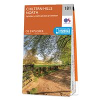
Wandelkaart - Topografische kaart 181 OS Explorer Map Chiltern Hills North | Ordnance Survey
The essential map for outdoor activities in Chiltern Hills North. The OS Explorer Map is the Ordnance Survey's most detailed folding map and is recommended for anyone enjoying outdoor activities including walking, horse riding and off-road cycling. This map now comes with a digital version which you can download to your smartphone or tablet.Providing complete GB coverage, the OS Explorer map series details information essential in the great outdoors, including youth hostels, pubs and visitor information. Rights of way, fences, permissive paths and bridleways are clearly shown, ensuring you have the best information to get the most out of your time in the countryside. FeaturesIcknield Way RidgewayNorth Buckinghamshire Way Icknield Way PathSwan's Way Two Ridges Link Aylesbury RingSouth Bucks Way Chess Valley Walk Chiltern Link Thame Valley WalkGrand Union Canal Walk Midshires Way Bledlow Circular Ride Hertfordshire Way Chiltern WayRidgeway (National Trail) Bedfordshire Buckinghamshire H…
19,50
Wandelkaart - Topografische kaart 160 OS Explorer Map | Active Windsor / Weybridge / Bracknell | Ordnance Survey
Follow the Thames Path through Windsor, home to the world’s largest and oldest inhabited castle, to Egham, Staines and Weybridge with its motoring and aviation museums. Walk in the footsteps of King John as you take the Three Castles Path from Windsor Castle southwest past Bracknell and Wokingham.     Enjoy a royal encounter at Windsor Castle, home to British kings and queens for over 1,000 years and Her Majesty the Queen’s favourite residence  Discover the pretty villages of Chertsey and Chobham, Ascot Racecourse and the London Bus Museum in Weybridge  Walk, ramble or cycle along the Thames Path and recreational paths including the Blackwater Valley Path, Colne Valley Way and Three Castles Path Met zijn 4cm voor 1 km (2 ½ cm voor 1 mijl) schaal, is de OS Explorer kaartenserie de ideale en meest gedetailleerde kaartenreeks voor mensen die graag outdoor-activiteiten zoals fietsen, wandelen, paardrijden, klimmen en watersporten.   Deze kaart is nog gedetailleerder dan de 'gewone' Landra…
25,95
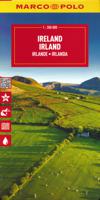
Wegenkaart - landkaart Ierland - Ireland | Marco Polo
Duidelijke wegenkaart van Marco Polo: alle wegen, zowel de verharde als belangrijke onverharde wegen zijn weergegeven.  Mooie toeristisch interessante wegen die de moeite waard zijn, zijn groen gearceerd. Veel toeristische informatie is toegevoegd zoals de nationale parken, campings, kastelen en vliegvelden. Afstanden tussen belangrijke steden en benzinestations staan ook op de kaart.  Discover picturesque towns and dramatic coastlines with this highly durable, detailed touring map of Ireland. It folds away easily and is always on standby to help when you're stuck.   Perfect touring map - the scale is 1 : 350 000 ideal to help you tour the country by car or campervan Easy to use - the superbly clear mapping in strong colours and easy to read text will help you navigate the country like a local Durable, tear-resistant map - designed to withstand the rigors of the road, the map is printed on tear-resistant, water repellent and writeable paper Highlights included - major sights and key p…
14,95
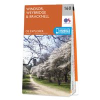
Wandelkaart - Topografische kaart 160 OS Explorer Map Windsor, Weybridge, Bracknell | Thames Path | Ordnance Survey
Follow the Thames Path through Windsor, home to the world’s largest and oldest inhabited castle, to Egham, Staines and Weybridge with its motoring and aviation museums. Walk in the footsteps of King John as you take the Three Castles Path from Windsor Castle southwest past Bracknell and Wokingham.     Enjoy a royal encounter at Windsor Castle, home to British kings and queens for over 1,000 years and Her Majesty the Queen’s favourite residence  Discover the pretty villages of Chertsey and Chobham, Ascot Racecourse and the London Bus Museum in Weybridge  Walk, ramble or cycle along the Thames Path and recreational paths including the Blackwater Valley Path, Colne Valley Way and Three Castles Path Met zijn 4cm voor 1 km (2 ½ cm voor 1 mijl) schaal, is de OS Explorer kaartenserie de ideale en meest gedetailleerde kaartenreeks voor mensen die graag outdoor-activiteiten zoals fietsen, wandelen, paardrijden, klimmen en watersporten. Deze kaart is nog gedetailleerder dan de 'gewone' Landr…
19,50
Wandelkaart - Topografische kaart 179 OS Explorer Map Gloucester, Cheltenham, Stroud | Ordnance Survey
The essential map for outdoor activities in Gloucester, Cheltenham and Stroud. The OS Explorer Map is the Ordnance Survey's most detailed folding map and is recommended for anyone enjoying outdoor activities including walking, horse riding and off-road cycling. This map now comes with a digital version which you can download to your smartphone or tablet.Providing complete GB coverage, the OS Explorer map series details information essential in the great outdoors, including youth hostels, pubs and visitor information. Rights of way, fences, permissive paths and bridleways are clearly shown, ensuring you have the best information to get the most out of your time in the countryside. FeaturesCotswold Way Severn Way Gloucestershire Way Macmillan Way Wysis WayCotswold Way (National Trail) GloucesterCheltenhamGloucester Stroud1:25 000 scale (4 cm to 1 km - 2.5 inches to 1 mile) Met zijn 4cm voor 1 km (2 ½ cm voor 1 mijl) schaal, is de OS Explorer kaartenserie de ideale en meest gedetailleerd…
19,50
Wandelkaart - Topografische kaart 353 OS Explorer Map Islay North | Ordnance Survey
Met zijn 4cm voor 1 km (2 ½ cm voor 1 mijl) schaal, is de OS Explorer kaartenserie de ideale en meest gedetailleerde kaartenreeks voor mensen die graag outdoor-activiteiten zoals fietsen, wandelen, paardrijden, klimmen en watersporten. Deze kaart is nog gedetailleerder dan de 'gewone' Landranger maps. Voor- en achterzijde bedrukt! Zeker op de moors en andere natuurgebieden van onschatbare waarden met echt alle aspecten van het landschap op de kaart ingetekend. Zeer goede detailkaart met topografische ondergrond. Hierop zijn toeristische symbolen van bezienswaardigheden ingetekend, daarnaast staan bijvoorbeeld campings en jeugdherbergen vermeld en - voor wandelaars het belangrijkst - alle right of way paden en Lange afstands Wandelpaden zijn er op te vinden. De ideale kaart voor het wandelen in Engeland, Wales of Schotland.   These highly detailed maps show all the administrative boundaries, settlements as small as isolated farms, the road network down to unfenced roads and country tra…
19,50
Wandelkaart - Topografische kaart 357 OS Explorer Map Kintyre North | Ordnance Survey
Met zijn 4cm voor 1 km (2 ½ cm voor 1 mijl) schaal, is de OS Explorer kaartenserie de ideale en meest gedetailleerde kaartenreeks voor mensen die graag outdoor-activiteiten zoals fietsen, wandelen, paardrijden, klimmen en watersporten. Deze kaart is nog gedetailleerder dan de 'gewone' Landranger maps. Voor- en achterzijde bedrukt! Zeker op de moors en andere natuurgebieden van onschatbare waarden met echt alle aspecten van het landschap op de kaart ingetekend. Zeer goede detailkaart met topografische ondergrond. Hierop zijn toeristische symbolen van bezienswaardigheden ingetekend, daarnaast staan bijvoorbeeld campings en jeugdherbergen vermeld en - voor wandelaars het belangrijkst - alle right of way paden en Lange afstands Wandelpaden zijn er op te vinden. De ideale kaart voor het wandelen in Engeland, Wales of Schotland.   These highly detailed maps show all the administrative boundaries, settlements as small as isolated farms, the road network down to unfenced roads and country tra…
19,50

Klanten-reviews van Wegenkaart - landkaart Ireland North ( Ierland ) | Ordnance Survey Ireland

Er zijn nog geen beoordelingen voor dit productBen jij de eerste die een review plaatst?

Meer over Wegenkaart - landkaart Ireland North ( Ierland ) | Ordnance Survey Ireland

Productomschrijving

Hele duidelijke kaarten van een groot gebied: Ierland is in vieren gedeeld. Met alle noodzakelijke informatie, bijna topografisch van aard. Campings en bezienswaardigheden zijn er o.a. op terug te vinden! Veel wegen staan ingetekend, spoorlijnen, vliegvelden maar ook nationale parken zijn er goed op ingetekend.

Whether you are on a motoring tour or exploring cross-country, these maps show you how to get there. They contain a clear presentation of the road network. Tourist features such as tourist offices, official caravan parks and picnic areas are also shown. These are clearly marked and easy to follow. Planning your itinerary is therefore made as simple as possible.

Verken gerelateerde categorieën

Webshop.nl maakt gebruik van cookies. Ga je verder op onze website, ga dan akkoord met het plaatsen van cookies en de verwerking van deze data door ons en vermelde partners.