Wegenkaart - landkaart Ireland - Ierland | AA Publishing

0
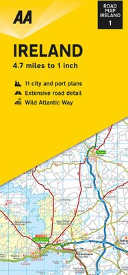
Folded, double-sided sheet map shows the detailed road network with toll motorways and dual carriageways identified. Includes motorway service areas, AA-inspected campsites, viewpoints and picnic sites. Gaeltacht regions are highlighted with place names in English and Irish. Includes 6 city plans of Dublin, Belfast, Cork, Derry Londonderry, Sligo ...

Verkopers met dit product

Verkoper
Bezorging
Prijs
DeZwerver.nl logo
DeZwerver.nl
niet bekend
8,95

Anderen bekeken ook

Wegenatlas Road Atlas Ireland - Ierland | AA Publishing
Handige wegenatlas van Ierland en Noord-Ierland, schaal 1:200.000. Met 10 stadsplattegronden: Belfast, Cork, Londonderry, Dublin, Galway, Killarney, Kilkenny, Limerick, Sligo and Waterford. Created from brand new mapping data, this atlas includes AA inspected camping sites and AA listed golf courses, picnic sites, port plans and ferry routes. Plus, motorway strip maps detailing all of Ireland's motorway junctions. Toll motorways are clearly highlighted.There are 10 detailed city and town plans with street indexes: Belfast, Cork, Londonderry, Dublin, Galway, Killarney, Kilkenny, Limerick, Sligo and Waterford and an easy-to-read place name index, with top tourist sites highlighted.New district maps of Dublin and Belfast show the surrounding area in more detail.
11,95
Wegenkaart - landkaart 6 Road Map Britain Wales | AA Publishing
Goede dubbelzijdige wegenkaart met plaatsnamenindex van Wales Britain’s clearest mapping from the experts at the AA, in a handy foldable map. Fully updated, this map of Wales combines clear design and an easy-to-read scale with more road detail to ensure that you never lose your way. This map of Wales includes information on toll points, service areas, road numbers, motorways, dual carriageways and wide and narrow local roads. National Parks, and places of interest are also highlighted. Caravan and camping sites pinpointed on the mapping. City and town plans Easy-to-read place index name. Part of a range of 9 regional sheet maps plus 1 map covering the whole of Britain. Map Series - 1 West Country & Wales. 2 Central Southern England. 3 South East England. 4 East Anglia. 5 Midlands & Central England. 6 Wales. 7 Northern England. 8 North England & Scottish Borders. 9 Scotland. 10 Britain.  
10,95
Wegenkaart - landkaart 4 Road Map Britain East Anglia | AA Publishing
Goede dubbelzijdige wegenkaart met  plaatsnamenindex van East Anglia. Grof geschetst is het een rechthoek tussen Lincoln, Norwich, Ipswich en Luton Britain’s clearest mapping from the experts at the AA, in a handy foldable map. Fully updated, this map of East Anglia combines clear design and an easy-to-read scale with more road detail to ensure that you never lose your way. The map includes information on toll points, service areas, road numbers, motorways, dual carriageways and wide and narrow local roads. National Parks, and places of interest are also highlighted. Caravan and camping sites pinpointed on the mapping. City and town plans Easy-to-read place index name. Part of a range of 9 regional sheet maps plus 1 map covering the whole of Britain. Map Series - 1 West Country & Wales. 2 Central Southern England. 3 South East England. 4 East Anglia. 5 Midlands & Central England. 6 Wales. 7 Northern England. 8 North England & Scottish Borders. 9 Scotland. 10 Britain.  
10,95
Wegenkaart - landkaart 9 Road Map Britain Scotland - Schotland | AA Publishing
Goede dubbelzijdige wegenkaart van Schotland met plaatsnamen index. Britain’s clearest mapping from the experts at the AA, in a handy foldable map. Fully updated, this map of Scotland combines clear design and an easy-to-read scale with more road detail to ensure that you never lose your way. The map includes information on toll points, service areas, road numbers, motorways, dual carriageways and wide and narrow local roads. National Parks, and places of interest are also highlighted. Caravan and camping sites pinpointed on the mapping. City and town plans Easy-to-read place index name. Part of a range of 9 regional sheet maps plus 1 map covering the whole of Britain. Map Series - 1 West Country & Wales. 2 Central Southern England. 3 South East England. 4 East Anglia. 5 Midlands & Central England. 6 Wales. 7 Northern England. 8 North England & Scottish Borders. 9 Scotland. 10 Britain.  
10,95
Wegenkaart - landkaart 7 Road Map Britain Northern England | AA Publishing
Goede dubbelzijdige wegenkaart met plaatsnamenindex van noord Engeland. Grof geschetst is het een rechthoek tussen Penrith, Hartlepool, Lincoln en Chester. Britain’s clearest mapping from the experts at the AA, in a handy foldable map. Fully updated, this map of Northern England combines clear design and an easy-to-read scale with more road detail to ensure that you never lose your way. The map includes information on toll points, service areas, road numbers, motorways, dual carriageways and wide and narrow local roads. National Parks, and places of interest are also highlighted. Caravan and camping sites pinpointed on the mapping. City and town plans Easy-to-read place index name. Part of a range of 9 regional sheet maps plus 1 map covering the whole of Britain. Map Series - 1 West Country & Wales. 2 Central Southern England. 3 South East England. 4 East Anglia. 5 Midlands & Central England. 6 Wales. 7 Northern England. 8 North England & Scottish Borders. 9 Scotland. 10 Britain.  
10,95
Wegenkaart - landkaart 10 Road Map Britain Britain - Groot Brittannië | AA Publishing
Goede dubbelzijdige overzichtskaart met plaatsnamenregister  van heel Engeland met Schotland erbij. Britain’s clearest mapping from the experts at the AA, in a handy foldable map. Fully updated, this map of Britain combines clear design and an easy-to-read scale with more road detail to ensure that you never lose your way. The map includes information on toll points, service areas, road numbers, motorways, dual carriageways and wide and narrow local roads. National Parks, and places of interest are also highlighted. Caravan and camping sites pinpointed on the mapping. City and town plans Easy-to-read place index name. Part of a range of 9 regional sheet maps plus 1 map covering the whole of Britain. Map Series - 1 West Country & Wales. 2 Central Southern England. 3 South East England. 4 East Anglia. 5 Midlands & Central England. 6 Wales. 7 Northern England. 8 North England & Scottish Borders. 9 Scotland. 10 Britain.    
10,95
Wegenkaart - landkaart 3 Road Map Britain South East England | AA Publishing
Goede wegenkaart van zuid oost Engeland. Grof geschetst is het een rechthoek tussen Ipswich, Dover, Southampton en Oxford. Britain’s clearest mapping from the experts at the AA, in a handy foldable map. Fully updated, this map of South East England combines clear design and an easy-to-read scale with more road detail to ensure that you never lose your way. The map includes information on toll points, service areas, road numbers, motorways, dual carriageways and wide and narrow local roads. National Parks, and places of interest are also highlighted. Caravan and camping sites pinpointed on the mapping. City and town plans Easy-to-read place index name. Part of a range of 9 regional sheet maps plus 1 map covering the whole of Britain. Map Series - 1 West Country & Wales. 2 Central Southern England. 3 South East England. 4 East Anglia. 5 Midlands & Central England. 6 Wales. 7 Northern England. 8 North England & Scottish Borders. 9 Scotland. 10 Britain.  
10,95
Wegenkaart - landkaart 5 Road Map Britain Midlands & Central England | AA Publishing
Goede dubbelzijdige wegenkaart van midden Engeland. Grof geschetst is het een rechthoek tussen Shrewsbury, Lincoln, Cambridge en Glouchester Britain’s clearest mapping from the experts at the AA, in a handy foldable map. Fully updated, this map of the Midlands & Central England combines clear design and an easy-to-read scale with more road detail to ensure that you never lose your way. The map includes information on toll points, service areas, road numbers, motorways, dual carriageways and wide and narrow local roads. National Parks, and places of interest are also highlighted. Caravan and camping sites pinpointed on the mapping. City and town plans Easy-to-read place index name. Part of a range of 9 regional sheet maps plus 1 map covering the whole of Britain. Map Series - 1 West Country & Wales. 2 Central Southern England. 3 South East England. 4 East Anglia. 5 Midlands & Central England. 6 Wales. 7 Northern England. 8 North England & Scottish Borders. 9 Scotland. 10 Britain.  
10,95
Wegenkaart - landkaart 2 Road Map Britain Central Southern England | AA Publishing
Goede dubbelzijdige Wegenkaart met plaatsnamenindex van het centrale deel van het zuiden van Engeland.  Grof geschetst is het een rechthoek tussen Gloucester, Luton, London, Dorcester en Brighton. Britain’s clearest mapping from the experts at the AA, in a handy foldable map. Fully updated, this map of Central Southern England combines clear design and an easy-to-read scale with more road detail to ensure that you never lose your way. The map includes information on toll points, service areas, road numbers, motorways, dual carriageways and wide and narrow local roads. National Parks, and places of interest are also highlighted. Caravan and camping sites pinpointed on the mapping. City and town plans Easy-to-read place index name. Part of a range of 9 regional sheet maps plus 1 map covering the whole of Britain. Map Series - 1 West Country & Wales. 2 Central Southern England. 3 South East England. 4 East Anglia. 5 Midlands & Central England. 6 Wales. 7 Northern England. 8 North England…
10,95
Wegenkaart - landkaart 8 Road Map Britain North of England & Scottish Borders | AA Publishing
Goede dubbelzijdige wegenkaart met plaatsnamenindex van het noorden van Engeland en het zuiden van Schotland. Grof geschetst is het een rechthoek tussen Motherwell, Berwick-upon-Tweed, Middlesbrough en Kendal. Inclusief Isle of Man. Britain’s clearest mapping from the experts at the AA, in a handy foldable map. Fully updated, this map of North England & Scottish Borders combines clear design and an easy-to-read scale with more road detail to ensure that you never lose your way. The map includes information on toll points, service areas, road numbers, motorways, dual carriageways and wide and narrow local roads. National Parks, and places of interest are also highlighted. Caravan and camping sites pinpointed on the mapping. City and town plans Easy-to-read place index name. Part of a range of 9 regional sheet maps plus 1 map covering the whole of Britain. Map Series - 1 West Country & Wales. 2 Central Southern England. 3 South East England. 4 East Anglia. 5 Midlands & Central England. …
10,95

Klanten-reviews van Wegenkaart - landkaart Ireland - Ierland | AA Publishing

Er zijn nog geen beoordelingen voor dit productBen jij de eerste die een review plaatst?

Meer over Wegenkaart - landkaart Ireland - Ierland | AA Publishing

Productomschrijving

Folded, double-sided sheet map shows the detailed road network with toll motorways and dual carriageways identified. Includes motorway service areas, AA-inspected campsites, viewpoints and picnic sites. Gaeltacht regions are highlighted with place names in English and Irish. Includes 6 city plans of Dublin, Belfast, Cork, Derry Londonderry, Sligo and Waterford and 5 port plans. A separate map of Ireland features relief shading with key physical landmarks. City, town and port plans. Distance in miles and kilometers.

Verken gerelateerde categorieën

Webshop.nl maakt gebruik van cookies. Ga je verder op onze website, ga dan akkoord met het plaatsen van cookies en de verwerking van deze data door ons en vermelde partners.