webshop.nl
Categorieën
  Sluiten

Meer Borch

Wegenkaart - landkaart India Zuid | Borch

0
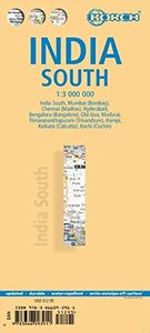
Mooie geplasticieerde kaart van het zuiden van india. Deze kaart biedt een goed overzicht van het land met detailkaarten. Our soft-laminated folded map of India South shows: India South 1:3 000 000, Mumbai 1:30 000, Kolkata 1:30 000, Chennai 1:30 000, Hyderabad 1:30 000, Bengaluru 1:30 000, Old Goa 1:15 000, Madurai 1:30 000, Trivandrum 1:30 000, H...

Webshops met dit product

Webshop
Bezorging
Prijs

Anderen bekeken ook

Wegenkaart - landkaart India Zuid | Borch
Mooie geplasticieerde kaart van het zuiden van india. Deze kaart biedt een goed overzicht van het land met detailkaarten. Our soft-laminated folded map of India South shows: India South 1:3 000 000, Mumbai 1:30 000, Kolkata 1:30 000, Chennai 1:30 000, Hyderabad 1:30 000, Bengaluru 1:30 000, Old Goa 1:15 000, Madurai 1:30 000, Trivandrum 1:30 000, Hampi 1:30 000, Kochi 1:30 000 and India administrative and time zones. Borch maps are easy to fold, durable and water-repellent with a wipeable surface. Borch Maps show hotels, museums, monuments, markets, public transport, top sights and points of interest, useful statistics, conversion charts for temperatures, weights and measurements, climate charts showing temperatures, sunshine hours, precipitation and humidity, overview maps, time zones, and much more...   Southern India, bordered by the Arabian Sea, the Indian Ocean, and the Bay of Bengal, is a culturally diverse region evoking images of colourful, chaotic cities, Ayurveda retreats, dr…
11,50
Wegenkaart - landkaart India Noord | Borch
Mooie geplasticieerde kaart van het noorden van India. Deze kaart biedt een goed overzicht van het land met detailkaarten.   Our soft-laminated folded map of India North shows: India North 1:3 000 000, Delhi 1:30 000, Mumbai 1:30 000, Kolkata 1:30 000, Jaipur 1:30 000, Agra 1:30 000, Varanasi 1:30 000, Amritsar 1:30 000, Jodhpur 1:30 000, Udaipur 1:30 000, Bodhgaya 1:15 000 and India administrative and time zones. Borch maps are easy to fold, durable and water-repellent with a wipeable surface. Borch Maps show hotels, museums, monuments, markets, public transport, top sights and points of interest, useful statistics, conversion charts for temperatures, weights and measurements, climate charts showing temperatures, sunshine hours, precipitation and humidity, overview maps, time zones, and much more...   Northern India is bordered by Pakistan to the west, China, Nepal and Bhutan to the north, and Bangladesh and Myanmar to the east. Hindi and English are the two official languages. After …
11,50
Wegenkaart - landkaart Kreta - Crete | Borch
Mooie geplasticieerde kaart van Kreta. Deze kaart biedt een goed overzicht van dit eiland met detailkaarten.   Our soft-laminated folded map of Crete shows: Crete (West) 1:200 000, Crete (East) 1:200 000, Iraklio 1:7 000, Agios Nikolaos 1:6 000, Chania 1:10 000, Ierapetra 1:10 000, Rethimno 1:9 000, Samaria Gorge 1:90 000, Sitia 1:7 000 and Gavdos 1:200 000. Borch maps are easy to fold, durable and water-repellent with a wipeable surface. Borch Maps show hotels, museums, monuments, markets, top sights and points of interest, useful statistics, conversion charts for temperatures, weights and measurements, climate charts showing temperatures, sunshine hours, precipitation and humidity, overview maps, time zones, and much more...   Crete is more than just another Greek island, it is the fifth largest island in the Mediterranean Sea and the cradle of ancient Mediterranean civilization. By 2000 B.C. the Minoans had set up a base here for their international trade with the East, North Africa…
11,50
Wegenkaart - landkaart Aruba | Borch
Mooie, geplastificeerde kaart van Aruba. Deze kaart biedt een goed overzicht van het land met detailkaarten.   Our soft-laminated folded map of Aruba shows: Aruba 1:50 000, Beaches 1:25 000, Oranjestad 1:10 000, San Nicolas 1:20 000, ABC Islands 1:1 000 000, Lesser Antilles 1:7 000 000, Lesser Antilles time zones. Borch maps are easy to fold, durable and water-repellent with a wipeable surface. Borch Maps show hotels, museums, monuments, markets, public transport, top sights and points of interest, useful statistics, conversion charts for temperatures, weights and measurements, climate charts showing temperatures, sunshine hours, precipitation and sea temperatures, overview maps, time zones, and much more...   Aruba is the westernmost of the "ABC" islands (Aruba, Bonaire, Curaçao) and approximately 30 km off the coast of Venezuela. Sun-aficionados know these islands are home to probably the most beautiful sand beaches of the Caribbean. Wind and water conditions are ideal for the intern…
11,50
Wegenkaart - landkaart Chile - Chili | Borch
Mooie geplasticieerde kaart van Chili. Deze kaart biedt een goed overzicht van het land met detailkaarten. Our soft-laminated folded map of Chile shows: Northern Chile, Central Chile, Southern Chile & Patagonia 1:2 000 000, Torres del Paine National Park 1:240 000, Robinson Crusoe Island 1:200 000, Easter Island (Rapa Nui) 1:160 000, Punta Arenas, Antofagasta, Iquique 1:15 000, Valparaiso 1:10 000, Arica 1:16 000, La Serena 1:13 000, Vina del Mar 1:22 000, Santiago 1:20 000 and Chile administrative & time zones. Borch Maps are easy to fold, durable and water-repellent with a wipeable surface. Borch Maps show hotels, museums, monuments, markets, public transport, top sights and points of interest, useful statistics, conversion charts for temperatures, weights and measurements, climate charts showing temperatures, sunshine hours, precipitation and humidity, overview maps, time zones, and much more...   The Republic of Chile is a long and narrow coastal strip on the western side of the So…
11,50
Wegenkaart - landkaart Ecuador | Borch
Mooie geplasticieerde kaart van Ecuador. Deze kaart biedt een goed overzicht van het land met detailkaarten.   Our soft-laminated folded map of Ecuador shows: Ecuador West 1:1 000 000, Ecuador Est 1:2 000 000, Galapagos Islands1:1 300 000, Gran Quito 1:100 000, Quito 1:20 000, Cuenca 1:17 000, Guayaquil 1:18 000, Ecuador administrative and times zones. Borch maps are easy to fold, durable and water-repellent with a wipeable surface. Borch Maps show hotels, museums, monuments, markets, public transport, top sights and points of interest, useful statistics, conversion charts for temperatures, weights and measurements, climate charts showing temperatures, sunshine hours, precipitation and humidity, overview maps, time zones, and much more...   Dominated by the towering Andean range, Ecuador is a country of magnificent highlands, dramatic slopes, dense rainforests, fertile lowlands and tranquil sandy beaches. Its immense variety of landscapes and habitats support a unique flora and fauna c…
11,50

Klanten-reviews van Wegenkaart - landkaart India Zuid | Borch

Er zijn nog geen beoordelingen voor dit productBen jij de eerste die een review plaatst?

Meer over Wegenkaart - landkaart India Zuid | Borch

Productomschrijving

Mooie geplasticieerde kaart van het zuiden van india. Deze kaart biedt een goed overzicht van het land met detailkaarten. Our soft-laminated folded map of India South shows: India South 1:3 000 000, Mumbai 1:30 000, Kolkata 1:30 000, Chennai 1:30 000, Hyderabad 1:30 000, Bengaluru 1:30 000, Old Goa 1:15 000, Madurai 1:30 000, Trivandrum 1:30 000, Hampi 1:30 000, Kochi 1:30 000 and India administrative and time zones. Borch maps are easy to fold, durable and water-repellent with a wipeable surface. Borch Maps show hotels, museums, monuments, markets, public transport, top sights and points of interest, useful statistics, conversion charts for temperatures, weights and measurements, climate charts showing temperatures, sunshine hours, precipitation and humidity, overview maps, time zones, and much more...   Southern India, bordered by the Arabian Sea, the Indian Ocean, and the Bay of Bengal, is a culturally diverse region evoking images of colourful, chaotic cities, Ayurveda retreats, dreamy backwaters and riverscapes, beautiful beaches and some dishes so "hot" they should be tried only by the courageous. Apart from some especially fiery dishes, the cuisine here is universally renowned as being delicious! Southern India ranks very highly in terms of social and economic development, the state of Kerala being the most highly developed, with the highest literacy rate in all India (over 89%). Southern India is home to many wildlife sanctuaries and has a tropical climate. The main religions here are Hinduism, Buddhism and Jainism. Christianity has also flourished here and one of the oldest Jewish communities in the world is located in Kerala. Take all necessary vaccination precautions, make sure you get clued in on appropriate local customs and enjoy an unforgettable vacation in one of the most diverse and beautiful regions in the world!

Productspecificaties

Artikelnummer(s)
Brand
Borch
Webshop.nl maakt gebruik van cookies. Ga je verder op onze website, ga dan akkoord met het plaatsen van cookies en de verwerking van deze data door ons en vermelde partners.