webshop.nl
Categorieën
  Sluiten

Meer ITMB
Meer ITMB in Geschiedenis & politiek boeken

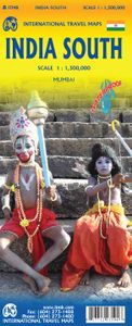
Wegenkaart - landkaart India South | ITMB

Een degelijke kaart met aanduidingen van o.a. nationale parken, vliegveld, benzinepomp, dirt-roads en kleine plattegrond van Mumbai. Als overzichtskaart goed te gebruiken. Gedrukt op watervast papier wat de levensduur van deze kaart ten goede komt! India is a very large country! It also has an unusual diamond shaped physical appearance that makes i...
13,95

Webshops met dit product

Webshop
Bezorging
Prijs

Anderen bekeken ook

Wegenkaart - landkaart India South | ITMB
Een degelijke kaart met aanduidingen van o.a. nationale parken, vliegveld, benzinepomp, dirt-roads en kleine plattegrond van Mumbai. Als overzichtskaart goed te gebruiken. Gedrukt op watervast papier wat de levensduur van deze kaart ten goede komt! India is a very large country! It also has an unusual diamond shaped physical appearance that makes it hard to map. The north is also very different from the south, so we decided to expand our data base for India and publish a map covering India from Hyderabad and Mumbai south to the southern tip of the country. As the country economically modernizes, it becomes better known. As a country, India is fascinating and a great travel experience. I well remember visiting the temple city of Tiruchirappalli many years ago and travelling by local trains (an experience that tends to sear itself on to ones memory cells!) Interesting-sounding names fill the map: Madurai, Kochi, Bangalore, Nagpur, and Pune; the map reeks of adventure and exoticism!
13,95
Wegenkaart - landkaart 3014 Adventure Map India South - Zuid | Nationa
Wegenkaart van Zuid India met vermelding van veel bezienswaardigheden, nationale parken en attrakties. Watervast en scheurvast. National Geographic's India South Adventure Map is designed to meet the unique needs of adventure travelers with its durability and detailed, accurate information. The map includes the locations of thousands of cities and towns with a user-friendly index, as well as a clearly marked road network complete with distances and designations for highways, major routes and secondary roads.   The India South Adventure Map differs from a traditional road map for it includes hundreds of points of interest that highlight the diverse and unique destinations found in this region. The map features UNESCO World Heritage sites, archaeological sites, wildlife sanctuaries, Hindu and Buddhist temples, sacred sites, forts, palaces, ruins, waterfalls, caves and other points of interest, making it an invaluable resource to travelers hoping to experience all the history and culture …
17,50
Wegenkaart - landkaart India | ITMB
Een degelijke kaart met aanduidingen van o.a. nationale parken, vliegveld, benzinepomp, dirt-roads en kleine plattegrond van Delhi. Kleine overzichtskaarten van de regio's rondom Mumbai en Kolkata. Als overzichtskaart goed te gebruiken. Gedrukt op watervast papier wat de levensduur van deze kaart ten goede komt! In spite of the current turmoil, India is not just an important Asian country, it is a dynamic powerhouse of the continent, vying with China for dominance in the emerging world order. It is also an ancient society, home of Buddhism, Hinduism, and the Sikh faith. It is also a very complicated country to map and we have spent a lot of time and effort into adding new roads and extra towns. India evokes for me the days of the Rajasthan, the pink city of Jaipur, the deserted city of Fathepur Sikri, the Red Fort at Delhi, and the Residency at Lucknow. India is huge, it is beautiful, and it is – well, India. It is unique. Legend Includes: Main roads, Tourism information, historic plac…
13,95
Wegenkaart - landkaart Canada | ITMB
Een degelijke kaart met aanduidingen van o.a. nationale parken, vliegveld, benzinepomp, dirt-roads en kleine plattegrond van hoofdstad. Well, it’s about time, eh?!? ITMB, after only thirty years on the go, finally gets around to publishing a map of Canada. When we first started mapping, there was a pressing need for good maps of Central and South America, then of Africa, then etc etc and we never found time to concentrate on our own country until fairly recently. This map was prepared by Natural Resources Canada and is, as a result, as accurate a map as one could hope to have. We are very proud of it, and very pleased to be able to use such top-rate cartography. The map covers all of the land mass of Canada, from its southernmost point to the top of Ellesmere Island and from the Atlantic coast to the Pacific. It’s an excellent map, but I’m going to give one proviso. Canada is the second-largest country on the face of the planet and there is no way that a single-sided sheet can portray …
13,95
Wegenkaart - landkaart 3012 Adventure Map India Northeast - Noordoost
Wegenkaart van Noordoost India met vermelding van veel bezienswaardigheden, nationale parken en attrakties. Watervast en scheurvast.   National Geographic's India Northeast Adventure Map is designed to meet the unique needs of adventure travelers with its durability and detailed, accurate information. The map includes the locations of thousands of cities and towns with a user-friendly index, as well as a clearly marked road network complete with distances and designations for highways, major routes and secondary roads.   The India Northeast Adventure Map differs from a traditional road map for it includes hundreds of points of interest that highlight the diverse and unique destinations found in this region. The map features UNESCO World Heritage sites, archaeological sites, wildlife sanctuaries, Hindu and Buddhist temples, forts, ruins, caves and other points of interest, making it an invaluable resource to travelers hoping to experience all the history and culture this part of India h…
17,50
Wegenkaart - landkaart New South Wales, Victoria, & Tasmania | ITMB
Een degelijke wegenkaart , schaal 1:1.900.000, met aanduidingen van o.a. nationale parken, vliegveld, benzinepomp, dirt-roads. Als overzichtskaart goed te gebruiken. We are pleased to announce the completion of our regional maps covering Australia with this map of the south-eastern segment of the country. This is the most densely-populated part of Australia, stretching from Lismore in the northeast to the Tasman Sea in the south. It includes all of New South Wales (NSW) and Victoria State, with South Australia as far west as Adelaide. It also shows Tasmania, Australia’s only island state, in good detail, as well as Flinders Island and King Island. The map includes two very large inset maps of Melbourne and of Sydney. This map covers the travel plans of 90% of the visitors travelling around Australia, a continental country that is very difficult to see all of in one trip. The expanded scale we’ve used allows adequate room to include wilderness campgrounds, recreational vehicle parks, ai…
13,95
Wegenkaart - landkaart 3011 Adventure Map India | National Geographic
Wegenkaart van India met vermelding van veel bezienswaardigheden, nationale parken en attrakties. Watervast en scheurvast.   National Geographic's India Adventure Map is designed to meet the unique needs of adventure travelers with its durability and detailed, accurate information. The map includes the locations of thousands of cities and towns with a user-friendly index, as well as a clearly marked road network complete with distances and designations for highways, major routes and secondary roads.   The India Adventure Map differs from a traditional road map for it includes hundreds of points of interest that highlight diverse and unique destinations in the region. The map features UNESCO World Heritage sites, national parks, archaeological sites, nature reserves, Hindu and Buddhist temples, and other points of interest, making it an invaluable resource to travelers hoping to experience all the history and culture India has to offer. Additional travel aids include the location of air…
17,50

Klanten-reviews van Wegenkaart - landkaart India South | ITMB

Er zijn nog geen beoordelingen voor dit productBen jij de eerste die een review plaatst?

Meer over Wegenkaart - landkaart India South | ITMB

Productomschrijving

Een degelijke kaart met aanduidingen van o.a. nationale parken, vliegveld, benzinepomp, dirt-roads en kleine plattegrond van Mumbai. Als overzichtskaart goed te gebruiken. Gedrukt op watervast papier wat de levensduur van deze kaart ten goede komt! India is a very large country! It also has an unusual diamond shaped physical appearance that makes it hard to map. The north is also very different from the south, so we decided to expand our data base for India and publish a map covering India from Hyderabad and Mumbai south to the southern tip of the country. As the country economically modernizes, it becomes better known. As a country, India is fascinating and a great travel experience. I well remember visiting the temple city of Tiruchirappalli many years ago and travelling by local trains (an experience that tends to sear itself on to ones memory cells!) Interesting-sounding names fill the map: Madurai, Kochi, Bangalore, Nagpur, and Pune; the map reeks of adventure and exoticism!

Productspecificaties

Artikelnummer(s)
Brand
ITMB

Verken gerelateerde categorieën

Webshop.nl maakt gebruik van cookies. Ga je verder op onze website, ga dan akkoord met het plaatsen van cookies en de verwerking van deze data door ons en vermelde partners.