webshop.nl
Categorieën
  Sluiten

Meer Borch
Meer Borch in Auto-onderdelen

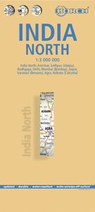
Wegenkaart - landkaart India Noord | Borch

0
Mooie geplasticieerde kaart van het noorden van India. Deze kaart biedt een goed overzicht van het land met detailkaarten.   Our soft-laminated folded map of India North shows: India North 1:3 000 000, Delhi 1:30 000, Mumbai 1:30 000, Kolkata 1:30 000, Jaipur 1:30 000, Agra 1:30 000, Varanasi 1:30 000, Amritsar 1:30 000, Jodhpur 1:30 000, Udaipur 1...

Webshops met dit product

Webshop
Bezorging
Prijs

Anderen bekeken ook

Wegenkaart - landkaart India Noord | Borch
Mooie geplasticieerde kaart van het noorden van India. Deze kaart biedt een goed overzicht van het land met detailkaarten.   Our soft-laminated folded map of India North shows: India North 1:3 000 000, Delhi 1:30 000, Mumbai 1:30 000, Kolkata 1:30 000, Jaipur 1:30 000, Agra 1:30 000, Varanasi 1:30 000, Amritsar 1:30 000, Jodhpur 1:30 000, Udaipur 1:30 000, Bodhgaya 1:15 000 and India administrative and time zones. Borch maps are easy to fold, durable and water-repellent with a wipeable surface. Borch Maps show hotels, museums, monuments, markets, public transport, top sights and points of interest, useful statistics, conversion charts for temperatures, weights and measurements, climate charts showing temperatures, sunshine hours, precipitation and humidity, overview maps, time zones, and much more...   Northern India is bordered by Pakistan to the west, China, Nepal and Bhutan to the north, and Bangladesh and Myanmar to the east. Hindi and English are the two official languages. After …
11,50
Wegenkaart - landkaart 2 India - West | Nelles Verlag
Goede kaart van een deel van India. Aan beide kanten bedrukt. Met veel toeristische aanduidingen als nationale parken en culturele bezienswaardigheden. Prima leesbare kaart. Detailkaart: Mumbai (Bombay) 1 : 300.000 Stadsplattegrond: Delhi 1 : 50.000 one of five maps in a series covering India at 1:1 500 000 scale. Folded road and tourist map of western India, including edge of Pakistan to the west, Chandigarh to the north, Pune to the south and Bhopal and Delhi to the east. Points of interest, national parks, and railways are all highlighted and shaded-relief colouring clearly depicts the topography.  The map includes insets showing central Delhi at 1:50 000 and Mumbai (Bombay) region at 1:300 000. The legend is in English, French and German. The other titles in the series are India East, India North, India North East, and India South. Nelles also produces a map of the whole Indian Subcontinent at a scale of 1:4 500 000.   For over 20 years Nelles maps have been renowned throughout the…
11,95
Wegenkaart - landkaart India Zuid | Borch
Mooie geplasticieerde kaart van het zuiden van india. Deze kaart biedt een goed overzicht van het land met detailkaarten. Our soft-laminated folded map of India South shows: India South 1:3 000 000, Mumbai 1:30 000, Kolkata 1:30 000, Chennai 1:30 000, Hyderabad 1:30 000, Bengaluru 1:30 000, Old Goa 1:15 000, Madurai 1:30 000, Trivandrum 1:30 000, Hampi 1:30 000, Kochi 1:30 000 and India administrative and time zones. Borch maps are easy to fold, durable and water-repellent with a wipeable surface. Borch Maps show hotels, museums, monuments, markets, public transport, top sights and points of interest, useful statistics, conversion charts for temperatures, weights and measurements, climate charts showing temperatures, sunshine hours, precipitation and humidity, overview maps, time zones, and much more...   Southern India, bordered by the Arabian Sea, the Indian Ocean, and the Bay of Bengal, is a culturally diverse region evoking images of colourful, chaotic cities, Ayurveda retreats, dr…
11,50
Wegenkaart - landkaart India North & West | ITMB
Een degelijke kaart met aanduidingen van o.a. nationale parken, vliegveld, benzinepomp, dirt-roads en kleine plattegrond van hoofdstad. Als overzichtskaart goed te gebruiken. Northern and western India on a double-sided, indexed map from ITMB, providing on each side useful coverage of some of the country’s most visited areas. Each side of the map has a separate index of localities. The northern side is centred on Delhi and extends north to the Line of Control dividing Jammu and Kashmir. Coverage east along the Ganges extends beyond Varanasi; west to Jodhour, the outskirts of Ahmadabad and to Vadodara (Baroda); and south to Nagpur, the geographical centre of India. The western side of the map extends from Delhi to Bangalore and Mysore, and inland beyond Hyderabad, so includes Mumbai and Goa. The map has altitude colouring (in feet) and shows the country’s road and rail networks and local airports. Symbols highlight various places of interest including historic or scenic sites, hill stat…
13,95
Wegenkaart - landkaart 2 India - West | Nelles Verlag
Goede kaart van een deel van India. Aan beide kanten bedrukt. Met veel toeristische aanduidingen als nationale parken en culturele bezienswaardigheden. Prima leesbare kaart. Detailkaart: Mumbai (Bombay) 1 : 300.000 Stadsplattegrond: Delhi 1 : 50.000 one of five maps in a series covering India at 1:1 500 000 scale. Folded road and tourist map of western India, including edge of Pakistan to the west, Chandigarh to the north, Pune to the south and Bhopal and Delhi to the east. Points of interest, national parks, and railways are all highlighted and shaded-relief colouring clearly depicts the topography.  The map includes insets showing central Delhi at 1:50 000 and Mumbai (Bombay) region at 1:300 000. The legend is in English, French and German. The other titles in the series are India East, India North, India North East, and India South. Nelles also produces a map of the whole Indian Subcontinent at a scale of 1:4 500 000.   For over 20 years Nelles maps have been renowned throughout the…
11,95
Wegenkaart - landkaart India North & West | ITMB
Een degelijke kaart met aanduidingen van o.a. nationale parken, vliegveld, benzinepomp, dirt-roads en kleine plattegrond van hoofdstad. Als overzichtskaart goed te gebruiken. Northern and western India on a double-sided, indexed map from ITMB, providing on each side useful coverage of some of the country’s most visited areas. Each side of the map has a separate index of localities. The northern side is centred on Delhi and extends north to the Line of Control dividing Jammu and Kashmir. Coverage east along the Ganges extends beyond Varanasi; west to Jodhour, the outskirts of Ahmadabad and to Vadodara (Baroda); and south to Nagpur, the geographical centre of India. The western side of the map extends from Delhi to Bangalore and Mysore, and inland beyond Hyderabad, so includes Mumbai and Goa. The map has altitude colouring (in feet) and shows the country’s road and rail networks and local airports. Symbols highlight various places of interest including historic or scenic sites, hill stat…
13,95
Wegenkaart - landkaart Planning Map India | Lonely Planet
Durable and waterproof, with a handy slipcase and easy-fold format, Lonely Planet’s India Planning Map helps you get around with ease.   Get more from your map and your trip with images and information about top country attractions, itinerary suggestions, a transport guide, planning information, themed lists and practical travel tips.   With this easy-to-use, full-colour map in your back pocket, you can truly get to the heart of India.   Durable and waterproof Easy-fold format and convenient size Handy slipcase Full colour and easy-to-use Before-you-go info Beautiful imagery Tailored itineraries Can’t-miss regional highlights Detailed town index Transport planner Themed lists Covers Rajasthan, Jaipur, Jaisalmer, Ranthambhore National Park, Udaipur, Delhi, Agra, Varanasi, Lucknow, Himachal Pradesh, Ladakh, Shimla, Leh, McLeod Ganj, Manali, Kolkata, Sundarbans, Darjeeling, Assam, Mumbai, Goa, Ajanta & Ellora Caves, Kerala, Hampi, Mysuru, Chennai Looking for more in-dept…
10,95
Wegenkaart - landkaart Chile - Chili | Borch
Mooie geplasticieerde kaart van Chili. Deze kaart biedt een goed overzicht van het land met detailkaarten. Our soft-laminated folded map of Chile shows: Northern Chile, Central Chile, Southern Chile & Patagonia 1:2 000 000, Torres del Paine National Park 1:240 000, Robinson Crusoe Island 1:200 000, Easter Island (Rapa Nui) 1:160 000, Punta Arenas, Antofagasta, Iquique 1:15 000, Valparaiso 1:10 000, Arica 1:16 000, La Serena 1:13 000, Vina del Mar 1:22 000, Santiago 1:20 000 and Chile administrative & time zones. Borch Maps are easy to fold, durable and water-repellent with a wipeable surface. Borch Maps show hotels, museums, monuments, markets, public transport, top sights and points of interest, useful statistics, conversion charts for temperatures, weights and measurements, climate charts showing temperatures, sunshine hours, precipitation and humidity, overview maps, time zones, and much more...   The Republic of Chile is a long and narrow coastal strip on the western side of the So…
11,50

Klanten-reviews van Wegenkaart - landkaart India Noord | Borch

Er zijn nog geen beoordelingen voor dit productBen jij de eerste die een review plaatst?

Meer over Wegenkaart - landkaart India Noord | Borch

Productomschrijving

Mooie geplasticieerde kaart van het noorden van India. Deze kaart biedt een goed overzicht van het land met detailkaarten.   Our soft-laminated folded map of India North shows: India North 1:3 000 000, Delhi 1:30 000, Mumbai 1:30 000, Kolkata 1:30 000, Jaipur 1:30 000, Agra 1:30 000, Varanasi 1:30 000, Amritsar 1:30 000, Jodhpur 1:30 000, Udaipur 1:30 000, Bodhgaya 1:15 000 and India administrative and time zones. Borch maps are easy to fold, durable and water-repellent with a wipeable surface. Borch Maps show hotels, museums, monuments, markets, public transport, top sights and points of interest, useful statistics, conversion charts for temperatures, weights and measurements, climate charts showing temperatures, sunshine hours, precipitation and humidity, overview maps, time zones, and much more...   Northern India is bordered by Pakistan to the west, China, Nepal and Bhutan to the north, and Bangladesh and Myanmar to the east. Hindi and English are the two official languages. After colonisation by Great Britain in the mid-1850s, India achieved independence in 1947, mostly by non-violence. India is home to 1.2 billion people and is richly diverse. This vast country's northern region is home to it's capital city, New Delhi, as well as to many pilgrimage centers such as Varanasi, world heritage sites such as the Taj Mahal, many great universities, countless national parks and reserves and breathtaking flora and fauna. Rajasthan is one of India's most touristically-popular northern provinces, of which Jaipur is the state capital. This area is well known for it's rich cultural heritage. The Indian people, 80% of whom follow Hinduism, are kind and welcoming. Popular trips for tourists include the Golden Triangle (Delhi, Agra, Jaipur), Dharamsala and the palaces of northern India. Considerations: get vaccinations before you leave, avoid getting too close to Pakistan, never keep your wallet in your back pocket, avoid using your left hand (particularly when eating), avoid inappropriate attire (don't sunbathe topless) and don't smoke in public.

Productspecificaties

Artikelnummer(s)
Brand
Borch

Verken gerelateerde categorieën

Webshop.nl maakt gebruik van cookies. Ga je verder op onze website, ga dan akkoord met het plaatsen van cookies en de verwerking van deze data door ons en vermelde partners.