webshop.nl
Categorieën
  Sluiten

Meer ITMB
Meer ITMB in Literatuur boeken

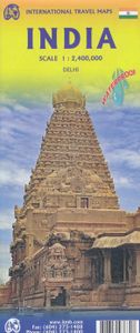
Wegenkaart - landkaart India | ITMB

Een degelijke kaart met aanduidingen van o.a. nationale parken, vliegveld, benzinepomp, dirt-roads en kleine plattegrond van Delhi. Kleine overzichtskaarten van de regio's rondom Mumbai en Kolkata. Als overzichtskaart goed te gebruiken. Gedrukt op watervast papier wat de levensduur van deze kaart ten goede komt! In spite of the current turmoil, Ind...
13,95

Webshops met dit product

Webshop
Bezorging
Prijs

Anderen bekeken ook

Wegenkaart - landkaart India | ITMB
Een degelijke kaart met aanduidingen van o.a. nationale parken, vliegveld, benzinepomp, dirt-roads en kleine plattegrond van Delhi. Kleine overzichtskaarten van de regio's rondom Mumbai en Kolkata. Als overzichtskaart goed te gebruiken. Gedrukt op watervast papier wat de levensduur van deze kaart ten goede komt! In spite of the current turmoil, India is not just an important Asian country, it is a dynamic powerhouse of the continent, vying with China for dominance in the emerging world order. It is also an ancient society, home of Buddhism, Hinduism, and the Sikh faith. It is also a very complicated country to map and we have spent a lot of time and effort into adding new roads and extra towns. India evokes for me the days of the Rajasthan, the pink city of Jaipur, the deserted city of Fathepur Sikri, the Red Fort at Delhi, and the Residency at Lucknow. India is huge, it is beautiful, and it is – well, India. It is unique. Legend Includes: Main roads, Tourism information, historic plac…
13,95
Wegenkaart - landkaart India South | ITMB
Een degelijke kaart met aanduidingen van o.a. nationale parken, vliegveld, benzinepomp, dirt-roads en kleine plattegrond van Mumbai. Als overzichtskaart goed te gebruiken. Gedrukt op watervast papier wat de levensduur van deze kaart ten goede komt! India is a very large country! It also has an unusual diamond shaped physical appearance that makes it hard to map. The north is also very different from the south, so we decided to expand our data base for India and publish a map covering India from Hyderabad and Mumbai south to the southern tip of the country. As the country economically modernizes, it becomes better known. As a country, India is fascinating and a great travel experience. I well remember visiting the temple city of Tiruchirappalli many years ago and travelling by local trains (an experience that tends to sear itself on to ones memory cells!) Interesting-sounding names fill the map: Madurai, Kochi, Bangalore, Nagpur, and Pune; the map reeks of adventure and exoticism!
13,95
Wegenkaart - landkaart Bangladesh & India oost | ITMB
Een degelijke kaart met aanduidingen van o.a. nationale parken, vliegveld, benzinepomp, dirt-roads en kleine plattegrond van hoofdstad. Als overzichtskaart goed te gebruiken. I like Bangladesh. Sure, the government is too corrupt and the country gets schmucked every time there's a hurricane, but the people are friendly and hard-working and gradually improving their country. As a travel destination, Bangladesh has to be considered as part of a trip to India for most people, so in addition to updating and modernizing our artwork, we have added a map of the easternmost portion of India, showing access routes and sites of interest in both countries. One of the great treats of Bangladesh is to take a ferry from Dhaka to Khulna, a two-day trip. The map also includes an inset of Dhaka, the capital, although we had to show only a few of the thousands of mosques in the city.    Legend Includes: Roads by classification, Airports, Ferrie routes, Bus stations, Car parks, State boudaries, border cr…
13,95
Wegenkaart - landkaart India North & West | ITMB
Een degelijke kaart met aanduidingen van o.a. nationale parken, vliegveld, benzinepomp, dirt-roads en kleine plattegrond van hoofdstad. Als overzichtskaart goed te gebruiken. Northern and western India on a double-sided, indexed map from ITMB, providing on each side useful coverage of some of the country’s most visited areas. Each side of the map has a separate index of localities. The northern side is centred on Delhi and extends north to the Line of Control dividing Jammu and Kashmir. Coverage east along the Ganges extends beyond Varanasi; west to Jodhour, the outskirts of Ahmadabad and to Vadodara (Baroda); and south to Nagpur, the geographical centre of India. The western side of the map extends from Delhi to Bangalore and Mysore, and inland beyond Hyderabad, so includes Mumbai and Goa. The map has altitude colouring (in feet) and shows the country’s road and rail networks and local airports. Symbols highlight various places of interest including historic or scenic sites, hill stat…
13,95
Wegenkaart - landkaart Panama | ITMB
Een degelijke kaart met aanduidingen van o.a. nationale parken, vliegveld, benzinepomp, dirt-roads en kleine plattegrond van hoofdstad. Als overzichtskaart goed te gebruiken. Panama on an indexed, double-sided map from ITMB, printed on waterproof and tear-resistant plastic paper, with large, clear street plan of central Panama City highlighting various places of interest and tourist facilities, including 18 selected hotels. The map divides the country east/west, with some overlap between the two sides. Topography is shown by altitude colouring with spot heights and names of mountain ranges. Swaps, mangrove and salt marshes are marked, and national parks or protected areas and Indian Reserves highlighted. The map shows the country’s road network with locations of petrol stations and border crossings, plus railways and local airports or landing grounds. Internal administrative boundaries are shown with names of the provinces. Symbols highlight various places of interest, archaeological s…
13,95
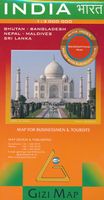
Wegenkaart - landkaart India | Gizi Map
Natuurkundige wegenkaart van India met ook veel aandacht voor het wegennet en plaatsen, achterop de kaart staat een uitgebreid register. A detailed and attractive general map showing relief through altitude tinting, with an inset administrative map also included. Coverage extends beyond India to include the whole of Nepal, Bangladesh and large sections of Myanmar, Pakistan and Afghanistan. The Maldives, Andaman & Nicobar Islands and Eastern India (Assam & surroundings) are shown in insets. Selected peak heights are indicated and some terrain features such as salt flats, glaciers & swamps are distinguished. Several categories of roads are distinguished, including selected minor roads and tracks, with intermediate driving distances marked on many routes. Railways, shipping routes, airports and ports are marked and administrative region boundaries (and disputed frontiers) are shown. Symbols denote major places of worship, palaces, temples, beach resorts, antiquities, archeological sites, …
15,95
Wegenkaart - landkaart India North & West | ITMB
Een degelijke kaart met aanduidingen van o.a. nationale parken, vliegveld, benzinepomp, dirt-roads en kleine plattegrond van hoofdstad. Als overzichtskaart goed te gebruiken. Northern and western India on a double-sided, indexed map from ITMB, providing on each side useful coverage of some of the country’s most visited areas. Each side of the map has a separate index of localities. The northern side is centred on Delhi and extends north to the Line of Control dividing Jammu and Kashmir. Coverage east along the Ganges extends beyond Varanasi; west to Jodhour, the outskirts of Ahmadabad and to Vadodara (Baroda); and south to Nagpur, the geographical centre of India. The western side of the map extends from Delhi to Bangalore and Mysore, and inland beyond Hyderabad, so includes Mumbai and Goa. The map has altitude colouring (in feet) and shows the country’s road and rail networks and local airports. Symbols highlight various places of interest including historic or scenic sites, hill stat…
13,95

Klanten-reviews van Wegenkaart - landkaart India | ITMB

Er zijn nog geen beoordelingen voor dit productBen jij de eerste die een review plaatst?

Meer over Wegenkaart - landkaart India | ITMB

Productomschrijving

Een degelijke kaart met aanduidingen van o.a. nationale parken, vliegveld, benzinepomp, dirt-roads en kleine plattegrond van Delhi. Kleine overzichtskaarten van de regio's rondom Mumbai en Kolkata. Als overzichtskaart goed te gebruiken. Gedrukt op watervast papier wat de levensduur van deze kaart ten goede komt! In spite of the current turmoil, India is not just an important Asian country, it is a dynamic powerhouse of the continent, vying with China for dominance in the emerging world order. It is also an ancient society, home of Buddhism, Hinduism, and the Sikh faith. It is also a very complicated country to map and we have spent a lot of time and effort into adding new roads and extra towns. India evokes for me the days of the Rajasthan, the pink city of Jaipur, the deserted city of Fathepur Sikri, the Red Fort at Delhi, and the Residency at Lucknow. India is huge, it is beautiful, and it is – well, India. It is unique. Legend Includes: Main roads, Tourism information, historic places, temples, gardens, elephant training, zoo, airports, places and buildings of interest, hotels, hospitals.

Productspecificaties

Artikelnummer(s)
Brand
ITMB

Verken gerelateerde categorieën

Webshop.nl maakt gebruik van cookies. Ga je verder op onze website, ga dan akkoord met het plaatsen van cookies en de verwerking van deze data door ons en vermelde partners.