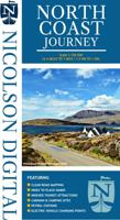
Wegenkaart - landkaart in your pocket North Coast Scotland NSC500 | Nicolson

0
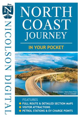
The North Coast Journey In Your Pocket is the essential guide to driving the 500 miles around the Scottish Coast. The front has a full route overview map with main tourist attractions. Ten detailed routes are shown on the reverse clearly showing petrol stations, EV charging points and tourist attractions. Both sides highlight alternative routes fo...

Verkopers met dit product

Verkoper
Bezorging
Prijs
DeZwerver.nl logo
DeZwerver.nl
2,95
7,95

Anderen bekeken ook

Wegenkaart - landkaart North Coast Journey | Nicolson
Nicolson Digital Tourist Maps are ideal for planning your visit on a circular tour round the Northern Scotland tourist route. A great map to use along with Bridget Benson’s North Coast Journey.   Our sectional map showing the popular tourist route round the North of Scotland.   Starting at Inverness, heading west through Applecross then North to Gairloch, Ullapool to Lochinver then on to Durness. Along the Northern Coastline to John O'Groats and back down the east coast to finish in Inverness   Back of the map has the index to places & attractions for each section   Featuring: Exceptionally clear road mapping Popular tourist and historical sites Alternative routes for large vehicles Electric Vehicle Charging points & Petrol Stations 1/150000 Tourist Mapping   Card cover   Cover size approx 135 mm wide x 240mm tall   Sheet size (unfolded) 1000 mm wide x 690mm tall    
12,95
Wegenkaart - landkaart Scotland Tourist Map | Nicolson
The Nicolson Digital Scotland Tourist Map is a must-have for planning your trip to Scotland. Clearly shows main tourist attractions, places, national & fore st parks, the increasingly popular long distance driving routes and locations for wild swimming, kayaking & paddleboarding. National cycle routes and long distance footpaths are also included.    Featuring: Clear road mapping with mileagesIndex to place names and main tourist attractionsLong distance driving routes footpaths & national cycle routesNational & forest parksLocations for wild swimming, kayaking & paddleboarding  
9,95
Wegenkaart - landkaart in your pocket Outer Hebrides | Nicolson
The Outer Hebrides In Your Pocket is our new essential map for visiting these beautiful islands. Exceptionally clear road mapping of the Outer Hebrides shows main tourist attractions, EV charge points and a full index to places & tourist attractions. Lewis & Harris are on the front and North & South Uist down to Berneray are on the reverse. A useful travel information section is also included allowing visitors to plan their perfect trip. Don't leave home without it!        Featuring:    Exceptionally clear, fully indexed road mapping EV charging points and tourist attractions shown Travel information section
7,95
Wegenkaart - landkaart in your pocket Isle of Skye | Nicolson
The Isle of Skye In Your Pocket is our new essential map for visiting Skye. The front has exceptionally clear road mapping of the whole island showing main tourist attractions, EV charge points and full index to places & tourist attractions. The reverse has detailed town maps of Portree and Broadford at 1:14,000, useful travel information and glorious full colour photographs of some of the famous sights - you will want to visit them and many more. Don't leave home without it!    Featuring:    Exceptionally clear, fully indexed road mapping Detailed town plans of Portree & Broadf ord EV charging points and tourist attractions shown Travel information and glorious full colour photographs
7,95
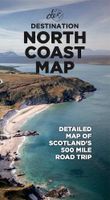
Wegenkaart - landkaart North Coast Road Trip Map | Destination Earth
This North Coast road trip map is the essential tool that will guide you through the breathtaking landscapes, stunning coastal views, and enchanting villages of the North Coast 500 in Scotland. Designed by travel enthusiasts, for travel enthusiasts, our map is more than just a navigation tool. It's a gateway to adventure, a treasure trove of hidden gems, and a companion that will make your journey even more extraordinary. Featuring a detailed and easy-to-read layout, this Destination NC500 Map will assist you in planning and navigating your way along the 500-mile route. With precise mile markers, highlighted attractions, and recommended stopping points, this map will ensure you don't miss a single sight along the way.   NC500 A1 Map Features:     Exact Locations: All of the exact locations of over 110+ Sights and Attractions, as well as Accommodation, Restaurants, Campervan Water and Waste Facilities, Electric Vehicle Charging Points, Train Stations, Airports, and much more! Must-know…
13,-
Wegenkaart - landkaart - Fietskaart Donegal | Xploreit Maps
Zeer goed leesbare deelkaart van Ierland. Alle wegen, alle dorpen en steden en veel topografische details staan er op: daardoor zowel als wegenkaart ook als fietskaart goed te gebruiken. Naast de algemene kaartdetails zijn ook de bezienswaardigheden en historische monumenten goed ingetekend en makkelijk te vinden. Campings en jeugdherbergen maken het compleet.  This convenient and informative paper travel map is specifically designed for visitors to Donegal – the northernmost county in Ireland. With a heady mix of peninsulas, promontories and sandy beaches, Donegal’s  long, indented coastline includes some of the most spectacular scenery in the country. Further inland, the attractions are just as enticing and include Glenveagh National Park – an all-time favourite destination. This new map covers all of County Donegal and highlights local walking trails, cycle routes and scenic drives. The road network shown includes local roads and driving distances are indicated on the main routes. …
21,95
Wegenkaart - landkaart - Wegenatlas Pan-Americana North | ITMB
Wegenatlas - A5 formaat - verschillende schalen - voor de het Noord-Amerikaanse gedeelte van de Pan-Americana ( Pan-American Highway ) van Alaska langs the Pacific kust van British Colombia in Canada, de staten Washington, Oregon en Californie, Mexico, Guatemala tot Panama.   The Pan-American Highway was created by the USA to improve road communications within the Western Hemisphere post-WW2. The highway started at the Mexican border and eventually reached somewhere south of Santiago in Chile. It was a vote-buying gimmick by the Americans to fund allies, but it also created an essential 'spine' road through Central America to the Darien Gap and along the west coast of South America to the then-limits of Chile. Driving the Pan-Am has become a travel experience. More recently, the improvement in more northerly highways, such as the Dalton Highway from Fairbanks to Prudhoe Bay in Alaska, the paving of most of the Stewart Highway through British Columbia, and the tremendous improvement in…
16,50
Wegenkaart - landkaart Montenegro | Marco Polo
Duidelijke wegenkaart van Marco Polo: alle wegen, zowel de verharde als belangrijke onverharde wegen zijn weergegeven.  Mooie toeristisch interessante wegen die de moeite waard zijn, zijn groen gearceerd. Veel toeristische informatie is toegevoegd zoals de nationale parken, campings, kastelen en vliegvelden. Afstanden tussen belangrijke steden en benzinestations staan ook op de kaart. Een plaatsnamenregister ontbreekt niet.   ---   This Marco Polo map features really easy to read cartography. Topography is highlighted with relief shading and loads of spot heights and the road network is clearly shown with roads ranging from motorways all the way through to minor secondary roads. The map also clearly indicates airports, places of interest, scenic/tourist routes, view points etc.   The map includes a booklet attached to the cover that contains some useful information and a very extensive index that covers locations, places of interest and geographical features. Also included are a dista…
14,95
Wegenkaart - landkaart Portugal | Marco Polo
Duidelijke wegenkaart van Marco Polo: alle wegen, zowel de verharde als belangrijke onverharde wegen zijn weergegeven.  Mooie toeristisch interessante wegen die de moeite waard zijn, zijn groen gearceerd. Veel toeristische informatie is toegevoegd zoals de nationale parken, campings, kastelen en vliegvelden. Afstanden tussen belangrijke steden en benzinestations staan ook op de kaart. Een plaatsnamenregister ontbreekt niet.   ---   This Marco Polo map features really easy to read cartography. Topography is highlighted with relief shading and loads of spot heights and the road network is clearly shown with roads ranging from motorways all the way through to minor secondary roads. The map also clearly indicates airports, places of interest, scenic/tourist routes, view points etc.   The map includes a booklet attached to the cover that contains some useful information and a very extensive index that covers locations, places of interest and geographical features. Also included are a dista…
14,95
Wegenkaart - landkaart India | Marco Polo
Duidelijke wegenkaart van Marco Polo: alle wegen, zowel de verharde als belangrijke onverharde wegen zijn weergegeven.  Mooie toeristisch interessante wegen die de moeite waard zijn, zijn groen gearceerd. Veel toeristische informatie is toegevoegd zoals de nationale parken, campings, kastelen en vliegvelden. Afstanden tussen belangrijke steden en benzinestations staan ook op de kaart. Een plaatsnamenregister ontbreekt niet.   ---   This Marco Polo map features really easy to read cartography. Topography is highlighted with relief shading and loads of spot heights and the road network is clearly shown with roads ranging from motorways all the way through to minor secondary roads. The map also clearly indicates airports, places of interest, scenic/tourist routes, view points etc.   The map includes a booklet attached to the cover that contains some useful information and a very extensive index that covers locations, places of interest and geographical features. Also included are a dista…
14,95

Klanten-reviews van Wegenkaart - landkaart in your pocket North Coast Scotland NSC500 | Nicolson

Er zijn nog geen beoordelingen voor dit productBen jij de eerste die een review plaatst?

Meer over Wegenkaart - landkaart in your pocket North Coast Scotland NSC500 | Nicolson

Productomschrijving

The North Coast Journey In Your Pocket is the essential guide to driving the 500 miles around the Scottish Coast. The front has a full route overview map with main tourist attractions. Ten detailed routes are shown on the reverse clearly showing petrol stations, EV charging points and tourist attractions. Both sides highlight alternative routes for large vehicles and mileage pins between various points ensuring that you don't get stranded! Don't leave home without it!    Featuring:    Full 500 mile driving route overview map at 6.2 miles to the inch Ten detailed individual route maps at 3.6 miles to the inch Petrol stations, EV charging points and tourist attractions shown Alternative route for large vehicles clearly marked

Verken gerelateerde categorieën

Webshop.nl maakt gebruik van cookies. Ga je verder op onze website, ga dan akkoord met het plaatsen van cookies en de verwerking van deze data door ons en vermelde partners.