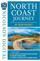
Wegenkaart - landkaart in your pocket North Coast Scotland NSC500 | Nicolson

0
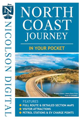
The North Coast Journey In Your Pocket is the essential guide to driving the 500 miles around the Scottish Coast. The front has a full route overview map with main tourist attractions. Ten detailed routes are shown on the reverse clearly showing petrol stations, EV charging points and tourist attractions. Both sides highlight alternative routes fo...

Verkopers met dit product

Verkoper
Bezorging
Prijs
DeZwerver.nl logo
DeZwerver.nl
2,95
7,95

Anderen bekeken ook

Wegenkaart - landkaart in your pocket North Coast Scotland NSC500 | Nicolson
The North Coast Journey In Your Pocket is the essential guide to driving the 500 miles around the Scottish Coast. The front has a full route overview map with main tourist attractions. Ten detailed routes are shown on the reverse clearly showing petrol stations, EV charging points and tourist attractions. Both sides highlight alternative routes for large vehicles and mileage pins between various points ensuring that you don't get stranded! Don't leave home without it!    Featuring:    Full 500 mile driving route overview map at 6.2 miles to the inch Ten detailed individual route maps at 3.6 miles to the inch Petrol stations, EV charging points and tourist attractions shown Alternative route for large vehicles clearly marked
7,95
Wegenkaart - landkaart Scotland Tourist Map | Nicolson
The Nicolson Digital Scotland Tourist Map is a must-have for planning your trip to Scotland. Clearly shows main tourist attractions, places, national & fore st parks, the increasingly popular long distance driving routes and locations for wild swimming, kayaking & paddleboarding. National cycle routes and long distance footpaths are also included.    Featuring: Clear road mapping with mileagesIndex to place names and main tourist attractionsLong distance driving routes footpaths & national cycle routesNational & forest parksLocations for wild swimming, kayaking & paddleboarding  
9,95
Wegenkaart - landkaart North Coast Journey | Nicolson
Nicolson Digital Tourist Maps are ideal for planning your visit on a circular tour round the Northern Scotland tourist route. A great map to use along with Bridget Benson’s North Coast Journey.   Our sectional map showing the popular tourist route round the North of Scotland.   Starting at Inverness, heading west through Applecross then North to Gairloch, Ullapool to Lochinver then on to Durness. Along the Northern Coastline to John O'Groats and back down the east coast to finish in Inverness   Back of the map has the index to places & attractions for each section   Featuring: Exceptionally clear road mapping Popular tourist and historical sites Alternative routes for large vehicles Electric Vehicle Charging points & Petrol Stations 1/150000 Tourist Mapping   Card cover   Cover size approx 135 mm wide x 240mm tall   Sheet size (unfolded) 1000 mm wide x 690mm tall    
12,95
Wegenkaart - landkaart in your pocket Outer Hebrides | Nicolson
The Outer Hebrides In Your Pocket is our new essential map for visiting these beautiful islands. Exceptionally clear road mapping of the Outer Hebrides shows main tourist attractions, EV charge points and a full index to places & tourist attractions. Lewis & Harris are on the front and North & South Uist down to Berneray are on the reverse. A useful travel information section is also included allowing visitors to plan their perfect trip. Don't leave home without it!        Featuring:    Exceptionally clear, fully indexed road mapping EV charging points and tourist attractions shown Travel information section
7,95
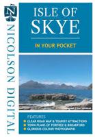
Wegenkaart - landkaart in your pocket Isle of Skye | Nicolson
The Isle of Skye In Your Pocket is our new essential map for visiting Skye. The front has exceptionally clear road mapping of the whole island showing main tourist attractions, EV charge points and full index to places & tourist attractions. The reverse has detailed town maps of Portree and Broadford at 1:14,000, useful travel information and glorious full colour photographs of some of the famous sights - you will want to visit them and many more. Don't leave home without it!    Featuring:    Exceptionally clear, fully indexed road mapping Detailed town plans of Portree & Broadf ord EV charging points and tourist attractions shown Travel information and glorious full colour photographs
7,95
Wegenkaart - landkaart 3 Nicolson Road 3, South Scotland : Southern Scotland & Northumberland | Nicolson
Based on the Ordnance Survey 1/250000 Road mapping.    Road Map 3 covers Southern Scotland & Northumberland. Please scroll through the images to see the area of coverage (in white). This sheet covers from just south of  Tobermory in the west, right over to Forfar & Arbroath and everything on the Scottish mainland south of there.    Features:   • Clear road mapping & ferry routes • Index to place names (which the Ordnance Survey version doesn't have) • National & forest parks • Contours and peak heights   ISBN 9781912046584   Cover size 133mm wide x 240mm tall   Sheet size (when unfolded) 1250mm wide x 952mm tall
12,95
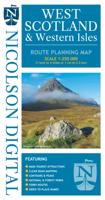
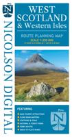
Wegenkaart - landkaart West Scotland & Western Isles | Nicolson
Based on the Ordnance Survey 1/250000 Road mapping.    Road Map 2 covers West Scotland & the Western Isles. Please scroll through the images to see the area of coverage (in white). This sheet covers from Dumbarton in the south west, due north to Loch Eribol (east of Durness) all the way west to Lewis, Harris, the Uists, Benbecula & Barra. It also includes an inset of Islay & Jura.   Features:   • Clear road mapping & ferry routes • Index to place names (which the Ordnance Survey version doesn't have) • National & forest parks • Contours and peak heights   ISBN 9781912046591   Cover size 133mm wide x 240mm tall   Sheet size (when unfolded) 952 mm wide x 1250 mm tall
12,95
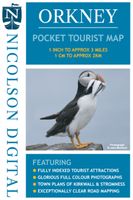
Wegenkaart - landkaart Orkney Pocket Tourist Map | Nicolson
This Nicolson Digital Pocket Tourist Map is the latest addition to our range & ideal for your visit to Orkney. Tourist attractions & places are clearly marked. Detailed street maps included for main towns within the area shown.   Topography is shown by layer tints & peak heights. Quality information for a budget-friendly price! Glorious colour photographs & tourist informationIndex to place names & major tourist attractionsIndexed street plans of Kirkwall & StromnessExceptionally clear road mapping
7,95
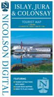
Wegenkaart - landkaart Islay, Jura & Colonsay Tourist Map | Nicolson
Nicolson Digital Tourist Maps are ideal for planning your visit to some of the most beautiful areas of Scotland.  Tourist attractions and places are clearly marked. Topography is shown through layer tints with major peaks highlighted.  Detailed street maps included for main towns within the area shown.  A must for every visitor!Featuring:Exceptionally clear road mappingIndex to place names & major tourist attractionsIndexed street plans of Lerwick & ScallowayLayer tints and peak heights. The ideal map for any tourist visiting Islay & Jura
12,95

Klanten-reviews van Wegenkaart - landkaart in your pocket North Coast Scotland NSC500 | Nicolson

Er zijn nog geen beoordelingen voor dit productBen jij de eerste die een review plaatst?

Meer over Wegenkaart - landkaart in your pocket North Coast Scotland NSC500 | Nicolson

Productomschrijving

The North Coast Journey In Your Pocket is the essential guide to driving the 500 miles around the Scottish Coast. The front has a full route overview map with main tourist attractions. Ten detailed routes are shown on the reverse clearly showing petrol stations, EV charging points and tourist attractions. Both sides highlight alternative routes for large vehicles and mileage pins between various points ensuring that you don't get stranded! Don't leave home without it!    Featuring:    Full 500 mile driving route overview map at 6.2 miles to the inch Ten detailed individual route maps at 3.6 miles to the inch Petrol stations, EV charging points and tourist attractions shown Alternative route for large vehicles clearly marked

Productinformatie

    Verken gerelateerde categorieën

    Webshop.nl maakt gebruik van cookies. Ga je verder op onze website, ga dan akkoord met het plaatsen van cookies en de verwerking van deze data door ons en vermelde partners.