webshop.nl
Categorieën
  Sluiten

Meer Nicolson
Meer Nicolson in Literatuur boeken

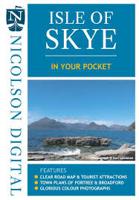
Wegenkaart - landkaart in your pocket Isle of Skye | Nicolson

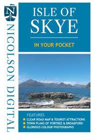
The Isle of Skye In Your Pocket is our new essential map for visiting Skye. The front has exceptionally clear road mapping of the whole island showing main tourist attractions, EV charge points and full index to places & tourist attractions. The reverse has detailed town maps of Portree and Broadford at 1:14,000, useful travel information and glori...
7,95

Webshops met dit product

Webshop
Bezorging
Prijs

Anderen bekeken ook

Wegenkaart - landkaart in your pocket Isle of Skye | Nicolson
The Isle of Skye In Your Pocket is our new essential map for visiting Skye. The front has exceptionally clear road mapping of the whole island showing main tourist attractions, EV charge points and full index to places & tourist attractions. The reverse has detailed town maps of Portree and Broadford at 1:14,000, useful travel information and glorious full colour photographs of some of the famous sights - you will want to visit them and many more. Don't leave home without it!    Featuring:    Exceptionally clear, fully indexed road mapping Detailed town plans of Portree & Broadf ord EV charging points and tourist attractions shown Travel information and glorious full colour photographs
7,95
Wegenkaart - landkaart in your pocket Outer Hebrides | Nicolson
The Outer Hebrides In Your Pocket is our new essential map for visiting these beautiful islands. Exceptionally clear road mapping of the Outer Hebrides shows main tourist attractions, EV charge points and a full index to places & tourist attractions. Lewis & Harris are on the front and North & South Uist down to Berneray are on the reverse. A useful travel information section is also included allowing visitors to plan their perfect trip. Don't leave home without it!        Featuring:    Exceptionally clear, fully indexed road mapping EV charging points and tourist attractions shown Travel information section
7,95
Reisgids Isle of Skye Guide Book | Charles Tait
The Isle of Skye is one of the most popular visitor destinations in Scotland and it was voted the fourth best island in the world by National Geographic. Being a relitavely small island, this guidebook has everything you'll need to experience the wonders of Skye. It covers all the main sites of interest, monuments, details of all of the best places to visit, walks and visitor attractions. It also includes a selection of 11 suggested day itineraries.   Charles does an excellent job at leaving nothing untouched when delving into the beauty that Skye has to offer. Some of the different sections covered range from Nature and Enviroment, Birds, Flora, Fauna, History, Archaeology and Culture. All sections are supported with Charles' own photography, with nearly 800 mostly new and unpublished photographs.   Charles Tait guide books   The Charles Tait guides for Scotland are chock full of information, which will both inspire you before your trip and enhance your experience whilst you're there.…
18,95
Wegenkaart - landkaart Pocket Map Skye | Collins
Handy little full colour Collins map of Skye with a high level of detail. Clear mapping of the Isle of Skye showing the road network, ferries and places of interest. Map at a scale of 1:175 000 (3 miles to 1 inch).   Clear, detailed, full colour Collins road mapping is presented in a handy format ideal for the pocket or handbag. It is excellent value and covers the whole of the Isle of Skye. This map includes:* Scotland route map* Caravan and camping sites* Tourist locations* Ferry links* Listing of major places to visit, with additional details for Dunvegan Castle, Old Man of Storr and Loch Coruisk* Detailed place names index
7,95
Wegenkaart - landkaart Orkney Pocket Tourist Map | Nicolson
This Nicolson Digital Pocket Tourist Map is the latest addition to our range & ideal for your visit to Orkney. Tourist attractions & places are clearly marked. Detailed street maps included for main towns within the area shown.   Topography is shown by layer tints & peak heights. Quality information for a budget-friendly price! Glorious colour photographs & tourist informationIndex to place names & major tourist attractionsIndexed street plans of Kirkwall & StromnessExceptionally clear road mapping
6,95
Wandelgids The Isle of Skye | Cicerone
Uitstekende wandelgids, sommige meerdaags, voor dit uitdagende wandelgebied in Schotland. This third edition of Terry Marsh’s walking and scrambling guide to Skye, the Hebrides, northwest Scotland, updated using digital mapping and GPS. 87 walks and scrambles in Sleat and South-East Skye, Strath, Minginish, Duirinish, Waternish and Trotternish for all abilities. Each route describes local historical and geological points of interest. The fame of Skye, the most scenically awe-inspiring of Scotland's many islands, is widespread; you either love it, or hate it. There is no neutrality. For walkers and climbers this is the Promised Land, a place of raw elemental forces, a land barely scratched by man. Over-riding everything hangs an indefinable, almost supernatural, charisma that evokes a deep and abiding affection among those privileged to share Skye's secrets. To go in search of those secrets there is no better way than on foot, and in this collection of walks, Terry Marsh visits all corn…
22,50

Klanten-reviews van Wegenkaart - landkaart in your pocket Isle of Skye | Nicolson

Er zijn nog geen beoordelingen voor dit productBen jij de eerste die een review plaatst?

Meer over Wegenkaart - landkaart in your pocket Isle of Skye | Nicolson

Productomschrijving

The Isle of Skye In Your Pocket is our new essential map for visiting Skye. The front has exceptionally clear road mapping of the whole island showing main tourist attractions, EV charge points and full index to places & tourist attractions. The reverse has detailed town maps of Portree and Broadford at 1:14,000, useful travel information and glorious full colour photographs of some of the famous sights - you will want to visit them and many more. Don't leave home without it!    Featuring:    Exceptionally clear, fully indexed road mapping Detailed town plans of Portree & Broadf ord EV charging points and tourist attractions shown Travel information and glorious full colour photographs

Productspecificaties

Artikelnummer(s)
Brand
Nicolson

Verken gerelateerde categorieën

Webshop.nl maakt gebruik van cookies. Ga je verder op onze website, ga dan akkoord met het plaatsen van cookies en de verwerking van deze data door ons en vermelde partners.