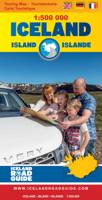
Wegenkaart - landkaart IJsland - Iceland Road Guide | Vegahandbokin

0
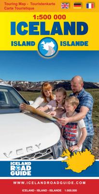
Toeristische kaart van IJsland inclusief handige app. High quality overall map of the country in the scale 1:500 000 with the latest official update about the road system.   Some unique features of this map are explanation of lcelandic place names, table of volcano activity, night & daylight scheme for each month, distance table and place name ...

Verkopers met dit product

Verkoper
Bezorging
Prijs
DeZwerver.nl logo
DeZwerver.nl
2,95
19,95

Anderen bekeken ook

Nieuw
Reisgids Iceland Road Guide | Vegahandbokin
Anders dan de titel doet vermoeden is deze gids een reisgids en geen wegenatlas. Met veel beschrijving, kaarten en foto's! A complete road and reference guide:  The Iceland Road Guide has been travelling for 40 years in the vehicles of Icelanders and foreigners alike, and has been steadily improved and updated with every new edition. Texts, figures, photos and maps will guide you on your travels around the country, adding to your memories when returning home.   Iceland Road Guide App is included:  In the new 2019 edition, Iceland Road Guide App is included. The App reflects the book and it''s with a map browser.   Easy - to - use atlas:  This edition now includes a detailed 24-page atlas, on a scale of 1:500 000. This is above all a road atlas, using information from the Icelandic Road Administration, it also shows places which offer accommodation, camping, swimming, natural baths, golfing and skiing, as well as museums, exhibitions, tourist information, other public centres and …
39,90
Wegenkaart - landkaart IJsland | 2025 | Ferdakort
Goede wegenkaart van IJsland met naast de topografische details ook symbolen voor alle belangrijke toeristische zaken als benzinepompen, campings, winkels etc. Gemaakt door de IJslandse topografische dienst.   Overall map of Iceland – Place-name index and road distances This is a high quality, overall map of the country with contour shading. This map includes the latest information about Iceland´s road system and road numbers, as well as tourist-service information such as filling stations, accommodation, swimming pools, museums, golf courses, etc. Included with the map is a separate place-name index with over 3000 entries and a road-distance chart.
26,95
Wandelgids Walking and Trekking in Iceland - IJsland | Cicerone
Wandelgids met beschrijvingen, kaarten en praktische informatie zoals bussen, overnachten, etc. voor meerdaagse wandelroutes en dagwandeltochten op IJsland. A country of extraordinary beauty, Iceland’s incredible variety of volcanic and glacial landscapes makes it a unique destination for walking and trekking holidays. Its three national parks include the mighty Vatnajökull, largest national park in Europe.   The wide range of routes in this book introduce walkers and backpackers to this ‘Land of Ice and Fire’. There are 100 days of walking in this guidebook, stretching over 1722km, split between 49 day walks and 10 multi-stage treks. They climb mountains, cross glaciers, pass lakes and explore coastlines and geothermal areas, and range from easy nature trails to challenging treks. So, there is enough variation to satisfy all kinds of walkers. The routes are spread all around Iceland, grouped into twelve regions. Detailed information is given at the start of each route or trekking sta…
26,95
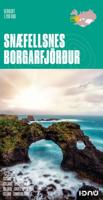
Wegenkaart - landkaart Snaefellsnes - Borgarfjordur (special map IJsland) | Ferdakort
Topografische overzichtskaart 1:200.000 Snæfellsnes / Borgarfjörður - special map in het westen van IJsland - Ferðakort ( vroeger Landmaelingar Íslands ) De wegenkaart laat de toeristisch interessante gebieden op het schiereiland Snaefellsnes en rond Borgarnes zien. Met verhard en onverhard wegennet hoogtelijnen, overnachtingsplekken, hutten voor wandelaars, campings, bezienswaardigheden etc. This high quality map shows the most popular tourist area in Iceland. The map includes photographs and information about the most visited places in the area. The map uses latest geographical data to produce an excellent up-to-date source of information on regional tourist attractions, roads, and services.
21,50
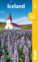
Reisgids Iceland - IJsland | Bradt Travel Guides
Voor vele landen net zo goed, zo niet beter dan de Planet. Beduidend soberder uitgevoerd, maar ook met veel informatie voor backpackers en met veel kaartmateriaal. Een aanrader! This new, thoroughly updated fifth edition of Bradt’s award-winning Iceland guide remains the most in-depth guide available to one of the few countries in the world that has no mosquitoes, no ants, no Starbucks and no MacDonalds. Featuring honest, practical information from an author who has repeatedly visited the country over twenty years and is familiar with its language, history and culture, Bradt’s Iceland has won the Lowell Thomas Award (the highest travel writing award available in the United States) and provides more context for individual places than any other guidebook, plus frank, investigative hotel and restaurant reviews that hide nothing.   This latest edition covers everything you would expect, from the Northern Lights to snow mobiling, dog sledding, visiting West Fjords, Iceland’s remotest co…
24,95
Nieuw
Wegenkaart - landkaart Iceland - IJsland | Marco Polo
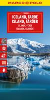
Duidelijke wegenkaart van Marco Polo: alle wegen, zowel de verharde als belangrijke onverharde wegen zijn weergegeven.  Mooie toeristisch interessante wegen die de moeite waard zijn, zijn groen gearceerd. Veel toeristische informatie is toegevoegd zoals de nationale parken, campings, kastelen en vliegvelden. Afstanden tussen belangrijke steden en benzinestations staan ook op de kaart. Een plaatsnamenregister ontbreekt niet.   ---   This Marco Polo map features really easy to read cartography. Topography is highlighted with relief shading and loads of spot heights and the road network is clearly shown with roads ranging from motorways all the way through to minor secondary roads. The map also clearly indicates airports, places of interest, scenic/tourist routes, view points etc.   The map includes a booklet attached to the cover that contains some useful information and a very extensive index that covers locations, places of interest and geographical features. Also included are a dista…
14,95
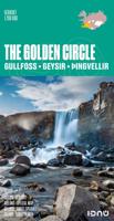
Wegenkaart - landkaart The golden Circle - Zuidwest IJsland | Ferdakort
Hele goede wegenkaart met veel topografische details, aangepast aan de toerist / reiziger met symbolen voor allerhande bezienswaardigheden en praktische zaken als campings en benzinepompen. Quality map of the most popular tourist route in South Iceland, Gullfoss - Geysir - Þingvellir, with pictures and information of the highlights of the tour like the Blue lagoon. The map contains the latest information about Iceland's road system, including road distances and road numbers, as well as important travel-service information.
21,50
Reisgids Explore IJsland - Iceland | Insight Guides
Insight Guides Explore is an illustrated, practical pocket-sized travel guide to Iceland with ready-made cycling, walking and driving itineraries for different interests and themes, backed up by maps and all the practical information you will need for your trip. The easy-to-follow routes will save you time, and help you plan and enhance your visit. This Iceland guide book has been fully updated post-COVID-19.   In our Iceland travel guide you will find: 16 READY-MADE ITINERARIES TO CHOOSE FROMEach detailed itinerary guides you step-by-step and features all the best places to visit en route, including where to eat and drink along the way. With this guide book to Iceland you will enjoy 16 best routes around Iceland, from a Reykjavik Bike Tour to the East Fjords and the Kjoelur Route, without having to plan them yourself. INVALUABLE MAPSEach Best Route of this Iceland travel guide is accompanied by a detailed full-colour map, while the larger pull-out map provides an essential overview o…
13,95
Accommodatiegids Namibia Self-Drive Guide | Tracks4Africa
So, what is so special about the Tracks4Africa guide books? These are not guides written by armchair travellers or the personal experience of one person, but the combined experiences of a whole community of travellers. The T4A community travel far and wide – not by luxury bus or safari vehicle but on their own wheels. Sometimes they travel in groups and sometimes as lone rangers, but they always travel by motorbike, sedan or 4WD, therefore this guide is specifically aimed at self-drive travellers.   If you are a self-drive tourist, there are five things that you need to know when you are on the road: 1. Where to sleep. 2. Where to get fuel. 3. What to see and do. 4. Where to buy supplies. 5. Where to go in case of an emergency.   If you have the Tracks4Africa Self-Drive Guide as your travel companion, the answers to all these and many more questions will be at hand. If you are well prepared and well informed, you can really enjoy the unspoilt beauty of Africa! The Tracks4Afr…
52,50
Reisgids Mini Rough Guide Iceland | Rough Guides
Een kleinere versie in zakformaat van de grotere versies van de Rough Guides. Als altijd weer vol met goede informatie over cultuur en praktische zaken. Achterin kleine plattegronden. Compact, concise and packed full of essential information about where to go and what to do, this is an ideal on-the-move guide for exploring Iceland. From top tourist attractions like Blue Lagoon, whale watching, Geysir, Reykjavik to hidden gems, plan your perfect trip with this practical, all-in-one travel guide. Features of this travel guide to Iceland - Inspirational itineraries: discover the best destinations, sights and excursions, highlighted with stunning photography - Historical and cultural insights: delve into the country's rich history and culture, and learn all about its people, art and traditions - Practical full-colour map: with every major sight and listing highlighted, the full-colour maps make on-the-ground navigation easy - Key tips and essential information: from transport to tipping, …
12,50

Klanten-reviews van Wegenkaart - landkaart IJsland - Iceland Road Guide | Vegahandbokin

Er zijn nog geen beoordelingen voor dit productBen jij de eerste die een review plaatst?

Meer over Wegenkaart - landkaart IJsland - Iceland Road Guide | Vegahandbokin

Productomschrijving

Toeristische kaart van IJsland inclusief handige app.

High quality overall map of the country in the scale 1:500 000 with the latest official update about the road system.   Some unique features of this map are explanation of lcelandic place names, table of volcano activity, night & daylight scheme for each month, distance table and place name index.   How to drive in Iceland. Some facts about Iceland. Information and photos of 34 tourist attractions along with important tourist information such as accommodations, swimming pools, natural baths, museums, golf courses, filling stations etc.


Verken gerelateerde categorieën

Webshop.nl maakt gebruik van cookies. Ga je verder op onze website, ga dan akkoord met het plaatsen van cookies en de verwerking van deze data door ons en vermelde partners.