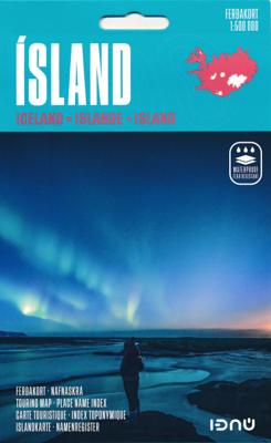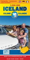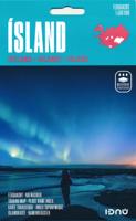
Wegenkaart - landkaart IJsland | 2025 | Ferdakort

0
Goede wegenkaart van IJsland met naast de topografische details ook symbolen voor alle belangrijke toeristische zaken als benzinepompen, campings, winkels etc. Gemaakt door de IJslandse topografische dienst.   Overall map of Iceland – Place-name index and road distances This is a high quality, overall map of the country with contour shading. This ...

Verkopers met dit product

Verkoper
Bezorging
Prijs
DeZwerver.nl logo
DeZwerver.nl
2,95
26,95

Anderen bekeken ook

Wegenkaart - landkaart IJsland - Iceland Road Guide | Vegahandbokin
Toeristische kaart van IJsland inclusief handige app. High quality overall map of the country in the scale 1:500 000 with the latest official update about the road system.   Some unique features of this map are explanation of lcelandic place names, table of volcano activity, night & daylight scheme for each month, distance table and place name index.   How to drive in Iceland. Some facts about Iceland. Information and photos of 34 tourist attractions along with important tourist information such as accommodations, swimming pools, natural baths, museums, golf courses, filling stations etc.  
19,95
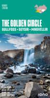
Wegenkaart - landkaart The golden Circle - Zuidwest IJsland | Ferdakort
Hele goede wegenkaart met veel topografische details, aangepast aan de toerist / reiziger met symbolen voor allerhande bezienswaardigheden en praktische zaken als campings en benzinepompen. Quality map of the most popular tourist route in South Iceland, Gullfoss - Geysir - Þingvellir, with pictures and information of the highlights of the tour like the Blue lagoon. The map contains the latest information about Iceland's road system, including road distances and road numbers, as well as important travel-service information.
21,50
Nieuw
Wegenkaart - landkaart 801 Malta | Michelin
Edition updated in 2025), Malta is an archipelago in the central Mediterranean between Sicily and the North African coast. It's a nation known for historic sites related to a succession of rulers including the Romans, Moors, Knights of Saint John, French and British. It has numerous fortresses, megalithic temples and the al Saflieni Hypogeum, a subterranean complex of halls and burial chambers dating to circa 4000 B.C. MICHELIN National Map Malta will give you an overall picture of your journey thanks to its clear and accurate mapping scale 1:50,000. Our map will help you easily plan your safe and enjoyable journey in Malta thanks to a comprehensive key, a complete name index as well a clever time & distance chart. Includes a City map of Valletta. Our National Map Series will help you easily plan your safe and enjoyable journey thanks to a comprehensive key, a complete name index as well a clever time & distance chart. Michelin's driving information will help you navigate safely in al…
11,95
Nieuw
Wegenatlas IJsland met stadsplattegronden | Ferdakort
Super handige kleine wegenatlas van IJsland (schaal 1:500.000) met vooral een enorme hoeveelheid plattegronden van steden en dorpen, enkele themakaarten en een groot register. De kaarten zijn uitstekend leesbaar en de atlas in in een mooie ringband uitgevoerd.  Road Atlas of Iceland at 1:500,000 from Ferðakort, published in a handy 15x25cm spiral-bound format, with an index of over 3,000 entries, a comprehensive distance table, 46 street plans including Reykjavik and several thematic map sincluding cultural heritage and geology.   The whole of Iceland is covered at 1:500,000 with the road network distinguishing between paved and gravel roads, and showing which small local roads are maintained by the country’s government. Fords, locations of petrol stations, driving distances and car ferry routes are marked. National parks and other protected areas are highlighted and symbols mark locations of various places of interest: different types of tourist accommodations including campsites, re…
30,95
Nieuw
Wegenkaart - landkaart 770 Vietnam - Laos - Cambodja | Michelin
Zoals je van Michelin mag verwachten is deze kaart zeer overzichtelijk en heeft een duidelijk helder kaartbeeld. De kaart geeft uitgebreide toeristische informatie weer. De perfecte overzichtskaart!   This Vietnam - Laos - Cambodia map from Michelin is part of their red national map series. These are perfect for route planning as well as getting around by car once you're there. They clearly mark out major roads and also show many of the more important minor roads. A street plan of central Lima that highlights the city's mai attractions is included.   The map's simple folding design with durable paper cover, allows it to be read like a book and easily folded back together. Road numbers and intermediate distances are clearly displayed with the more scenic routes highlighted in green.   The map also features:   Political boundaries Regional and National Parks Important sights (points of interest, historic sites, etc.) Driving Times and Distances Road Safety Information A legend in multip…
12,95
Nieuw
Wegenkaart - landkaart 763 Peru | Michelin
Zoals je van Michelin mag verwachten is deze kaart zeer overzichtelijk en heeft een duidelijk helder kaartbeeld. De kaart geeft uitgebreide toeristische informatie weer. De perfecte overzichtskaart! (Edition updated in 2022), MICHELIN National Map Peru will give you an overall picture of your journey thanks to its clear and accurate mapping scale 1/1,500,000. Our National Map Series will help you easily plan your safe and enjoyable journey thanks to a comprehensive key, a complete name index as well a clever time & distance chart. Michelin's driving information will help you navigate safely in all circumstances. In addition, some MICHELIN National Maps are cross-referenced with the MICHELIN Green Guide highlighting destinations worth stopping for! With MICHELIN National Maps, find more than just your way! MICHELIN NATIONAL MAPS feature: * Up-to-date mapping * A scale adapted to the size of the country * A clear and comprehensive key * Distance and time chart * Place name index * Drivi…
12,95
Nieuw
Reisgids Iceland Road Guide | Vegahandbokin
Anders dan de titel doet vermoeden is deze gids een reisgids en geen wegenatlas. Met veel beschrijving, kaarten en foto's! A complete road and reference guide:  The Iceland Road Guide has been travelling for 40 years in the vehicles of Icelanders and foreigners alike, and has been steadily improved and updated with every new edition. Texts, figures, photos and maps will guide you on your travels around the country, adding to your memories when returning home.   Iceland Road Guide App is included:  In the new 2019 edition, Iceland Road Guide App is included. The App reflects the book and it''s with a map browser.   Easy - to - use atlas:  This edition now includes a detailed 24-page atlas, on a scale of 1:500 000. This is above all a road atlas, using information from the Icelandic Road Administration, it also shows places which offer accommodation, camping, swimming, natural baths, golfing and skiing, as well as museums, exhibitions, tourist information, other public centres and …
39,90
Nieuw
Wegenkaart - landkaart 3302 Adventure Map Iceland - IJsland | National Geographic
Wegenkaart van IJsland met vermelding van veel bezienswaardigheden, nationale parken en attrakties. Watervast en scheurvast. Juist door deze vermeldingen onderscheidt de kaart zich van andere wegenkaarten. National Geographic's Iceland Adventure Map is designed to meet the unique needs of adventure travelers—detailed, durable, and accurate. Iceland includes the locations of thousands of cities and towns with an index for easily locating them, plus a clearly marked road network complete with distances and designations for expressways, motorways, and more. Transportation within and beyond the country is made easier with the locations of airports, airfields, railroads, ferry routes, and lighthouses. What sets National Geographic Adventure Maps apart from traditional road maps are the hundreds of points of interest that highlight the diverse and unique destinations within Iceland. Outdoor activities abound on the island and activity symbols note popular locations to ski, golf, camp, fish,…
17,50
Nieuw
Wegenkaart - landkaart 738 Roemenië - Roemenie | Michelin
Zoals je van Michelin mag verwachten is deze kaart zeer overzichtelijk en heeft een duidelijk helder kaartbeeld. De kaart geeft uitgebreid toeristische informatie weer. Met register, afstanden en reistijden. Wegen worden naar verschillende klasse ingedeeld en - mooi van Michelin - de interessante mooie routes worden gemarkeerd met een groene streep.    Hindernissen voor automobilisten met caravans zijn gemarkeerd: steile hellingen, bergpassen of een anderzins moeilijke route. Bezienswaardigheden als een kasteel, religieus gebouw, ruine of grot is door een symbool goed te vinden.   The Michelin national road map of Romania at 1:750,000 scale is best suited to trip & route planning. The map gives comprehensive coverage of national road networks showing major motorways, dual carriageways, national & regional main roads and some smaller local roads. Unsurfaced roads and tracks and some major footpaths are also shown. The map shows useful motoring information for motorways and major roads …
11,95
Nieuw
Wegenkaart - landkaart - Fietskaart Clare (Ierland) | Xploreit Maps
Mooie geplastificeerde en scheurvaste kaart van de County Clare met index. This Xploreit map is an essential companion for your next trip to County Clare. Whatever your location in the county, a quick scan of the map will reveal all the local attractions including the best drives, cycle routes and walks in the area.  It is fully revised and now includes the Clare section of the long-distance Euro Velo Atlantic Cycle Route. From Loop Head, with its famous lighthouse, you can follow West Clare’s wild and rugged coast as it rises to the spectacular Cliffs of Moher and meets The Burren, the unique limestone pavement of the northern uplands. East Clare has numerous walking and sightseeing opportunities also, with Lough Derg and Slieve Bernagh as highlights. Convenient and informative, this touring map will help you discover ancient megalithic tombs, imposing castles, sparkling lakes, golden beaches and the many charming towns and villages dotted around ‘The Banner County’. Topography is sh…
23,50

Klanten-reviews van Wegenkaart - landkaart IJsland | 2025 | Ferdakort

Er zijn nog geen beoordelingen voor dit productBen jij de eerste die een review plaatst?

Meer over Wegenkaart - landkaart IJsland | 2025 | Ferdakort

Productomschrijving

Goede wegenkaart van IJsland met naast de topografische details ook symbolen voor alle belangrijke toeristische zaken als benzinepompen, campings, winkels etc. Gemaakt door de IJslandse topografische dienst.   Overall map of Iceland – Place-name index and road distances This is a high quality, overall map of the country with contour shading. This map includes the latest information about Iceland´s road system and road numbers, as well as tourist-service information such as filling stations, accommodation, swimming pools, museums, golf courses, etc. Included with the map is a separate place-name index with over 3000 entries and a road-distance chart.

Verken gerelateerde categorieën

Webshop.nl maakt gebruik van cookies. Ga je verder op onze website, ga dan akkoord met het plaatsen van cookies en de verwerking van deze data door ons en vermelde partners.