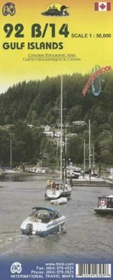
Wegenkaart - landkaart Gulf Islands & Nanaimo (Canada) | ITMB

0
This is completely new artwork and a new approach to ITMB’s mapping of the islands in the Gulf of Georgia, between the mainland and Vancouver Island. This double-sided map incorporates two NTS topographical maps into its artwork, with points of interest, hiking trails, boat launching spots, and B&Bs included. It also covers a wider area than previ...

Verkopers met dit product

Verkoper
Bezorging
Prijs
DeZwerver.nl logo
DeZwerver.nl
2,95
13,95

Anderen bekeken ook

Wegenkaart - landkaart Scotland - Schotland | ITMB
Anyone who has been in this business for a few years remembers Ordnance Survey and their brilliantly detailed artwork. They should also remember that OS guarded this artwork religiously. That all changed when the then head of government in the UK, one soon-forgotten Gordon Brown, decreed that commercial OS artwork had to be discontinued and artwork had to be made more freely available to users. I expected an outpouring of new artwork by private UK firms. It did not happen; in fact, the range of travel maps decreased dramatically. However, OS artwork is still an excellent source of mapping artwork. This is a wonderful double-sided, detailed map of Scotland. It is both extremely detailed and accurate. We have added symbols for parks, historic sites, battlefields, country hotels, and anything else that we think would interest visitors. In order to portray Scotland to best scale advantage, the only inset included with this map are those of outlying islands, such as the Shetlands. ITMB als…
13,95
Wegenkaart - landkaart Canada | ITMB
Een degelijke kaart met aanduidingen van o.a. nationale parken, vliegveld, benzinepomp, dirt-roads en kleine plattegrond van hoofdstad. Well, it’s about time, eh?!? ITMB, after only thirty years on the go, finally gets around to publishing a map of Canada. When we first started mapping, there was a pressing need for good maps of Central and South America, then of Africa, then etc etc and we never found time to concentrate on our own country until fairly recently. This map was prepared by Natural Resources Canada and is, as a result, as accurate a map as one could hope to have. We are very proud of it, and very pleased to be able to use such top-rate cartography. The map covers all of the land mass of Canada, from its southernmost point to the top of Ellesmere Island and from the Atlantic coast to the Pacific. It’s an excellent map, but I’m going to give one proviso. Canada is the second-largest country on the face of the planet and there is no way that a single-sided sheet can portray…
13,95
Wegenkaart - landkaart Cayman Islands (Kaaiman Eilanden) & Jamaica | ITMB
Een degelijke kaart met aanduidingen van o.a. nationale parken, vliegveld, benzinepomp, dirt-roads en kleine plattegrond van verschillende steden. Als overzichtskaart goed te gebruiken. De kaart is aan twee zijden bedrukt, de ene zijde omvat de Cayman Islands (schaal 1:37.500 en 1:70.000). Op de andere zijde staat de kaart van Jamaica (schaal 1:250.000) en plattegronden van onder andere Kingston. We are pleased to announce the latest new Caribbean map to our growing series. The Caymans, for there are three major islands and numerous little shoals, remains a British colony, like the British Virgin Islands, the Turks and Caicos, and Bermuda. Tourism is the number one industry of the Cayman Islands, with dozens of hotels dotting the beachfronts, especially north of George Town. There are numerous dive sites for viewing tropical fish and we have shown about a hundred on the map, as well as every side street and gas station. One interesting place to visit is Hell, which is a frozen lava er…
13,95
Wegenkaart - landkaart Hawaii - Honolulu + Hawaiian Islands | ITMB
This map represents a major change for ITMB. It is completely new artwork, using the latest satellite downloads, and is GPS compliant. The contouring is superb, the roads easy to read, and the rivers clearly shown. Naturally, all towns and touristic sites have been included and the map is fully indexed. New features for this edition, apart from the artwork itself, is the use of plastic paper and the inclusion of a detailed map of Honolulu from Waikiki to Pearl harbour. All the state's islands have been included, with Big Island and Oahu on one side, and Maui and the other islands on the reverse. This map is a huge improvement.
13,95
Wegenkaart - landkaart Venezuela | ITMB
Wegenkaart met tevens aanduidingen van Nationale Parken en reservaten. Stadsplattegrond van Caracas 1:25.000 en kaart 1:500.000 van omgeving Caracas. This is another one of our brand new maps. The artwork has been digitally-prepared, and this time printed double-sided to achieve a MUCH better scale. We have included a regional inset map of the Caracas area, and insets of the Roraima Mountains region, but the size of Venezuela is such that the rest of the paper consists solely of the country itself. The southern portion remains relatively unexplored and undeveloped, with few roads and only the occasional settlement, and the northern coastal region shows the road network very well. This is the first new map of Venezuela in many years. Legend Includes: Roads by classification, Railways, Rivers, Rapids, Lakes, Swamps, Points of Interest, Airports, Harbours, Archaeological Sites, Museums, Churches, Car Ferries, Oilfields, Heights in meters, Beaches, Hospitals, Hotels, Universities, Gas Sta…
13,95
Wegenkaart - landkaart Jersey - Guernsey - Sark - Alderney (Kanaaleilanden) | ITMB
Goede detailkaart van alle kanaaleilanden. Het is zo gedetailleerd dat zelfs straatnamen er op staan. De kaart is ook nog eens geplastificeerd en daarmee scheur- en watervast.  ITMB is pleased to re-introduce the Channel Islands map area after a lengthy hiatus of preparing new artwork. The first version of this part of Europe was licensed artwork by a local firm in Jersey, and upon running out of copies of the printed map, we opted to prepare fresh artwork of our own to continue this interesting corner of the continent to continue to be available. The islands, collectively known in English as the Channel Islands, are one of those anomalies that make Europe so attractive. They are part of Great Britain, but not part of the UK; hence, they are not part of the EU. They are self-governing entities ‘owned’ by the Queen in her role of being Duchess of Normandy. This is, of course, merely a hereditary situation, but the islands were the personal possessions of William the Conqueror in 1066, …
14,50
Wegenkaart - landkaart Atlantic Canada | ITMB
The first edition was published in 2000 using artwork under licence. This edition uses original ITMB artwork. Side 1 covers Nova Scotia, New Brunswick, and Prince Edward Island as well as Quebec s Magdalen Islands at a scale of 1:800,000. This side also includes the Top 10 Attractions of the three provinces. The second side is devoted to the Canadian Province of Newfoundland and Labrador, with the much smaller island portion being a half-page inset at 1:150,000 scale and the larger mainland portion being at 1:1,700,000. The northernmost tip of Quebec/Labrador belongs to Nunavut. St. Pierre et Miquelon, a French overseas possession just south of Newfoundland Island, is also included, as well as the map s only urban inset, historic St. John s, one of North America s oldest cities. The map also includes a listing of 9 Top Attractions. ITMB also publishes maps of the individual provinces, but the advantage of this regional map is that it combines together four interesting parts of Canada …
13,95
Wegenkaart - landkaart British Columbia South (Canada) | ITMB
Deze wegenkaart van British Columbia bestrijkt het gebied tussen Vancouver en Calgary, en is de perfecte toeristische kaart voor het verkennen van de regio Rocky Mountain. Alle wegen en spoorlijnen tussen de twee steden worden getoond, evenals campings en parken.   This map covers the area between Vancouver and Calgary, and is the perfect tourist map for exploring the Rocky Mountain region. All roads and rail lines between the two cities are shown, as well as camp grounds, parks. Legend Includes: Points of interests, airports, RV and camping sites, wilderness camps, picnic areas, waterfalls, tourist information, museums, golf courses, gas stations, outdoor activities and other information. Folded paper, road and travel map in color. Scale 1:900,000. Distinguishes roads ranging from divided highways to other roads-4WD/dry weather. Legend includes railways, trails, ferry routes, glaciers, points of interest, international airports, domestic airports, museums, mountain peaks, camping/rec…
13,95
Wegenkaart - landkaart Togo en Benin | ITMB
Een degelijke kaart met aanduidingen van o.a. nationale parken, vliegveld, benzinepomp, dirt-roads en kleine plattegrond van hoofdstad. Als overzichtskaart goed te gebruiken. Togo and Benin. These two countries have developed an incredible tourism industry and are very popular with visitors. They are larger than one expects; small in comparison to neighbouring Nigeria, but large as countries go. This map is brand new artwork at a much more attractive scale than the previous version; printed double-sided with much more information than was available to us when the original map was being developed. We’ve also added a few capsule comments about interesting facts related to the two countries, and large inset maps of Lome and Porto Novo. The map is divided into a north half and south half, as most attractions are in the south. As with all ITM maps, this one shows physical features, road conditions, and petrol stations in more isolated parts of both countries. Legend Includes: Roads by clas…
13,95
Wegenkaart - landkaart Guyana Suriname & French Guiana | ITMB
Een degelijke wegenkaart met aanduidingen van o.a. nationale parken, vliegveld, benzinepomp, dirt-roads en kleine plattegrond van hoofdstad. Als overzichtskaart goed te gebruiken.   The focus of this map is on Guyana, reflecting the changes coming about as a result of the growing assertiveness of Brasil, which has repaved the highway north from Manaus on the Amazon to the border with Guyana (at Bomfin). The Guyanese are improving the road to Georgetown, shortening travel times for goods in both directions by weeks. This new bridge also enables travelers to pass north and south much more easily. We have also re-done the inset map of Georgetown to bring it up to date. We have also changed the regional map on the reverse side, which used to cover all three Guianas countries, and replaced it by one concentrating on the other two countries. The most significant change we've made is to re-name Surinam to the country's preferred name of Suriname. As we made relatively few changes to the artw…
13,95

Klanten-reviews van Wegenkaart - landkaart Gulf Islands & Nanaimo (Canada) | ITMB

Er zijn nog geen beoordelingen voor dit productBen jij de eerste die een review plaatst?

Meer over Wegenkaart - landkaart Gulf Islands & Nanaimo (Canada) | ITMB

Productomschrijving

This is completely new artwork and a new approach to ITMB’s mapping of the islands in the Gulf of Georgia, between the mainland and Vancouver Island. This double-sided map incorporates two NTS topographical maps into its artwork, with points of interest, hiking trails, boat launching spots, and B&Bs included. It also covers a wider area than previously, so we have decided to call this map a 1st Edition; printed on durable ITM plastic paper.

Legend Includes:
Roads by classification, Ferry terminal, camping sites, museums, canoeing, fishing, tourist information sites, hiking roads, lighthouse, picnic areas, parks, and point of interest.

Verken gerelateerde categorieën

Webshop.nl maakt gebruik van cookies. Ga je verder op onze website, ga dan akkoord met het plaatsen van cookies en de verwerking van deze data door ons en vermelde partners.