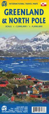
Wegenkaart - landkaart Groenland en Noordpool - Greenland & North Pole | ITMB

0
Overzichtskaart met alle noodzakelijke informatie. Goed kleurgebruik.   Legend Includes: Boundary, national park boundary, capitals, villages, world heritage site, airport, heliport, ferry and other information.   This map has just run out of copies. I know; how can anyone update Greenland? Well, we still have to update the program language to mod...

Verkopers met dit product

Verkoper
Bezorging
Prijs
DeZwerver.nl logo
DeZwerver.nl
2,95
13,95

Anderen bekeken ook

Wegenkaart - landkaart Groenland en Noordpool - Greenland & North Pole | ITMB
Overzichtskaart met alle noodzakelijke informatie. Goed kleurgebruik.   Legend Includes: Boundary, national park boundary, capitals, villages, world heritage site, airport, heliport, ferry and other information.   This map has just run out of copies. I know; how can anyone update Greenland? Well, we still have to update the program language to modern usage, and who knows, maybe we have to correct some errors. I don't know. Anyway, it's being updated, whoopie deal. It should be available again in January or February. The North Pole side was updated by Canada Map Office just before we first published this title, so needs no alteration. This title, by the way, has proven to be quite popular.  
13,95
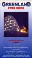
Wegenkaart - landkaart Greenland Explorer ( Groenland ) | Ocean Explorer Maps
Grove overzichtskaart van Groenland, die meer is bedoeld ter informatie over geschiedenis, ontdekkingsreizigers en bijvoorbeeld geologie dan ter oriëntatie. Folded visitor's map that features illustrated biographies of explorers and other notable people, historical time lines, details of the human population from the early Greenlandic cultures to the Norse settlers and Danish colonisation. Miscellaneous information on subjects such as the search for the North Pole, Greenland's role in WWII, geology and glaciology. Color photos and text on the plants and wildlife. Map scale 1:3,250,000. 2008 edition.
19,95
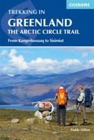
Wandelgids Groenland: Trekking in Greenland The Arctic Circle Trail | Cicerone
Uitstekende wandelgids van dit geweldige gebied. goed beschreven met veel praktische informatie om de route te kunnen lopen, inclusief redelijke kaarten. A comprehensive guidebook for hiking the Arctic Circle Trail, which crosses the largest ice-free area of West Greenland, 25-30 miles north of the Arctic Circle. At just over 100 miles long, and taking 7 to 10 days to complete, this splendid backpacking route runs from Kangerlussuaq to Sisimiut - both with airport access. At just over 100 miles long, and taking 7 to 10 days to complete, the Arctic Circle Trail crosses the largest ice-free patch of West Greenland. This splendid trekking route, lying 25-30 miles north of the Arctic Circle runs from Kangerlussuaq to Sisimiut (both of which have airport access).    The trail traverses remote, empty, silent and stunningly scenic arctic tundra, and is mostly gently graded with just a few short, steep and rocky slopes. However, the landscape between the two towns of Kangerlussuaq and Sisimiu…
23,95
Wegenkaart - landkaart Amazon & Brazil North | ITMB
We first mapped the Amazon River Basin for a rainforest protection conference many years ago, preparing what we thought was a pretty good rendition until we arrived at a conference full of experts who were able to add so much more data that we re-did the map before publishing it. We have updated it repeatedly as more information has come to light and are pleased to release this sixth version, which does something that we have wanted to do for some time - it adds a detailed map of the northern half of Brazil/Brasil to a river map that covers portions of seven different countries. The map is printed on revolutionary stone paper (tear-resistant, waterproof, friendly to the environment, and bio-degradable as well as extremely durable), and has two different cover pictures, so it can be marketed either as a map of Brasil or of the Amazon Basin - or both! It is also the only map of the river basin in print. As the world emerges from the era of Covid, this part of the world will once again d…
13,95
Wegenkaart - landkaart Sabah - Sarawak - Brunei | ITMB
Een degelijke kaart met aanduidingen van o.a. nationale parken, vliegveld, benzinepomp, dirt-roads en kleine plattegrond van hoofdstad. Als overzichtskaart goed te gebruiken. At last! This is the 'new' artwork covering northern Borneo in detail. We used to have two maps for this area, but have combined the artwork into one double-sided map covering the same area as formerly, but as one map, and with greater consistency in colouring and style. The base artwork has been updated and readability improved. This is a 'new' map, in that ITMB has never had a title exactly like this, but it is an 'update' in that we have had this artwork available before, which justifies the 2nd Edition label.   Legend Includes: Motorway, Major Highway,Airport,Car Ferry route and many more
13,95
Wegenkaart - landkaart Thailand | ITMB
Een degelijke wegenkaart met aanduidingen van o.a. nationale parken, vliegveld, benzinepomp, dirt-roads. Als overzichtskaart goed te gebruiken. What can I say about Thailand that hasn t already been said? This is our eighth edition of this ever-popular title. It has a new ISBN, as we are gradually replacing our former prefix, but there is modest change on this map. The rail line into Vientiane, Laos, is now shown, and the inset map of Chiang Mai improved, as are insets for Bangkok and Pattaya. The transit map of Bangkok on the back cover has been updated to show the new MTR line. We have done our best to portray this wonderful country accurately, attractively, and beneficially for end users. This is a very good map.
13,95
Wegenkaart - landkaart Grönland - Groenland | Reise Know-How Verlag
Tweetalige kaart (Engels en Duits). Door ingetekende lengte- en breedtegraden is het gebruik van GPS mogelijk. Met hoogtelijnen en uitgebreid wegennetwerk: daarnaast worden ook de afstanden tussen belangrijke plaatsen duidelijk leesbaar weergegeven. Het kleurgebruik is zodanig dat je een goede indruk krijgt van hoogteverschillen en soorten landschap. Natuurlijk staan de toeristische bezienswaardigheden duidelijk vermeld.   Gedrukt op water- en scheurvast papier! Polyart is een synthetisch product vrij van giftige stoffen dus duurzaam. Het papier gaat echt lang mee.   Topography is indicated by altitude colouring with numerous spot heights and names of mountain ranges and passes. Salt lakes, swamps, seasonal rivers and glacier are also shown. Detailed presentation of the road network includes minor roads and tracks and railways are also shown.   Internal administrative units are presented with their boundaries and names. National parks and other protected areas are highlighted. …
11,50
Wegenkaart - landkaart Korea, North & South | ITMB
Een degelijke kaart met aanduidingen van o.a. nationale parken, vliegveld, benzinepomp en dirt-roads. Als overzichtskaart goed te gebruiken. Met Noord Korea, schaal 1:830.000, aan een kant en op de andere zijde Zuid Korea, schaal 1:550.000. This is a brand new title for ITMB, combining North and South Korea into one double-sided map focusing on the entire Korean Peninsula rather than its political components. The peninsula is undergoing a lot of change at the moment, and no one knows the ultimate outcome. North Korea seems interested in opening itself somewhat to South Koreans, and even if steps to date seem like baby ones, tensions between north and south seem cordial at the moment. For the time being, this map replaces our separate map of North Korea, as changing conditions makes it too risky for us to re-do our North Korea title until its future path is clearer. However, although this map also shows South Korea in good detail, we will continue marketing our Seoul and South Korea ma…
13,95
Wegenkaart - landkaart Kazachstan & Usbekistan | ITMB
Een degelijke kaart met aanduidingen van o.a. nationale parken, vliegveld, benzinepomp, dirt-roads en kleine plattegrond van hoofdstad. Als overzichtskaart goed te gebruiken. Kazachstan 1:3.000.000 Usbekistan schaal 1:1.580.000 The Stans of the former Soviet empire are difficult to map because in the aftermath of liberation, most place names, which the Russian overlords had Russified were changed and not always to their original names or former spellings. Time has sorted out most nomenclature problems, and we hope that this version is letter perfect. In this updated edition for both countries, we have obviously tried our best to create a detailed and accurate map. The big difference between this edition and the previous one is the addition of Uzbekistan to the second side. The two countries seem to share certain common characteristics, as do the other three more easterly Stans, so we feel that combining similarities is better for end users than keeping separate sheets for each country…
13,95
Wegenkaart - landkaart Brisbane & Queensland | ITMB
Australia is a very large country. It is also very unevenly populated, with most of the people living close to the eastern coast. Brisbane is the second-largest city in Australia, and the preferred landing spot for most international flights. This makes Brisbane an attractive point of entry to Australia for visitors. The city has several attractions, which are noted on the map, several transit lines, also noted, and an interesting ferry boat system along the Brisbane River. The city is also the capital of Queensland, which occupies the north-east quarter of the continent and fills the second side of the map. Our map of the state stretches from the northern tip of Cape York to beyond the southern boundary of the state to just south of Sydney, in New South Wales. An inset map of central Sydney is included, but the strength of the map is the fact that Queensland is covered in excellent detail. ITMB also has a separate map of Sydney.   Legend Includes: Roads by classification, Rivers and …
13,95

Klanten-reviews van Wegenkaart - landkaart Groenland en Noordpool - Greenland & North Pole | ITMB

Er zijn nog geen beoordelingen voor dit productBen jij de eerste die een review plaatst?

Meer over Wegenkaart - landkaart Groenland en Noordpool - Greenland & North Pole | ITMB

Productomschrijving

Overzichtskaart met alle noodzakelijke informatie. Goed kleurgebruik.

  Legend Includes: Boundary, national park boundary, capitals, villages, world heritage site, airport, heliport, ferry and other information.   This map has just run out of copies. I know; how can anyone update Greenland? Well, we still have to update the program language to modern usage, and who knows, maybe we have to correct some errors. I don't know. Anyway, it's being updated, whoopie deal. It should be available again in January or February. The North Pole side was updated by Canada Map Office just before we first published this title, so needs no alteration. This title, by the way, has proven to be quite popular.  

Productinformatie

    Verken gerelateerde categorieën

    Webshop.nl maakt gebruik van cookies. Ga je verder op onze website, ga dan akkoord met het plaatsen van cookies en de verwerking van deze data door ons en vermelde partners.