Wegenkaart - landkaart Greenland Explorer ( Groenland ) | Ocean Explorer Maps

0
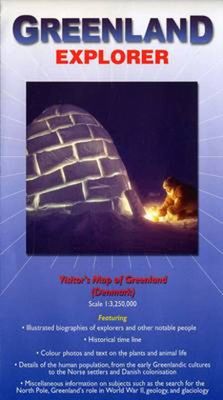
Grove overzichtskaart van Groenland, die meer is bedoeld ter informatie over geschiedenis, ontdekkingsreizigers en bijvoorbeeld geologie dan ter oriëntatie. Folded visitor's map that features illustrated biographies of explorers and other notable people, historical time lines, details of the human population from the early Greenlandic cultures to ...

Verkopers met dit product

Verkoper
Bezorging
Prijs
DeZwerver.nl logo
DeZwerver.nl
2,95
19,95

Anderen bekeken ook

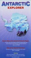
Wegenkaart - landkaart Antarctic Explorer | Ocean Explorer Maps
An excellent foldout map of Antarctica. On one side there is a map of the Antarctic continent, around which succinct biographies of Antarctic explorers from William Spiers Bruce to Edward Wilson are shown. On the other side there are many fine colour photographs of seals, penguins and other Antarctic wildlife, together with an inset box summarising the Antarctic Treaty and other information on Antarctic waters, Cape Horn, Tierra del Fuego, the Beagle Channel, the Falkland Islands and South Georgia. Aimed at visitors arriving by sea.
13,95
Wegenkaart - landkaart Spitsbergen ( Svalbard ) | Ocean Explorer Maps
The Spitsbergen Explorer is the ideal map to accompany cruising amongst these dramatic islands. The Svalbard Archipelago was a pioneer destination for Arctic tourism, and the Explorer contains essential details on the flora and fauna that have attracted visitors since the mid-19th century. Featuring: Illustrated biographies of 27 noted explorers.. Color photos and introductory text on plants & wildlife. Map showing protected areas. Diagram charting the rising & setting of the midnight sun.
19,95
Wegenkaart - landkaart Falkland Islands Explorer | Ocean Explorer Maps
Overzichtskaart van de Falkland Eilanden. - Met geillustreerde biografieën van ondekkers en andere notabelen. - Historische tijdslijn - Kleuren foto's en wildlife - Details van veel bezienswaardigheden - Algemene informatie over de eilanden. General map showing main roads and tracks, airports, rivers, lakes and settlements. Mountain peaks and highland ranges are identified and very subtle tinting shows the general relief. Twenty places of interest are highlighted and described in annotations around the map. Locations of tourist accommodation sites are marked. Latitude and longitude lines are at 30' intervals. On the reverse: information on wildlife, geography, history, economy and notable historical figures in the exploration of the region. A basic street plan of Stanley is included.  
19,95
Wegenkaart - landkaart South Georgia Explorer - Zuid-Georgië | Ocean Explorer Maps
Overzichtskaart van Zuid-Georgië en de Zuidelijke Sandwich Eilanden. - Met geillustreerde biografieën van ondekkers en andere notabelen. - Historische tijdslijn - Kleuren foto's en wildlife - Details van veel bezienswaardigheden - Algemene informatie over de eilanden. General map showing historic sites, former whaling stations & scientific stations. Mountain peaks and glaciers are identified and very subtle tinting shows the general relief. Twenty-five places of interest are highlighted and described in annotations around the map. Latitude and longitude lines are at 20' intervals. On the reverse: information on wildlife, history, economy and notable historical figures in the exploration of the region.  
19,95
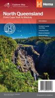
Wegenkaart - landkaart Explorer Map North Queensland | Hema Maps
Detailkaart van een deel van Australië. Zeer goed leesbaar, met naast de topografische details veel symbolen waarmee allerhande toeristische zaken worden aangeduid als campsites, nationale parken, attracties, wandelmogelijkheden etc. Covering Australia's beautiful North Queensland. There is alot of town map insets, tourist information, and photographs on the reverse side Touring map of the northern half of Queensland, with enlargements of popular areas, street plans, lists of facilities, etc. The main map extends south to well beyond the Flinders Highway between Townsville and Mount Isa, including Mackay on the coast. The map shows the road network, including minor roads and unsurfaced tracks, plus railways and local airfields/aerodromes. Designated Tourist Routes are highlighted and symbols mark places of interest (many annotated with brief description), historical sites, tourist resorts, youth hostels, etc. Topography is indicated by names of mountain ranges and peaks, as well as by…
17,50
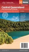
Wegenkaart - landkaart Explorer Map Central Queensland | Hema Maps
Detailkaart van een deel van Australië. Zeer goed leesbaar, met naast de topografische details veel symbolen waarmee allerhande toeristische zaken worden aangeduid als campsites, nationale parken, attracties, wandelmogelijkheden etc. A regional map of central Queensland (1:1,000,000) that stretches inland past Jericho and from Maryborough in the south to Mackay in the north. On the opposite side is tourist information on the region, as well as inset maps of Mackay, the Capricorn Coast, Gladstone, Bundaberg, Rockhampton, and the Gemfields. Accompanying each inset map are photos as well as background and travel information on the region that help for planning and touring.  
17,50
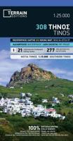
Wandelkaart - Wegenkaart - landkaart 308 Tinos | Terrain maps
Gedetailleerde wegenkaart en wandelkaart met alle kleine wegen, wandelpaden, hoogtelijnen en toeristische informatie aangegeven. Alle tekst is tweetalig in Engels en Grieks en de waterproof kaart is geschikt voor gebruik met GPS. This is a great map of Tinos because:   •    It is waterproof and rip-proof. You can fold and unfold it a thousand times, fold it in irregular ways, dunk it in the sea or leave it out in the rain. This map is indestructible!    •    It is the first time the island’s entire coastline is mapped. Cartography was done with TERRAIN’s specially equipped and staffed cartographic vessel. This means that you can locate all beaches of the island, down to the tiniest cove! In fact, the special features of every single beach are recorded: whether it is sandy or pebbled, whether it features natural tree shade, water, a beach bar or organized water sports, whether the seabed in front of the beach is sandy or rocky (so that you will know where to anchor).    •    It feature…
12,50
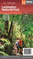
Wegenkaart - landkaart Lamington National Park | Hema Maps
Detailkaart van een deel van Australië. Zeer goed leesbaar, met naast de topografische details veel symbolen waarmee allerhande toeristische zaken worden aangeduid als campsites, nationale parken, attracties, wandelmogelijkheden etc. This map covers the whole area of the park and all the graded walking tracks that start from Binna Burra and O'Reilly's. It has been drawn at a good walking scale of 1:35 000 and shows all points of interest in the park. The walking tracks are shown in different colours on the map and have been broken up into short walks, half day walks and full day walks. A detailed description of each of the walks is shown on the back of the map. Detailed contoured map of the park in southern Queensland on the NSW border. Overprint highlights several hiking routes, from 0.5km to 24km long. Symbols show various facilities in the park, including accommodation, camping areas, viewpoints, places of interest, etc. Enlargements show two areas with main facilities and accommod…
17,50
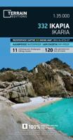
Wandelkaart - Wegenkaart - landkaart 332 Ikaria | Terrain maps
Gedetailleerde wegenkaart en wandelkaart met alle kleine wegen, wandelpaden, hoogtelijnen en toeristische informatie aangegeven. Alle tekst is tweetalig in Engels en Grieks en de waterproof kaart is geschikt voor gebruik met GPS. THIS IS THE BEST MAP OF IKARIA BECAUSE: • It is the only map of Ikaria made with data collected 100% through field survey. • It comes in a more detailed scale than other map in the market. • For the first time, the entire trail network of Ikaria is shown with absolute accuracy. All trails have been measured in kilometers, so you can estimate the duration of your hike. On the back side you ‘ll find detailed descriptions of 11 of the best hikes in Ikaria. These are distinctly labeled on the map, so you can easily locate them. • It features the most complete road network, with scenic routes marked in green. • It is printed on Polyart plastic “paper”, making it totally waterproof and rip-proof. You can fold it and unfold it a hundred times, fold it in irregular w…
12,50
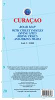
Wegenkaart - landkaart Curacao | Kasprowski Maps
Bijzonder gedetailleerde kaart (1:55000) van alleen het eiland Curacao. Zowel de wegen als ook de wandelpaden staan er op vermeld. Stranden, interessante plekken en bovendien de meeste duikplakken staan met diepte helder weergegeven op de kaart. Met stadsplattegrond van Willemstad. The most up-to-date and only complete road map of Curaçao (Scale 1 : 55 000), as well as the entire Willemstad urban area on the reverse, spanning from the international airport to Spanse (Scale 1 : 18 500). Insets of the Willemstad center (Scale 1 : 8 000), Grote Berg (Scale 1 : 6 000), Tera Kora (Scale 1 : 6 000), Barber (Scale 1 : 6 000), and the island Klein Curaçao (Scale 1 : 55 000) are also included. All maps and insets come with thorough street indexes.   The map shows all the island's known roads and streets with their names, displays its many diving sites, and indicates an extensive set of biking routes and hiking trails..   The double-sided map is sold folded, measuring 4 7/8" x 8 7/8" ( 12.5 cm …
18,50

Klanten-reviews van Wegenkaart - landkaart Greenland Explorer ( Groenland ) | Ocean Explorer Maps

Er zijn nog geen beoordelingen voor dit productBen jij de eerste die een review plaatst?

Meer over Wegenkaart - landkaart Greenland Explorer ( Groenland ) | Ocean Explorer Maps

Productomschrijving

Grove overzichtskaart van Groenland, die meer is bedoeld ter informatie over geschiedenis, ontdekkingsreizigers en bijvoorbeeld geologie dan ter oriëntatie.

Folded visitor's map that features illustrated biographies of explorers and other notable people, historical time lines, details of the human population from the early Greenlandic cultures to the Norse settlers and Danish colonisation. Miscellaneous information on subjects such as the search for the North Pole, Greenland's role in WWII, geology and glaciology. Color photos and text on the plants and wildlife. Map scale 1:3,250,000. 2008 edition.

Verken gerelateerde categorieën

Webshop.nl maakt gebruik van cookies. Ga je verder op onze website, ga dan akkoord met het plaatsen van cookies en de verwerking van deze data door ons en vermelde partners.