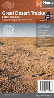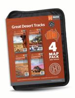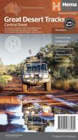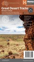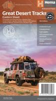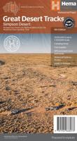
Wegenkaart - landkaart Great Desert Tracks Simpson Desert - Simpson woestijn | Hema Maps

0
Detailkaart van een deel van Australië. Zeer goed leesbaar, met naast de topografische details veel symbolen waarmee allerhande toeristische zaken worden aangeduid als campsites, nationale parken, attracties, wandelmogelijkheden etc. Hema's Great Desert Tracks maps are essential for anyone travelling in the Australian outback. The mapping feature...

Verkopers met dit product

Webshop
Bezorging
Prijs
DeZwerver.nl logo
DeZwerver.nl
2,95
17,50

Anderen bekeken ook

Nieuw
Wegenkaart - landkaart 3021 Adventure Map Malaysia Maleisië | National Geographic
Wegenkaart van Maleisië met vermelding van veel bezienswaardigheden, nationale parken en attrakties. Watervast en scheurvast. National Geographic's Malaysia Adventure Map is designed to meet the unique needs of adventure travelers with its durability and accurate information. Each folded map provides global travelers with the perfect combination of detail and perspective, highlighting the area’s terrain and best locations for adventure activities like snorkeling, surfing, fishing, and more. Adventure Maps include hundreds of points of interest that highlight diverse and unique destinations within the country.   The map includes the locations of thousands of cities and towns with a user-friendly index, plus a clearly marked road network complete with distances and designations for major highways, main roads, and tracks and trails for those seeking to explore more remote regions.   Key Features: Waterproof and tear-resistant Detailed interpretive information and local travel tips Det…
17,50
Nieuw
Wegenkaart - landkaart 3323 Adventure Map Slovakia - Slowakije | National Geographic
Wegenkaart van Slowakije met vermelding van veel bezienswaardigheden, nationale parken en attrakties. Watervast en scheurvast. Juist door deze vermeldingen onderscheidt de kaart zich van andere wegenkaarten. National Geographic's Slovakia Adventure Map is designed to meet the unique needs of adventure travelers with its durability and accurate information. Each folded map provides global travelers with the perfect combination of detail and perspective, highlighting the area’s terrain and best locations for adventure activities like snorkeling, surfing, fishing, and more. Adventure Maps include hundreds of points of interest that highlight diverse and unique destinations within the country.   The map includes the locations of thousands of cities and towns with a user-friendly index, plus a clearly marked road network complete with distances and designations for major highways, main roads, and tracks and trails for those seeking to explore more remote regions.   Key Features: Waterproo…
17,50
Nieuw
Wegenkaart - landkaart 3205 Adventure Map Kenya - Kenia | National Geographic
Wegenkaart van Kenia met vermelding van veel bezienswaardigheden, nationale parken en attrakties. Watervast en scheurvast. Juist door deze vermeldingen onderscheidt de kaart zich van andere wegenkaarten.   National Geographic's Kenya Adventure Map is designed to meet the unique needs of adventure travelers with its durability and accurate information. This folded map provides global travelers with the perfect combination of detail and perspective, highlighting hundreds of points of interest and the diverse and unique destinations within the country. The map includes the locations of cities and towns with a user-friendly index, plus a clearly marked road network complete with distances and designations for major highways, main roads, and tracks and trails for those seeking to explore more remote regions.   The front side of the Kenya map details the southern region of the country, from The Indian Ocean to the east, to the bordering country of Tanzania to the southwest. The reverse sid…
17,50
Wegenkaart - landkaart 173 Great Lakes - Grote Meren USA | Michelin
Bijzonder goed leesbare kaart van een deel van de Verenigde Staten - USA, in dit geval het gebied van de staten rond de Great Lakes - Grote Meren.   Op deze kaart zijn de Nationale Parken goed zichtbaar ingetekend met een heldere achtergrondkleur. Wegnummers, register, afstanden tussen steden en bijvoorbeeld de beroemde groene wegenaanduiding van Michelin ontbreken niet.    Met stadsplattegronden (alleen het centrum) van Buffalo/Niagar Falls, Chicago, Cleveland, Detroit, Milwaukee en Toronto.   Michelin USA Great Lakes Map 173 (scale: 1:1,267,000)—part of Michelin's brand-new US regional map series with bright green covers—zooms in close for comprehensive coverage of Wisconsin and Michigan, as well as areas of the other states surrounding the Great Lakes (Minnesota, Iowa, Illinois, Indiana, Ohio, Pennsylvania) and southern Ontario in Canada. It contains city maps for easy driving in Buffalo, Chicago, Cleveland, Detroit, Indianapolis, Milwaukee, Minneapolis/St. Paul, Pittsburgh and Tor…
10,95
Wegenkaart - landkaart The Cotswolds | Philip's Maps
A new edition of this double-sided map of the Cotswolds clearly featuring places of tourist and historic interest in an easy-to-read style of mapping, alongside six handy town centre plans. This leisure and tourist map of the Cotswolds gives detailed coverage of the area's road network at a scale of approximately 2 miles to 1 inch (1:125,000). The coverage stretches from Abingdon in the east to Gloucester in the west, and from Swindon in the south to Great Malvern in the north. The map shows places of tourist and historic interest, including castles, camping and caravanning sites, country parks, galleries, gardens, golf courses, museums, nature trails, historic sites, sports venues, theatres and wildlife parks. An index to principal places of interest is also featured. With some of the most enchanting towns and cities in England in the area - all with extraordinary history and notable natural beauty - use the Philip's Leisure Map to explore and delight in the Cotswold magic. Includ…
11,50
Wegenkaart - landkaart Switzerland - Zwitserland | Marco Polo
Marco Polo Switzerland Map: the ideal map for your trip   Let the Marco Polo Switzerland Road Map guide you around the Switzerland. Discover quaint mountain villages, shimmering lakes, high peaks, stunning waterfalls and exquisite cities with this highly durable, detailed, touring map of Switzerland. It folds away easily and is always on standby to help when you're stuck. Perfect touring map - the scale is 1 : 275 000 ideal to help you tour the region by car or RV Easy to use - the superbly clear mapping in strong colors and easy to read text will help you navigate the country like a local   Durable, tear-resistant map - designed to withstand the rigors of the road, the map is printed on tear-resistant, water repellent and writeable paper Highlights included - major sights and key points of interest are marked on the map by numbered stars. Further information about these key sights can be downloaded via a QR code where you’ll find a brief description to help you pick the best places t…
14,95
Wegenkaart - landkaart National Park Pocket Map Snowdonia | Collins
Duidelijke pocket wandelkaart met belangrijke toeristische informatie, bezienswaardigheden, campeerplekken e.d.   Handy little full colour map and guide of Snowdonia National Park. Detailed mapping and visitor information to the National Park along with a selection of photographs. Map at a scale of 1:119 000 (1.2cm to 1km, 1.9 miles to 1 inch).   This small map with additional text and photographs gives a great overview of the Snowdonia National Park, and is the perfect companion for exploring this beautiful area of North Wales.   Clear, detailed mapping Key park, tourist and travel information Ideal for planning visits to the National Park Index to help locate and plan your trip Information on historic railways, stargazing, mountain biking and places of interest
7,95
Wegenkaart - landkaart Orkney Shetland | Philip's Maps
Whether it's the outstanding natural beauty, ancient sites or an activity-packed break calling you, the Philip's leisure and tourist map of Orkney and Shetland is all you need. Places of interest are clearly marked on the easy-to-read mapping - ideal for planning that all-important route.   This double-sided Philip's leisure and tourist map of Orkney and Shetland gives detailed coverage of the islands' road networks at an easy-to-read scale of approximately 2.5 miles to 1 inch. The Orkney Islands are featured on side one of the map, with the Shetland Islands shown on the reverse.   The maps show places of tourist and historic interest, including beaches, castles, camping sites, distilleries, galleries, gardens, golf courses, museums, nature trails, historic sites, sports and entertainment venues. From the ancient settlement of Orkney's Skara Brae and Scapa Flow to the Shetland Museum and Bobby's Bus Shelter, all the top places of interest are featured on each side of the map for Orkne…
11,50
Wegenkaart - landkaart Turkey - Turkije | Marco Polo
Duidelijke wegenkaart van Marco Polo: alle wegen, zowel de verharde als belangrijke onverharde wegen zijn weergegeven.  Mooie toeristisch interessante wegen die de moeite waard zijn, zijn groen gearceerd. Veel toeristische informatie is toegevoegd zoals de nationale parken, campings, kastelen en vliegvelden. Afstanden tussen belangrijke steden en benzinestations staan ook op de kaart. Een plaatsnamenregister ontbreekt niet.   Let the Marco Polo Türkiye / Turkey Road Map guide you around this stunning country.   From the Turquoise Riviera to the Fairy Chimneys of Cappadocia this highly durable, detailed touring map of Turkey will ensure you don’t miss a thing. It folds away easily and is always on standby to help when you're stuck.   Perfect touring map - the scale is 1 : 800 000 ideal to help you tour the country by car or campervan Easy to use - the superbly clear mapping in strong colours and easy to read text will help you navigate the country like a local Durable, tear-resi…
14,95
Nieuw
Wegenkaart - landkaart 175 Four Corners USA | Michelin
Bijzonder goed leesbare kaart van een deel van de Verenigde Staten - USA, in dit geval het gebied van de staten Arizona - Utah - Colorado - New Mexico, ook wel de Four Corners genoemd.  Op deze kaart zijn de Nationale Parken goed zichtbaar ingetekend met een heldere achtergrondkleur. Wegnummers, register, afstanden tussen steden en bijvoorbeeld de beroemde groene wegenaanduiding van Michelin ontbreken niet.  Met stadsplattegronden (alleen het centrum)  van Albuquerque, Colorado Springs, Denver, Phoenix, Salt Lake City en Tucson. Michelin USA Four Corners Map 175 (scale: 1:1,267,000)—part of Michelin's brand-new US regional map series with bright green covers—zooms in close for comprehensive coverage of Arizona, Colorado, New Mexico and Utah. It contains city maps for easy driving in Albuquerque, Colorado Springs, Denver, Phoenix, Salt Lake City and Tucson. Michelin star-rated sights and a selection of not-to-be-missed annual events and festivals serve as inspiration for future road tr…
10,95

Klanten-reviews van Wegenkaart - landkaart Great Desert Tracks Simpson Desert - Simpson woestijn | Hema Maps

Er zijn nog geen beoordelingen voor dit productBen jij de eerste die een review plaatst?

Meer over Wegenkaart - landkaart Great Desert Tracks Simpson Desert - Simpson woestijn | Hema Maps

Productomschrijving

Detailkaart van een deel van Australië. Zeer goed leesbaar, met naast de topografische details veel symbolen waarmee allerhande toeristische zaken worden aangeduid als campsites, nationale parken, attracties, wandelmogelijkheden etc.

Hema's Great Desert Tracks maps are essential for anyone travelling in the Australian outback. The mapping features roads and 4WD tracks field-checked by the Hema Map Patrol, Points of Interest for remote area travellers and touring information for learning more about the region and planning your journey.   Discover the Simpson Desert with detailed mapping, relevant points of interest and essential touring information for the journey. One side of the map covers the desert at a scale of 1:500,000, while the other is at 1:1,000,000 for planning purposes. Marked on the mapping are roads and 4WD tracks checked by the Hema Map Patrol, distance markers, topographical relief and touring points of interest including 24-hour fuel, camping areas and caravan parks, facilities, services and more. Also included is information on travelling the desert, what you need for the trip and relevant contact information.    Tracks include:  
  • Madigan Line
  • French Line
  • Rig Road
  • WAA Line
  • K1 Line
  • Warburton Track
  • Hay River Track
    Key Features
  • All maps field checked by the Hema Map Patrol
  • Printed on durable, waterproof paper
  • Shows free camping areas
  • Fuel supplies
  • GPS surveyed roads and tracks
  • Historical explorer routes
  • Points of Interest


Verken gerelateerde categorieën

Webshop.nl maakt gebruik van cookies. Ga je verder op onze website, ga dan akkoord met het plaatsen van cookies en de verwerking van deze data door ons en vermelde partners.