Wegenkaart - landkaart Great British Music Map | Strumpshaw, Tincleton & Giggleswick's Marvellous Maps

0
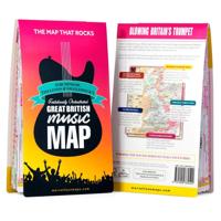
When it comes to music, Britain calls the tune on the world stage, playing second fiddle to nobody. This new and unique fold-out map celebrates Britain’s globe-straddling musical prowess, featuring over 2,000 festivals, live music venues, places celebrated in song and a symphony of tenuously tuneful trivia… plus a unique road trip through Britain’...

Verkopers met dit product

Verkoper
Bezorging
Prijs
DeZwerver.nl logo
DeZwerver.nl
2,95
21,95

Anderen bekeken ook

Wegenkaart - landkaart Great British Music Map | Strumpshaw, Tincleton & Giggleswick's Marvellous Maps
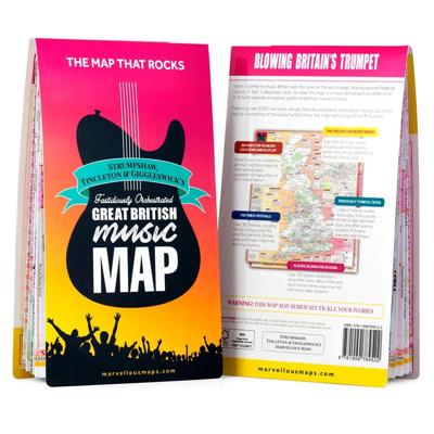
When it comes to music, Britain calls the tune on the world stage, playing second fiddle to nobody. This new and unique fold-out map celebrates Britain’s globe-straddling musical prowess, featuring over 2,000 festivals, live music venues, places celebrated in song and a symphony of tenuously tuneful trivia… plus a unique road trip through Britain’s top 50 music locations (and the perfect playlist to go with). It really blows Britain’s trumpet.    Folds out to 100 cm x 89 cm. Made in Britain using FSC-certified paper. Perfect for music lovers of every kind.   Music and maps may not be typical bedfellows, but at long last they’ve come together for a unique collaboration. If you’ve ever wondered where the best festivals are located, where your favourite pop video was filmed, which locations around Britain have inspired classic tunes... or if you simply fancy going on an epic music-themed road trip around Britain with the perfect playlist blaring from your stereo… this map is for you.  …
21,95
Wegenkaart - landkaart Explorer Map Nullarbor Plain - Eastern Map | Hema Maps
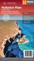
This map is part of Hema's new Nullarbor Plain Map Series (East and West) and covers Border Village to Port Pirie including the Eyre Peninsula.    Truly one of the worlds great adventure drives, Australia's semi-arid Nullarbor Plain stretches some 1,256 kilometres (781 miles) via the Eyre Highway and links the cities of Adelaide and Perth (or vice versa depending on your direction). The length of this journey is so large we needed to stretch it over two maps; East from Port Pirie to Border Village in South Australia and the Western sheet from Border Village to Kalgoorlie.    While all the key sites and facilities along the Eyre Highway are listed this map allows you to broaden your horizon and consider some of the other attractions off the Highway, including; the various Nullarbor caves, iconic beaches across the Great Australian Bight and thousands of kilometres of 4WD tracks (including Googs Track), all field-checked by the Hema Map Patrol for superior accuracy.   This map combines …
17,50
Wegenkaart - landkaart Explorer Map Nullarbor Plain - Western Map | Hema Maps
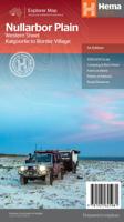
This map is part of Hema's new Nullarbor Plain Map Series and covers the area from Kalgoorlie to Border Village and its surrounds.   Truly one of the worlds great adventure drives, Australia's semi-arid Nullarbor Plain stretches some 1,256 kilometres (781 miles) via the Eyre Highway and links the cities of Adelaide and Perth (or vice versa depending on your direction). The length of this journey is so large we needed to stretch it over two maps; East from Port Pirie to Border Village in South Australia and the Western sheet from Border Village to Kalgoorlie.    While all the key sites and facilities along the Eyre Highway are listed this map allows you to broaden your horizon and consider some of the other attractions off the Highway, including; the various Nullarbor caves, iconic beaches across the Great Australian Bight and thousands of kilometres of 4WD tracks (including Old Coach Road (by permit)), all field-checked by the Hema Map Patrol for superior accuracy.   This map combines…
17,50
Wegenkaart - landkaart Great Desert Tracks 4 Map Pack | Hema Maps
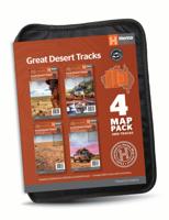
Hema’s Great Desert Tracks Map Pack The Great Desert Tracks Map Pack presents Hema's iconic Great Desert Tracks series in a soft and durable map wallet. Explore the arid centre with these comprehensive maps that traverse Australia's desert regions — each map waterproof, tear proof and field-checked by the Hema Map Patrol to ensure the accuracy and detail necessary for desert travel. With complete coverage of the outback region of Australia's centre, the Great Desert Tracks Map Pack is the perfect navigation guide for every desert track and journey throughout Australia.   Included in each map pack:   • Great Desert Tracks Central Sheet     • Great Desert Tracks Eastern Sheet     • Great Desert Tracks Western Sheet     • Great Desert Tracks Simpson Desert     • Map Wallet     Great Desert Tracks Eastern Sheet: Oodnadatta Track, Birdsville Track, Simpson Desert, Strzelecki Track, Corner Country, Broken Hill, Lake Eyre, Plenty Highway, Sandover Highway, Channel Country, Hay …
59,95
Wegenkaart - landkaart 10 Road Map Britain Britain - Groot Brittannië | AA Publishing
Goede dubbelzijdige overzichtskaart met plaatsnamenregister  van heel Engeland met Schotland erbij. Britain’s clearest mapping from the experts at the AA, in a handy foldable map. Fully updated, this map of Britain combines clear design and an easy-to-read scale with more road detail to ensure that you never lose your way. The map includes information on toll points, service areas, road numbers, motorways, dual carriageways and wide and narrow local roads. National Parks, and places of interest are also highlighted. Caravan and camping sites pinpointed on the mapping. City and town plans Easy-to-read place index name. Part of a range of 9 regional sheet maps plus 1 map covering the whole of Britain. Map Series - 1 West Country & Wales. 2 Central Southern England. 3 South East England. 4 East Anglia. 5 Midlands & Central England. 6 Wales. 7 Northern England. 8 North England & Scottish Borders. 9 Scotland. 10 Britain.    
10,95
Wegenkaart - landkaart 3325 Adventure Map United Kingdom - Verenigd Koninkrijk - Engeland | National Geographic
Wegenkaart van het Verenigd Koninkrijk met vermelding van veel bezienswaardigheden, nationale parken en attrakties. Watervast en scheurvast. Juist door deze vermeldingen onderscheidt de kaart zich van andere wegenkaarten. National Geographic's United Kingdom AdventureMapis designed to meet the needs of adventure travelers with its durability and detailed, accurate information. The map includes the locations of cities and towns with a user-friendly index, a clearly marked road network complete with distances and designations for roads/highways, plus secondary routes for those seeking to explore off the beaten path.    AdventureMaps differ from a traditional road map because of the specialty content that they include. Each map contains hundreds of diverse and unique recreational, ecological, cultural and historic destinations - outside of the major tourist hubs. National Geographic AdventureMaps are the perfect companion to a guidebook, yet far easier to pack!    The Great Britain Adven…
17,50
Wegenkaart - landkaart 6 Road Map Britain Wales | AA Publishing
Goede dubbelzijdige wegenkaart met plaatsnamenindex van Wales Britain’s clearest mapping from the experts at the AA, in a handy foldable map. Fully updated, this map of Wales combines clear design and an easy-to-read scale with more road detail to ensure that you never lose your way. This map of Wales includes information on toll points, service areas, road numbers, motorways, dual carriageways and wide and narrow local roads. National Parks, and places of interest are also highlighted. Caravan and camping sites pinpointed on the mapping. City and town plans Easy-to-read place index name. Part of a range of 9 regional sheet maps plus 1 map covering the whole of Britain. Map Series - 1 West Country & Wales. 2 Central Southern England. 3 South East England. 4 East Anglia. 5 Midlands & Central England. 6 Wales. 7 Northern England. 8 North England & Scottish Borders. 9 Scotland. 10 Britain.  
10,95
Wegenkaart - landkaart 03 Southwest Alberta & Southeast British Columbia Map | Gem Trek Maps
Goede wegenkaart van Southwest Alberta en Southeast British Columbia met bezienswaardigheden, overnachtingsmogelijkheden en campings. Gem Trek’s Southwest Alberta and Southeast British Columbia Map is designed for visitors looking to explore the regions east and west of the Canadian Rockies, including the Kootenays of British Columbia, the Alberta foothills, and west-central Alberta. All the major highways are shown, as well as national and provincial parks and wilderness areas. The map also shows lesser-known back roads, and pinpoints the location of lodges, campgrounds and hot springs. Mileage charts on the front and back provide distances between major towns and cities.
13,95
Wegenkaart - landkaart 4 Road Map Britain East Anglia | AA Publishing
Goede dubbelzijdige wegenkaart met  plaatsnamenindex van East Anglia. Grof geschetst is het een rechthoek tussen Lincoln, Norwich, Ipswich en Luton Britain’s clearest mapping from the experts at the AA, in a handy foldable map. Fully updated, this map of East Anglia combines clear design and an easy-to-read scale with more road detail to ensure that you never lose your way. The map includes information on toll points, service areas, road numbers, motorways, dual carriageways and wide and narrow local roads. National Parks, and places of interest are also highlighted. Caravan and camping sites pinpointed on the mapping. City and town plans Easy-to-read place index name. Part of a range of 9 regional sheet maps plus 1 map covering the whole of Britain. Map Series - 1 West Country & Wales. 2 Central Southern England. 3 South East England. 4 East Anglia. 5 Midlands & Central England. 6 Wales. 7 Northern England. 8 North England & Scottish Borders. 9 Scotland. 10 Britain.  
10,95
Wegenkaart - landkaart 7 Road Map Britain Northern England | AA Publishing
Goede dubbelzijdige wegenkaart met plaatsnamenindex van noord Engeland. Grof geschetst is het een rechthoek tussen Penrith, Hartlepool, Lincoln en Chester. Britain’s clearest mapping from the experts at the AA, in a handy foldable map. Fully updated, this map of Northern England combines clear design and an easy-to-read scale with more road detail to ensure that you never lose your way. The map includes information on toll points, service areas, road numbers, motorways, dual carriageways and wide and narrow local roads. National Parks, and places of interest are also highlighted. Caravan and camping sites pinpointed on the mapping. City and town plans Easy-to-read place index name. Part of a range of 9 regional sheet maps plus 1 map covering the whole of Britain. Map Series - 1 West Country & Wales. 2 Central Southern England. 3 South East England. 4 East Anglia. 5 Midlands & Central England. 6 Wales. 7 Northern England. 8 North England & Scottish Borders. 9 Scotland. 10 Britain.  
10,95

Klanten-reviews van Wegenkaart - landkaart Great British Music Map | Strumpshaw, Tincleton & Giggleswick's Marvellous Maps

Er zijn nog geen beoordelingen voor dit productBen jij de eerste die een review plaatst?

Meer over Wegenkaart - landkaart Great British Music Map | Strumpshaw, Tincleton & Giggleswick's Marvellous Maps

Productomschrijving

When it comes to music, Britain calls the tune on the world stage, playing second fiddle to nobody. This new and unique fold-out map celebrates Britain’s globe-straddling musical prowess, featuring over 2,000 festivals, live music venues, places celebrated in song and a symphony of tenuously tuneful trivia… plus a unique road trip through Britain’s top 50 music locations (and the perfect playlist to go with). It really blows Britain’s trumpet.    Folds out to 100 cm x 89 cm. Made in Britain using FSC-certified paper. Perfect for music lovers of every kind.   Music and maps may not be typical bedfellows, but at long last they’ve come together for a unique collaboration. If you’ve ever wondered where the best festivals are located, where your favourite pop video was filmed, which locations around Britain have inspired classic tunes... or if you simply fancy going on an epic music-themed road trip around Britain with the perfect playlist blaring from your stereo… this map is for you.   The Fastidiously Orchestrated Great British Music Map features:  
  • Over 350 festivals, including the big, famous ones, the small but perfectly formed ones, and those in the most stunning locations
  • Over 700 live music venues, including over 400 essential grass-roots venues identified by the Music Venue Trust
  • Over 700 places celebrated in song titles / lyrics, album titles and band / artist names, plus cover art and music video locations
  • Trivia! Loads of famous studios, riotous gigs, funny quotes, shrines to dear departed stars, and other glorious locations of musical anecdote and intrigue
  • Britain’s Top 50 music locations, a glorious road trip connecting them all and playlist suggestions bringing them to life in unique fashion (and plenty of space to add your own favourite tunes and route notes)


Productinformatie

    Verken gerelateerde categorieën

    Webshop.nl maakt gebruik van cookies. Ga je verder op onze website, ga dan akkoord met het plaatsen van cookies en de verwerking van deze data door ons en vermelde partners.