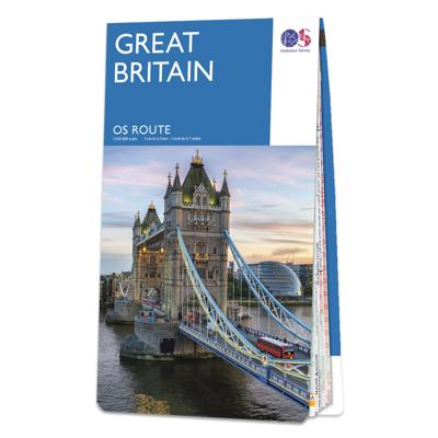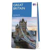
Wegenkaart - landkaart Great Britain OS route | Ordnance Survey

0
Tweezijdige overzichtskaart van heel Engeland en Schotland. Goed duildelijk leesbaar kaartbeeld met de doorgaande en grotere wegen. Ook Nationsle Parken staan er goed op. Ordnance Survey's double-sided OS Route Map - Route features clear, current mapping of motorways and road numbers as well as selected tourist information. Distances between citie...

Verkopers met dit product

Verkoper
Bezorging
Prijs
DeZwerver.nl logo
DeZwerver.nl
2,95
14,93

Anderen bekeken ook

Wegenkaart - landkaart Ancient Britain | Ordnance Survey
The Ordnance Survey Ancient Britain map is a comprehensive guide to the most important archaeological sites of early English, Welsh and Scottish history. Ordnance Survey's Ancient Britain map shows Neolithic, Bronze Age, Iron Age, Roman and early Medieval sites – against a backdrop of modern mapping. This extract shows some of the ancient sites of Wiltshire marked on the map. The secrets of Ancient Britain are to be revealed in a revised Historical map and guide from Ordnance Survey. Aimed at anyone with an interest in the early history of Britain – from schoolchildren through to archaeologists and tourists – the map helps bring the past to life. Information on the map includes ancient roads and place names – as well as comprehensive features and illustrations on many aspects of life in the period, including land use and settlement sites. Photographs, showing how many of the sites look today, are also used to give context. The map is created in conjunction with The National Monuments …
13,50
Wegenkaart - landkaart Roman Britain | Ordnance Survey
An informative map showing the location of the most important ancient monuments of Roman Britain. The map has been produced by Ordnance Survey in collaboration with the Ancient Monument Trusts of England, Scotland and Wales, so as to provide an authoritative map of the historical sights of Great Britain. It also contains valuable background details on life in Britain during this formative period. This Ordnance Survey Historical map and guide is a fascinating possession for the interested and enthusiastic historians of today.
12,95
Wegenkaart - landkaart 08 Discoverer Ballymoney | Ordnance Survey
Zeer gedetailleerde topografische kaart met een aantal toegevoegde toeristische symbolen voor bijv. Bezienswaardigheden en campings. Met hoogtelijnen, mooi kleurgebruik en ingetekende lange-afstands-wandelroutes.   OSNI has replaced the One-Inch maps with a completely new series at 1:50 000 scale. The series is numbered on an all-Ireland basis and Ordnance Survey of Northern Ireland is responsible for the design and publication of the sheets that cover Northern Ireland and adjoining parts of the Republic of Ireland. The layout incorporates a number of overlaps. This map is derived from the latest large scale material, supplemented by new aerial photographs and ground surveys. It is the country's most detailed small-scale map and as well as showing all the features that were on the One-Inch map.
19,50
Wandelkaart - Topografische kaart 181 OS Explorer Map Chiltern Hills North | Ordnance Survey
The essential map for outdoor activities in Chiltern Hills North. The OS Explorer Map is the Ordnance Survey's most detailed folding map and is recommended for anyone enjoying outdoor activities including walking, horse riding and off-road cycling. This map now comes with a digital version which you can download to your smartphone or tablet.Providing complete GB coverage, the OS Explorer map series details information essential in the great outdoors, including youth hostels, pubs and visitor information. Rights of way, fences, permissive paths and bridleways are clearly shown, ensuring you have the best information to get the most out of your time in the countryside. FeaturesIcknield Way RidgewayNorth Buckinghamshire Way Icknield Way PathSwan's Way Two Ridges Link Aylesbury RingSouth Bucks Way Chess Valley Walk Chiltern Link Thame Valley WalkGrand Union Canal Walk Midshires Way Bledlow Circular Ride Hertfordshire Way Chiltern WayRidgeway (National Trail) Bedfordshire Buckinghamshire H…
19,50
Wandelkaart - Topografische kaart 179 OS Explorer Map Gloucester, Cheltenham, Stroud | Ordnance Survey
The essential map for outdoor activities in Gloucester, Cheltenham and Stroud. The OS Explorer Map is the Ordnance Survey's most detailed folding map and is recommended for anyone enjoying outdoor activities including walking, horse riding and off-road cycling. This map now comes with a digital version which you can download to your smartphone or tablet.Providing complete GB coverage, the OS Explorer map series details information essential in the great outdoors, including youth hostels, pubs and visitor information. Rights of way, fences, permissive paths and bridleways are clearly shown, ensuring you have the best information to get the most out of your time in the countryside. FeaturesCotswold Way Severn Way Gloucestershire Way Macmillan Way Wysis WayCotswold Way (National Trail) GloucesterCheltenhamGloucester Stroud1:25 000 scale (4 cm to 1 km - 2.5 inches to 1 mile) Met zijn 4cm voor 1 km (2 ½ cm voor 1 mijl) schaal, is de OS Explorer kaartenserie de ideale en meest gedetailleerd…
19,50
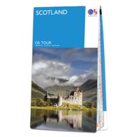
Wegenkaart - landkaart 12 Tour Map Scotland | Ordnance Survey
If you are on holiday and looking for a simple map containing all the information you need to make the most of your visit, the Tour maps are for you. These easy-to-read maps are packed with essential tourist information, town plans and scenic areas in addition to roads, rail, cycle routes and ground height information. These products cover popular tourist areas and are ideal for helping you to plan where to visit and how to get there. The OS Travel Map – Tour series can be used for navigating popular Long Distance Routes, coastal paths and National Trails.
10,95
Wandelgids Epic British Walks | Ordnance Survey
This magnificent collection of truly EPIC WALKS brings together Britain’s most beautiful countryside with the long-distance trails that present the very best means of experiencing it.   An inspiring introduction to distance walking, discover thirty-eight amazing trails of immense diversity incorporating National Parks, Areas of Outstanding Natural Beauty, National Scenic Areas, Heritage Coastline, and UNESCO World Heritage Sites.   The perfect book for planning a walking adventure, hiking holiday or weekend ramble, discover insightful introductions to each route, suggested itineraries, the must-see highlights to take in along the way and, of course, the list of Ordnance Survey sheet maps for completing the walks.   Epic in so many ways…   Thirty-eight EPIC long-distance walks across England, Scotland, and Wales 5000 miles of inspirational walking in National parks, AONBs, UNESCO World Heritage Sites and more Stunning and inspiring photography revealing the character of each walk A…
27,95
Wandelkaart - Topografische kaart 181 OS Explorer Map | Active Chiltern Hills North | Ordnance Survey
The essential map for outdoor activities in Chiltern Hills North. The OS Explorer Map is the Ordnance Survey's most detailed folding map and is recommended for anyone enjoying outdoor activities including walking, horse riding and off-road cycling. This map now comes with a digital version which you can download to your smartphone or tablet.Providing complete GB coverage, the OS Explorer map series details information essential in the great outdoors, including youth hostels, pubs and visitor information. Rights of way, fences, permissive paths and bridleways are clearly shown, ensuring you have the best information to get the most out of your time in the countryside. FeaturesIcknield Way RidgewayNorth Buckinghamshire Way Icknield Way PathSwan's Way Two Ridges Link Aylesbury RingSouth Bucks Way Chess Valley Walk Chiltern Link Thame Valley WalkGrand Union Canal Walk Midshires Way Bledlow Circular Ride Hertfordshire Way Chiltern WayRidgeway (National Trail) Bedfordshire Buckinghamshire H…
25,95
Wandelkaart - Topografische kaart 179 OS Explorer Map | Active Gloucester / Cheltenham / Stroud | Ordnance Survey
The essential map for outdoor activities in Gloucester, Cheltenham and Stroud. The OS Explorer Map is the Ordnance Survey's most detailed folding map and is recommended for anyone enjoying outdoor activities including walking, horse riding and off-road cycling. This map now comes with a digital version which you can download to your smartphone or tablet.Providing complete GB coverage, the OS Explorer map series details information essential in the great outdoors, including youth hostels, pubs and visitor information. Rights of way, fences, permissive paths and bridleways are clearly shown, ensuring you have the best information to get the most out of your time in the countryside. FeaturesCotswold Way Severn Way Gloucestershire Way Macmillan Way Wysis WayCotswold Way (National Trail) GloucesterCheltenhamGloucester Stroud1:25 000 scale (4 cm to 1 km - 2.5 inches to 1 mile)   Met zijn 4cm voor 1 km (2 ½ cm voor 1 mijl) schaal, is de OS Explorer kaartenserie de ideale en meest gedetaillee…
25,95

Klanten-reviews van Wegenkaart - landkaart Great Britain OS route | Ordnance Survey

Er zijn nog geen beoordelingen voor dit productBen jij de eerste die een review plaatst?

Meer over Wegenkaart - landkaart Great Britain OS route | Ordnance Survey

Productomschrijving

Tweezijdige overzichtskaart van heel Engeland en Schotland. Goed duildelijk leesbaar kaartbeeld met de doorgaande en grotere wegen. Ook Nationsle Parken staan er goed op.

Ordnance Survey's double-sided OS Route Map - Route features clear, current mapping of motorways and road numbers as well as selected tourist information. Distances between cities are also shown which makes this the ideal map for planning long journeys.

Productinformatie

    Verken gerelateerde categorieën

    Webshop.nl maakt gebruik van cookies. Ga je verder op onze website, ga dan akkoord met het plaatsen van cookies en de verwerking van deze data door ons en vermelde partners.