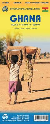
Wegenkaart - landkaart Ghana | ITMB

0
Een degelijke kaart met aanduidingen van o.a. nationale parken, vliegveld, benzinepomp, dirt-roads en kleine plattegrond van hoofdstad. Als overzichtskaart goed te gebruiken. Folded road and travel map in color. Scale 1:500,000. Distinguishes roads ranging from motorways to other roads. Legend includes tracks, railroads, ferry routes, internationa...

Verkopers met dit product

Verkoper
Bezorging
Prijs
DeZwerver.nl logo
DeZwerver.nl
2,95
13,95

Anderen bekeken ook

Wegenkaart - landkaart Accra & Ghana zuid | ITMB
Ghana was the first African colony to become an independent nation, in 1957. It may not be the largest, most populous, or richest country on the continent, but it is one of the best-managed and prosperous democracies. One seldom hears about Ghana on the news as a result, because there is seldom bad news to report! Accra is one of the oldest cities in sub-Saharan Africa, and the coast of Ghana is littered by historical remnants of trading forts built by the Portuguese, the Dutch, and the British during the age of expansion. Accra itself is an interesting city and our motivation in publishing a map of it is simply the reality that no map existed prior to this effort. The regional map shows Ghana's coastline to advantage and the interior of the country as far north as Kumasi.   Legend Includes: Roads by classification, Airports, Aerodromes and small aircrafts, Ferries, Bus terminals, Railway stations, Gas stations, Border crossing and custom posts, Hospitals, Museums, Tourist information…
13,95
Wegenkaart - landkaart Bahrain & Qatar | ITMB
Een degelijke kaart met aanduidingen van o.a. nationale parken, vliegveld, benzinepomp, dirt-roads en kleine plattegrond van hoofdstad. Als overzichtskaart goed te gebruiken.  Schaal: - Bahrein 1:115.000 - Qatar 1:300.000 The northern portion of the United Arab Emirates consists of a small peninsula (Qatar) and an island (Bahrain). Although these countries are not geographically significant in relation to their neighbours, they are enormously wealthy, thanks to oil, and have aspirations of grandeur. Qatar hosted the FIFA World Cup of soccer in November 2022. This is significant. Qatar, as a destination country, is now 'on the map'. Its capital, Doha, is quite well developed, with three Metro subway lines, motorways, and a sophisticated city centre dominated by superb high-rise architecture. Just to the west, the island of Bahrain is just as wealthy, and just as likely to have ornate architecture, luxurious shopping arcades, and an extravagant lifestyle. Its capital, Manama, is growing…
13,95
Wegenkaart - landkaart Philadelphia & Pennsylvania | ITMB
This map began as a result of a map conference held in Philadelphia a few years ago. Maps of the city at that time tended to concentrate on the entire spread-out urban area, resulting in the historic core, which was of interest mostly to visitors, crowded into a small portion of the map. Our map covers from the zoo and art gallery in the north to West Oregon St in South Phillie, so takes on much more than the historic area and the downtown, but does so at an excellent scale, so everything from the Liberty Bell to the University of Pennsylvania campus shows up clearly and easy to read. The other side of the map is also a brand new map for ITMB.     Legend Includes: Roads by classification, Airports, Aerodromes and small aircrafts, Ferrie routes, Bus terminals, Metro Stations, Railway stations, Gas stations, Car Parks, Border crossing, State parks with or without campsites, Hospitals, Shopping centres, Postoffices, Police stations, FireStations, Museums, Tourist information centers, Poi…
13,95
Wegenkaart - landkaart Namibia - Namibië | ITMB
Een degelijke kaart met aanduidingen van o.a. nationale parken, vliegveld, benzinepomp, dirt-roads en kleine plattegrond van hoofdstad. Als overzichtskaart goed te gebruiken. The former German colony and mandated territory of South-west Africa has emerged as a major touristic destination. Following our recent research trip to the country, we have made numerous changes to the map – upgrading roads that have been paved, changing our Caprivi Strip information, and re-doing our inset map of Windhoek. Printed on paper, single-sided; Folded road and travel map. Scale 1:1,600,000. Distinguishes roads ranging from highways to tracks (seasonal). Legend includes points of interest, internet cafes, restricted access roads, railroads, international/domestic airports, aerodromes, lodging, rest houses, guest farms, campsites, ruins historic/archaeological), museums, vistas, hot springs, caves, forts, shipwrecks, gas stations, medical facilities, missions, national parks/reserves, salt pans, restric…
13,95
Wegenkaart - landkaart British Columbia South (Canada) | ITMB
Deze wegenkaart van British Columbia bestrijkt het gebied tussen Vancouver en Calgary, en is de perfecte toeristische kaart voor het verkennen van de regio Rocky Mountain. Alle wegen en spoorlijnen tussen de twee steden worden getoond, evenals campings en parken.   This map covers the area between Vancouver and Calgary, and is the perfect tourist map for exploring the Rocky Mountain region. All roads and rail lines between the two cities are shown, as well as camp grounds, parks. Legend Includes: Points of interests, airports, RV and camping sites, wilderness camps, picnic areas, waterfalls, tourist information, museums, golf courses, gas stations, outdoor activities and other information. Folded paper, road and travel map in color. Scale 1:900,000. Distinguishes roads ranging from divided highways to other roads-4WD/dry weather. Legend includes railways, trails, ferry routes, glaciers, points of interest, international airports, domestic airports, museums, mountain peaks, camping/rec…
13,95
Wegenkaart - landkaart Ethiopia Ethiopië - Eritrea | ITMB
Een degelijke kaart met aanduidingen van o.a. nationale parken, vliegveld, benzinepomp, dirt-roads en kleine plattegrond van hoofdstad. Als overzichtskaart goed te gebruiken. This is the latest updating of one of the most interesting countries in Africa. There isn’t anything brilliantly innovative to report. We have tidied up the different layers of the artwork, have updated the road system, and have added more tourist information. We have also modernized the cover design and changed the ISBN – printed on paper, single-sided, inset map of Addis Ababa. Legend Includes: roads by classification, Airports, Ports, Gasolines, Polices, Post Offices, Bus Stations, Hospitals, Schools, Universities, Buildings, Point of Interests, Bridges, Lodgings, Campsites or Huts, Museums, and many more   Double-sided map from ITMB presenting on one side a road map of Ethiopia at 1:2,000,000 accompanied by a street plan of Addis Ababa, with on the reverse Eritrea at 1:900,000 with a plan of Asmara. Both roa…
13,95
Wegenkaart - landkaart Queensland | ITMB
Een degelijke wegenkaart van Queensland met aanduidingen van o.a. nationale parken, vliegveld, benzinepomp, dirt-roads en kleine plattegrond van hoofdstad. Als overzichtskaart goed te gebruiken. We complete our series of regional maps covering Australia with this map of Queensland, which nicely fills a double-sided sheet with only small portions of adjoining states showing. The map also includes a large inset map of central Brisbane. At this scale, the road/rail network of this part of Australia becomes very clear. The first side concentrates on the northern portion of the state, and the other side, the more densely-developed southern half. The map includes a listing of the state’s top attractions, and notes al major touristic attractions. Although gas/petrol stations are commonly found, we have included some gas symbols in remoter parts of Queensland to encourage drivers to venture into roads less travelled. All states and territories of Australia are now available from ITMB as separ…
13,95
Wegenkaart - landkaart Morocco - Marokko | ITMB
Een degelijke kaart met aanduidingen van o.a. nationale parken, vliegveld, benzinepomp, dirt-roads. Als overzichtskaart goed te gebruiken. One of the most stable and attractive Arabic countries for visitors is Morocco. The sea crossing from Spain is short, and travel facilities for visitors arriving by air are modern. We have updated our map to show the latest road improvements and have prepared insets of Casablanca, Marrakesh, Rabat/Sale, and Tangier. We have visited Morocco three times in recent years and have always found the people to be hospitable, the accommodations satisfactory, the food excellent, and the scenery superlative. We have printed the map on durable ITM plastic paper. Legend Includes: Roads by classification, airports, ferry Routes, bus stations, train stations, parks, points of interest, post offices, hospitals, border crossings, churches, mosques, oases, golf courses, embassies, banks, restaurants, schools, parking, museums, cinemas, accommodations, beaches, light…
13,95
Wegenkaart - landkaart Mexico Oaxaca & Chiapas & Guerrero | ITMB
Folded road and travel map, in color. Scale 1:700,000. Distinguishes roads ranging from expressways (free/toll) to rural roads. Legend includes tracks, trails, international airports, domestic airports, airfields, gas stations, points of interest, archaeological sites, caves, beaches, lighthouses, mines, national parks, swamps, mangroves. Includes inset map of Oaxaca City Downtown Legend Includes: Airports, roads by classifications, distances between points, gas station, point of interests, archaeological sites, beaches, lighthouses, hypsography and other information.
13,95
Wegenkaart - landkaart New South Wales, Victoria, & Tasmania | ITMB
Een degelijke wegenkaart , schaal 1:1.900.000, met aanduidingen van o.a. nationale parken, vliegveld, benzinepomp, dirt-roads. Als overzichtskaart goed te gebruiken. We are pleased to announce the completion of our regional maps covering Australia with this map of the south-eastern segment of the country. This is the most densely-populated part of Australia, stretching from Lismore in the northeast to the Tasman Sea in the south. It includes all of New South Wales (NSW) and Victoria State, with South Australia as far west as Adelaide. It also shows Tasmania, Australia’s only island state, in good detail, as well as Flinders Island and King Island. The map includes two very large inset maps of Melbourne and of Sydney. This map covers the travel plans of 90% of the visitors travelling around Australia, a continental country that is very difficult to see all of in one trip. The expanded scale we’ve used allows adequate room to include wilderness campgrounds, recreational vehicle parks, a…
13,95

Klanten-reviews van Wegenkaart - landkaart Ghana | ITMB

Er zijn nog geen beoordelingen voor dit productBen jij de eerste die een review plaatst?

Meer over Wegenkaart - landkaart Ghana | ITMB

Productomschrijving

Een degelijke kaart met aanduidingen van o.a. nationale parken, vliegveld, benzinepomp, dirt-roads en kleine plattegrond van hoofdstad. Als overzichtskaart goed te gebruiken.

Folded road and travel map in color. Scale 1:500,000. Distinguishes roads ranging from motorways to other roads. Legend includes tracks, railroads, ferry routes, international airports, national airports, aerodromes/small aircrafts, gasoline/petrol stations, bus stations, hospitals/medical facilities, castles/forts, points of interest, ruins or archaeological sites, campsites and huts, museums, lodges, churches, mosques. Includes inset map of Cape Coast, Accra and Kumasi. Extensive index.

Productinformatie

    Verken gerelateerde categorieën

    Webshop.nl maakt gebruik van cookies. Ga je verder op onze website, ga dan akkoord met het plaatsen van cookies en de verwerking van deze data door ons en vermelde partners.