Wegenkaart - landkaart Geologische kaart van IJsland - Jardfraedikort | Mal og Menning

0
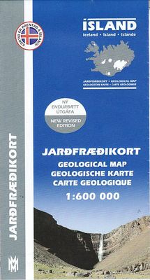
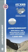
Prachtige geologische kaart van IJsland. Aan de hand van veel verschillende kleuren wordt de samenstelling, leeftijd en type van de bodem duidelijk weergegeven. Voor een eiland als IJsland zeer aan te raden! The Geological Map of Iceland shows the main features of the bedrock geology. Formations are classified by age, type and composition. The map...

Verkopers met dit product

Verkoper
Bezorging
Prijs
DeZwerver.nl logo
DeZwerver.nl
2,95
22,50

Anderen bekeken ook

Natuurgids Hvalakort Walviskaart Ijsland | Mal og Menning
De walviskaart toont alle belangrijke walvissoorten rond IJsland, inclusief verspreidingskaarten en informatie over grootte en leeftijd. The Whale Map shows all the major whale species around Iceland, including distribution maps and information about sizes and age. The water-colour illustrations are by Jón Baldur Hlíðberg. The Whale Map is an essential companion for all nature lovers who want to learn more about Iceland´s whales on their travels around the country. All text is in Icelandic, English, German and French.
22,50
Vogelgids Birdwatcher's Map of Iceland / Vogelkaart van IJsland | Mal og Menning
Handige kaart met kleine gids van de verspreiding en het voorkomen van de meest bekende en opmerkelijke vogels van IJsland. Erg makkelijk als de reis naar IJsland in het teken staat van vogels! A simple and accessible guide to Iceland's birdlife, covering 70 species ofbreeding bird and 37 migrants, winter visitors and vagrant. Breeding birdsare pictured together with maps showing their distribution and illustrations indicating the size and appearance of their eggs. The map is based on thebook Íslenskir fuglar (Icelandic Birds) by Ævar Petersen an ornithologistwith the Icelandic Institute of Natural History. The water-colourillustrations are by Jón Baldur Hlíðberg. The Birdwatcher's Map of Iceland is an essential companion for all naturelovers who want to learn more about Iceland's birdlife on their travelsaround the country.
22,50
Natuurgids Botanical map Ijsland | Mal og Menning
The botanical map provides clear and accessible information on Iceland's main plants. It shows 78 flowering plants, together with distribution maps and information on size, habitat and season of flowering. The map also includes pictures of Iceland's principal cryptograms (spore-bearing plants), grasses, algae, lichens and fungi. The map's sources include Flowering Plants and Ferns of Iceland by Hörður Kristinsson. The watercolour illustrations areby Jón Baldur Hlíðberg, one of the authors of the Mál og menning Birdwatchers' Map. The botanical map is indispensable to all lovers of Icelandic nature, who wish to learn about Icelandic flora on their travels.
22,50
Topografische kaart Höggunakort Tectonic Map of Iceland | Mal og Menning
The Höggunarkort is a map about tectonics in Iceland. On the front side you will find a 1:600,000 map of the island with the different layers of land differentiated according to their period of formation and not their composition, but also various volcanic formations.   On the back, photos and explanatory texts illustrate, among other things, the terms of the legend (period and volcanic formations). Some of the concepts developed are: fault, Tertiary, Miocene, caldera, central volcano...
22,50
Wegenkaart - landkaart Ontario | ITMB
Een degelijke kaart voor Ontario met aanduidingen van o.a. nationale parken, vliegveld, benzinepomp, dirt-roads en kleine plattegrond van Toronto, Sault Ste. Marie. Als overzichtskaart goed te gebruiken. Ontario and Quebec form the portion of Canada known as Central Canada. Ontario is the industrial heartland of the country, and the southern portion is the most densely-populated and urbanized part of Canada. Toronto is a city of 2.8M people and the heartland of an economic region serving 100,000,000 people in two countries. Southern Ontario is also home for six million residents, some of the most historic sites in the country, and major recreational land masses (Algonquin Park, Bruce Trail, Muskoka/Haliburton). Northern Ontario, on the other side of the map, occupies the bulk of the land area of the province, and is dominated by the Canadian Shield (a pre-Cambrian rock formation that is the oldest land on earth, rich in mineral wealth). The North is dominated by recreational activitie…
13,95
Stadsplattegrond - Wegenkaart - landkaart Cardiff & Wales | ITMB
Een dubbelzijdige kaart met aan de ene zijde een plattegrond van Cardiff, schaal 1:8.000 en op de andere zijde een wegenkaart, schaal 1:300.000, met aanduidingen van o.a. nationale parken, vliegveld, benzinepompen. ITMB finds the UK to be a never-ending source of maps needing to be prepared, such as this one of Cardiff and Wales. Cardiff is the capital of Wales, and is also an international access point to the UK; a map seems desirable. The city is based at the mouth of the River Taff, with most touristic points being concentrated in the harbour area, the city centre, and a concentration of eateries along Albany Road. Cardiff is shaped by two parallel motorways; the A4232close to the waterfront, and the A48 near the northern extremities. Both are included in our map, which also shows historic sites, hotels, and tourist amenities. The reverse side shows all of Wales as an entity, showing roads, rail lines, ferry crossing points, and access routes to England. It also shows historic site…
13,95
Nieuw
Wegenkaart - landkaart 738 Roemenië - Roemenie | Michelin
Zoals je van Michelin mag verwachten is deze kaart zeer overzichtelijk en heeft een duidelijk helder kaartbeeld. De kaart geeft uitgebreid toeristische informatie weer. Met register, afstanden en reistijden. Wegen worden naar verschillende klasse ingedeeld en - mooi van Michelin - de interessante mooie routes worden gemarkeerd met een groene streep.    Hindernissen voor automobilisten met caravans zijn gemarkeerd: steile hellingen, bergpassen of een anderzins moeilijke route. Bezienswaardigheden als een kasteel, religieus gebouw, ruine of grot is door een symbool goed te vinden.   The Michelin national road map of Romania at 1:750,000 scale is best suited to trip & route planning. The map gives comprehensive coverage of national road networks showing major motorways, dual carriageways, national & regional main roads and some smaller local roads. Unsurfaced roads and tracks and some major footpaths are also shown. The map shows useful motoring information for motorways and major roads …
11,95
Wegenkaart - landkaart Sahara | ITMB
Een degelijke overzichtskaart met aanduidingen van o.a. nationale parken, vliegveld, benzinepomp, dirt-roads.Waterproof. Double-sided, waterproof and tear-resistant map, extending east to just beyond 25°(the border of Libya and Egypt) , and roughly to 15° degrees (Bamako and Niamey) on its western half, and slightly further south on the other side (beyond Kano and Ndjamena). Elevation colouring indicates the topography, with landscape feature such as calderas, scarps and cliffs, lava fields, dunes, serir, marches, seasonal rivers, and salt pans. Oases and numerous wells/waterholes are also marked, most of them with names. International boundaries are shown with, where appropriate, border crossings. Road network includes rough tracks, and indicates location of petrol stations. Railways within the coastal areas of the covered countries are marked, and the map also shows small local airfields. A range of symbols indicate selected accommodation including rest houses and campsites, hospita…
13,95
Wegenkaart - landkaart The Cotswolds | Philip's Maps
A new edition of this double-sided map of the Cotswolds clearly featuring places of tourist and historic interest in an easy-to-read style of mapping, alongside six handy town centre plans. This leisure and tourist map of the Cotswolds gives detailed coverage of the area's road network at a scale of approximately 2 miles to 1 inch (1:125,000). The coverage stretches from Abingdon in the east to Gloucester in the west, and from Swindon in the south to Great Malvern in the north. The map shows places of tourist and historic interest, including castles, camping and caravanning sites, country parks, galleries, gardens, golf courses, museums, nature trails, historic sites, sports venues, theatres and wildlife parks. An index to principal places of interest is also featured. With some of the most enchanting towns and cities in England in the area - all with extraordinary history and notable natural beauty - use the Philip's Leisure Map to explore and delight in the Cotswold magic. Includ…
11,50
Wandelkaart - Wegenkaart - landkaart Sint Maarten - St. Martin | Kasprowski Maps
Bijzonder gedetailleerde kaart (1:15000 !) van alleen het eiland Sint Maarten - Saint Martin. Zowel de wegen als ook de wandelpaden staan er op vermeld. Stranden, interessante plekken en bovendien de meeste duikplakken staan met diepte helder weergegeven op de kaart. Met stadsplattegronden van Philipsburg en Marigot.   The most recent edition of the first and only complete road map of the French-Dutch island of Saint-Martin/Sint Maarten renders all known roads and streets with their names; indicates hiking trails, biking routes and diving sites; maps restaurants and hotels; features insets of the Marigot and Philipsburg capitals, as well as Tintamarre Island. Street, hotel, and restaurant indexes are printed on the reverse side of the map.   NEW FEATURES:   Street and road additions, incl. Simpson Bay Causeway; Over 200 restaurants and hotels mapped and indexed; Tintamarre island inset; Biking routes; Birding and turtle nesting sites, other natural attractions; Snorkeling si…
18,50

Klanten-reviews van Wegenkaart - landkaart Geologische kaart van IJsland - Jardfraedikort | Mal og Menning

Er zijn nog geen beoordelingen voor dit productBen jij de eerste die een review plaatst?

Meer over Wegenkaart - landkaart Geologische kaart van IJsland - Jardfraedikort | Mal og Menning

Productomschrijving

Prachtige geologische kaart van IJsland. Aan de hand van veel verschillende kleuren wordt de samenstelling, leeftijd en type van de bodem duidelijk weergegeven. Voor een eiland als IJsland zeer aan te raden!

The Geological Map of Iceland shows the main features of the bedrock geology. Formations are classified by age, type and composition. The map also clearly shows the island's volcanic zones and the distribution of the recent eruption sites. Lava fields of the Holocene are shown as pre-historic or historic. This is the second, revised, edition of the map.

Productinformatie

    Verken gerelateerde categorieën

    Webshop.nl maakt gebruik van cookies. Ga je verder op onze website, ga dan akkoord met het plaatsen van cookies en de verwerking van deze data door ons en vermelde partners.