webshop.nl
Categorieën
  Sluiten

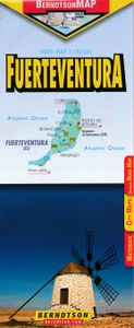
Wegenkaart - landkaart Fuerteventura | Berndtson

Geplastificeerde wegenkaart van Fuerteventura. Goede duidelijke kaart voor de toerist die rondreist met auto of vanuit vaste standplaats uitstapjes maakt. Het is geen wandelkaart.   Main Map: Fuerteventura 1:140 000 Additional Maps: Corralejo 1:10 000 Islas Canarias 1:1 200 000 Morro Jable 1:10 000 Puerto del Rosario 1:10 000 Time Zones Basic Infor...
10,95

Webshops met dit product

Webshop
Bezorging
Prijs

Anderen bekeken ook

Wegenkaart - landkaart Fuerteventura | Berndtson
Geplastificeerde wegenkaart van Fuerteventura. Goede duidelijke kaart voor de toerist die rondreist met auto of vanuit vaste standplaats uitstapjes maakt. Het is geen wandelkaart.   Main Map: Fuerteventura 1:140 000 Additional Maps: Corralejo 1:10 000 Islas Canarias 1:1 200 000 Morro Jable 1:10 000 Puerto del Rosario 1:10 000 Time Zones Basic Information: Facts, Geography, Weather diagram Touristic Information: Selected and rated 10 top POIs (Points of Interest) shown in LocatorMap with text information, including e.g. opening hours and web links.
10,95
Reisgids Fuerteventura | Michael Müller Verlag
Uitstekende, diepgaande reisgids over Fuerteventura. Met veel achtergrondinformatie en ook praktische zaken als overnachtingen en eet- en drinkgelegenheden. Thematische hoofdstukken over geschiedenis, geologie etc. Met uitneembare overzichtskaart. Let op: Duits!   Entdecken Sie mit dem Fuerteventura-Reiseführer in der zweiten Auflage die zweitgrößte der kanarischen Inseln. Autor Thilo Scheu zeigt auf 272 Seiten mit 140 Farbfotos die herbe Schönheit und alle Sehenswürdigkeiten der zu Spanien gehörenden Vulkaninsel. 44 Übersichtskarten und Pläne, eine herausnehmbare Karte im Maßstab 1:175.000 sowie 16 Wanderungen und Ausflüge samt gratis herunterladbarer GPS-Tracks – so wird Ihr Fuerteventura-Urlaub zu einem individuellen und unvergesslichen Erlebnis.   Die Insel im Detail – 168 Seiten mit allen wichtigen und interessanten Orten und allen von Fuerteventuras Sehenswürdigkeiten: Der Inselnorden mit Corralejo, El Cotillo, Lajares, La Oliva, Villaverde, Tindaya, dem Naturpark Dunas de Corral…
20,50
Wandelgids Walking on Lanzarote and Fuerteventura | Cicerone
Uitgebreide wandelgids van Lanzarote en Fuerteventura: goede beschrijvingen, veel keuze, kaarten wat minder goed.   This book offers 21 walks on Lanzarote, two on Isla La Graciosa (off Lanzarote's northern coast) and 22 on Fuerteventura, including 14 walks on the GR 131 trail, which crosses both islands. These 45 traditional routes link several villages and span a range of arid agricultural and natural areas. Both popular holiday destinations, Lanzarote and Fuerteventura are two remarkably different islands. Lanzarote has a fascinating volcanic national park at Timanfaya, and vineyards fill huge areas of black volcanic ash at La Geria; Fuerteventura is famous for extensive golden beaches, but its splendid mountain paths are less well-known. Both islands are crossed by new waymarked trails.   These traditional routes span a range of arid, agricultural and natural areas, including hill and mountain trails, coastal walks including Fuerteventura’s golden beaches, and some walks visit villa…
21,95
Reisgids Fuerteventura | Michael Müller Verlag
Uitstekende, diepgaande reisgids over Fuerteventura. Met veel achtergrondinformatie en ook praktische zaken als overnachtingen en eet- en drinkgelegenheden. Thematische hoofdstukken over geschiedenis, geologie etc. Met uitneembare overzichtskaart. Let op: Duits!   Entdecken Sie mit dem Fuerteventura-Reiseführer in der zweiten Auflage die zweitgrößte der kanarischen Inseln. Autor Thilo Scheu zeigt auf 272 Seiten mit 140 Farbfotos die herbe Schönheit und alle Sehenswürdigkeiten der zu Spanien gehörenden Vulkaninsel. 44 Übersichtskarten und Pläne, eine herausnehmbare Karte im Maßstab 1:175.000 sowie 16 Wanderungen und Ausflüge samt gratis herunterladbarer GPS-Tracks – so wird Ihr Fuerteventura-Urlaub zu einem individuellen und unvergesslichen Erlebnis.   Die Insel im Detail – 168 Seiten mit allen wichtigen und interessanten Orten und allen von Fuerteventuras Sehenswürdigkeiten: Der Inselnorden mit Corralejo, El Cotillo, Lajares, La Oliva, Villaverde, Tindaya, dem Naturpark Dunas de Corral…
20,50
Wandelkaart Tour & Trail Fuerteventura | Discovery Walking Guides
For the best adventures, use the best map. Fuerteventura is a large, 1,660 square kilometres, island. At 65k scale Fuerteventura Tour & Trail Super-Durable Map is a large 960mm by 620mm, double sided map sheet, which folds down to its 220mm by 120mm pocket size.   A specialist concertina map fold means this map is easy to unfold for use and then refold to its pocket size. Super-Durable means that the Tour & Trail Map is printed on a plastic substrate using specially curing inks to produce a map that feels like silk but is tougher than any other map. Super-Durable is backed by a Discovery Walking Guides (DWG) 2-Year Guarantee against failure in the adventurous use for which the map is designed.   If your Super-Durable Map gets dirty then gently wipe clean with a soft wet cloth and allow to fully dry before refolding to pocket size. On one side of the map is the island's north with the south on the reverse side. There's a generous common overlap to minimise turning the map in use.   100 …
15,95
Wandelkaart 240 Fuerteventura | Kompass
Goede wandelkaart met vrijwel alle topografische details als hoogtelijnen, vegetatie, schaduwtekening maar ook de ingetekende wandelroutes en in veel gevallen ook fietsroutes (MTB). Gevaarlijke routes worden als zodanig weergegeven met een bepaalde markering. Berghutten en campings zijn goed terug te vinden op deze kaarten.   Daarnaast staan de toeristische bezienswaardigheden met symbolen vermeld. Kleurgebruik kan soms vrij fel overkomen, daardoor oogt deze detailkaart wellicht wat druk, maar het blijft een goed leesbare kaart. Sommige kaarten zijn geplastificeerd, maar helaas niet allemaal. De graden staan aan de zijkanten van de kaart, daardoor te gebruiken voor GPS.   Steden/dorpen/gebieden: Corralejo, Puerto del Rosario, Caleta de Fuste, Gran Tarajal, Tarajaleja, Costa Calma, Morro Jable, Pajara, Betancuria, Antigua, La Oliva, El Cotillo   Bergen/dalen: Pico de la Zarza
13,50
Wandelkaart Tour & Trail Fuerteventura | Discovery Walking Guides
For the best adventures, use the best map. Fuerteventura is a large, 1,660 square kilometres, island. At 65k scale Fuerteventura Tour & Trail Super-Durable Map is a large 960mm by 620mm, double sided map sheet, which folds down to its 220mm by 120mm pocket size.   A specialist concertina map fold means this map is easy to unfold for use and then refold to its pocket size. Super-Durable means that the Tour & Trail Map is printed on a plastic substrate using specially curing inks to produce a map that feels like silk but is tougher than any other map. Super-Durable is backed by a Discovery Walking Guides (DWG) 2-Year Guarantee against failure in the adventurous use for which the map is designed.   If your Super-Durable Map gets dirty then gently wipe clean with a soft wet cloth and allow to fully dry before refolding to pocket size. On one side of the map is the island's north with the south on the reverse side. There's a generous common overlap to minimise turning the map in use.   100 …
15,95
Wegenkaart - landkaart Dominicaanse Republiek | Borch
Mooie geplasticieerde kaart van de Dominicaanse Republiek. Deze kaart biedt een goed overzicht van het land met detailkaarten.   Our soft-laminated map of the Dominican Republic includes: Dominican Republic 1:600 000, Puerto Plata & Region 1:250 000, Puerto Plata 1:20 000, Santiago 1:17 500, Santo Domingo & Region 1:250 000, Santo Domingo 1:22 500, Colonial Santo Domingo 1:10 000, Punta Cana & Region 1:185 000, Dominican Republic administrative / time zones; interesting statistics: conversion chart for temperatures, weights and measures; climate chart with temperatures, sunshine hours, precipitation and humidity; table of distances; hotels, museums, markets, public transport and much more.   Christopher Columbus discovered the island of Hispaniola on December 5th 1492 and founded "La Navidad", said to be the first European settlement in the New World. He became viceroy of Hispaniola and settled in the place where today's capital, Santo Domingo, is situated. During the following centuri…
11,50

Klanten-reviews van Wegenkaart - landkaart Fuerteventura | Berndtson

Er zijn nog geen beoordelingen voor dit productBen jij de eerste die een review plaatst?

Meer over Wegenkaart - landkaart Fuerteventura | Berndtson

Productomschrijving

Geplastificeerde wegenkaart van Fuerteventura. Goede duidelijke kaart voor de toerist die rondreist met auto of vanuit vaste standplaats uitstapjes maakt. Het is geen wandelkaart.   Main Map: Fuerteventura 1:140 000 Additional Maps: Corralejo 1:10 000 Islas Canarias 1:1 200 000 Morro Jable 1:10 000 Puerto del Rosario 1:10 000 Time Zones Basic Information: Facts, Geography, Weather diagram Touristic Information: Selected and rated 10 top POIs (Points of Interest) shown in LocatorMap with text information, including e.g. opening hours and web links.
Webshop.nl maakt gebruik van cookies. Ga je verder op onze website, ga dan akkoord met het plaatsen van cookies en de verwerking van deze data door ons en vermelde partners.