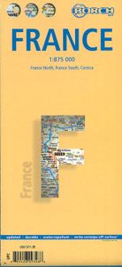
Wegenkaart - landkaart Frankrijk | Borch
Mooie geplasticieerde kaart van Frankrijk. Deze kaart biedt een goed overzicht van het land met detailkaarten. Our soft-laminated folded map of France shows: France North 1:875 000, France South 1:875 000, Corsica 1: 875 000, France administrative, Europe time zones. Borch Maps are easy to fold, durable and water-repellent with a wipeable surface. Borch Maps show hotels, museums, monuments, markets, public transport, top sights and points of interest, useful statistics, conversion charts for temperatures, weights and measurements, climate charts showing temperatures, sunshine hours, precipitation and humidity, overview maps, time zones, and much more... France, one of the largest countries in Western Europe, is bordered by the English Channel, the North Sea and the Benelux countries to the north. To the East the Rhine river creates a natural border, as do the mountains toward Switzerland and Italy down to the shores and picturesque fishing villages of the Mediterranean coast. The maj…
11,50


