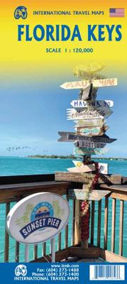
Wegenkaart - landkaart Florida Keys | ITMB

0

Verkopers met dit product

Verkoper
Bezorging
Prijs
DeZwerver.nl logo
DeZwerver.nl
2,95
13,95

Anderen bekeken ook

Wegenkaart - landkaart USA Florida & Deep South | ITMB
Florida has been unavailable for far too long! We wanted to improve the area of coverage while converting the artwork to a GIS-based digital data base, so the area of coverage now includes Georgia, Alabama, part of Mississippi, and most of the Carolinas. This would be an excellent map to use on the way south (or north) along I-95 or I-85 through Atlanta or Augusta and south to the Gulf Coast. The Panhandle of Florida is on the same side of the sheet, with the second side being devoted to Florida south to the Keys. There isn't enough space to show many insets; just the Orlando area and a Florida map showing population by counties. Another innovation we have introduced is to print the map on waterproof paper, for durability as well as for use as an umbrella during sudden downpours! Legend Includes: Road by classification, motorway, two land road, railway with station, waterway and much more...   Deep South, schaal 1: 1000000 Florida schaal 1: 720000
13,95
Wegenkaart - landkaart Mali | ITMB
Een degelijke kaart met aanduidingen van o.a. nationale parken, vliegveld, benzinepomp, dirt-roads en kleine plattegrond van hoofdstad. Als overzichtskaart goed te gebruiken.   Folded road and travel map in color. Scale 1:2,400,000. Distinguishes roads ranging from primary paved roads to other roads or tracks. Legend includes international airport/national airports, air fields, gasoline/petrol stations, post office, hospital/medical facilities, hotels, motels/lodging, resthouse or hostel, campsites or huts, museums, border crossings, no border crossings, points of interest, crafts/pottery, archaelogical sites, historic ruins or sites, mines, bus station, forts, mosques, churches/missions, oasis, caves, fishing ports, beaches, hiking/trekking. Includes inset map of Bamako and Timbuktu, road distance chart and extensive index.
13,95
Wegenkaart - landkaart Ghana | ITMB
Een degelijke kaart met aanduidingen van o.a. nationale parken, vliegveld, benzinepomp, dirt-roads en kleine plattegrond van hoofdstad. Als overzichtskaart goed te gebruiken. Folded road and travel map in color. Scale 1:500,000. Distinguishes roads ranging from motorways to other roads. Legend includes tracks, railroads, ferry routes, international airports, national airports, aerodromes/small aircrafts, gasoline/petrol stations, bus stations, hospitals/medical facilities, castles/forts, points of interest, ruins or archaeological sites, campsites and huts, museums, lodges, churches, mosques. Includes inset map of Cape Coast, Accra and Kumasi. Extensive index.
13,95
Wegenkaart - landkaart Gibraltar | ITMB
We are always pleased to announce the release of a new title. The Straits of Gibraltar, as this map should be named is historically significant as the crossing point between Europe and North Africa and, more recently, as the guardian of the Mediterranean. It is now moving into a new era – tourism. The city/colony of Gibraltar itself is well worth a visit, and a detailed map is provided. The Spanish city/colony on the North African coast is equally interesting and is also shown, as is Tangier and a good stretch of the Moroccan north coast. This map is printed single-sided, on paper.
13,95
Wegenkaart - landkaart Colombia | ITMB
Goede wegenkaart waarbij naast de gebruikelijke zaken als wegen en plaatsen ook veel aandacht is voor de natuurkundige aspecten van het land. Door het kleurgebruik wordt goed duidelijk waar bos, oerwoud, rivieren, meren liggen. Hoogtes zijn zichtbaar door gebruik van verschillende kleuren. Vaak is op de kaart nog een kleine plattegrond van het centrum van de belangrijkste stad te vinden. Colombia is growing in popularity as a travel destination. It is also changing quickly as peace and stability return to a lovely country. We have updated the map to the best of our ability and now have detailed inset maps of Bogota, Medellin, and Cartagena. The border to Ecuador is now an improved crossing. We have printed this updated edition on plastic paper, another improvement, in line with our policy of converting most hot, humid, country maps to plastic.  Legend Includes: Roads by classification, Rivers and Lakes, National Park, Airports, Points of Interests, Mining, Archaeological sites, Beach …
13,95
Wegenkaart - landkaart Cyprus | ITMB
Goede gedetailleerde kaart van Cyprus. De kaart is tweezijdig en gedrukt op scheur- en watervast papier. Voelt zwaarder aan, maar gaat langer mee! Kaartbeeld is helder met een mooi kleurgebruik waarbij je goed kunt zien hoe de hoogteverdeling is. Wegen en spoorlijnen staan er goed op, maar ook bijvoorbeeld extra aanduidingen voor bezienswaardigheden, campings en zelfs benzinepompen.  Cyprus is a lovely Mediterranean island; a popular tourist destination for Europeans. It is also a very historic island, with roots going back to Phoenician times and probably before. Politically, the island is divided into Turkish-controlled Northern Cyprus and EU-member Cyprus, the southern two-thirds of the island. Most travel is to the southern portion, with numerous resort hotels and beaches lining the coast. This is also the most economically-developed part of the island, as the northern portion has not been recognized by anyone except Turkey, which still maintains a significant military presence in…
13,95
Wegenkaart - landkaart Ecuador | ITMB
Duidelijke wegenkaart van Ecuador, aan 2 zijden bedrukt. Met stadsplattegronden van Quito, Guayaquil. Aanduidingen van benzinestations, Nationale parken en bezienswaardigheden. Very detailed, double sided travel map of Ecuador shows road network and physical features. Distances between communities are shown, as well as gas stations outside of major towns. National parks and points of interest are also shown. Includes an inset map of Quito and Environs of Guayaquil as well as a comprehensive place name index. Printed on waterproof synthetic paper suitable for tropical conditions.
13,95

Klanten-reviews van Wegenkaart - landkaart Florida Keys | ITMB

Er zijn nog geen beoordelingen voor dit productBen jij de eerste die een review plaatst?

Meer over Wegenkaart - landkaart Florida Keys | ITMB

Productinformatie

    Verken gerelateerde categorieën

    Webshop.nl maakt gebruik van cookies. Ga je verder op onze website, ga dan akkoord met het plaatsen van cookies en de verwerking van deze data door ons en vermelde partners.