Wegenkaart - landkaart - Fietskaart Kerry (Ierland) | Xploreit Maps

0
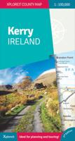
Een nieuwe editie van de populaire Xploreit-kaart van County Kerry   Of u nu uw dagelijkse activiteiten wilt plannen of gewoon een snelle scan van uw huidige locatie nodig hebt, deze kaart is een uitstekende metgezel voor uw avonturen in County Kerry. Deze handige en informatieve tourkaart heeft al vele jaren duizenden bezoekers en inwoners naar d...

Verkopers met dit product

Verkoper
Bezorging
Prijs
DeZwerver.nl logo
DeZwerver.nl
2,95
23,95

Anderen bekeken ook

Wegenkaart - landkaart - Fietskaart Kerry (Ierland) | Xploreit Maps
Een nieuwe editie van de populaire Xploreit-kaart van County Kerry   Of u nu uw dagelijkse activiteiten wilt plannen of gewoon een snelle scan van uw huidige locatie nodig hebt, deze kaart is een uitstekende metgezel voor uw avonturen in County Kerry. Deze handige en informatieve tourkaart heeft al vele jaren duizenden bezoekers en inwoners naar de beste autoritten, fietsroutes, wandelingen en bezienswaardigheden in Kerry, 'The Kingdom', geleid. Deze opwindende nieuwe editie is volledig herzien en bijgewerkt. Het Kerry-gedeelte van de nieuwe langeafstands Euro Velo Atlantic Cycle Route is opgenomen, samen met de nieuwe groene routes, waaronder Listowel naar Abbeyfeale en Tralee naar Fenit. Topografie wordt weergegeven door hoogtekleuren met contouren op 30 m en er worden talrijke geografische kenmerken geïdentificeerd. Het wegennet omvat lokale wegen en paden met gemarkeerde schilderachtige wegen, waaronder het Kerry-gedeelte van de Wild Atlantic Way en relevante Discovery Points. Elk…
23,95
Wegenkaart - landkaart - Fietskaart Cork (Ierland) | Xploreit Maps
Mooie geplastificeerde en scheurvaste kaart met index The Xploreit Map of County Cork includes all of Cork along with parts of counties Kerry, Limerick, Tipperary and Waterford. Cork's rich heritage of megalithic monuments, medieval churches and castles can instantly be identified. Noted sites such as Blarney Castle, St. Finbarr's Oratory at Gougane Barra and McCarthy's Bar in Castletownbere are featured in red text. Whether you want to explore Youghal's town walls in the east, savour the views from the footbridge at Mizen Head in the south-west or or imagine times past as you stroll around Mitchelstown's King's Square and Kingston College in the north it's easy to find your chosen destination. Showing a large array of golf courses, angling spots, sandy beaches for swimming and surfing, equestrian facilities, boating facilities, this map is an indispensable tool for visitors. Several scenic drives, cycle routes and waymarked walks are shown. The scale of the Cork map is 1:100,000. Wal…
23,95
Wegenkaart - landkaart - Fietskaart Clare (Ierland) | Xploreit Maps
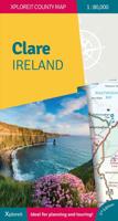
Mooie geplastificeerde en scheurvaste kaart van de County Clare met index. This Xploreit map is an essential companion for your next trip to County Clare. Whatever your location in the county, a quick scan of the map will reveal all the local attractions including the best drives, cycle routes and walks in the area.  It is fully revised and now includes the Clare section of the long-distance Euro Velo Atlantic Cycle Route. From Loop Head, with its famous lighthouse, you can follow West Clare’s wild and rugged coast as it rises to the spectacular Cliffs of Moher and meets The Burren, the unique limestone pavement of the northern uplands. East Clare has numerous walking and sightseeing opportunities also, with Lough Derg and Slieve Bernagh as highlights. Convenient and informative, this touring map will help you discover ancient megalithic tombs, imposing castles, sparkling lakes, golden beaches and the many charming towns and villages dotted around ‘The Banner County’. Topography is sh…
23,50
Wegenkaart - landkaart - Fietskaart Mayo en Sligo (Ierland) | Xploreit Maps
Mooie geplastificeerde en scheurvaste kaart van Mayo en Sligo met index. Mayo’s wealth of unspoiled, natural beauty is a fitting compliment to Sligo’s magnificent scenery providing a wonderfully varied landscape to be enjoyed by visitors. This map shows where all the famous landmarks and hidden gems are to be found when touring the area. A comprehensive compilation of waymarked trails with local walking loops , cycle routes, scenic drives, beaches, medieval buildings, megalithic sites, historic houses and numerous other points of interest are illustrated. Discover the haunts of W.B. Yeats like Lissadell, Drumcliff and Lough Gill along with dramatic vistas such as Croagh Patrick and the Doolough Valley using this easy to read sheet. Parts of Counties Galway, Roscommon, Leitrim and Donegal are also included.   The scale of the Mayo & Sligo map is 1:100,000.   Walking Routes The following long distance waymarked ways in Mayo and Sligo are included: The Western Way The Great Western Gre…
23,95
Wegenkaart - landkaart - Fietskaart Donegal | Xploreit Maps
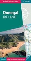
Zeer goed leesbare deelkaart van Ierland. Alle wegen, alle dorpen en steden en veel topografische details staan er op: daardoor zowel als wegenkaart ook als fietskaart goed te gebruiken. Naast de algemene kaartdetails zijn ook de bezienswaardigheden en historische monumenten goed ingetekend en makkelijk te vinden. Campings en jeugdherbergen maken het compleet.  This convenient and informative paper travel map is specifically designed for visitors to Donegal – the northernmost county in Ireland. With a heady mix of peninsulas, promontories and sandy beaches, Donegal’s  long, indented coastline includes some of the most spectacular scenery in the country. Further inland, the attractions are just as enticing and include Glenveagh National Park – an all-time favourite destination. This new map covers all of County Donegal and highlights local walking trails, cycle routes and scenic drives. The road network shown includes local roads and driving distances are indicated on the main routes. …
21,95
Wegenatlas The Wild Atlantic Way Ierland | Xploreit Maps
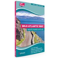
Yvonne Gordon provides an essential guide to Ireland's epic coastal driving route - the Wild Atlantic Way. In this newly revised and updated edition she divides the route into 16 easy-to-follow scenic drives from Kinsale, in south Cork, all the way to the little village of Muff in the far north of the island. Each drive can be comfortably completed in one day and includes an overview map with photographs to illustrate the text. Information is provided on mileage, directions, official discovery points and numerous additional attractions, including the many towns and villages dotted along the way. The generous fold-out maps can be used to follow the guided route or to design custom itineraries. 31 handy fold-out maps. 16 easy-to-follow drives. Official Discovery Points highlighted. Additional recommendations and tips. Route planning maps for the national road network. Distance charts for towns and villages. Yvonne Gordon is an award-winning travel writer who writes about Ireland for pub…
24,95
Fietsgids Cycling Kerry | The Collins Press
Een beschrijving van een deel van The Wild Atlantic Way in 3 etappes en ook nog eens 28 dagtochten , wel alleen in Kerry. Goede beschrijvingen, veel praktische informatie maar wel slechts schetsmatige kaarten  A guidebook to the scenic bicycling routes of County Kerry, Ireland, for all cycling abilities. It includes popular routes as well as hidden gems. Each route description is illustrated with color maps, photos, a gradient graph and key facts and statistics. Information is provided on the natural landmarks and historical sites you'll see along the way. With some of Ireland's most beautiful and untamed scenery, 400km of rugged coastline and enticingly peaceful roads, what better way to explore County Kerry than by bike? These scenic cycles will guide you along popular routes and bring you to hidden gems. In a county famous for its climbs, some of the country's most spectacular ascents, summit views and descents feature, including the Conor Pass and Ballaghbeama.Each route descripti…
22,50
Wegenkaart - landkaart 712 Ierland | Michelin
Zoals je van Michelin mag verwachten is deze kaart zeer overzichtelijk en heeft een duidelijk helder kaartbeeld. De kaart geeft uitgebreid toeristische informatie weer. Met register, afstanden en reistijden. Wegen worden naar verschillende klasse ingedeeld en - mooi van Michelin - de interessante mooie routes worden gemarkeerd met een groene streep.    Hindernissen voor automobilisten met caravans zijn gemarkeerd: steile hellingen, bergpassen of een anderzins moeilijke route. Bezienswaardigheden als een kasteel, religieus gebouw, ruine of grot is door een symbool goed te vinden.   This Ireland map from Michelin is part of their red national map series. These are perfect for route planning as well as getting around by car once you're there. They clearly mark out major roads and also show many of the more important minor roads. A couple of insets showing enlargements of Dublin and environs at 1:120 000 and Belfast and environs, also at 1:120 000, are included.   The map's simple folding…
11,95
Wegenkaart - landkaart Ierland - Ireland | Marco Polo
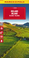
Duidelijke wegenkaart van Marco Polo: alle wegen, zowel de verharde als belangrijke onverharde wegen zijn weergegeven.  Mooie toeristisch interessante wegen die de moeite waard zijn, zijn groen gearceerd. Veel toeristische informatie is toegevoegd zoals de nationale parken, campings, kastelen en vliegvelden. Afstanden tussen belangrijke steden en benzinestations staan ook op de kaart.  Discover picturesque towns and dramatic coastlines with this highly durable, detailed touring map of Ireland. It folds away easily and is always on standby to help when you're stuck.   Perfect touring map - the scale is 1 : 350 000 ideal to help you tour the country by car or campervan Easy to use - the superbly clear mapping in strong colours and easy to read text will help you navigate the country like a local Durable, tear-resistant map - designed to withstand the rigors of the road, the map is printed on tear-resistant, water repellent and writeable paper Highlights included - major sights and key p…
14,95
Wegenkaart - landkaart Ierland | ITMB
As technology improves, we are able to produce more detailed maps than was previously possible. Such is the case with Ireland, a part of the world consisting of two countries divided by religion and history. Preparing a map of Ireland as a double-sided map means cutting the island into two geographic portions. Side 1 covers the northern half. This includes the portion known as Northern Ireland, or Ulster, and a fair portion of the Republic of Ireland, or Eire; essentially everything north of Dublin and west to Counties Mayo and Galway. Side 2 covers the southern half of the island from just north of Dublin to the outer tips of County Kerry. It also includes a nice inset map of central Dublin. Naturally, all motorways and roads are included, as are touristic attractions, camping/caravan sites, ferry terminals, and Top Attractions. This is a very detailed travel map of the island, printed on waterproof paper for durability. We had great fun driving around Ireland researching this map. I…
14,95

Klanten-reviews van Wegenkaart - landkaart - Fietskaart Kerry (Ierland) | Xploreit Maps

Er zijn nog geen beoordelingen voor dit productBen jij de eerste die een review plaatst?

Meer over Wegenkaart - landkaart - Fietskaart Kerry (Ierland) | Xploreit Maps

Productomschrijving

Een nieuwe editie van de populaire Xploreit-kaart van County Kerry   Of u nu uw dagelijkse activiteiten wilt plannen of gewoon een snelle scan van uw huidige locatie nodig hebt, deze kaart is een uitstekende metgezel voor uw avonturen in County Kerry. Deze handige en informatieve tourkaart heeft al vele jaren duizenden bezoekers en inwoners naar de beste autoritten, fietsroutes, wandelingen en bezienswaardigheden in Kerry, 'The Kingdom', geleid. Deze opwindende nieuwe editie is volledig herzien en bijgewerkt. Het Kerry-gedeelte van de nieuwe langeafstands Euro Velo Atlantic Cycle Route is opgenomen, samen met de nieuwe groene routes, waaronder Listowel naar Abbeyfeale en Tralee naar Fenit. Topografie wordt weergegeven door hoogtekleuren met contouren op 30 m en er worden talrijke geografische kenmerken geïdentificeerd. Het wegennet omvat lokale wegen en paden met gemarkeerde schilderachtige wegen, waaronder het Kerry-gedeelte van de Wild Atlantic Way en relevante Discovery Points. Elke centimeter op de kaart is gelijk aan 1 kilometer, dus de kaart biedt een goed detailniveau, maar is duidelijk en gemakkelijk te volgen.   De kaart is dubbelzijdig, eenvoudig te lezen en vouwen en er is een goede overlap tussen noord en zuid. De kaart is licht en past gemakkelijk in het handschoenenkastje of een rugzak. Een breed scala aan symbolen geeft verschillende interessante plaatsen aan: antiquiteiten, recreatiefaciliteiten, musea en erfgoedlocaties, toeristeninformatiecentra, campings en caravanparken, enz. Plaatsnamen zijn geïndexeerd en er zijn breedtegraad- en lengtegraadlijnen in decimale graden met intervallen van respectievelijk 0,01 en 0,1, waardoor het eenvoudig is om coördinaten te schatten voor gebruik met GPS-apparaten.   Belangrijkste kenmerken: • Heel County Kerry op één tourkaart • Gemakkelijk te lezen, duidelijke kaart • Lokale ritten, fietsroutes en wandelingen • Groot scala aan gemarkeerde toeristische attracties • Plaatsnamenindex • Lichtgewicht, gemakkelijk op te vouwen en mee te nemen

Walking Routes
It has been possible to include all the national waymarked ways in Kerry and many of the routes in Cork. The ways covered are listed below:

  • The Dingle Way
  • The Kerry Way
  • The North Kerry Way
  • The Beara Way
  • The Sheep's Head Way
  • The Blackwater Way (partly shown)

Cycling Routes
All the Kerry cycling routes are shown and many of the routes in Cork are also included:

  • The North Kerry Cycle Route including the Fenit and Kerry Head loops
  • The Ring of Kerry Cycle Route
  • The Beara Cycle Route
  • The Sheep's Head Cycle Route
  • The Gougane Barra Cycle Route (from Ballylickey to Macroom)
Productinformatie

    Verken gerelateerde categorieën

    Webshop.nl maakt gebruik van cookies. Ga je verder op onze website, ga dan akkoord met het plaatsen van cookies en de verwerking van deze data door ons en vermelde partners.