webshop.nl
Categorieën
  Sluiten

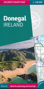
Wegenkaart - landkaart - Fietskaart Donegal | Xploreit Maps

Zeer goed leesbare deelkaart van Ierland. Alle wegen, alle dorpen en steden en veel topografische details staan er op: daardoor zowel als wegenkaart ook als fietskaart goed te gebruiken. Naast de algemene kaartdetails zijn ook de bezienswaardigheden en historische monumenten goed ingetekend en makkelijk te vinden. Campings en jeugdherbergen maken h...
21,50

Webshops met dit product

Webshop
Bezorging
Prijs

Anderen bekeken ook

Wegenkaart - landkaart - Fietskaart Clare (Ierland) | Xploreit Maps
Mooie geplastificeerde en scheurvaste kaart van de County Clare met index. Along with all of County Clare, parts of Counties Limerick, Kerry, Tipperary, Galway (including the famous Aran Islands) are shown on this map. World famous tourist destinations such as the Cliffs of Moher and the Burren are highlighted as are hundreds local beauty spots and heritage sites. Since the map is printed on a double-sided sheet and at a scale of 1:80 000, it is been possible to include a large area that is equivalent to approximately 7 Ordnance Survey Discovery Maps. However the map is easy to read and is not cluttered with unnecessary detail. The sample also includes the beach at Fanore, the Caher valley and the famous Corkscrew Hill viewpoint. Antiquities and historic locations such as Lismacsheedy ring fort, Newtown castle (which has a local walking trail) and Rathborney church are shown. Walking Routes All the waymarked ways in Clare and parts of others in Galway, Limerick and Tipperary are shown:…
23,50
Wegenkaart - landkaart - Fietskaart Mayo en Sligo (Ierland) | Xploreit Maps
Mooie geplastificeerde en scheurvaste kaart van Mayo en Sligo met index. Mayo’s wealth of unspoiled, natural beauty is a fitting compliment to Sligo’s magnificent scenery providing a wonderfully varied landscape to be enjoyed by visitors. This map shows where all the famous landmarks and hidden gems are to be found when touring the area. A comprehensive compilation of waymarked trails with local walking loops , cycle routes, scenic drives, beaches, medieval buildings, megalithic sites, historic houses and numerous other points of interest are illustrated. Discover the haunts of W.B. Yeats like Lissadell, Drumcliff and Lough Gill along with dramatic vistas such as Croagh Patrick and the Doolough Valley using this easy to read sheet. Parts of Counties Galway, Roscommon, Leitrim and Donegal are also included.   The scale of the Mayo & Sligo map is 1:100,000.   Walking Routes The following long distance waymarked ways in Mayo and Sligo are included: The Western Way The Great Western Gree…
23,50
Wegenkaart - landkaart - Fietskaart Kerry (Ierland) | Xploreit Maps
Mooie geplastificeerde en scheurvaste kaart met index The Xploreit Map of County Kerry includes all of the 'Kingdom' of Kerry along with parts of counties Clare, Limerick and a large part of County Cork. Famous tourist destinations such as Killarney National Park, the Dingle Peninsula, the Skellig Islands (a UNESCO listed World Heritage Site), Derrynane House and the 'Ring of Kerry' scenic route are all shown on one double-sided map sheet. It illustrates a magical landscape of mountains, lakes, woodlands, rivers and streams bordered by a rugged atlantic coastline which is the longest of any county in Ireland. Golf courses, angling locations, beaches for swimming and surfing, historic sites, tourist centres and a host of other points of interest are clearly identified making this map an invaluable tool for both visitors and locals alike. Several scenic drives, cycle routes and waymarked walks are shown. The scale of the Kerry map is 1:100,000. Walking Routes It has been possible to incl…
23,50
Wegenkaart - landkaart - Fietskaart Cork (Ierland) | Xploreit Maps
Mooie geplastificeerde en scheurvaste kaart met index The Xploreit Map of County Cork includes all of Cork along with parts of counties Kerry, Limerick, Tipperary and Waterford. Cork's rich heritage of megalithic monuments, medieval churches and castles can instantly be identified. Noted sites such as Blarney Castle, St. Finbarr's Oratory at Gougane Barra and McCarthy's Bar in Castletownbere are featured in red text. Whether you want to explore Youghal's town walls in the east, savour the views from the footbridge at Mizen Head in the south-west or or imagine times past as you stroll around Mitchelstown's King's Square and Kingston College in the north it's easy to find your chosen destination. Showing a large array of golf courses, angling spots, sandy beaches for swimming and surfing, equestrian facilities, boating facilities, this map is an indispensable tool for visitors. Several scenic drives, cycle routes and waymarked walks are shown. The scale of the Cork map is 1:100,000. Walk…
23,50
Wegenkaart - landkaart 714 Benelux 2024 | Michelin
Zoals je van Michelin mag verwachten is deze kaart zeer overzichtelijk en heeft een duidelijk helder kaartbeeld. De kaart geeft uitgebreid toeristische informatie weer. Met stadsplattegrond van de hoofdstad. Grote kracht van de Michelin kaarten is het uitstekende kaartbeeld. Ze maken gebruik van goede kleuren waardoor het zeer leesbaar is. Daarnaast staat er veel informatie op, ook toeristische details en bezienswaardigheden. Erg handig zijn de zogenaamde groene wegen: met een groene lijn geeft Michelin aan welke routes het mooist zijn om te rijden. Daarnaast wordt een beperkt aantal campings weergegeven, helaas niet allemaal. Meestal betreft het de zgn. camping municipale ofwel de gemeentecampings. Benelux at 1:400,000 from Michelin, with information on driving regulations in each country, a distance and journey time table, plus enlargements showing in greater detail road access to Amsterdam, Brussels and Luxembourg City. Coverage extends east to include the Ruhr and the Eifel in Germ…
11,95
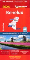
Wegenkaart - landkaart 795 Benelux 2024 | Michelin
Scheur- en watervast.   Zoals je van Michelin mag verwachten is deze kaart zeer overzichtelijk en heeft een duidelijk helder kaartbeeld. De kaart geeft uitgebreid toeristische informatie weer. Met stadsplattegrond van de hoofdstad.   Grote kracht van de Michelin kaarten is het uitstekende kaartbeeld. Ze maken gebruik van goede kleuren waardoor het zeer leesbaar is. Daarnaast staat er veel informatie op, ook toeristische details en bezienswaardigheden. Erg handig zijn de zogenaamde groene wegen: met een groene lijn geeft Michelin aan welke routes het mooist zijn om te rijden.   Daarnaast wordt een beperkt aantal campings weergegeven, helaas niet allemaal. Meestal betreft het de zgn. camping municipale ofwel de gemeentecampings.   Benelux at 1:400,000 from Michelin, with information on driving regulations in each country, a distance and journey time table, plus enlargements showing in greater detail road access to Amsterdam, Brussels and Luxembourg City. Coverage extends east to include …
12,95
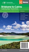
Wegenkaart - landkaart Brisbane to Cairns | Hema Maps
Detailkaart van een deel van Australië. Zeer goed leesbaar, met naast de topografische details veel symbolen waarmee allerhande toeristische zaken worden aangeduid als campsites, nationale parken, attracties, wandelmogelijkheden etc. An easy-to-follow map that shows both the coastal and inland routes from Brisbane to Cairns. Roadside rest areas, intermediate distances, and a quick-find distance chart are also shown. The map shows all the popular tourist destinations along the Queensland coast. Routes between Brisbane with Cairns in a series of touring maps connecting Australia’s main centres of population along some of the most spectacular routes such as the Great Ocean Road or the Savannah Way. The maps highlight 24-hour fuel supplies, roadside rest areas, camping facilities, places of interest, etc., and include distance charts and, in some titles, city maps. Road network indicates unsurfaced roads and tracks. The maps also show railway lines. There is no topographical information be…
13,95
Wegenkaart - landkaart 715 Nederland 2024 | Michelin
Zoals je van Michelin mag verwachten is deze kaart zeer overzichtelijk en heeft een duidelijk helder kaartbeeld. De kaart geeft uitgebreid toeristische informatie weer. Met stadsplattegrond van de hoofdstad. Netherlands at 1:400,000 from Michelin, with information on driving regulations, a distance and journey time table, plus enlargements showing in greater detail road access to Amsterdam, The Hague and Rotterdam with the Europoort and Hoek Van Holland. Roads network includes local roads and is graded according to the number of lanes. Junctions show full or partial interchanges. Steep gradients (!), level crossings and restricted entry sections are marked; scenic routes are highlighted. Railway lines and ferry routes are included.   Relief shading is used to indicate the topography, with colouring for forested areas. National parks are also marked. Small symbols indicate various landmarks or places of interest including campsites and youth hostels, but the map is not primarily designe…
11,95
Wegenkaart - landkaart Ierland | ITMB
As technology improves, we are able to produce more detailed maps than was previously possible. Such is the case with Ireland, a part of the world consisting of two countries divided by religion and history. Preparing a map of Ireland as a double-sided map means cutting the island into two geographic portions. Side 1 covers the northern half. This includes the portion known as Northern Ireland, or Ulster, and a fair portion of the Republic of Ireland, or Eire; essentially everything north of Dublin and west to Counties Mayo and Galway. Side 2 covers the southern half of the island from just north of Dublin to the outer tips of County Kerry. It also includes a nice inset map of central Dublin. Naturally, all motorways and roads are included, as are touristic attractions, camping/caravan sites, ferry terminals, and Top Attractions. This is a very detailed travel map of the island, printed on waterproof paper for durability. We had great fun driving around Ireland researching this map. It…
14,95
Wegenkaart - landkaart 01 Kaapstad - Cape Town and Surrounding Attractions | MapStudio
Het overzicht is soms misschien een beetje onduidelijk. maar de details in de inzetten en delen van de kaart zijn prima en voldoen goed voor het rondrijden met een eigen auto. Double-sided map, with a general road map on one side, plus numerous street plans and descriptions of four special routes on the reverse. The main map covers an area within reach as day trips from Cape Town, extending east to Swellendam and north to Langebaan. Road classification includes unsurfaced roads, intermediate driving distances on main and secondary roads, toll routes with gates, and mountain passes. Railways are shown with local stations. An impression of relief is provided by elevation tinting (perhaps somewhat confusing for regular map users - the higher the altitude, the greener the colour!), spot heights for main peaks, and names of mountain ranges. Nature and forest reserves, plus salt pans and marshes are indicated. Symbols mark local airfields, historical sites, caravan parks, many wine estates, …
16,95

Klanten-reviews van Wegenkaart - landkaart - Fietskaart Donegal | Xploreit Maps

Er zijn nog geen beoordelingen voor dit productBen jij de eerste die een review plaatst?

Meer over Wegenkaart - landkaart - Fietskaart Donegal | Xploreit Maps

Productomschrijving

Zeer goed leesbare deelkaart van Ierland. Alle wegen, alle dorpen en steden en veel topografische details staan er op: daardoor zowel als wegenkaart ook als fietskaart goed te gebruiken. Naast de algemene kaartdetails zijn ook de bezienswaardigheden en historische monumenten goed ingetekend en makkelijk te vinden. Campings en jeugdherbergen maken het compleet.  This convenient and informative paper travel map is specifically designed for visitors to Donegal – the northernmost county in Ireland. With a heady mix of peninsulas, promontories and sandy beaches, Donegal’s  long, indented coastline includes some of the most spectacular scenery in the country. Further inland, the attractions are just as enticing and include Glenveagh National Park – an all-time favourite destination. This new map covers all of County Donegal and highlights local walking trails, cycle routes and scenic drives. The road network shown includes local roads and driving distances are indicated on the main routes. Parking spots, passenger ferry routes, harbours and local piers are included. Woodland areas, mountains, rivers and lakes clearly marked. A large set of symbols is used to illustrate antiquities, golf courses, museums, heritage centres, beaches for surfing and swimming, campsites, caravan parks and many other local points of interest. The Xploreit County Series covers the western coastal counties of Ireland in a set of double-sided maps ranging from County Cork in the southwest to County Donegal in the northwest. Please note that this is a paper based map.    Key Points:  All of County Donegal on a single map  Easy to read, clear mapping Local walks and cycleways Wild Atlantic Way driving route Tourist attractions highlighted Handy street plan of Donegal town Detailed Index Scale is 1:100,000 Map legend in English, German and French
Webshop.nl maakt gebruik van cookies. Ga je verder op onze website, ga dan akkoord met het plaatsen van cookies en de verwerking van deze data door ons en vermelde partners.