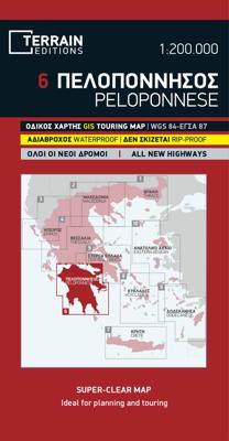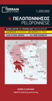
Wegenkaart - landkaart - Fietskaart 6 Touring Map Peloponnese - Peloponnesos | Terrain maps

0
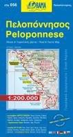
Scheur- en watervaste wegenkaart van de Peloponnesos.De plaatsnamen op de kaart zijn in het Grieks en het Engels. This is the best map of Peloponnese on the market in every respect. Here’s what makes it so special:  Excellent map composition and spatial distribution. The scale of 1:200.00 is extremely demanding in regards to map composition. If y...

Verkopers met dit product

Verkoper
Bezorging
Prijs
DeZwerver.nl logo
DeZwerver.nl
2,95
13,50

Anderen bekeken ook

Nieuw
Wandelkaart - Wegenkaart - landkaart 338 Kos | Terrain maps
Gedetailleerde wegenkaart en wandelkaart met alle kleine wegen, wandelpaden, hoogtelijnen en toeristische informatie aangegeven. Alle tekst is tweetalig in Engels en Grieks en de waterproof kaart is geschikt voor gebruik met GPS. This is a great map because: It is the first GIS map of the island, meaning that this is the first time Kos is mapped with a topographic precision in proportion to the map scale.  The road network of Kos is featured so completely for the first time. Every road, down to the secondary dirt roads and dead-ends, is illustrated on the map with precision. Naturally the main road network is clearly depicted, along with residential areas, the airport, the ports and the entire tourist infrastructure of Kos.  It is waterproof and rip-proof. You can fold and unfold it a thousand times, fold it in irregular ways, dunk it in the sea or leave it out in the rain. This map is indestructible!  It is remarkably detailed, as its scale is much larger (i.e. more detailed) tha…
12,50
Nieuw
Wandelkaart - Fietskaart - Wegenkaart - landkaart 450 Eastern Crete - Kreta Oost | Terrain maps
Gedetailleerde wegenkaart en wandelkaart met alle kleine wegen, wandelpaden, hoogtelijnen en toeristische informatie aangegeven. Alle tekst is tweetalig in Engels en Grieks en de waterproof kaart is geschikt voor gebruik met GPS. Terrain’s map of Eastern Crete provides travelers with everything they need:  Scale of 100.000, which attributes all the information with clarity and in detail.  Map data processed within a GIS environment, resulting in great accuracy.  Double coordinate system, WGS 84 and ΕΓΣΑ 87, completely compatible with GPS.  It is printed on Polyart material, making it totally waterproof and rip-proof. You can fold it and unfold it a hundred times, fold it in irregular ways, dunk it in the sea or leave it out in the rain. This map is indestructible!  Clear symbols, easily readable fonts, rich colors and excellent arrangement of every element make the map extremely friendly to the user.  Unique wealth of information. Every village, every road (including their dista…
12,50
Nieuw
Wandelkaart - Wegenkaart - landkaart 308 Tinos | Terrain maps
Gedetailleerde wegenkaart en wandelkaart met alle kleine wegen, wandelpaden, hoogtelijnen en toeristische informatie aangegeven. Alle tekst is tweetalig in Engels en Grieks en de waterproof kaart is geschikt voor gebruik met GPS. This is a great map of Tinos because:   •    It is waterproof and rip-proof. You can fold and unfold it a thousand times, fold it in irregular ways, dunk it in the sea or leave it out in the rain. This map is indestructible!    •    It is the first time the island’s entire coastline is mapped. Cartography was done with TERRAIN’s specially equipped and staffed cartographic vessel. This means that you can locate all beaches of the island, down to the tiniest cove! In fact, the special features of every single beach are recorded: whether it is sandy or pebbled, whether it features natural tree shade, water, a beach bar or organized water sports, whether the seabed in front of the beach is sandy or rocky (so that you will know where to anchor).    •    It feature…
12,50
Wegenkaart - landkaart - Fietskaart 433 Touring Map Evia | Terrain maps
Gedetailleerde wegenkaart en wandelkaart met alle kleine wegen, wandelpaden, hoogtelijnen en toeristische informatie aangegeven. Alle tekst is tweetalig in Engels en Grieks en de waterproof kaart is geschikt voor gebruik met GPS. Terrain’s map of Evia with everything you need:    Scale of 110.000, which attributes all the information with clarity and in detail.  Map data processed within a GIS environment, resulting in great accuracy.  Double coordinate system, WGS 84 and ΕΓΣΑ 87, completely compatible with GPS.  It is printed on Polyart material, making it totally waterproof and rip-proof. You can fold it and unfold it a hundred times, fold it in irregular ways, dunk it in the sea or leave it out in the rain. This map is indestructible!  Clear symbols, easily readable fonts, rich colors and excellent arrangement of every element make the map extremely friendly to the user.  Unique wealth of information. Every village, every road (including their distance in km), every sight, every be…
12,50
Wandelkaart - Wegenkaart - landkaart 319 Skiathos | Terrain maps
Gedetailleerde wegenkaart en wandelkaart met alle kleine wegen, wandelpaden, hoogtelijnen en toeristische informatie aangegeven. Alle tekst is tweetalig in Engels en Grieks en de waterproof kaart is geschikt voor gebruik met GPS. This is a great map of Skiathos because:   • It comes in the detailed scale of 1:15.000, showing everything very clearly (competitor maps are in the 1:25.000 scales).   • It is printed on Polyart plastic “paper”, making it totally waterproof and rip-proof. You can fold it and unfold it a hundred times, fold it in irregular ways, dunk it in the sea or leave it out in the rain. This map is indestructible!   • The island’s entire coastline is mapped for the first time with TERRAIN’s specially equipped and staffed cartographic vessel. This means that you can locate all beaches of the island, down to the tiniest cove! In fact, the special features of every single beach are recorded: whether it is sandy or pebbled, whether it features natural tree shade, water, a …
12,50
Nieuw
Wandelkaart 315 Ios | Terrain maps
Gedetailleerde wegenkaart en wandelkaart met alle kleine wegen, wandelpaden, hoogtelijnen en toeristische informatie aangegeven. Alle tekst is tweetalig in Engels en Grieks en de waterproof kaart is geschikt voor gebruik met GPS. This is a great map because: It is the first GIS map of the island, meaning that this is the first time Ios is mapped with a topographic precision in proportion to the map scale.  It is waterproof and rip-proof. You can fold and unfold it a thousand times, fold it in irregular ways, dunk it in the sea or leave it out in the rain. This map is indestructible!  It is remarkably detailed, at a scale nearly twice as large as the competition’s, which makes everything crystal clear!  It is the first time the island’s entire coastline is mapped. Cartography was done with TERRAIN’s specially equipped and staffed cartographic vessel. This means that you can locate all beaches of the island, down to the tiniest cove! In fact, the special features of every single b…
11,95
Nieuw
Wandelkaart 304 Sifnos | Terrain maps
Erg goede wandelkaart van Sifnos, weerbestendig en volledig. Bezienswaardigheden, campings en andere praktische zaken staan op de kaart aangegeven. GPS toepasbaar. This is a great map of Sifnos because: It is waterproof and rip-proof. You can fold and unfold it a thousand times, fold it in irregular ways, dunk it in the sea or leave it out in the rain. This map is indestructible!  It features more trails than any other map of Sifnos on the market. For example, take a look at the area between Apollonia and Kastro, which is where most visitors choose to hike. The trail from Plakoto and the chapel of Aghia Anastasia to Kastro, the trail ascending to Exambela and the branch leading to Apollonia, the trail to Kato Petali, the trail from Aghios Loukas to Kastro and so many more, appear on a map of Sifnos for the first time – in fact, the length of all trails is measured in kilometers so you can estimate the duration of your hike. Also, unlike other hiking maps, SKAI maps do not depict any…
11,95
Wandelkaart 316 Folegandros | Terrain maps
Gedetailleerde wegenkaart en wandelkaart met alle kleine wegen, wandelpaden, hoogtelijnen en toeristische informatie aangegeven. Alle tekst is tweetalig in Engels en Grieks en de waterproof kaart is geschikt voor gebruik met GPS. This is a great map because: First and foremost, it’s the only existing GIS map of Folegandros, which makes it the only truly accurate and GPS compatible map of the island.  It comes in the detailed scale of 1:20,000, showing everything with great clarity, and it is made with data collected 100% through field survey.  The entire trail network of Folegandros is shown for the first time, with impeccable accuracy. All trails are measured in kilometers, so you can estimate the duration of your hike. On the back side, the island’s 5 best hikes are presented in detail. These are also distinctly labeled on the map so you can easily locate them.  It is printed on Polyart material, making it totally waterproof and rip-proof. You can fold it and unfold it a hundred…
11,95
Nieuw
Wandelkaart 307 Andros | Terrain maps
Gedetailleerde wegenkaart en wandelkaart met alle kleine wegen, wandelpaden, hoogtelijnen en toeristische informatie aangegeven. Alle tekst is tweetalig in Engels en Grieks en de waterproof kaart is geschikt voor gebruik met GPS. This is a great map because: It is waterproof and rip-proof. You can fold and unfold it a thousand times, fold it in irregular ways, dunk it in the sea or leave it out in the rain. This map is indestructible!  It is the first time the island’s entire coastline is mapped. Cartography was done with TERRAIN’s specially equipped and staffed cartographic vessel. This means that you can locate all beaches of the island, down to the tiniest cove! In fact, the special features of every single beach are recorded: whether it is sandy or pebbled, whether it features natural tree shade, water, a beach bar or organized water sports, whether the seabed in front of the beach is sandy or rocky (so that you will know where to anchor).  It indicates the boundaries of NATURA…
11,95
Nieuw
Wandelkaart 329 Psara | Terrain maps
Gedetailleerde wegenkaart en wandelkaart met alle kleine wegen, wandelpaden, hoogtelijnen en toeristische informatie aangegeven. Alle tekst is tweetalig in Engels en Grieks en de waterproof kaart is geschikt voor gebruik met GPS.   This is a great map because: First and foremost, it is the only available map of Psara! So far, no other cartographer had taken interest in this historical but forgotten corner of Greece. It is made with data collected 100% through field survey and comes in the detailed scale of 1:15,000, showing everything very clearly.  For the first time, all the trails of Psara are shown with absolute accuracy. The length of all trails has been measured in kilometres, so you can estimate the duration of your hike. On the back side of the map you ‘ll find detailed descriptions of the 3 best hikes on the island, also labeled on the map itself, so you easily locate them.  The nearby uninhabited island of Antipsara as well as all the surrounding islets are also included,…
11,95

Klanten-reviews van Wegenkaart - landkaart - Fietskaart 6 Touring Map Peloponnese - Peloponnesos | Terrain maps

Er zijn nog geen beoordelingen voor dit productBen jij de eerste die een review plaatst?

Meer over Wegenkaart - landkaart - Fietskaart 6 Touring Map Peloponnese - Peloponnesos | Terrain maps

Productomschrijving

Scheur- en watervaste wegenkaart van de Peloponnesos.De plaatsnamen op de kaart zijn in het Grieks en het Engels.

This is the best map of Peloponnese on the market in every respect. Here’s what makes it so special: 
  • Excellent map composition and spatial distribution. The scale of 1:200.00 is extremely demanding in regards to map composition. If you squeeze in too much information you get a user-unfriendly, chaotic map. If you make it too roomy, you get a substandard map unable to satisfy demanding travelers. TERRAIN’s map of Peloponnese is the map with the most ‘practiced’ composition, and the final result is impressive: all roads, villages and sights that a 1:200.00 scale can ‘tolerate’ are so meticulously placed on the map that using it is a piece of cake! 
  • G.I.S. mapping technology in two geodetic reference systems (ΕΓΣΑ 87 and WGS 84.) 
  • Waterproof Polyart paper, which doesn’t rip. You can fold and unfold your map as many times as you want, in any shape or form, and it’s indestructible. 
  • The map of Peloponnese and all other TERRAIN maps are also available as smartphone apps (for all mobile phones with an internet connection.) Download the free app and TERRAIN’s free basic map of Greece from www.viewranger.com, and then download whichever TERRAIN map you are interested in at a greatly reduced price.

Verken gerelateerde categorieën

Webshop.nl maakt gebruik van cookies. Ga je verder op onze website, ga dan akkoord met het plaatsen van cookies en de verwerking van deze data door ons en vermelde partners.