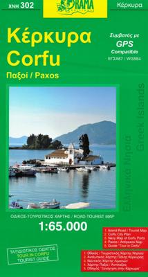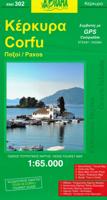
Wegenkaart - landkaart - Fietskaart 302 Corfu - Korfoe | Orama

0
Wefgenkaart van Korfu met veel details, als wandelkaart door de schaal net iets minder geschikt, voor fietsers prima. Mooie stranden, bezienswaardigheden, afstanden tussen dorpen staan er op ingetekend.  Corfu with Paxos at 1:65.000 on a road map with a street plan of Corfu/Kerkyra Town, notes on the island’s resorts, beaches and other places of i...

Verkopers met dit product

Verkoper
Bezorging
Prijs
DeZwerver.nl logo
DeZwerver.nl
2,95
8,95

Anderen bekeken ook

Wegenkaart - landkaart - Fietskaart 302 Corfu - Korfoe | Orama
Wefgenkaart van Korfu met veel details, als wandelkaart door de schaal net iets minder geschikt, voor fietsers prima. Mooie stranden, bezienswaardigheden, afstanden tussen dorpen staan er op ingetekend.  Corfu with Paxos at 1:65.000 on a road map with a street plan of Corfu/Kerkyra Town, notes on the island’s resorts, beaches and other places of interest, an extensive list of tourist accommodation, etc. On one side is a map of Corfu, Paxos and Antipaxos, with the nearby islands of Mathraki, Othoni and Erikoussa on an inset. All place names are shown in both Greek and Latin alphabet. The map shows the islands’ road network, indicating dirt roads and distances on main routes.  
8,95
Wegenkaart - landkaart Corfu - Korfoe | Freytag & Berndt
Goede wegenkaart van Corfu, die ook behoorlijk veel detail weergeeft als het gaat om wandelpaden, fietsbare wegen en met veel symbolen voor toeristische bezienswaardigheden. De berijdbare wegen zijn goed weergeven, zowel de hoofdwegen als provinciale en lokale wegen; wegnummers worden vermeld. Afstanden tussen plaatsen zijn in kilometers op de kaart ingetekend, daarnaast worden ook op belangrijke plekken benzinepompen gemarkeerd. In het kaartbeeld wordt door middel van schaduw het reliëf weergegeven en soms enkele punten in het landschap met de daadwerkelijke hoogte. Provinciegrenzen zijn goed terug te vinden, nationale parken en reservaten ook. Met allerhande symbolen worden toeristische bezienswaardigheden weergegeven als monumenten, historisch belangrijke plekken en uitzichtpunten. In bepaalde plaatsen zijn hotels en campings te vinden, luchthavens, treinverbindingen en havens vindt u er ook op! Explore Corfu, the second largest of the Ionian Islands located in Greece; with this Fr…
14,95
Reisgids Marco Polo ENG Corfu - Korfoe | MairDumont
Handige en overzichtelijke, kleine reisgids voor een eerste kennismaking met de vakantiebestemming. Globale uitklapkaart achterin, makkelijk binnenzakformaat. (Engelstalig) Your Marco Polo Corfu Pocket Guide includes: Insider Tips - we show you the hidden gems and little known secrets that offer a real insight into this beautiful island, from where royalty used to bathe to which trail to use to explore the entire island. Best of - find the best things to do for free, the best `only in' Corfu experiences, the best things to do if it rains and the best places to relax and spoil yourself. Sightseeing - all of the top sights are organized by areas of the island so you can easily plan your trip. Discovery Tours - 5 specially tailored tours that will get you to the heart of Corfu on foot, by car or by boat! Here are inspirational itineraries that will help you enjoy authentic Corfu. Discover wild, steep coastlines, fantastic beaches, old Venetian villages, tempting tavernas and historical t…
13,95
Wandelkaart Tour & Trail Corfu - Korfoe | Discovery Walking Guides
Goede wandelkaart van Korfoe. Scheur- en watervast. Corfu Tour & Trail Super-Durable Map is the most detailed, accurate, toughest, large scale map of the island that you can buy. Super-Durable Maps now come with a 2 year adventurous use wear and tear guarantee, see Discovery Walking Guides website for details. Our large 1:40,000 scale produces a double sided map sheet of 840mm by 680mm; big enough to show masses of detail but compact enough to use in the car or on the trail.   Corfu North is on the facing sheet of the map with Corfu South on the reverse side, including a generous overlap between the two sides. Our special concertina map fold means your map is easy to unfold, and more importantly easy to refold back to its pocket size. You get the most detailed map of Corfu that is produced including our 'Tour & Trail' level of detail ranging from major roads to secondary roads to minor roads to streets and narrow country roads, plus dirt roads and walking trails.   We have a new metho…
15,95
Wegenkaart - landkaart - Fietskaart Dalmatië - Dalmacija kaartenset | Kartografija
Goede wegenkaart met veel details: daardoor als fietskaart ook uitstekend te gebruiken. Naast de gewone geografische gegevens worden met symbolen veel toeristische mogelijkheden weergegeven, ook campings staan er op.   The Dalmatian Coast of the Adriatic on a set of two double-sided road maps at 1:100,000 from the Ljubljana-based Kartografija with good presentation of the topography of the islands and of the adjoining mainland, car ferry connections, etc. Coverage starts from the central part of Pag and on the mainland from north of Karlobag, so please note that the northern islands (Krk, Cres Rab and Lošoi) are not included.    Bold altitude colouring with relief shading and contour lines shows the topography. Road network includes cart tracks, shows locations of petrol stations and gives driving distances on main and many local roads. Also shown are selected footpaths, indicating waymarked routes. Railway lines are shown with stations and car ferry routes are also marked. Symbols in…
12,95
Wandelgids Korfoe - The Corfu Trail and 20 Day-Walks | Cicerone
This guidebook describes 22 day walks on the Greek island of Corfu, along with the 150km long Corfu Trail. Ranging from easy holiday strolls to challenging traverses, the day walks give a taste of the many different landscapes on Corfu, and visit olive groves, coastal paths, sandy beaches and quiet mountain villages. The Corfu Trail runs the length of the island from Kavos north to Agios Spiridonas. Described in 10 day stages, it is suitable for novices and experienced walkers alike. The walks in this guidebook can be done year round, but accommodation is easier to find in May to October. Although Corfu is known as a beach holiday destination, this book allows the walker to experience the island's laidback atmosphere and beautiful landscapes away from the crowded resorts. Highlights include golden beaches on the west coast, the spectacular Angelokastro fortress, the dramatic cliffs of Cape Drastis and the twin coves of Porto Timoni. The day walks begin from points across the island, i…
23,50
Wegenkaart - landkaart - Fietskaart Vanouver Island south - Victoria | ITMB
ITMB wegenkaarten en wandelkaarten kenmerken zich door het kleurgebruik waarbij zo de nadruk wordt gelegd op de natuurkundige aspecten van het land of de streek. Het soort landschap en de hoogte worden hierdoor zeer duidelijk zichtbaar. Natuurlijk vind je ook de 'gewone' zaken als wegennet, spoorwegen, vliegvelden, ferrys, toeristische bezienswaardigheden en nationale parken er op terug.. Vaak - maar niet op alle kaarten - staat op de achterzijde een stadsplattegrond van hoofdstad of belangrijkste stad in de regio.  Voorzijde: Vancouver Island zuidelijk gedeelte met schaal 1:270.000 Achterzijde: stadsplattegrond Victoria met schaal 1:10.000 Victoria is a brand new title for ITMB. The city is the capital of British Columbia (each of Canada’s provinces and territories has its own capital, in addition to Ottawa for the entire country). Located at the southern tip of Vancouver Island, Victoria was established as the colonial capital after the Oregon Treaty of 1846 forced the British to ab…
13,95
Wegenkaart - landkaart - Fietskaart 7 Crete - Kreta | Terrain maps
Gedetailleerde wegenkaart en wandelkaart met alle kleine wegen, wandelpaden, hoogtelijnen en toeristische informatie aangegeven. Alle tekst is tweetalig in Engels en Grieks en de waterproof kaart is geschikt voor gebruik met GPS.   The ideal map for planning your trip, as well as the journey itself – if you belong to the 99% of the island’s visitors, who have no intention whatsoever to take the narrowest dirt path leading to the remotest beach of the island! This map is very practical, at a scale of 1:200.000 which allows for a detailed presentation of the road network and sights without the exhaustive detail only the travelers – explorers are interested in.    We made this map based on our archival series of 1:100.00 Crete maps. We omitted all secondary dirt roads and loads of other unnecessary little roads, magnified the symbols and width of the roads for better visibility, and made colors more vibrant. All this makes for the best general map of Crete on the market!    Naturally, we…
13,50
Wegenkaart - landkaart 140 Corfu & the Ionian Islands | Michelin
MICHELIN Zoom Map Corfu will give you an overall picture of your journey thanks to its clear and accurate mapping scale 1/80,000. Our map will help you easily plan your safe and enjoyable journey thanks to a comprehensive key, a complete name index as well a clever time & distance chart. Michelin's driving information will help you navigate safely in all circumstances. With MICHELIN National Maps, find more than just your way! Corfu, the northernmost of the Ionian Islands in Greece. Located off of the far northwest coast of the Greece, Corfu is in the Ionian sea, east of Italy and southwest of Albania. MICHELIN NATIONAL MAPS feature: * Up-to-date mapping * A scale adapted to the size of the country * A clear and comprehensive key * Distance and time chart * Place name index * Driving and road safety information * Tourist sights information Our maps are regularly updated even if the ISBN does not change. Corfou, Iles grecques, Iles Ioniennes, Ithaque
10,95

Klanten-reviews van Wegenkaart - landkaart - Fietskaart 302 Corfu - Korfoe | Orama

Er zijn nog geen beoordelingen voor dit productBen jij de eerste die een review plaatst?

Meer over Wegenkaart - landkaart - Fietskaart 302 Corfu - Korfoe | Orama

Productomschrijving

Wefgenkaart van Korfu met veel details, als wandelkaart door de schaal net iets minder geschikt, voor fietsers prima. Mooie stranden, bezienswaardigheden, afstanden tussen dorpen staan er op ingetekend. 

Corfu with Paxos at 1:65.000 on a road map with a street plan of Corfu/Kerkyra Town, notes on the island’s resorts, beaches and other places of interest, an extensive list of tourist accommodation, etc. On one side is a map of Corfu, Paxos and Antipaxos, with the nearby islands of Mathraki, Othoni and Erikoussa on an inset. All place names are shown in both Greek and Latin alphabet. The map shows the islands’ road network, indicating dirt roads and distances on main routes.


Productinformatie

    Verken gerelateerde categorieën

    Webshop.nl maakt gebruik van cookies. Ga je verder op onze website, ga dan akkoord met het plaatsen van cookies en de verwerking van deze data door ons en vermelde partners.