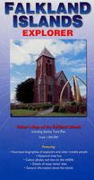
Wegenkaart - landkaart Falkland Islands Explorer | Ocean Explorer Maps

0
Overzichtskaart van de Falkland Eilanden. - Met geillustreerde biografieën van ondekkers en andere notabelen. - Historische tijdslijn - Kleuren foto's en wildlife - Details van veel bezienswaardigheden - Algemene informatie over de eilanden. General map showing main roads and tracks, airports, rivers, lakes and settlements. Mountain peaks and high...

Verkopers met dit product

Verkoper
Bezorging
Prijs
DeZwerver.nl logo
DeZwerver.nl
2,95
19,95

Anderen bekeken ook

Wegenkaart - landkaart South Georgia Explorer - Zuid-Georgië | Ocean Explorer Maps
Overzichtskaart van Zuid-Georgië en de Zuidelijke Sandwich Eilanden. - Met geillustreerde biografieën van ondekkers en andere notabelen. - Historische tijdslijn - Kleuren foto's en wildlife - Details van veel bezienswaardigheden - Algemene informatie over de eilanden. General map showing historic sites, former whaling stations & scientific stations. Mountain peaks and glaciers are identified and very subtle tinting shows the general relief. Twenty-five places of interest are highlighted and described in annotations around the map. Latitude and longitude lines are at 20' intervals. On the reverse: information on wildlife, history, economy and notable historical figures in the exploration of the region.  
19,95
Wegenkaart - landkaart Antarctic Explorer | Ocean Explorer Maps
An excellent foldout map of Antarctica. On one side there is a map of the Antarctic continent, around which succinct biographies of Antarctic explorers from William Spiers Bruce to Edward Wilson are shown. On the other side there are many fine colour photographs of seals, penguins and other Antarctic wildlife, together with an inset box summarising the Antarctic Treaty and other information on Antarctic waters, Cape Horn, Tierra del Fuego, the Beagle Channel, the Falkland Islands and South Georgia. Aimed at visitors arriving by sea.
13,95
Reisgids Falkland Islands | Bradt Travel Guides
Voor vele landen net zo goed, zo niet beter dan de Planet. Beduidend soberder uitgevoerd, maar ook met veel informatie voor backpackers en met veel kaartmateriaal. Een aanrader! This new, thoroughly updated second edition of Bradt's Falkland Islands remains the only standalone guide to this British Overseas Territory and is ideal for both independent and cruise visitors alike. New for this edition is a dedicated full-colour wildlife and natural history section, as well as all the most recent details needed for a smooth trip, from planning and history to Stanley restaurants and hotels, conservation issues, wildlife watching trips and how to explore beyond the capital. East and West Falkland are covered, and so too are Sea Lion, Pebble, Carcass, Saunders, Keppel, Weddell, Staats and Beaver islands. Situated in the South Atlantic Ocean over 300 miles from South America the Falkland Islands are one of the truly wild places in the world, a photographer's delight home to albatrosses, pengui…
27,95
Wegenkaart - landkaart Chobe | Shell
Zeer bijzondere goede landkaart van Chobe National Park in Botswana. Uitermate handig zijn de GPS coordinaten van de meest belangrijke punten als campings of uitzichtpunten. De kaart is gebaseerd op een luchtfoto, waarbij alle details zijn ingetekend. The map: The Chobe map consists of a complete map of Chobe on the front of the map and there are 5 individual maps of the major tourist areas on the back of the map. These are Chobe river front east, Chobe river front west, Nogatsaa, Savute and a small orientation map. The map was compiled by using satellite images, giving one a birds eye-view of the area. The roads were tracked by means of a GPS and then super-imposed on the photographs. Detailed GPS co-ordinates are supplied for game-drive areas. The Chobe map contains 126 GPS co-ordinates. The four main tourist areas: The Chobe National Park consists of a variety of vegetation types and geological features, offering extreme contrasts and a wide range of wildlife experiences within the…
17,50
Wegenkaart - landkaart Hawaiian Islands - Hawaii | Nelles Verlag
Overzichtskaart van alle eilanden. Folded road and tourist map for the Hawaiian Islands, U.S.A. at mostly 1:150 000 scale. The map covers the individual islands of Maui, Hawai i, Moloka i, Oahu, Kauai and Lanai. Places of interest, national parks, and beaches are all highlighted and shaded-relief colouring clearly depicts the topography.    The map includes insets showing Waikiki Beach in Honolulu at 1:14 000 and the Hawaii Volcanoes National Park at 1:125 000. The legend is in three languages, including English.   For over 20 years Nelles maps have been renowned throughout the world for their quality, faithfulness to detail and up-to-dateness.    So that streets, ferry links, railway lines, etc are always up to date, Nelles are continuously upgrading their maps - with the help of their international team of correspondents. Roads are provided with an exact kilometerage. Sights are highlighted extra clearly so that you don't miss any tourist attractions.   A good map must be hard-weari…
11,95
Wegenkaart - landkaart Explorer Map North Queensland | Hema Maps
Detailkaart van een deel van Australië. Zeer goed leesbaar, met naast de topografische details veel symbolen waarmee allerhande toeristische zaken worden aangeduid als campsites, nationale parken, attracties, wandelmogelijkheden etc. Covering Australia's beautiful North Queensland. There is alot of town map insets, tourist information, and photographs on the reverse side Touring map of the northern half of Queensland, with enlargements of popular areas, street plans, lists of facilities, etc. The main map extends south to well beyond the Flinders Highway between Townsville and Mount Isa, including Mackay on the coast. The map shows the road network, including minor roads and unsurfaced tracks, plus railways and local airfields/aerodromes. Designated Tourist Routes are highlighted and symbols mark places of interest (many annotated with brief description), historical sites, tourist resorts, youth hostels, etc. Topography is indicated by names of mountain ranges and peaks, as well as by…
17,50
Wegenkaart - landkaart Spitsbergen ( Svalbard ) | Ocean Explorer Maps
The Spitsbergen Explorer is the ideal map to accompany cruising amongst these dramatic islands. The Svalbard Archipelago was a pioneer destination for Arctic tourism, and the Explorer contains essential details on the flora and fauna that have attracted visitors since the mid-19th century. Featuring: Illustrated biographies of 27 noted explorers.. Color photos and introductory text on plants & wildlife. Map showing protected areas. Diagram charting the rising & setting of the midnight sun.
19,95
Wegenkaart - landkaart Okavango Delta - Tourist Map of the Okavango Delta and Linyanti Botswana - Veronica Roodt | Shell
Zeer bijzondere landkaart van de Okavango Delta en Linyanti. Uitermate handig zijn de GPS coördinaten van de meest belangrijke punten als campings of uitzichtpunten. De kaart is gebaseerd op een luchtfoto, waarbij alle details zijn ingetekend. The map: The map of the Okavango and Linyanti was compiled by using LANDSAT satellite images. The main reason for a tourist map of the area is to indicate the localities of the lodges as well as the wildlife management areas in which they occur. Tourists to the Okavango often visit more than one lodge and this will give them a good idea of where they have been. On the back of the map are enlargements of the different tourist areas, which shows more detail of the landscape. There are no GPS co-ordinates on the Okavango map as all the Wildlife areas consist of private concessions, which are not open to the general public. The roads in the private concessions have also not been indicated as this may mislead the self-driving public, making them thin…
17,50
Wegenkaart - landkaart Moremi - Tourist Map of Moremi Game Reserve Botswana | Shell
Zeer bijzondere landkaart van Moreni Game Reserve in Botswana. Uitermate handig zijn de GPS coördinaten van de meest belangrijke punten als campings of uitzichtspunten. De kaart is gebaseerd op een luchtfoto, waarbij alle details zijn ingetekend. The map: The Moremi map is based on satellite photos. The front of the map consists of a map of the entire Reserve and on the back are six separate maps of Khwai river-front east, Khwai river-front west, an orientation map of Moremi, Xakanaxa area and the Moanachira river, Xakanaxa game-drive area and Bodumatau area. The roads were tracked by GPS and there are 162 GPS co-ordinates on the map. General: As part of the Okavango Delta, Moremi consists of permanent swamp, seasonally swamped areas and dry land. It is one of the prime tourist destinations in Botswana and offers water activities, top game-viewing, some of the best bird-life in Africa and incredible scenery. Not to be missed! Locality and size: The Moremi Game Reserve is nestled withi…
17,50
Wegenkaart - landkaart Greenland Explorer ( Groenland ) | Ocean Explorer Maps
Grove overzichtskaart van Groenland, die meer is bedoeld ter informatie over geschiedenis, ontdekkingsreizigers en bijvoorbeeld geologie dan ter oriëntatie. Folded visitor's map that features illustrated biographies of explorers and other notable people, historical time lines, details of the human population from the early Greenlandic cultures to the Norse settlers and Danish colonisation. Miscellaneous information on subjects such as the search for the North Pole, Greenland's role in WWII, geology and glaciology. Color photos and text on the plants and wildlife. Map scale 1:3,250,000. 2008 edition.
19,95

Klanten-reviews van Wegenkaart - landkaart Falkland Islands Explorer | Ocean Explorer Maps

Er zijn nog geen beoordelingen voor dit productBen jij de eerste die een review plaatst?

Meer over Wegenkaart - landkaart Falkland Islands Explorer | Ocean Explorer Maps

Productomschrijving

Overzichtskaart van de Falkland Eilanden.

- Met geillustreerde biografieën van ondekkers en andere notabelen.
- Historische tijdslijn
- Kleuren foto's en wildlife
- Details van veel bezienswaardigheden
- Algemene informatie over de eilanden.

General map showing main roads and tracks, airports, rivers, lakes and settlements. Mountain peaks and highland ranges are identified and very subtle tinting shows the general relief. Twenty places of interest are highlighted and described in annotations around the map. Locations of tourist accommodation sites are marked. Latitude and longitude lines are at 30' intervals.

On the reverse: information on wildlife, geography, history, economy and notable historical figures in the exploration of the region. A basic street plan of Stanley is included.


Verken gerelateerde categorieën

Webshop.nl maakt gebruik van cookies. Ga je verder op onze website, ga dan akkoord met het plaatsen van cookies en de verwerking van deze data door ons en vermelde partners.